Map size in jpg-format: 60.3026MiB
Click to open in high resolution (open in new tab).
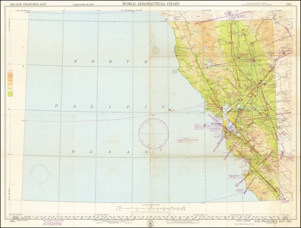
Detailed aeronautical map of the area around San Francisco Bay, and the Northwestern part of California.
The chart is a font of information about civil and military aviation in postwar Northern California. It was intended for civil aviators flying by visual navigation and so includes data that would be useful for this purpose. Topographical information consists of relief and a judicious selection of visual checkpoints used for navigation under visual flight rules. The checkpoints include populated places, roads, and distinct landmarks. The aeronautical information includes visual and radio aids to navigation, airports (aerodromes, both for landplanes and seaplanes), controlled airspace, restricted areas, and obstructions. Sectional Aeronautical Charts were updated somewhat frequently at this time and are now produced by the FAA.
The military information is probably the most interesting aspect of the chart, as it shows the state of postwar Bay Area region as it adopted an even greater role in national defense. Numerous airbases are noted. The region is positively blanketed with restricted flight zones.
On the Lambert Conformal Conic Projection.
If you are a student, write to us in telegram: @antiquemaps and indicate what material you need and for what work you need a map in high detail. We are ready to provide material on special terms. For students only!


