
Rare old maps of the United States.
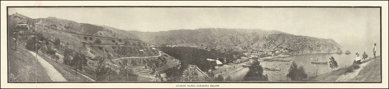
Scarce early Catalina Island promotional brochure, issued by the Wilmington Transportation Co. The brochure opens to reveal a panoramic view of Avalon, Santa Catalina Island, served by Steamers of Wilmington Transportation Line, Banning Line, the...
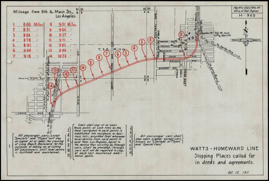
Detailed engineering map showing the various proposed stops on the Pacific Electric Railway line on the Watts-Homeward line, as prepared by the Pacific Electric Railway Company engineers. Includes a lengthy explanation of the various grant and deed...
![[Fruit Crate Label Advertising Map] Star of California Brand](/map/small/41396.jpg)
Decorative Fruit Crate Label map of California, promoting Exeter Orange Growers.
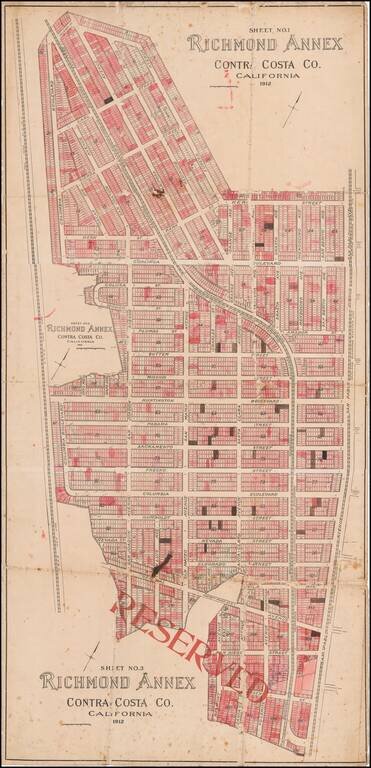
Early Richmond Annex / El Cerrito Real Estate Promotional Map Large separately published map of Richmond Annex, issued in 1912. The map would seem to have been used by a local real estate promoter, with pencil annotations and color shading, neither...
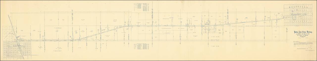
The Holton Inter-Urban Railway Company was incorporated W. F. Holt in December, 1903. The line connects El Centro with Holtville (a distance of about eleven miles) using standard gauge construction. The company carried both freight and passenger...
![[Section of Newport Beach]](/map/small/33577df.jpg)
Detailed map of part of Newport Beach, showing the route of the Pacific Electric Railway from 11th Street to 16th Street, along Ocean Avenue and Central Avenue, showing the water lines on both the Newport Bay and Pacific Ocean sides of the peninsula,...
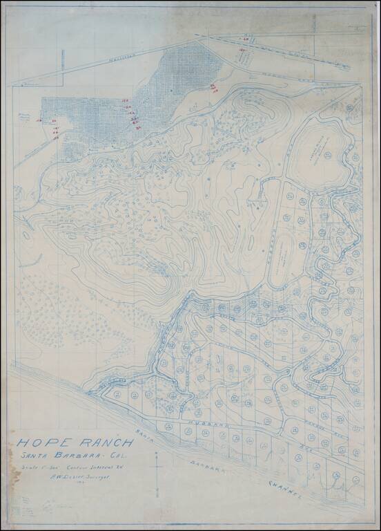
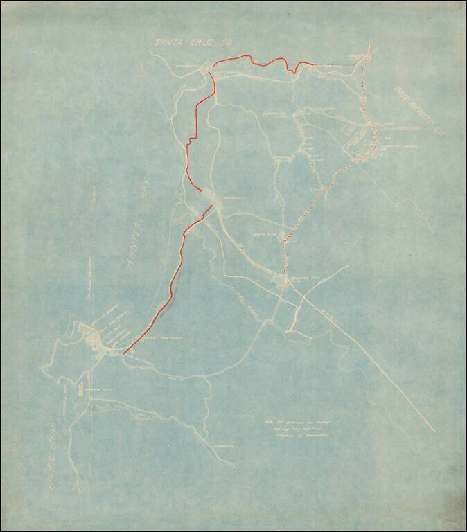
The Original Dozier Plan for Development of Hope Ranch Fine blue line contour map of Hope Ranch, executed by A.W. Dozier. This is the survey of Hope Ranch which would ultimately form the basis for its development by Harold Chase in 1923, illustrating...
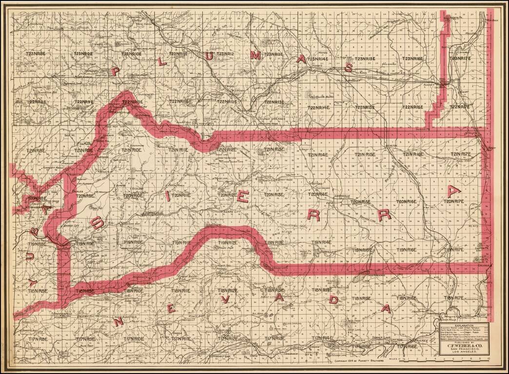
Highly detailed pocket map of Calaveras County, published by C.F. Weber. The map shows early railroads, roads, wagon roads, mines, lakes, mills, and many other details. Calaveras County was one of the original counties of the state of California,...
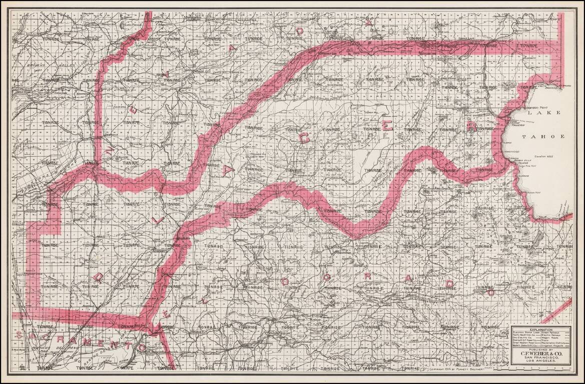
Separately issued unfolded map of Lake Tahoe, El Dorado County, Placer County, etc., published by C.F. Weber. The map shows early railroads, roads, wagon roads, mines, lakes, mills, and many other details.
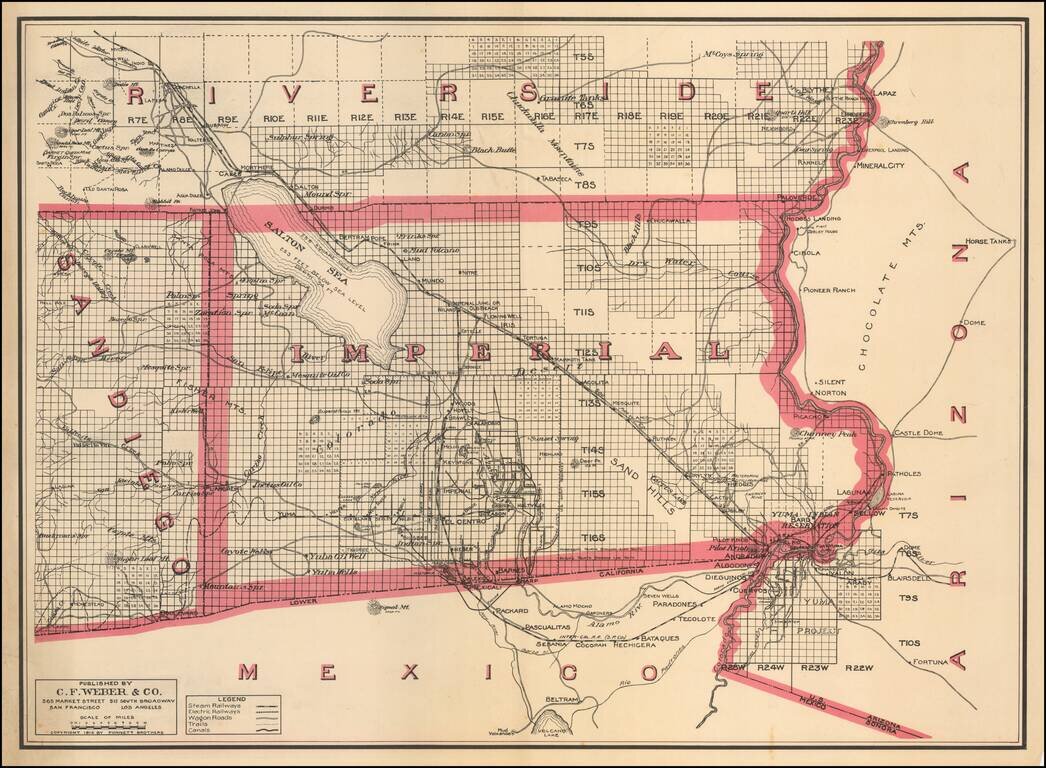
One of the Earliest Separate Maps of Imperial County Scarce separately issued map of Imperial County, published by C.F. Weber & Co. The map was issued just 7 years after the formation of the county and 9 years after the Salton Sea was created by...
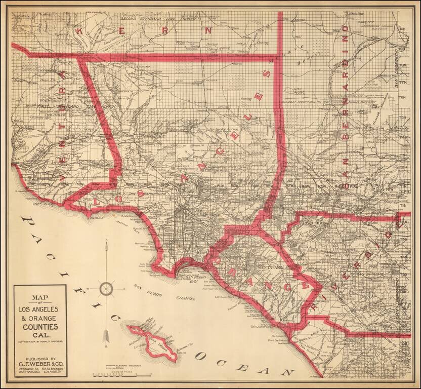
Highly detailed map of Los Angeles and Orange Counties, published by C.F. Weber. The map shows early railroads, roads, wagon roads, mines, lakes, mills, and many other details. A number of early ranchos are shown. There is additional detail of...
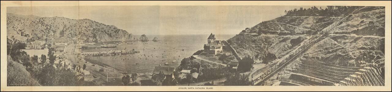
Scarce early Catalina Island promotional brochure, issued by the Wilmington Transportation Co. The brochure opens to reveal a panoramic view of Avalon, Santa Catalina Island, served by Steamers of Wilmington Transportation Line, Banning Line, the...
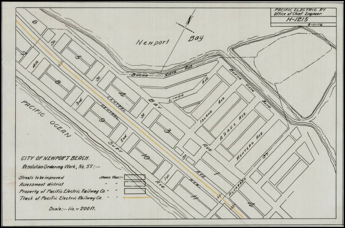
Detailed map of a portion of Newport Beach, bounded by Surf Avenue, Buena Vista Avenue, 4th Street and Alvarado Street. Shows the tracks of the Pacific Electric Railway and other details.
Detailed map of the area between Watsonville and Parjaro in the north and the Carmel River and Laureles in the south. The focus of the map is the New Castroville Road from Monterey to Castroville, Watsonville and Chittendens, with the road tentatively...
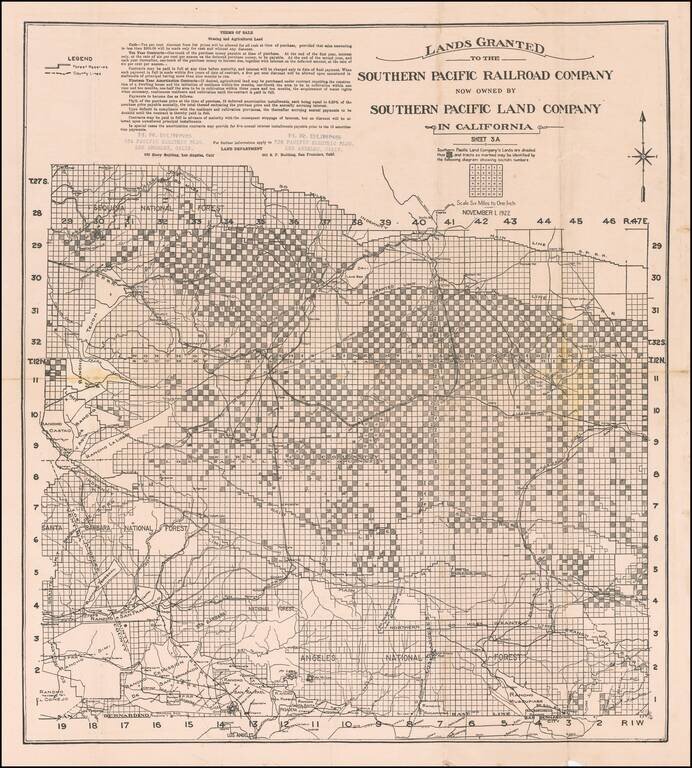
Rare promotional map showing the lands owned by the Southern Pacific Land Company in Southern California, focusing on the northern part of Los Angeles County. The map extends north to beyond Rancho Tejon and shows a number of Ranchos in Los Angeles...
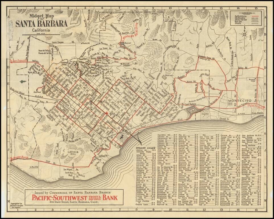
Rare early "midget" series map of Santa Barbara, published as a promotional map for Pacific-Southwest Trust & Savings Bank. Includes a birdseye view style "Motor and Relief Map" of Southern and Central California (extending to San Francisco) on...