Map size in jpg-format: 7.86078MiB
Click to open in high resolution (open in new tab).
Julian -- Where Winds From The Sea and Desert Meet
Rare pictorial map and promotional brochure for Julian, in San Diego County, published by the Julian Chamber of Commerce.
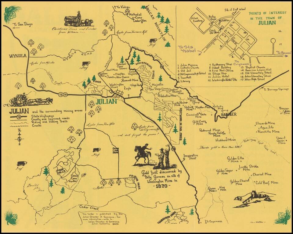
The primary map shows the areas around Julian, stretching from Wynola and Volcan Mountain in the north to Banner in the east, Harrison Park in the south. Includes a number of historical vignettes, roads and clever illustrations.
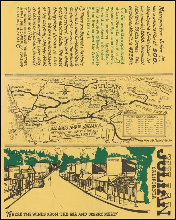
At the top right is a town plan of Julian, locating 17 points of interest, with a few manuscript notes. On the verso is a wider map and mileage chart, covering San Diego County and environs, centered on Julian and Cuyamaca State Park. Below the map, a clever illustration of main street Julian, with the initials RHP (Robert H Porter?), who would seem to be the illustrator, although his name on the map is partially obscured.
The map was likely issued shortly after September 1949, when the Highway 78 Association was formed and first met at Rincon Springs, with the objective of improving and promoting the route. As noted in the Escondido Times Advocate of September 21, 1949:
The association will also endeavor to publicize and popularize Route 78, thereby bringing business to the communities along this arterial. Probably a scenic travel map will be issued, thru cooperation of the business concerns who will benefit, to further promote travel.
One of the objectives of the "highwaymen" will be to extend their route from its present eastern terminus at Kane Springs, in Imperial Valley, on to the town of Calipatria, where it will pick up the International Four States Highway, Canada to Mexico, 1500 miles long. The latter is a much advertised and generally highly improved road . . . With the building of what is now a missing link there in the network . . . San Diego and its highway promotion bodies will take a great interest in Route 78, for it will then be the means of channeling into that city a great volume of traffic from the Four States Road, as the latter intercepts every east-west transcontinental road.
If you are a student, write to us in telegram: @antiquemaps and indicate what material you need and for what work you need a map in high detail. We are ready to provide material on special terms. For students only!
![[Signed Political Satire Artwork] Vietnam ... Vietnam ... Vietnam ...](/map/small/68726.jpg)

