
Rare old maps of the United States.
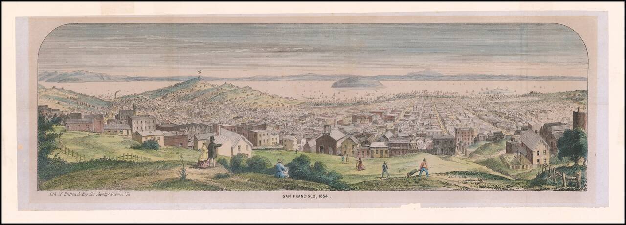
Rare Early Lettersheet View of San Francisco Panoramic view from Pacific Heights of densely populated city and harbor; Telegraph Hill and Russian Hill at left; Yerba Buena Island and bay in distance; artist sketching, onlookers and workers in...
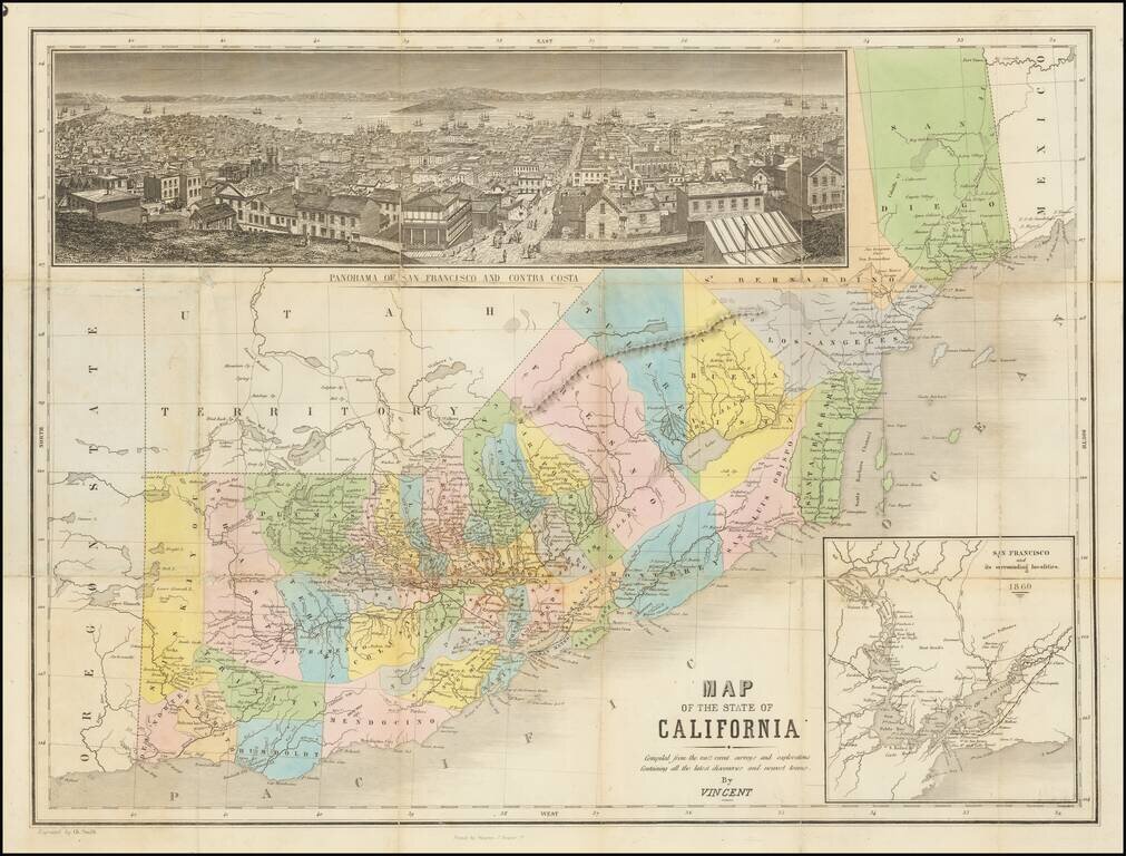
The Thomas Winthrop Streeter Copy Rare hand-colored engraved map of California with east at the top. The map includes a very nice inset view of San Francisco ("Panorama of San Francisco and Contra Costa") and a further inset of "San Francisco and its...
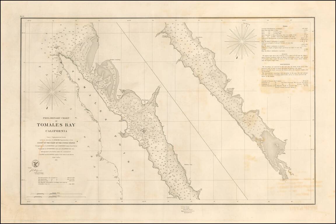
Rare separately pubilshed thick paper example of George Davidson's copy of the US Coast Survey Chart of Tomales Bay, first published in 1861. Tomales Bay's history is quite interesting, having been discovered by the English in the 16th Century,...
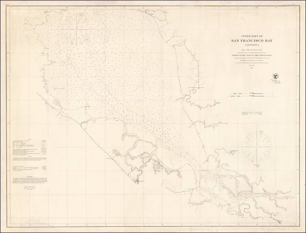
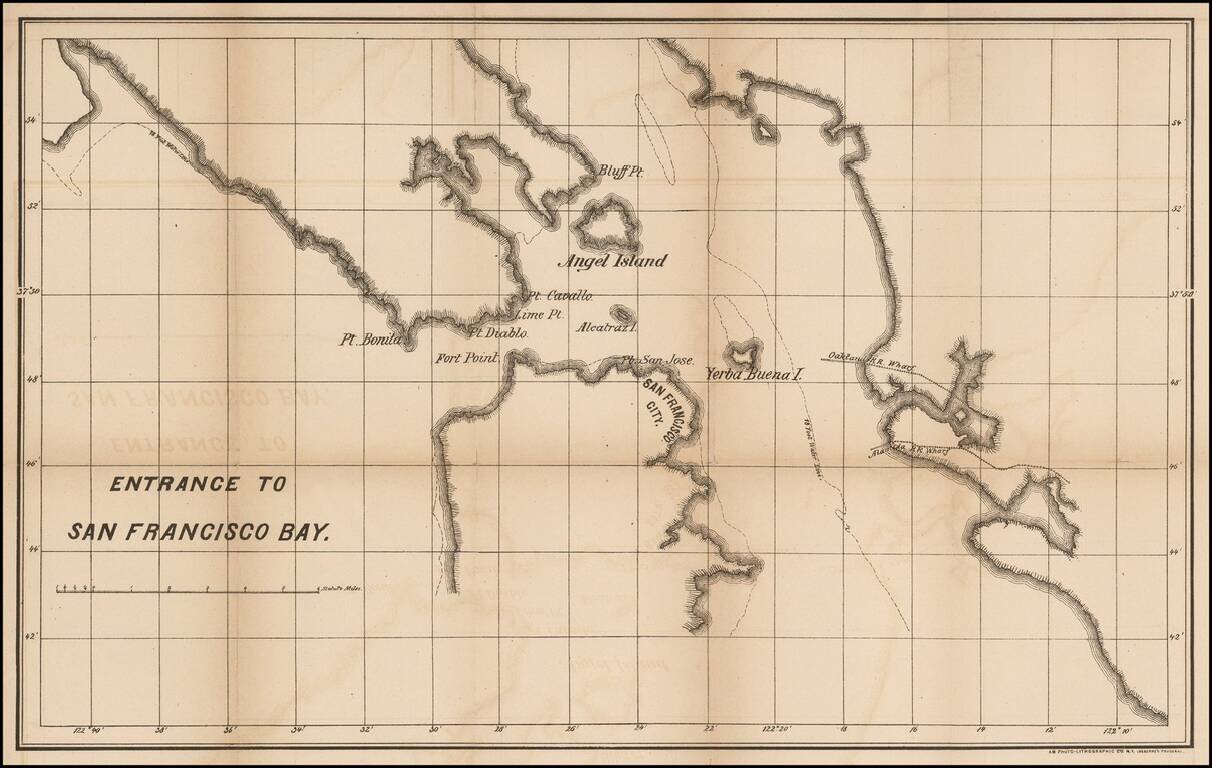
Rare separately issued chart of "Upper San Francisco Bay," published by the United States Coast Survey in 1862. The most northerly point on the map is Pt. Avisadero, just north of Candlestick Point and extending south to San Jose. The chart provides a...
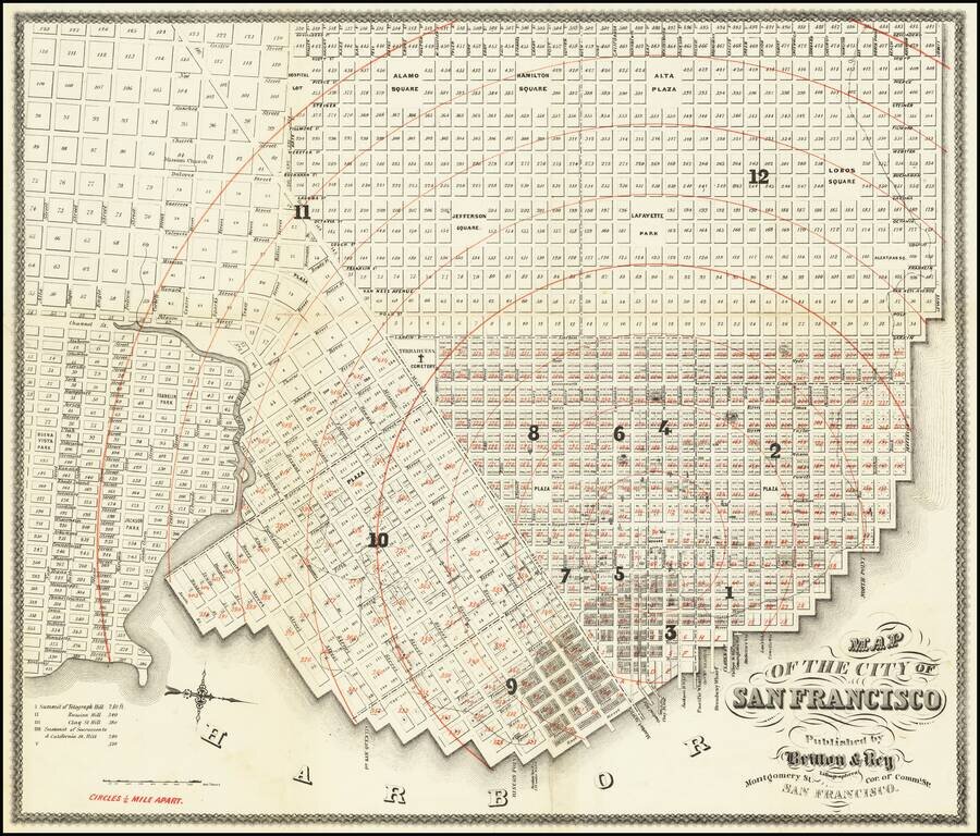
Presentation Copy! -- One of the Earliest Maps of San Francisco published in the City. Finely detailed map of the populated areas of San Francisco, oriented to the west. The map extends west to Divisadero; south to Alta. The present example is...
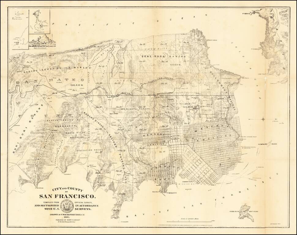
San Francisco at the Height of The Litigation over Land Ownership Claims Rare early map of the City and County of San Francisco, prepared by San Mateo County Vitus Wackenreuder and printed by Britton & Co in San Francisco. This is one of the...
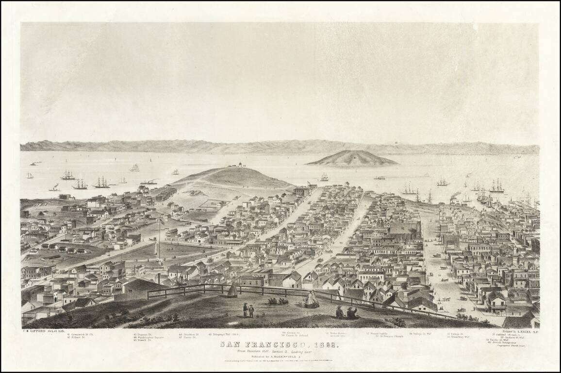
Sheet 3 of Gifford's rare 5-sheet (9 foot) panorama of San Francisco, published by A. Rosenfield in San Francisco, in 1862. The present sheet is centered on Telegraph Hill and Yerba Buena or Goat Island, with Oakland and the East Bay in the distance...
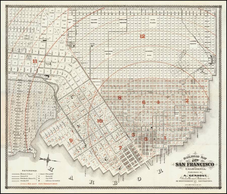
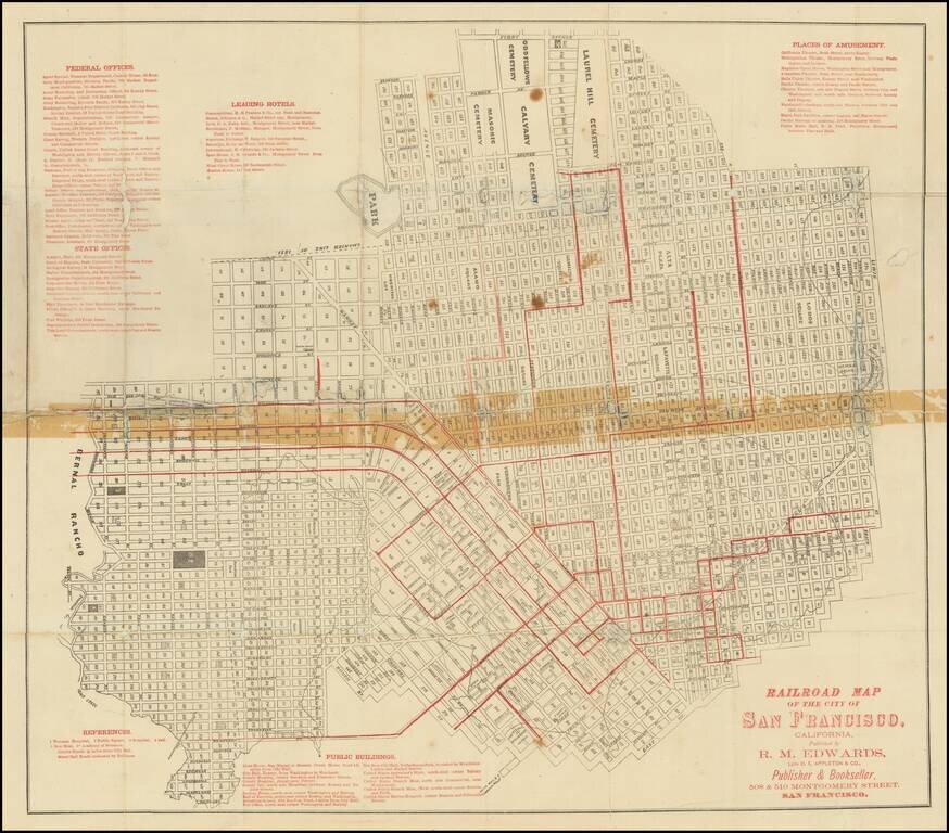
First state of "one of the rarest maps of the City of San Francisco" and one of the earliest printed in the city. The map shows the city in remarkable detail. Rumsey notes: Norris: "Very scarce railroad map of San Francisco." Streeter purchased the...
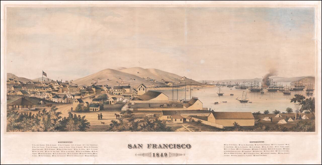
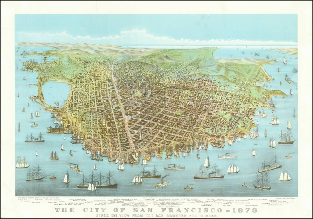
Fine Early View of San Francisco on the Eve of the Gold Rush An important San Francisco view, showing the city just a few months before the explosion in population which came with the Gold Rush. As noted by Deak: "A wide-ranging portrait of San...
Rare map of the San Francisco Bay, published in New York, using Osborne's Process. The empahsis seems to be on the Railroad Wharves in Oakland and Alameda in the East Bay. We have been unable to determine the source of this map and have never...
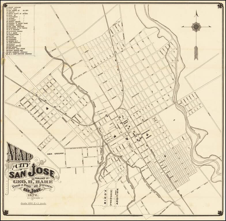
One of the Earliest Printed Maps (and Guides) for San Jose Fine early map of San Jose, lithographed in San Francisco by Britton & Rey in 1872. The map provides a fine early look at San Jose, including street names, early buildings, railroad...
Scarce folding map of San Francisco, with west at the top, printed in black and red, focusing on the city's budding urban rail system. Rumsey (258) dates his example to 1874 on the basis of the "new mint" at 5th and Mission. The first successful San...
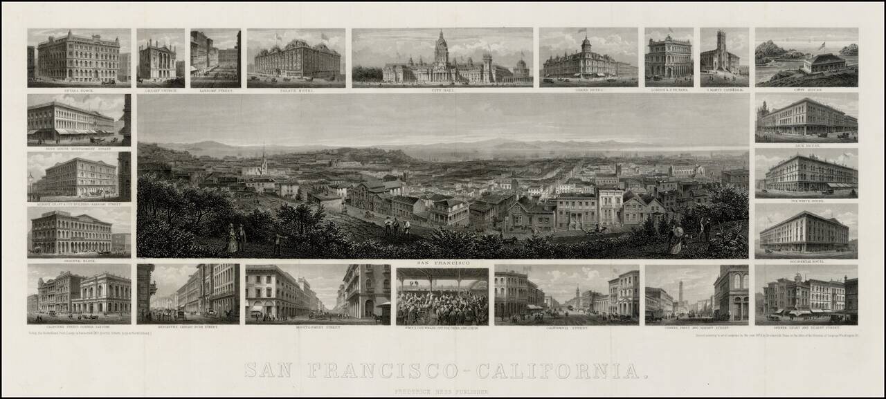
Unrecorded 1875 edition of Frederick Hess's fine steel engraved view of San Francisco, with 22 vignettes of San Francisco buildings. Very rare steel-engraved view of San Francisco with surrounding vignettes of various architectural landmarks of the...
An early reproduction of Currier & Ives famous view of San Francisco, likely printed about 1920.
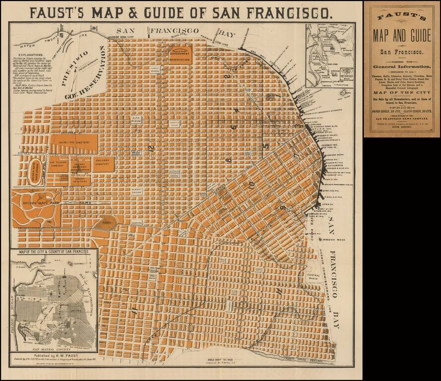
Very good example of Faust's map of the City of San Francisco. Not to be confused with his similar, but more common, map of the City and County of San Francisco, which extended to the Pacific in the west, and shows slightly less detail. The map...
![[Illustrated San Francisco Advertising Map] Map Business Portion San Francisco Showing Location of Hotels, Theaters, Etc. Etc.](/map/small/50207.jpg)
Rare Illustrated San Francisco Advertising Map Rare illustrated 19th Century San Francisco advertising map, which incorporates a map of the San Francisco Business District with finely illustrated advertisements on the front and back of the map. The...