Map size in jpg-format: 5.61647MiB
Click to open in high resolution (open in new tab).
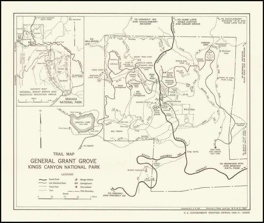
Trails and Big Trees
Early trail map of the General Grant Grover in Kings Canyon, published by the United States Government Printing Office.
The map shows paved roads, low standard roads, truck trails, trails, ranger stations, campgrounds and fire lookouts.
Rarity
OCLC locates 2 copies (Stanford and UC Berkeley).
If you are a student, write to us in telegram: @antiquemaps and indicate what material you need and for what work you need a map in high detail. We are ready to provide material on special terms. For students only!


