
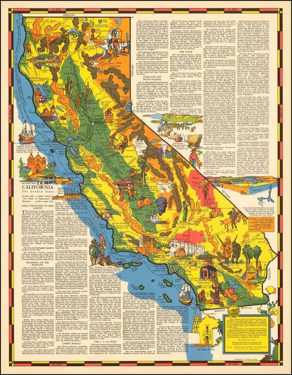
Rare old maps of the United States.
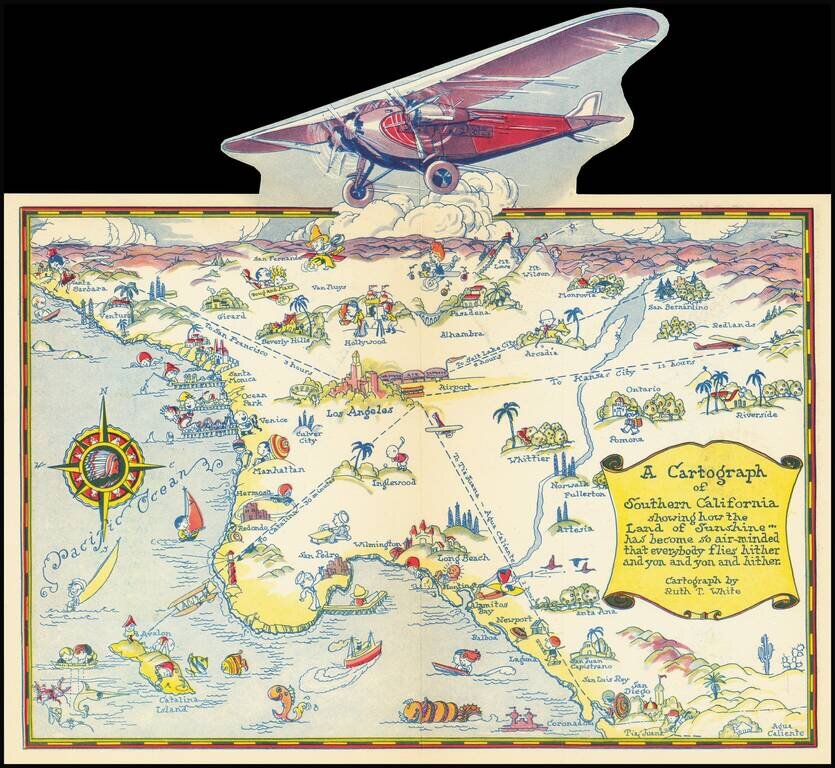
Rare pictographic map of Southern California with pop-up illustration of propeller plane. The map illustrates the routes of Western Air Express, with flights to Kansas City (12 hours), Tia Juana (1 hour), Catalina (30 minutes) and San Francisco (3...
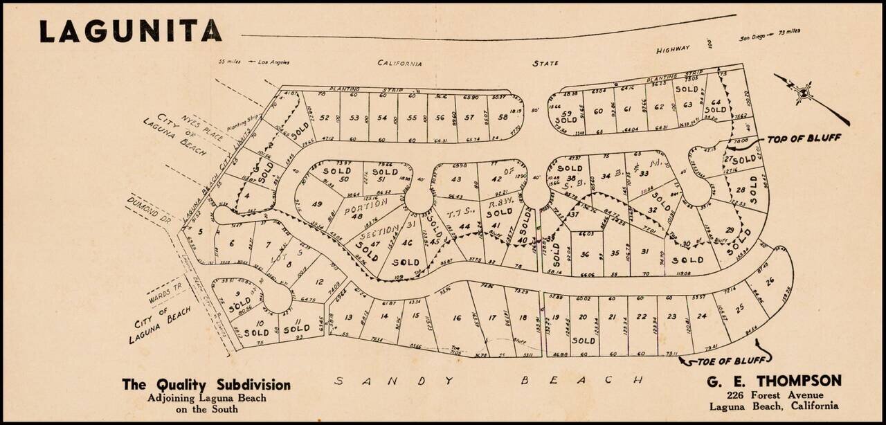
Fine example of this early subdivision map of Lagunita, in Orange County.
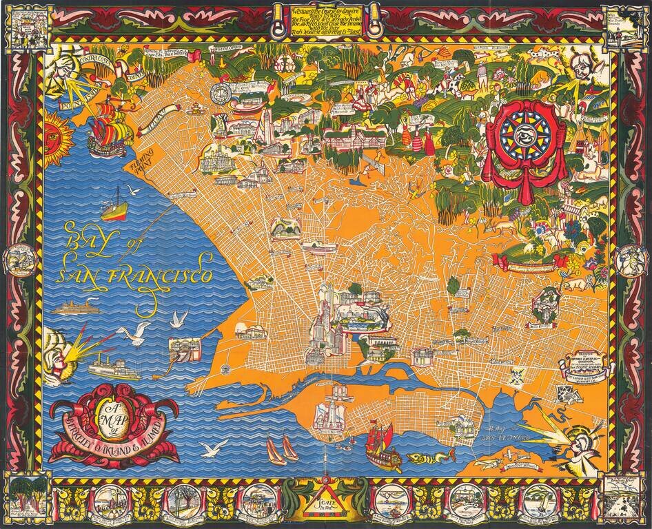
A Monumental Pictorial Map of Berkeley & The East Bay, With Original Decorative Folder Fabulous Art Deco style map by Michael Baltekal Goodman, notable for its brilliant color and striking design. The minimalist design of the street layout at...
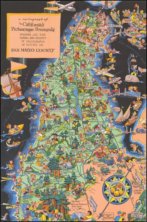
Marvelous whimsical map of San Mateo County by Ruth Taylor White one of the most famous pictograph artists of the period. Ruth Taylor White was among the most prolific makers of pictographic maps. Her whimsical style combines her artistic skills with...
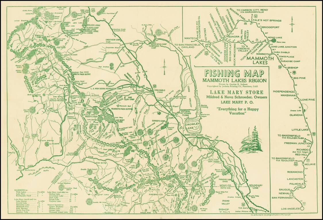
Everything For A Happy Vacation Interesting map of the area centered on Mammoth Lakes and Crowley Lake, published for the Lake Mary Store. The map covers parts of Mono, Inyo, Fresno and Madera Counties, focusing on the locations of the lakes and...
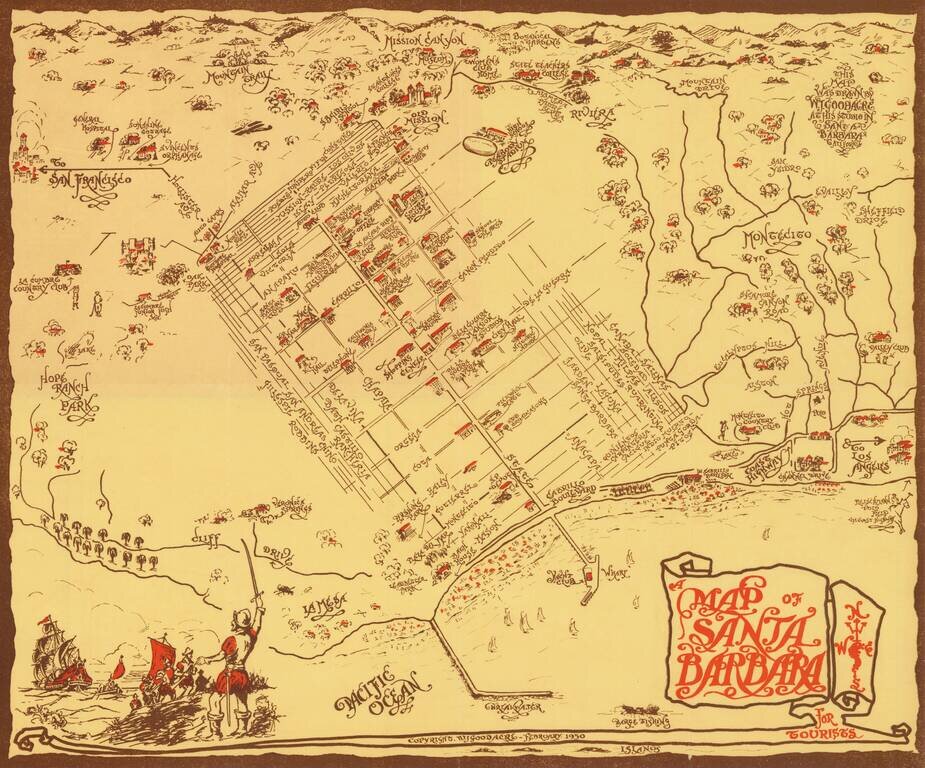
Rare pictorial map of Sant Barbara, drawn by William Johnson Goodacre. The map offers other interesting historical facts about the state of California. William Johnson Goodacre was a commercial artist who came to Santa Barbara from England in 1924....
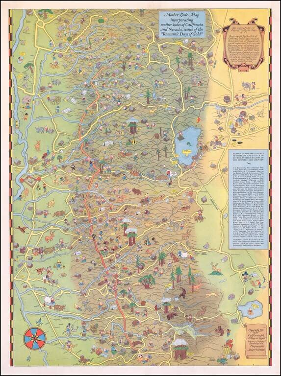
Scarce Pictorial Map of California's Gold Regions, including Lake Tahoe Area. The map extends from the Central Valley to the Comstock Lode, Nevada. A rare map -- the first example we have ever seen on the market.
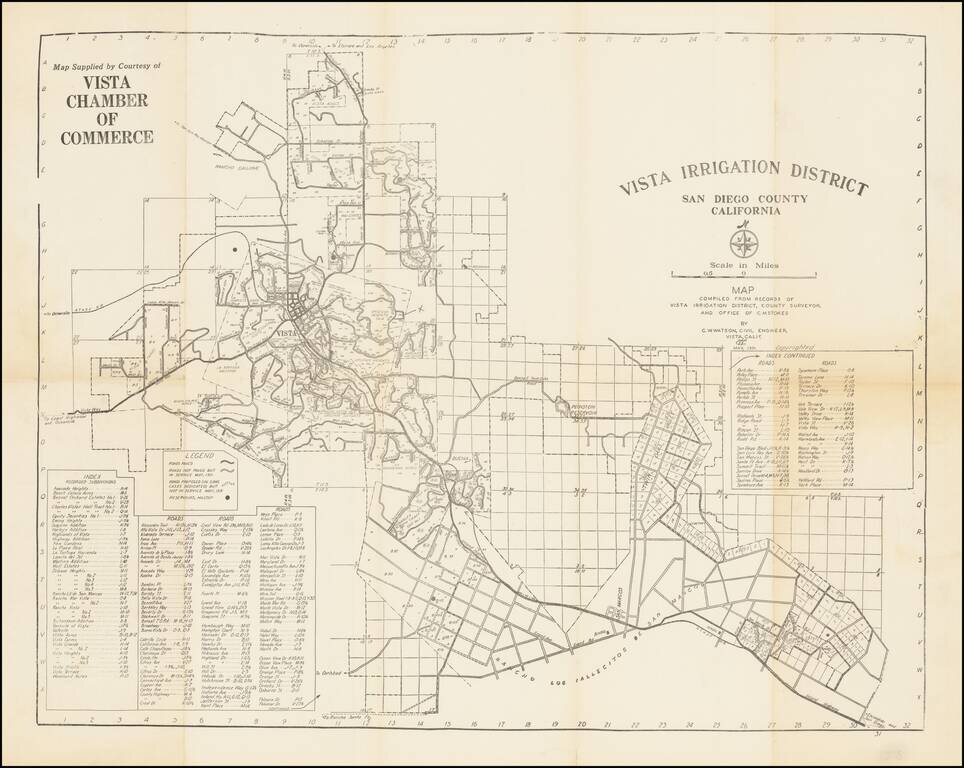
Early San Diego County water map, focusing on the cities of Vista and San Marcos in the North County region. The map was made by C.W. Watson for the Vista Chamber of Commerce. The map shows the initial subdivisions of what is now a major suburb of...
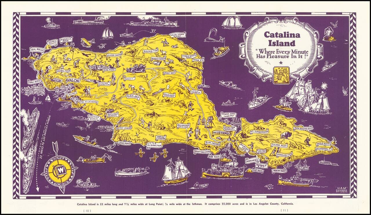
Decorative map of Catalina Island, appearing at the centerpiece of this interesting tourist brochure. The map is scarce. This is the first example we have offered for sale.
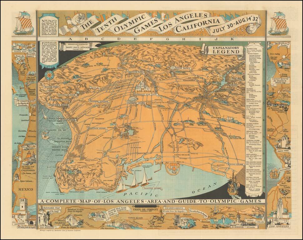
Highly detailed pictographic map, depicting Los Angeles, with a number of maps around the outer portion of the map illustrating various coastal and inland routes. The verso of the map extends from Riviera Country Club and USC and the Coliseum to City...
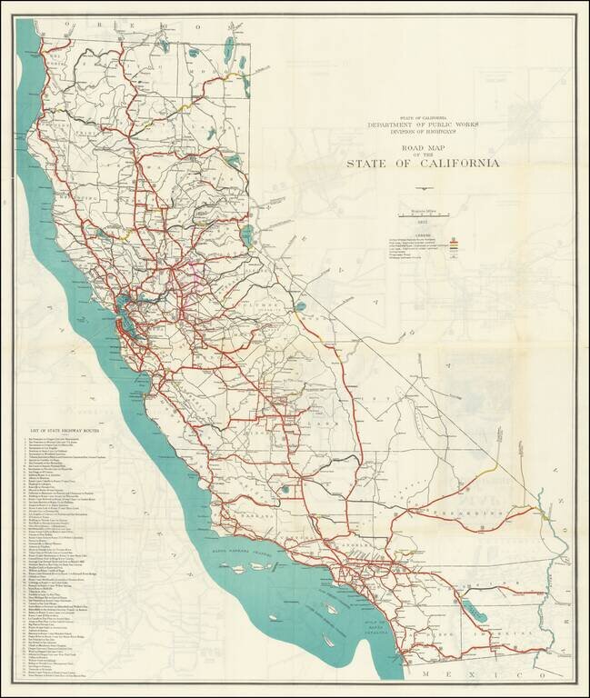
Large color-printed folding map of the roads in California in 1932, produced by the State of California, Department of Public Works, Division of Highways. The legend shows the following: United States Highway Route Numbers High type, improved or...
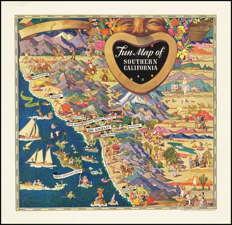
Striking pictorial advertising map, drawn by Raymond Winters in 1935. The map was originally published for the All-Year Club of Southern California and was issued both as a separate map and an advertising insert. Raymond Winters was a noted Western...
![[Imperial Valley]](/map/small/69292.jpg)
America's Winter Garden Fine promotional map and pamphlet, promoting the benefits of the Imperial Valley as an agricultural opportunity for farmers. The map provides a fine pictorial overview of Imperial County, with pictorial vignettes highlighting...
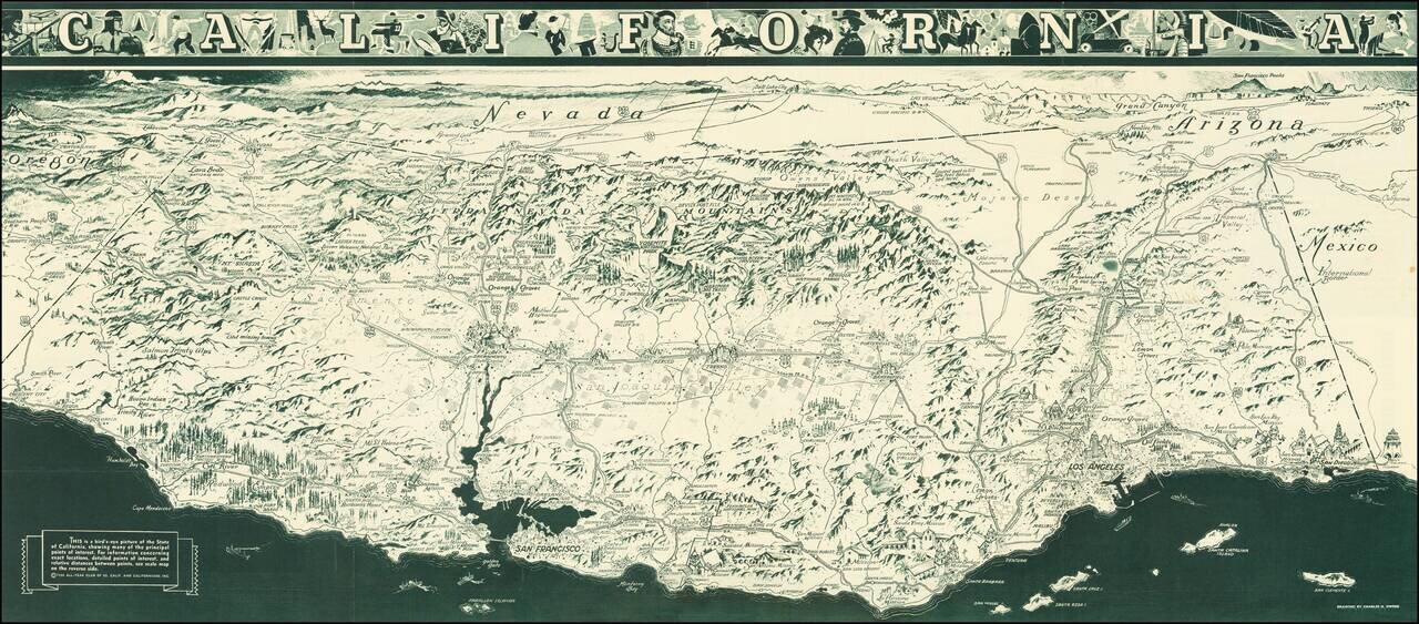
"While attractions for tourists are unlimited in California, it is necessary to advise persons seeking employment not to come here at this time. When opportunity arises California will gladly make it known." A striking Depression Era birds-eye view...
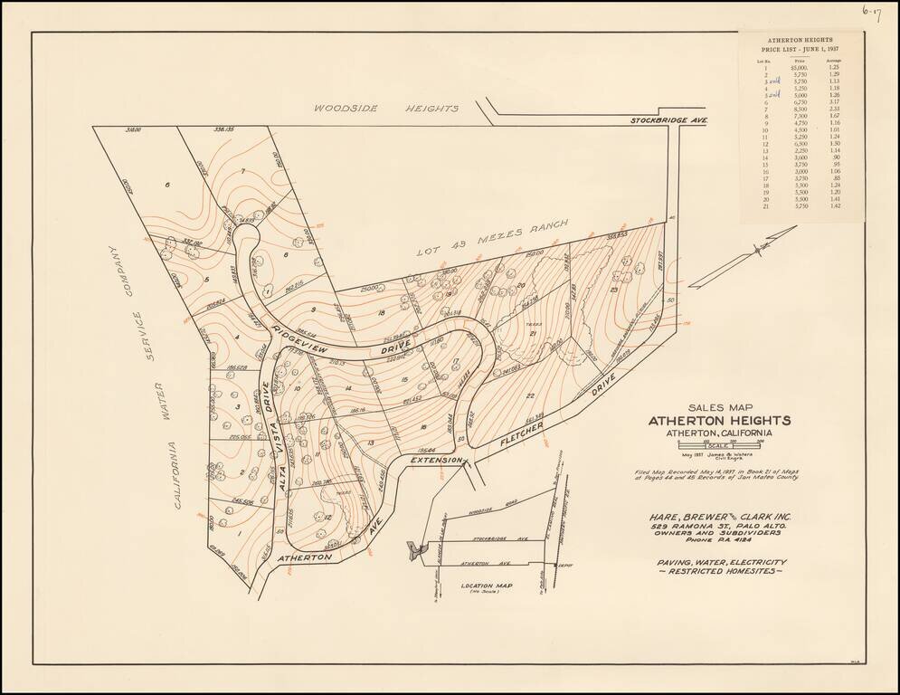
The First Subdivision Map of Atherton Heights - With Price List! Rare Subdivision Sales map for Atherton Heights, in Atherton, California, dated May 1937, prepared for Hare, Brewer and Clark, Inc., the owners and subdividers of Atherton Heights. The...
Rare pictorial map of California by R.T. Aitchison, published by the The Mentholatum Company. The map includes decorative vignettes illustrating California and a detailed text history of the state. R.T. Aitchison was a Wichita, Kansas illustrator....