logo

1948. Map of California Showing the State as it was known a century ago. Based on Briton & Rey's Lithograph of 1857, the first Map drawn from United States Land and Coat Surveys…

  • Map of California Showing the State as it was known a century ago.  Based on Briton & Rey's Lithograph of 1857, the first Map drawn from United States Land and Coat Surveys…

Map of California Showing the State as it was known a century ago. Based on Briton & Rey's Lithograph of 1857, the first Map drawn from United States Land and Coat Surveys… information:

Year of creation: 
Resolution size (pixels): 
 2768x4060 px
Disk Size: 
 2.2073MiB
Number of pages: 
 1
Place: 
 Unknown

Print information. Print size (Width x height in inches):
Printing at 72 dpi 
  38.44 х 56.39
Printing at 150 dpi 
 18.45 х 27.07
Printing at 300 dpi 
 9.23 х 13.53

An example of detailing the file of this map of in a printable high-resolution:

Click to open in high resolution (open in new tab).
Attention! this is just the central piece (central area 960x960 px) of the map file!
This is an example, so that you can see and study the level of detail of a given map. The entire Map will be fully available after payment!

Map of California Showing the State as it was known a century ago.  Based on Briton & Rey's Lithograph of 1857, the first Map drawn from United States Land and Coat Surveys…

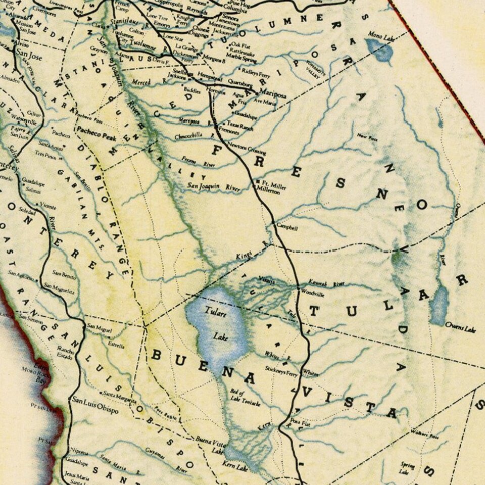
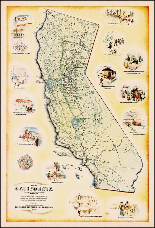
Decorative map of California, prepared under the direction of the California Centennial Commission to celebrate 100 years of California statehood.

The map shows California as it was in 1848 and includes illustrations of the Bear Flag Revolt, San Francisco Docks in 1849, Colton Hall in Monterrey, Portola's sighting of San Francisco, Cabrillo's discovery of California, Father Junipero Serra leaving the Mission San Gabriel, Pico's surrender to Fremont, the Manly expedition in Death Valley, Stage Coach headed for the mother load, Marshall's discovery of Gold, Fillmore's signing off on the admission of California to the Union in 1850, Survivors of the Donner Party and Klamath Indians.

A fine decorative image.


Special conditions for students!

If you are a student, write to us in telegram: @antiquemaps and indicate what material you need and for what work you need a map in high detail. We are ready to provide material on special terms. For students only!

Item information:

Year of creation:
Size:
2768x4060 px
Disk:
2.2073MiB
Number of pages:
1
Place:
Unknown
Author:
California Centennial Commission.
$14.99

Related item