
Rare old maps of the United States.
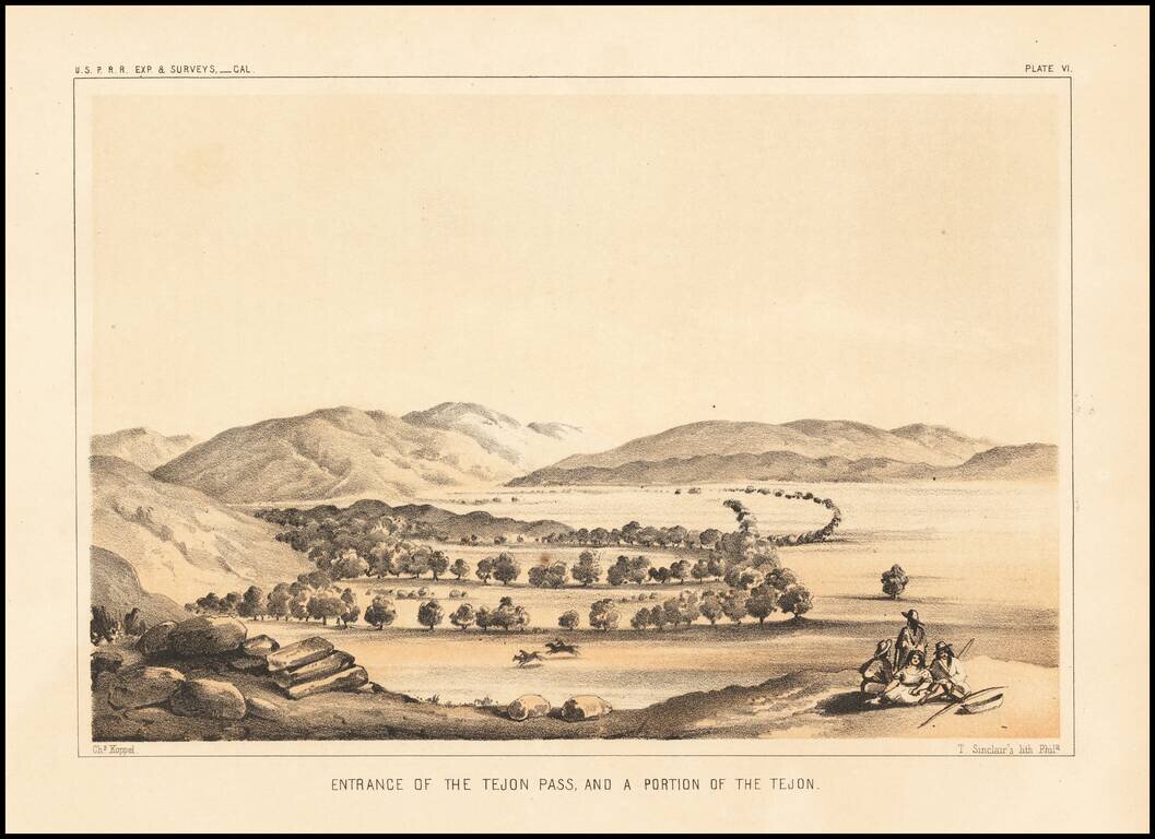
Interesting early view, looking into the Valley from the Tejon Pass.
![Valley of Kah Wee Ya River (Four Creeks) [San Joaquin Valley]](/map/small/61893.jpg)
Detailed view of the Valley of the Kah Wee Yah River, apparently the Tulare River.. From Reports of Explorations and Surveys, to ascertain the most practicable and economical route for a railroad from the Mississippi River to the Pacific Ocean, made...
Detailed view of the Valley of the Kah Wee Yah River (Tulare River) and the Kings River. From Reports of Explorations and Surveys, to ascertain the most practicable and economical route for a railroad from the Mississippi River to the Pacific Ocean,...
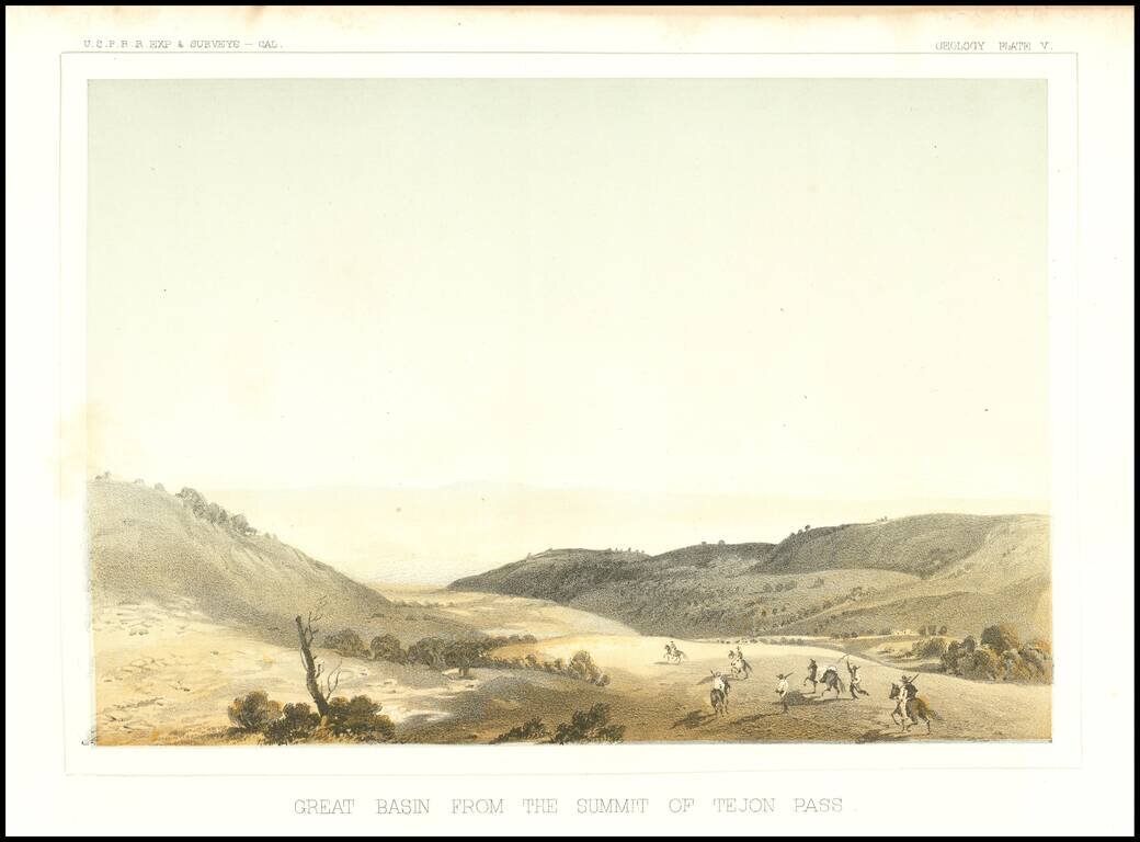
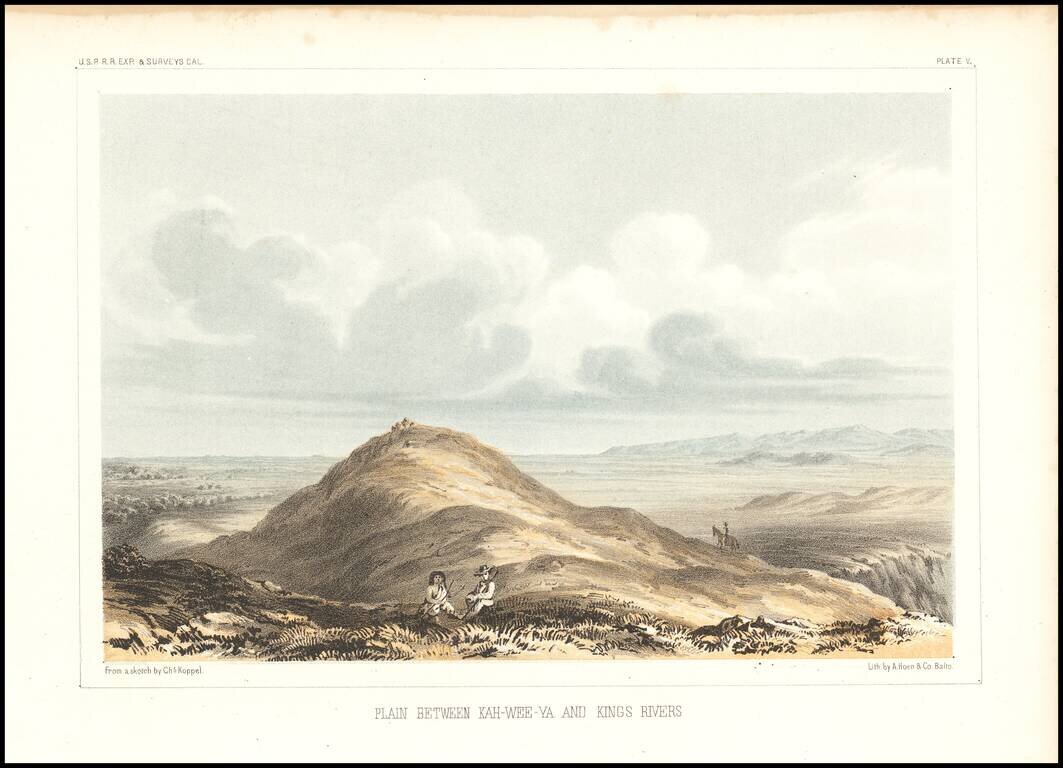
Early view of the Tejon Pass, looking to the northeast.
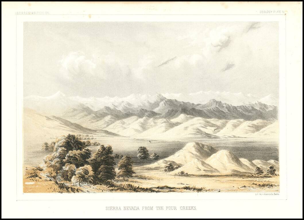
Detailed view of the Valley of the Kah Wee Yah River (Tulare River) and the Kings River. The expedition surveying the southern route along the 35th parallel, led by Lieutenant Amiel Weeks Whipple, explored from Little Rock, Arkansas, through Oklahoma,...
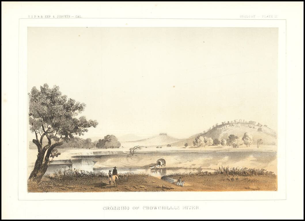
Interesting depiction of a crossing of the Chowchilla River, in Central California. The Chowchilla River is a river in Central California and a minor tributary of the San Joaquin River. It flows for 65 miles from the western side of the Sierra Nevada...
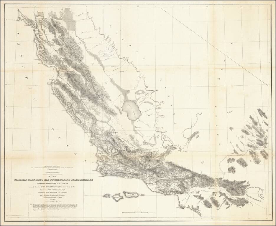
Fabulous regional map, extending from just north of San Francisco Bay to Orange County (not named) and the San Bernardino Valley. The map includes remarkable topographical detail throughout.
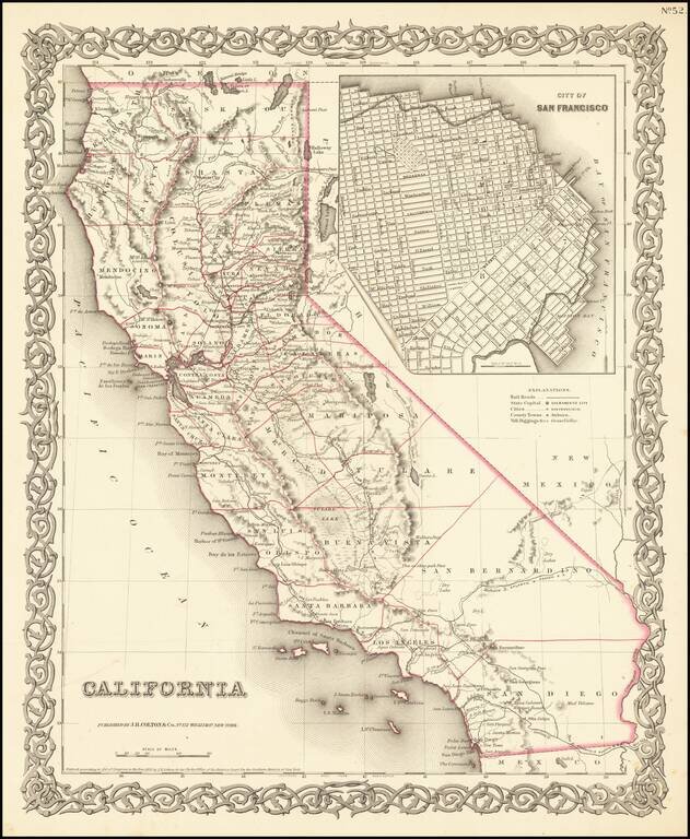
Rare first state of Colton's map of California, from Colton's Atlas of the United States. Only 6 counties in Southern California, including San Diego, Los Angeles, San Bernardino, Buena Vista, Santa Barbara and San Luis Obispo. Decorative border.
![Sketch of Anacapa Island In Santa Barbara Channel . . . 1854 [with] Reconnaissance of Smith's or Blunt's Island Washington . . . 1854 [J.A. Whistler engraving]](/map/small/70293.jpg)
Whistler's Seagulls -- Earliest Known Engraving Work By James Abott MacNeil Whistler An extremely important set of maps of from the California Coastline, being the first known example of the engraving work of James Abbott MacNeill Whistler, who would...
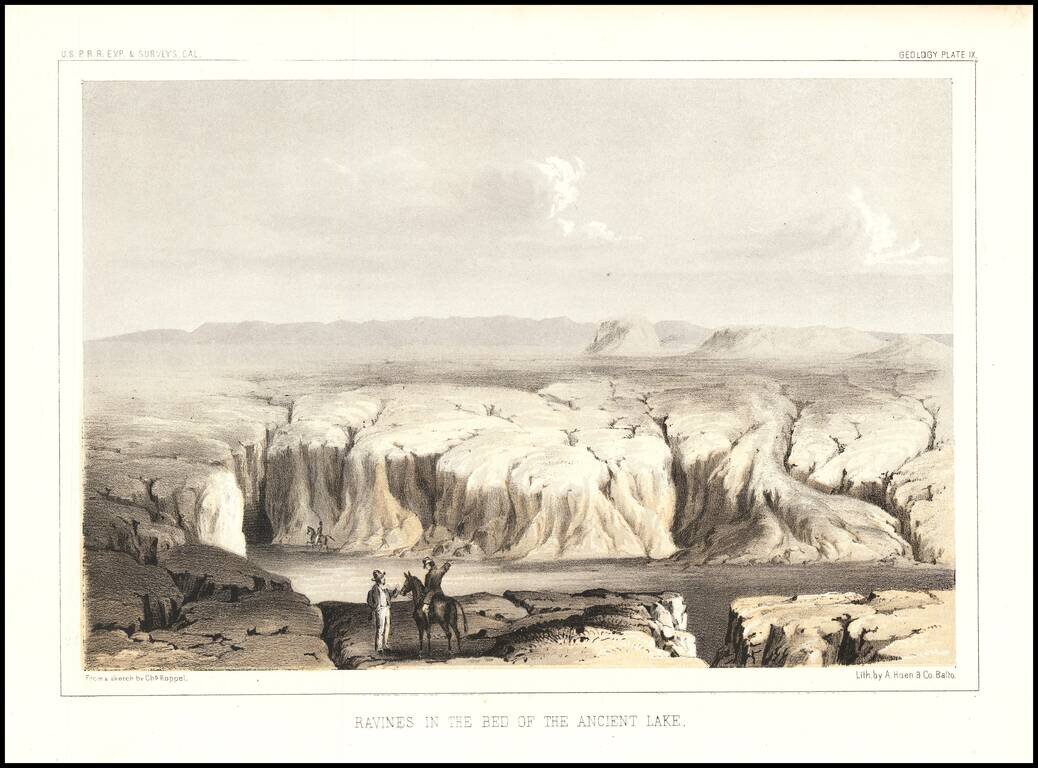
Interesting view showing a dry lake bed on the Arizona/California Border. The view was engraved by Charles Koppel for the Reports of Explorations and Surveys To Ascertain The Most Practicable and Economical Route For A Railroad From The Mississippi...
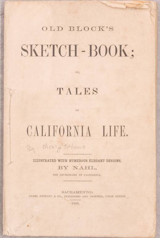
"Both author and illustrator are characteristically Californian, and few volumes have a truer flavor of the Mother Lode than this result of their combined efforts ... The illustrator collaborated with 'Old Block' in other volumes but this particular...
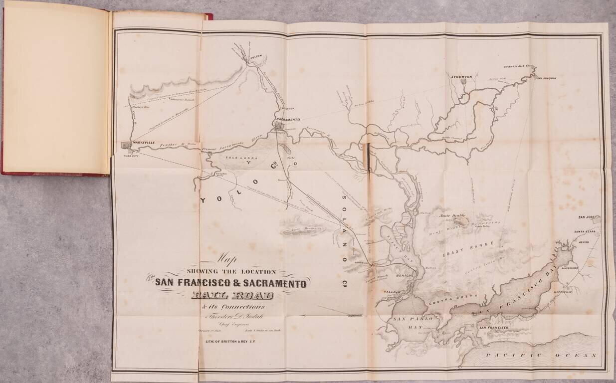
The Thomas W. Streeter - Warren Heckrotte Copy -- Rare Early California Railroad Map and Pamphlet By One of America's Most Important Railroad Engineers Rare early report on a California railroad, produced by Theodore Judah, the engineer who was the...
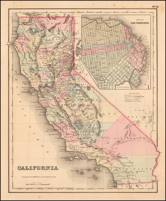
Scarce example of Colton's map of California, from Colton's Atlas of the United States. Hand colored by county. Only 6 counties in Southern California, including San Diego, Los Angeles, San Bernardino, Buena Vista, Santa Barbara and San Luis Obispo....
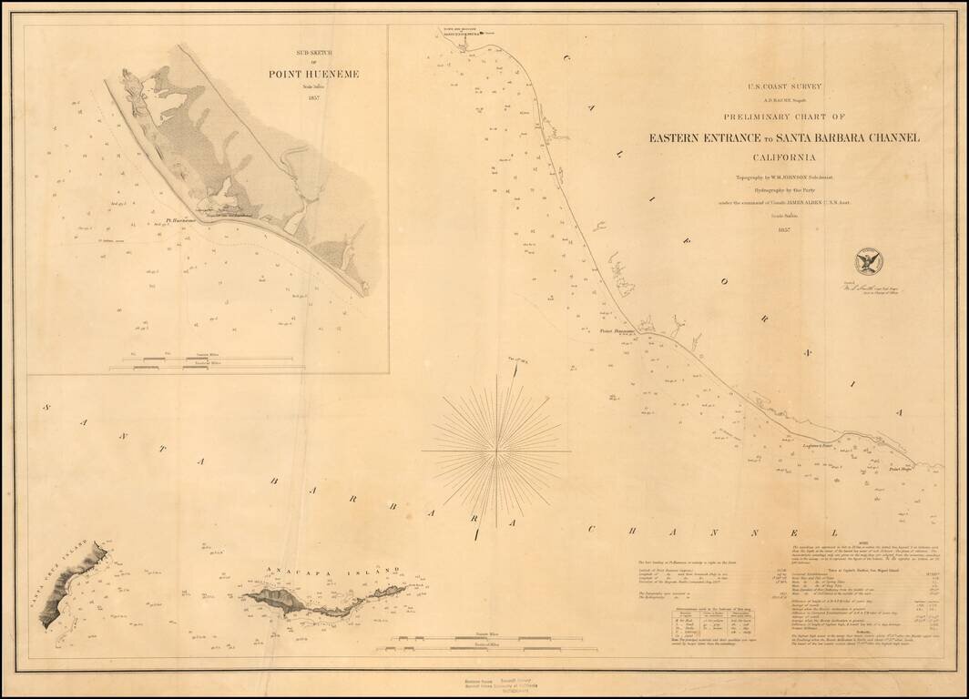
Fine Example on Thick Paper Early sketch chart, showing the Santa Barbara Channel from the Town and Mission of Santa Buenaventura (Ventura) to Point Magu and extending east to Anacapa Island and the western coastline of Santa Cruz Island. Includes...
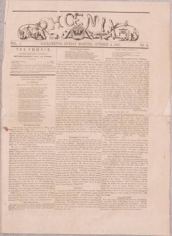
A Nearly-Complete Run of One of the Great Rarities of California Newspaper Collecting - the Sacramento Phoenix. Ned McGowan's Initial Response to the San Francisco Vigilance Committee. A substantially complete run of fifteen issues (numbers 6-20 and...
Fine large British sea chart of the Coast of California, improved to 1897, with small corrections to 1925. The chart tracks the coast of California, showing over over 30 light houses and lights, meticulous soundings and sailing directions. Early rail...