logo

1923. Midget Map of Santa Barbara, California

  • Midget Map of Santa Barbara, California
  • Midget Map of Santa Barbara, California

Midget Map of Santa Barbara, California information:

Year of creation: 
Resolution size (pixels): 
 7243x5775 px
Disk Size: 
 12.4083MiB
Number of pages: 
 2
Place: 
 Los Angeles
Author: 

Print information. Print size (Width x height in inches):
Printing at 72 dpi 
  100.6 х 80.21
Printing at 150 dpi 
 48.29 х 38.5
Printing at 300 dpi 
 24.14 х 19.25

An example of detailing the file of this map of in a printable high-resolution:

Click to open in high resolution (open in new tab).
Attention! this is just the central piece (central area 960x960 px) of the map file!
This is an example, so that you can see and study the level of detail of a given map. The entire Map will be fully available after payment!

Midget Map of Santa Barbara, California

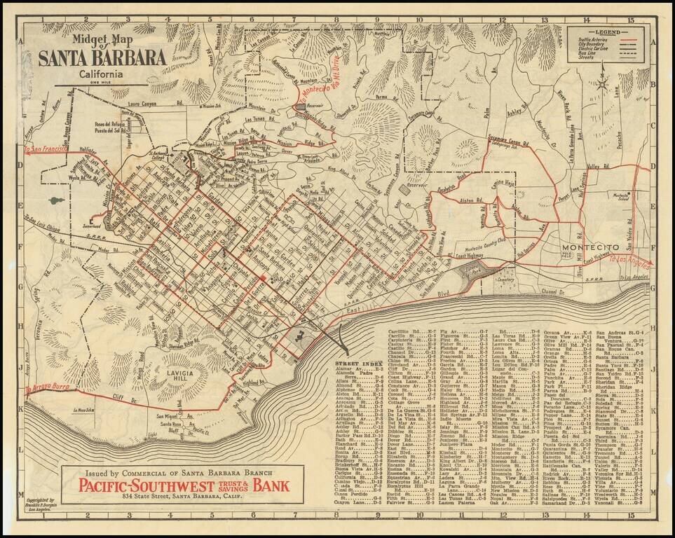
Rare early "midget" series map of Santa Barbara, published as a promotional map for Pacific-Southwest Trust & Savings Bank.

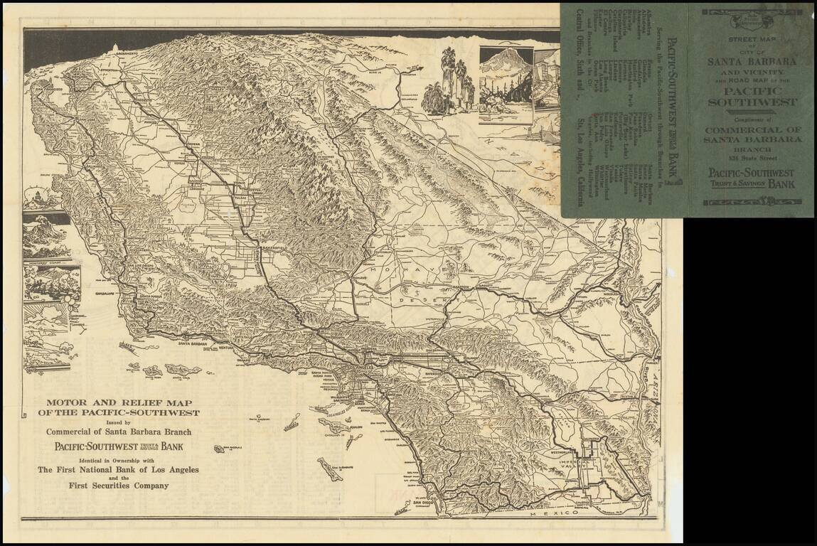
Includes a birdseye view style "Motor and Relief Map" of Southern and Central California (extending to San Francisco) on the verso.

This is the first example of the map we have ever seen.


Special conditions for students!

If you are a student, write to us in telegram: @antiquemaps and indicate what material you need and for what work you need a map in high detail. We are ready to provide material on special terms. For students only!

Item information:

Year of creation:
Size:
7243x5775 px
Disk:
12.4083MiB
Number of pages:
2
Place:
Los Angeles
Author:
Franklin P. Borgnis.
$14.99

Related item