
Rare old maps of the United States.
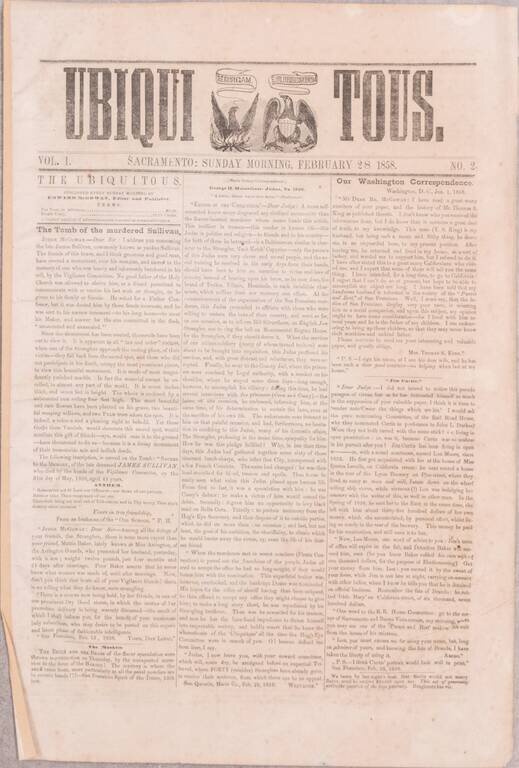
A Nearly-Complete Run of One of the Great Rarities of California Newspaper Collecting. Ned McGowan's Continued Response to the San Francisco Vigilance Committee. A substantially complete run of sixteen issues (numbers 2-11 and 13-18, of 18 total) of...
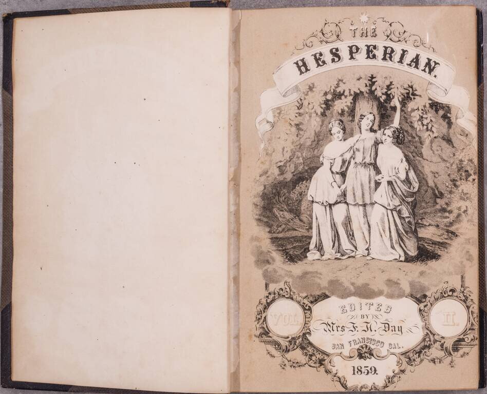
Extremely early women's periodical, published in San Francisco. This periodical is an early example of a magazine published by women for women, founded and edited by Mrs. F. H. Day. The work is an exceptional rarity. The "most complete" example...
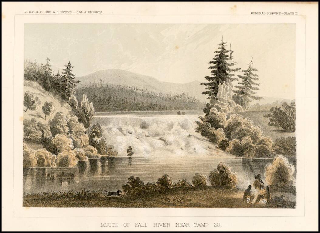
Striking view of Fall River near Camp 20, from the Pacific Railroad Surveys.
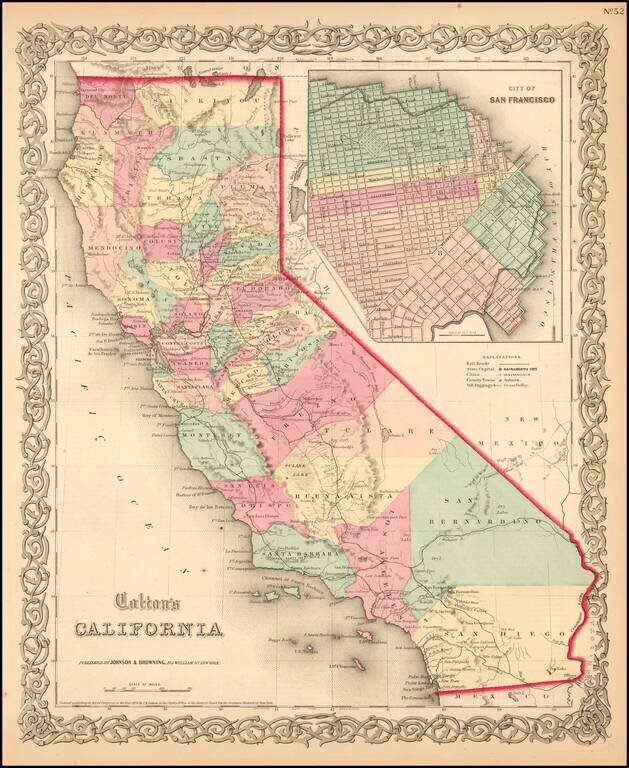
Scarce example of Colton's map of California, from Colton's Atlas of the United States. Hand colored by county. Only 6 counties in Southern California, including San Diego, Los Angeles, San Bernardino, Buena Vista, Santa Barbara and San Luis Obispo....
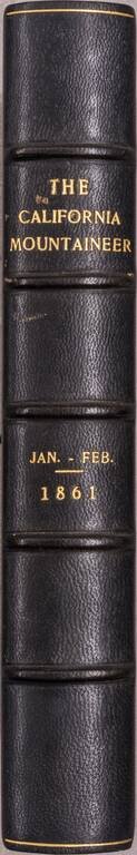
Six (of seven) issues of an important early California periodical, which ran for seven issues (from January to July of 1861). After seven issues, it merged with the recently-sold Hutchings’ Illustrated California Magazine; the combined Magazine and...
Attractive map of California, colored by county. Predates a number of Southern California Counties. Includes a detailed inset plan of San Francisco, colored by wards. Shows towns, roads, railroads, rivers, lakes, mountains, missions, etc. Decorative...
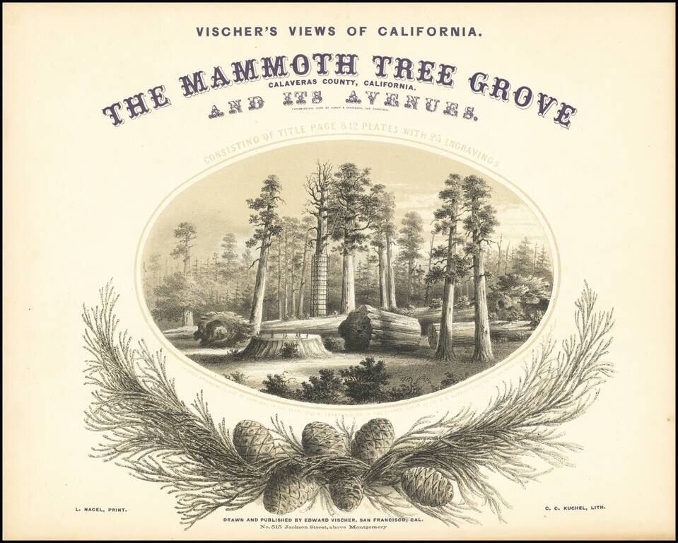
One of the Great California Plate Books. With Superb Lithographs of California's Giant Sequoias. This is the first edition, third issue (with three more plates called for by the title than the earlier issues), of Edward Vischer's great work on the...
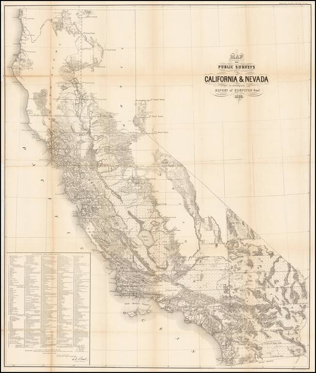
Remarkable large format map of California (along with some information in the Lake Tahoe area of Nevada), reporting the extent of the Land Office Surveys through 1863. The most notable feature is the list of 433 private land grants for which final...
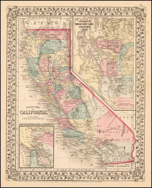
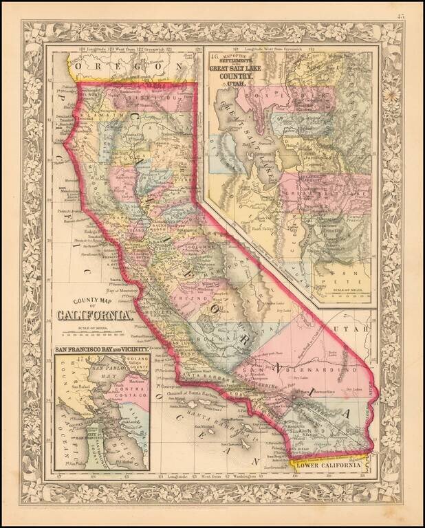
Fine early example of Mitchell's map of California, colored by county. Shows towns, railroads, roads, mountains, lakes, dry lakes, rivers, forts, etc. Insets of San Francisco Bay and the area around Salt Lake, with counties. Decorative border....
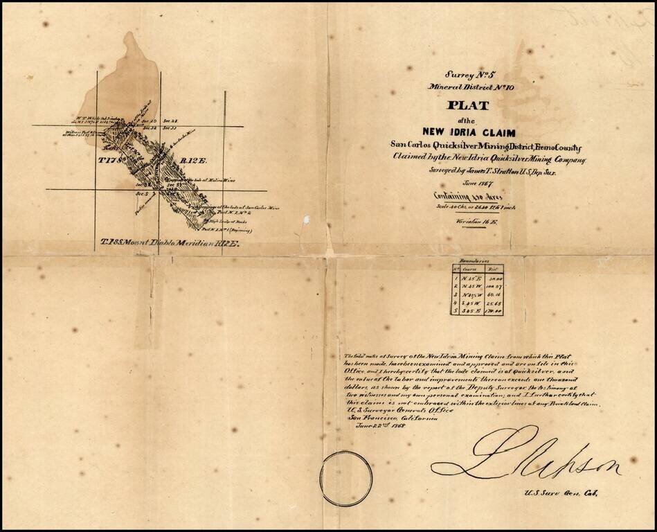
New Idria is an unincorporated town in San Benito County, California, which was named for a quicksilver (cinnabar) mine of the same name. The mine itself was named in honor of the world's second largest quicksilver mine in Idrija, Slovenia. The...
Rare separately issued map of California, published in New York City by Colton. Includes excellent detail throughout the map, including counties, roads, rivers, lakes, mountains, railroads, stations, gold mines, dry lakes, extinct volcano craters,...
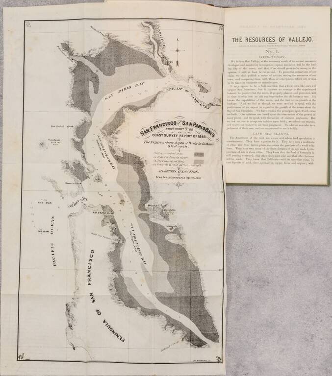
Rare Early Promotional Tract For The City of Vallejo Rare early pamphlet and maps on the prospects of the "up-bay" city of Vallejo, initially published by the local newspaper and later issued as a separate pamphlet. The two folding maps are San...
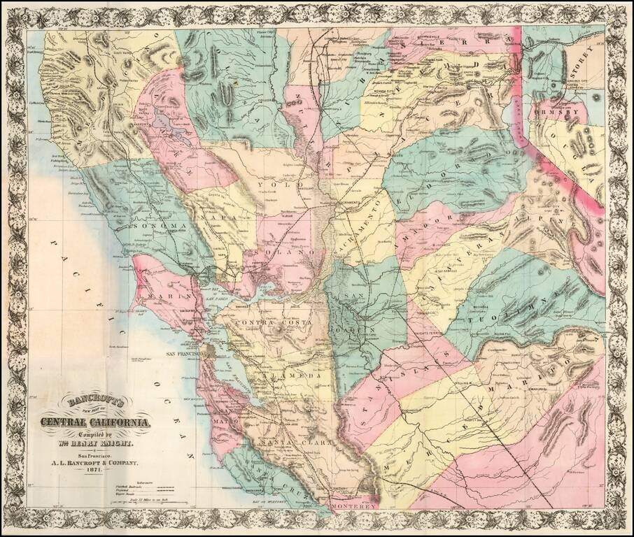
A Handsome Separately-Issued California Map Rare separately issued map of Central California and the Virginia City-Comstock Mining Region, compiled by William Knight and published by the San Francisco firm of A. L. Bancroft & Co. William Knight's...
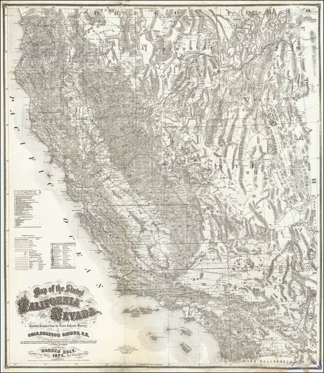
First state of this fine large format map of California and Nevada by Charles Drayton Gibbes, probably the best and most authoritative map of the region published in the 1870s. Charles Gibbes first issued his large format map of California and Nevada...
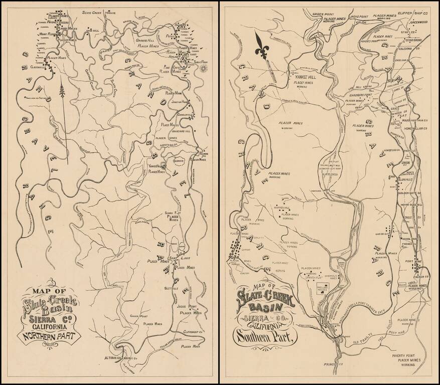
Fine Pair of California Gold Country Maps. Scarce pair of maps showing a portion of Sierra County, in California's Gold Region, with valuable information on individual mines and tunnels.
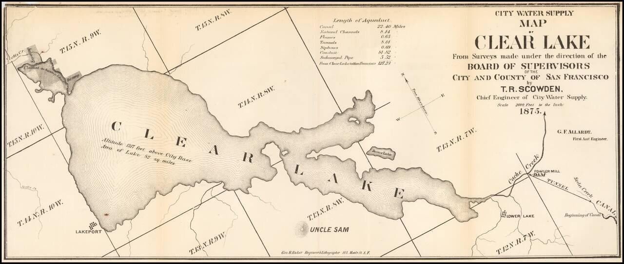
Fine early map of the Clear Lake Area, by George H. Baker, acknowledged as one of early California's leading artists and lithographers whose pioneering work documented California's earliest history. The map would seem to have been prepared for a...