
Rare old maps of the United States.
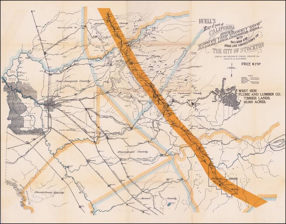
Electric Flumes! Detailed map of a portion of the mining regions of California, showing the area from Bouldin Island (just west of the City of Stockton) to Yosemite and from Amador County south to the Merced River. The map includes remarkable detail...
![[California in Miniature] Bird's-Eye View Map Showing Its Prominent Topographical Features, Location of Principal Cities, Towns and Points of Note, Also Lines of the Southern Pacific Company. 1898.](/map/small/63460.jpg)
A Synopsis of Resorts and other attractions worth visiting . . . Interesting birdseye view map of California, published by the Southern Pacific Company. The map is oriented with East at the top, looking from the Pacific Ocean to the Sierra Nevada...
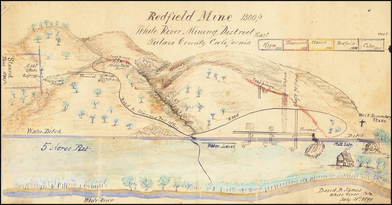
Manuscript View of Mining District By California Inventor David Bice James. Highly detailed rendering of the area around the White River, Mining District, drawn by David B. James, who would then have been serving as Mining Superintendent. James story...
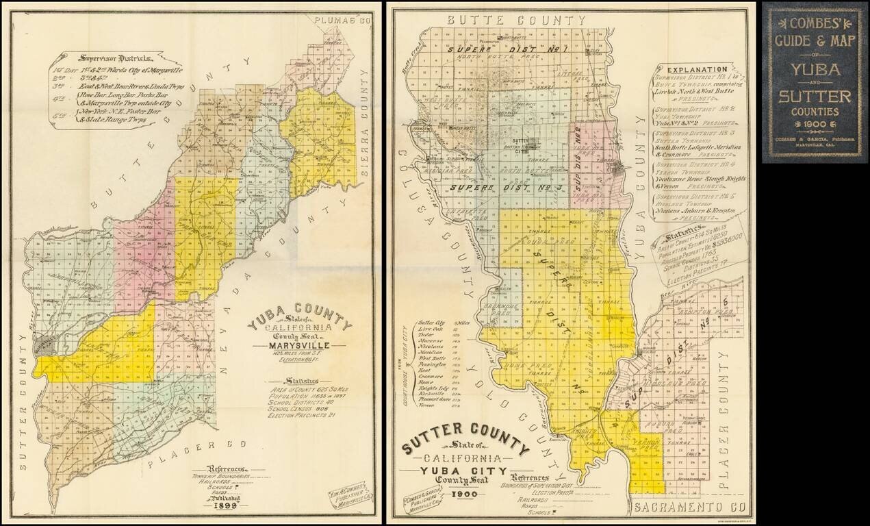
Highly detailed pair of pocket maps of Yuba County and Sutter County, published in Marysville and lithographed and printed by Britton & Rey in San Francisco. The maps are divided into townships and colored by County Supervisor districts, noting...
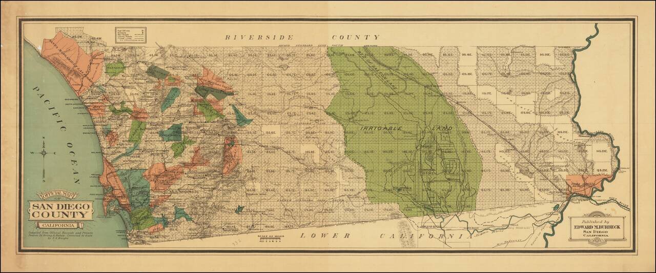
Colored By Ranchos! Fine early map of San Diego County, published by Edward M. Burbeck. the map shows the progress of township subdivisions, but is most noteworthy for its illustration of ranchos in color, an unusual feature for printed maps. Dozens...
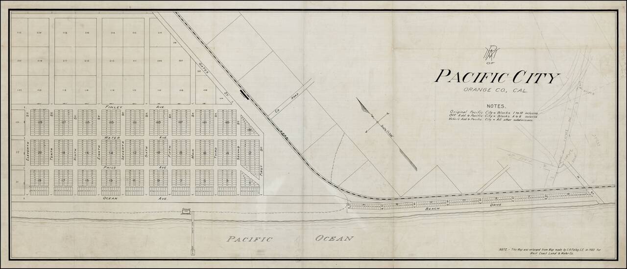
Rare Pacific Electric Railway working map of Pacific City, the first name used for the community which is now Huntington Beach, California, prior to its incorporation in 1909. The map is enlarged from the map made by S.H. Finley, Civil Engineer, in...
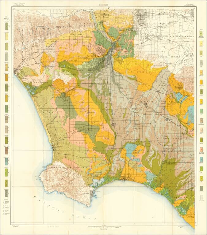
Colorful and highly detailed map of the Los Angeles Basin, drawn from maps by the United States Geological Survey. The map extends from the Sana Monica Mountains to Azusa in the north, to Rancho Las Bolsas (Huntington Beach, area) and Palos Verdes....
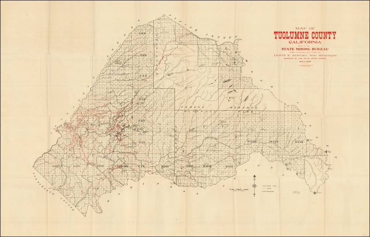
Scarce mining map of Tuolomne County, prepared by the California State Mining Bureau. The map identifies by number the active mining claims in the county, along with towns, roads, rivers, mountains, etc. The first time we have ever seen maps from this...
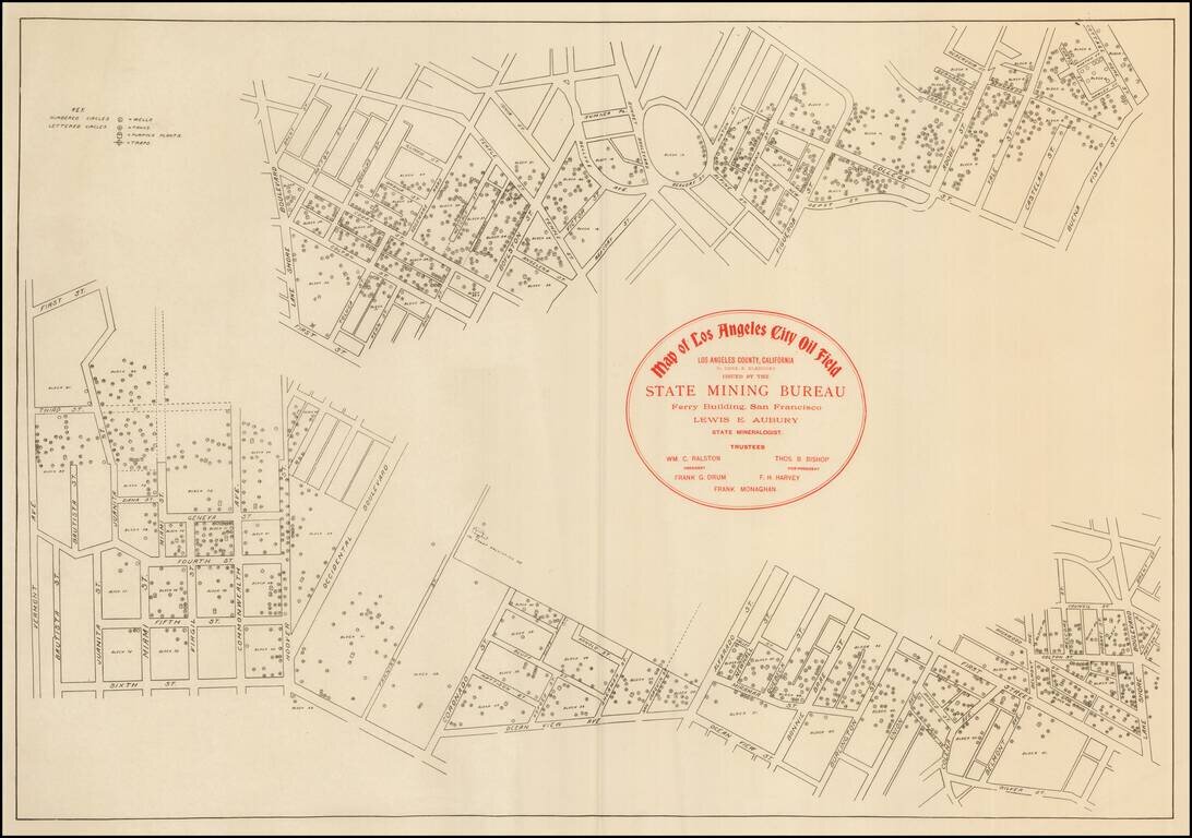
Rare early map of the Los Angeles Oil fields. The map shows many oil wells in the heart of Los Angeles, along with the tanks, pumping plants, and traps.
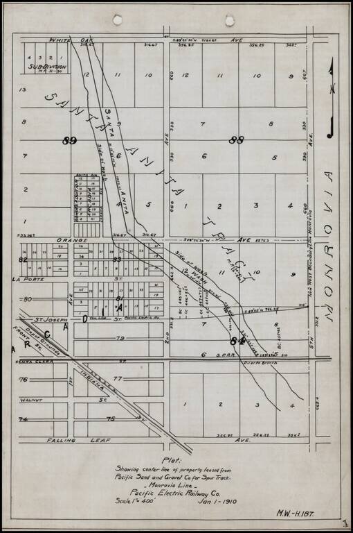
Detailed internal sketch map of the Pacific Electric Railway lines in Arcadia, California. Shows Depot Grounds of the ATS&F, Southern Pacific Railroad's Duarte Branch, a portion of the Santa Anita River and a street plan, centered on 2nd Avenue...
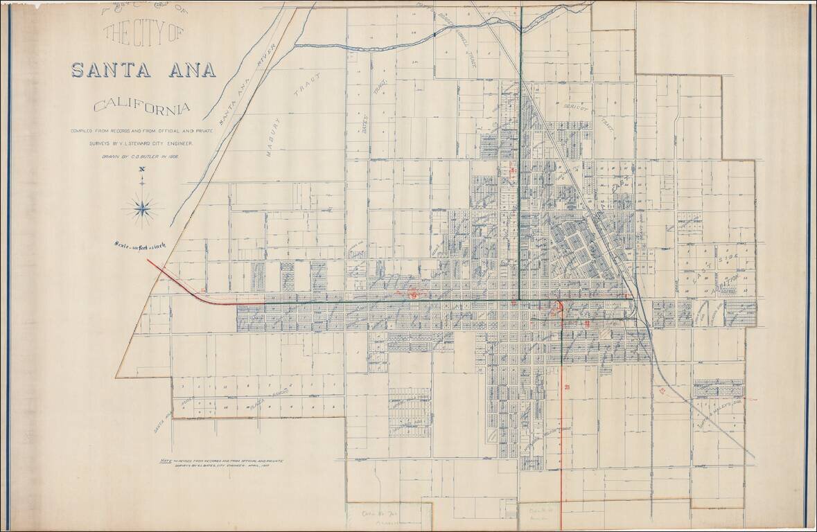
Excellent early map of Santa Ana, compiled by its City Engineer, W.L. Steward in 1906 and drawn by C.D. Butler, and later updated by G.L. Bates, the City Engineer in 1907. A reduced size edition of the map was printed by George L. Bates in Santa Ana,...
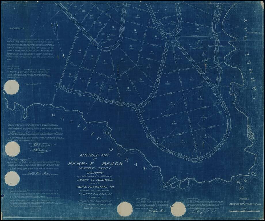
Rare early subdivision map showing a portion of Pebble Beach, California, the earliest map of Pebble Beach we have ever handled (all others were in the mid 1920s)., following Samuel Morse's acquisition and re-development of the area in 1919. A note in...
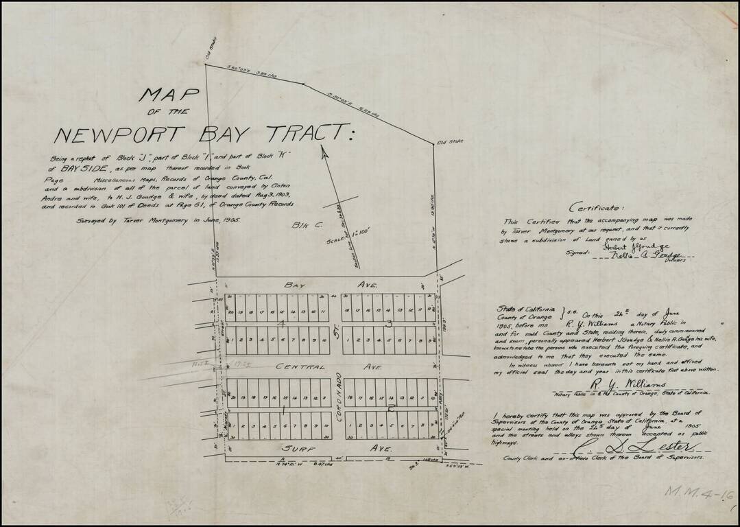
Detailed map of the "Newport Bay Tract," between Surf Avenue and Bay Avenue, centered on Coronado Street. Surf Avenue is now East Ocean Front. Central Avenue is now Balboa Boulevard. Bay Avenue is unchanged. Alvarado Street also appears. The land...

California's Redwood Belt Unrecorded Edward Denny wall map of a portion of Northern California, illustrating the so-called Redwood Belt. The map, in two strips, covers the California Coastline from Sonoma County to the Oregon border. The so-called...
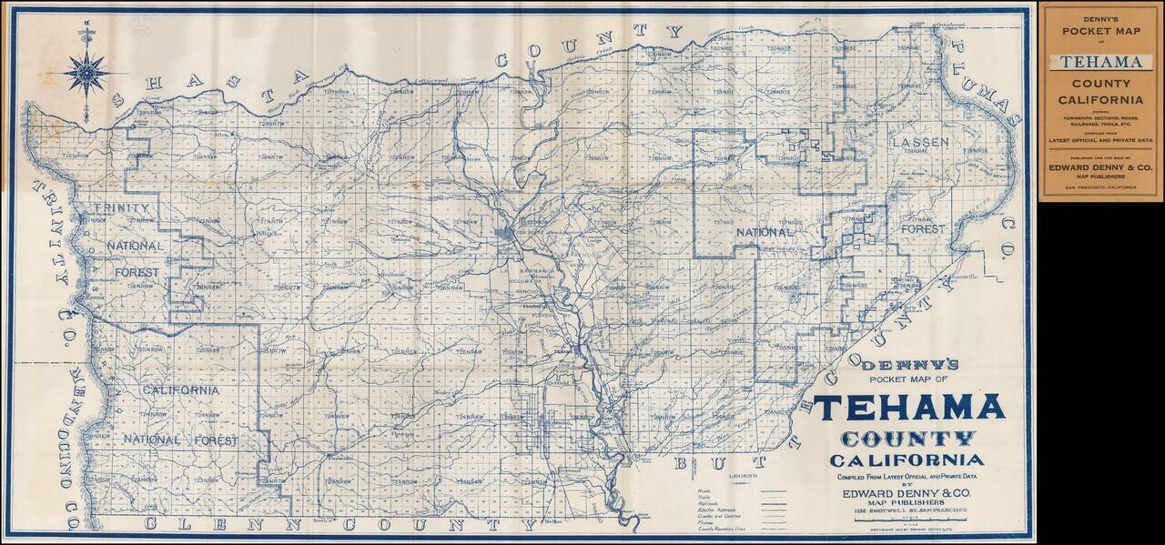
Rare Pocket Map of Tehama County. Scarce pocket map of Tehama County, California, published by Edward Denny. The map is centered on Red Bluff.
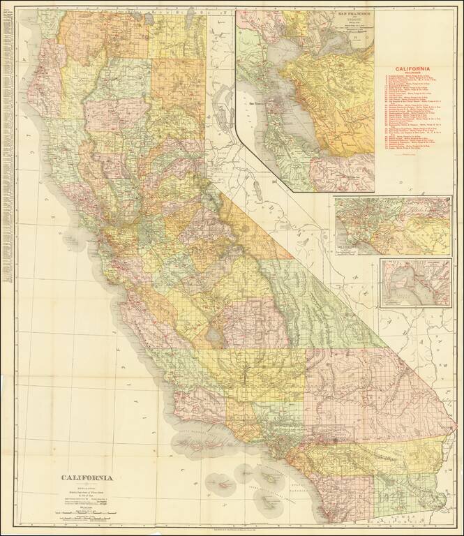
Highly detailed separately issued pocket map of California, published by Rand McNally & Co. The map locates over 30 railroads within the state and includes a large inset of San Francisco Bay and smaller insets of San Diego and Los Angeles. Orange...