
Rare old maps of the United States.
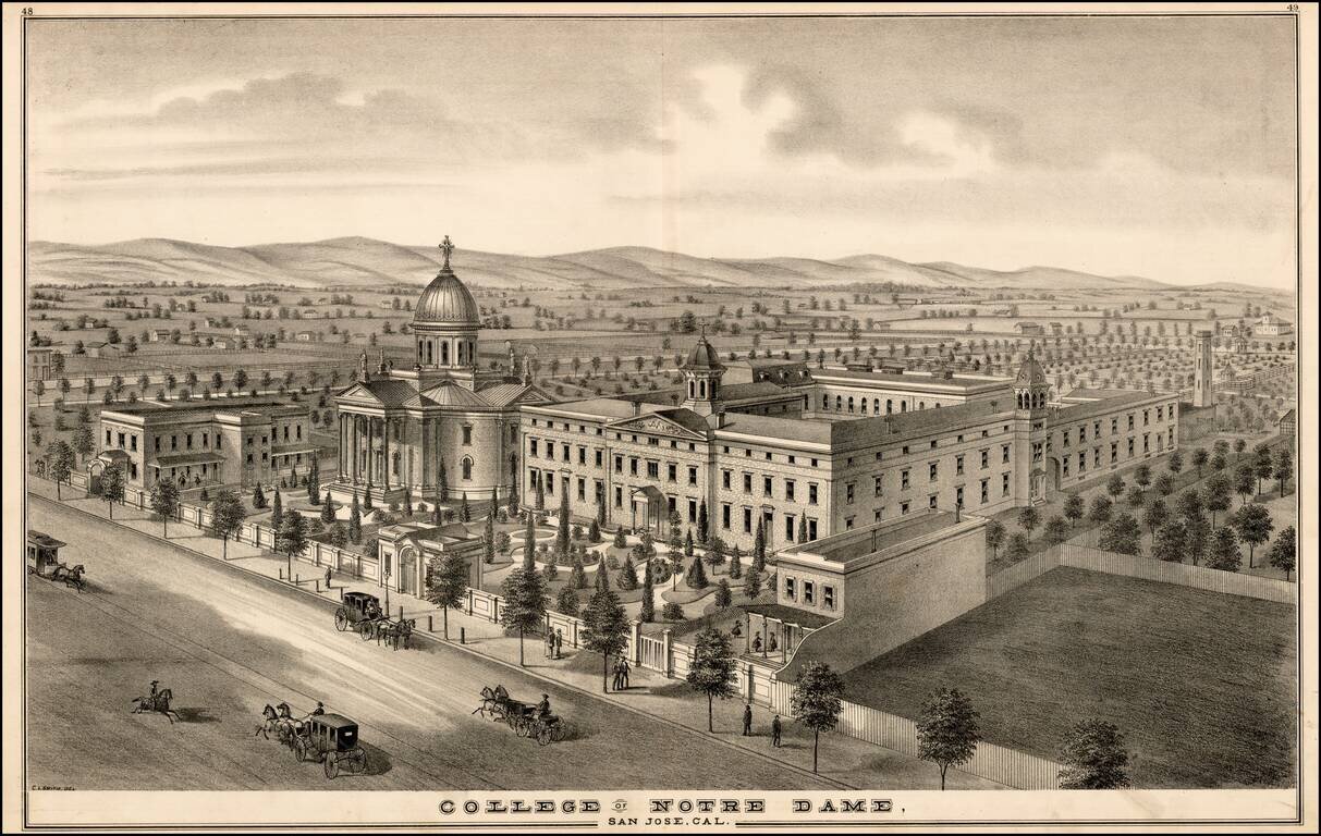
Fine early birdseye View of the original location of Notre Dame de Namur University (originally called the College of Notre Dame), from Thomson & West's Historical atlas map of Santa Clara County, California. Compiled, drawn and published from...
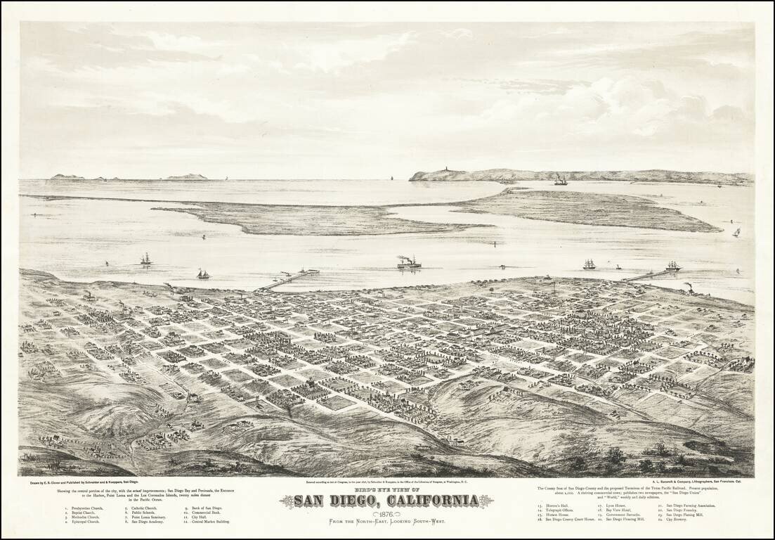
Fine Early Birdseye View of San Diego Extremely rare two-stone tinted-lithograph view of San Diego, made by California's greatest view maker, Eli Sheldon Glover, in 1876. The view was published by Schneider and Kueppers of San Diego and lithographed...
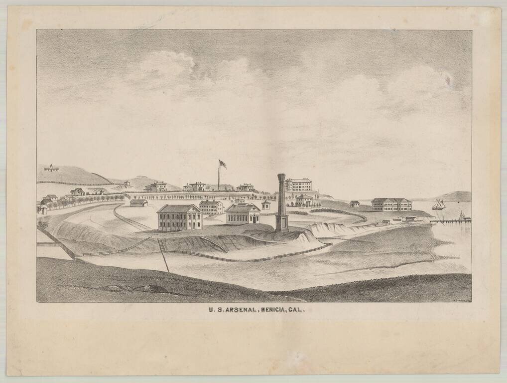
Rare separately issued lithographic view of Benicia, California, drawn by H. Straus. The view of Benecia and the Arsenal appeared in Thompson & West's Atlas of Solano County, but the present example is a rare separately published version, intended...
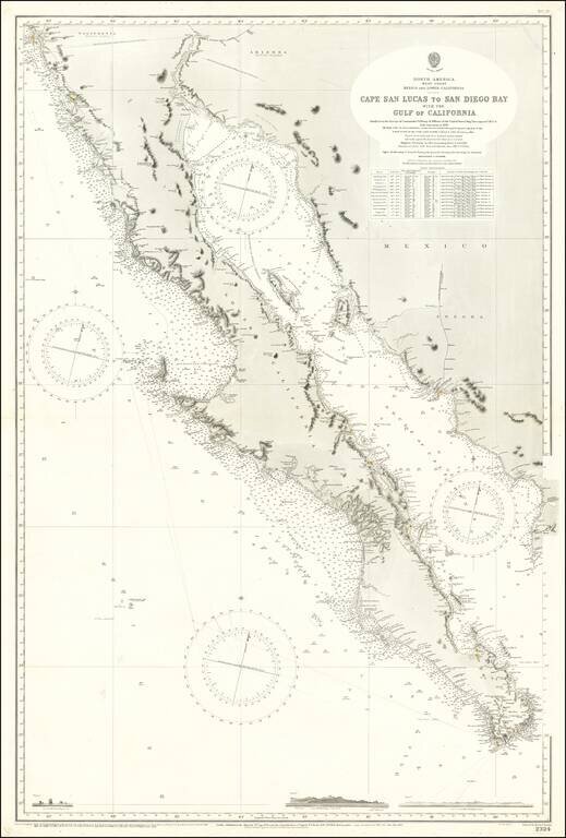
Large Sea Chart of Baja California and the Sea of Cortez / Gulf of California A fine example of the British Admiralty chart of Baja California and the Gulf of California, first engraved and published from London in 1879, and updated numerous times...
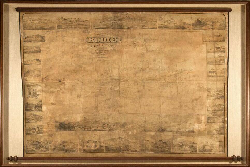
Edward Eysen's Mammoth View of Bodie, California. Remarkable view of Bodie, California, published by Edward Eysen in 1880. This spectacular wall map is arguably one of the most sought-after pieces from Bodie. The main body is a plan view map of...
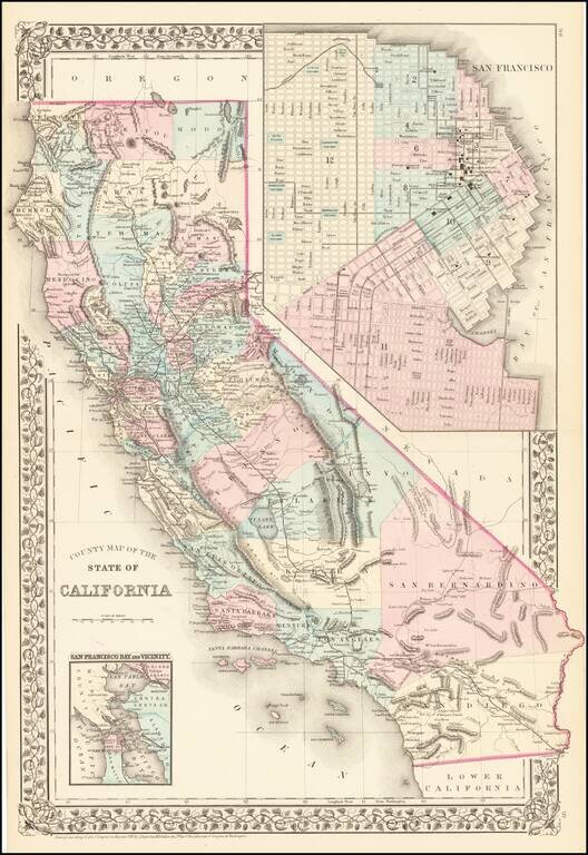
Attractive map of California, colored by county. Predates a number of Southern California Counties. Includes a detailed inset plan of San Francisco, colored by wards. Shows towns, roads, railroads, rivers, lakes, mountains, missions, etc. Decorative...
![Map Showing the Summer Resorts on the Pacific Coast, adjacent to the lines of the Central and Southern Railroads. [California Tourist. Yosemite, The Big-Tree Groves Geysers, Monterey and other Popular Summer Resorts of Californa]](/map/small/41461.jpg)
Detailed railroad map of the area around San Francisco Bay, extending to Virginia City, Nelson, Willows, Cloverdale, Clear Lake, Monterey, Madera, and Yosemite. The map shows the various railroad lines servicing the above listed destinations, via the...
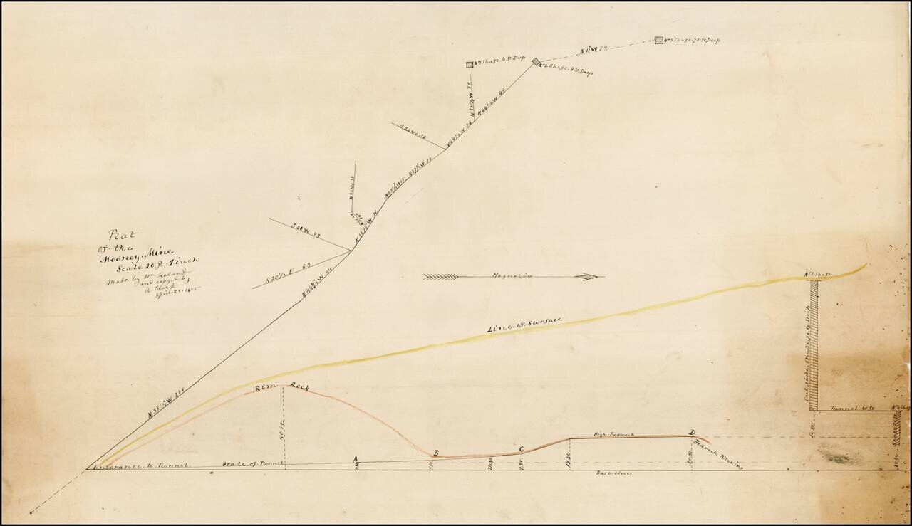
Plat of the Mooney Mine in El Dorado County, California, about 2 miles northeast of the town of Newton. In the Mines of El Dorado County by Doug Noble (2002), it is reported that this mine was only worked from 1894 to 1895. There are several other...
![Wm. T. Coleman & Co.'s Map of the State of California [and] Wm. T Coleman& Co's. Skeleton Map of Columbia River Canneries, Showing Their Location.](/map/small/69974.jpg)
Exceptional Chromolithographic Promotional Maps Rare promotional maps of California the Columbia River Basin one verso, promoting the shipping business of pioneer California Businessman William Tell Coleman. The California map locates several...

Detailed map of California, colored by Counties. The map pre-dates Orange, Riverside and Imperial Counties.
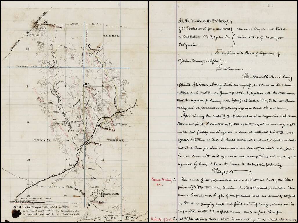
Interesting manuscript map of a part of Yuba County, Northeast of Yuba City and Northwest of Grass Valley, extending from the Yuba River in the south, beyond Sicard Flat and extending north toward Oroville along the Smith Valley. The map and...
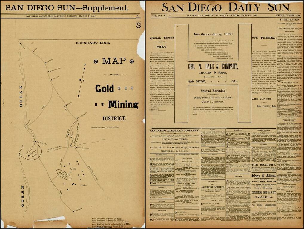
Rare map of the gold mining regions southeast of Ensenada near the Santa Clara Valley, published in the San Diego Sun in March 1889. The map shows the roads south from Tijuana to Ensenada and Santa Tomas, including the region identified as having Gold...
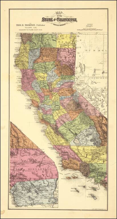
Scarce map of California, colored by counties. which appeared in Thompson's Atlas of Tulare County. The map shows California with completed township surveys. Orange County is present, but Riverside and Imperial Counties are still not yet formed....
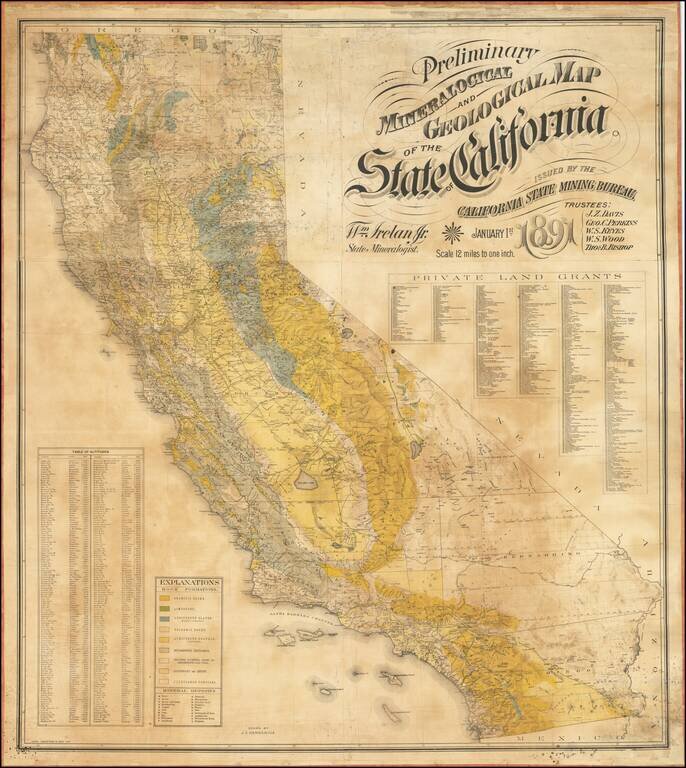
The First Comprehensive Geological Map of California Fine large mineralogical map of California, published by the California State Mining Bureau. The map was the result of an effort by the Trustees of the Mining Bureau, Harry I. Willey, as the former...
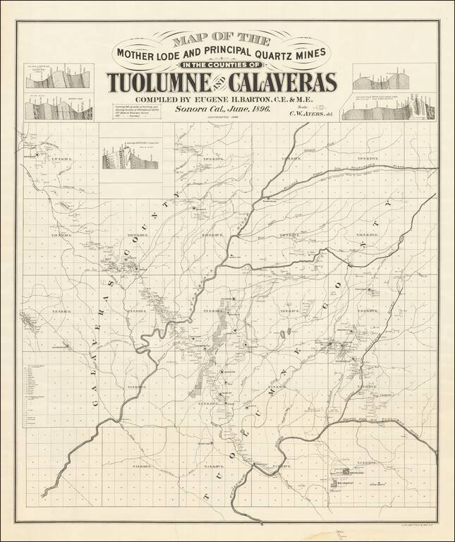
Mother Lode in Calaveras and Tuolumne Counties An interesting and little known map, centered on the Stanislaus River in Gold Country. The map is quite exceptional, "covering 860 square miles of territory and showing location of 500 different mines....
![The Map of Maps -- Alaska and British Columbia Showing the Yukon, Cariboo Cassiar, with a Portion of the Kootenay Gold Fields . . . Feb. 1898 [with inset showing Lake Routes to Dawson]](/map/small/40495.jpg)
Scarce separately issued map of Alaska and British Columbia, showing the various routes to the Klondyke Gold Fields, including a separate large format map showing the Lake Routes to Dawson. Rare Gold Rush Guide Map. Eberstadt (163:20, 1964, priced at...