Map size in jpg-format: 1840620B
Click to open in high resolution (open in new tab).
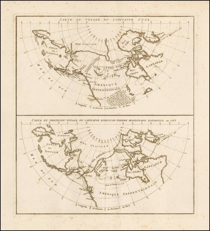
Rare pair of maps on a single sheet, showing the results of various real and apocryphal explorations in the Arctic Regions and the Northwest Coast of America, which appeared in the atlas volume of Jean Benjamin de LaBorde's Histoire Abrégée de la Mer du Sud,ornée de plusieurs cartes, published by Didot in Paris in 1791.
The map focuses on the mythical voyage of the Spanish Captain Lorenzo Ferrer Maldonado. In 1601, Maldonado submitted to King Philip III of Spain a document about his purported 1588 voyage through the Northwest Passage from east to west. His descriptions bear little semblance to reality, though his account received some support from geographers. In 1791 the Spanish government diverted Alejandro Malaspina's expedition to search the entrance reported by Maldonado.
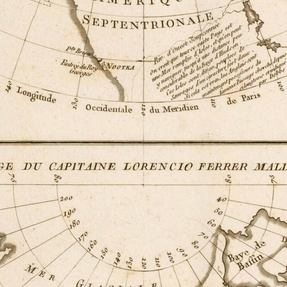
In addition to the the Maldonado information, there is an extensive note regarding the possible course of the River of the West, including a note about Indian Reports of the passage, and its having been claimed by the English, and a reference to Sir Arthur Dobbs. Dobbs was heavily involved in attempts to find a Northwest Passage in the Canadian Arctic during the 1740s. He actively worked to have the Hudson's Bay Company's trade monopoly revoked on the grounds that they showed little or no interest in promoting discovery expeditions relating to the Northwest Passage. Dobbs felt that others might finance exploration if they had some expectation of trade. Revoking the Hudson's Bay Company's trade monopoly was his solution for stimulating exploration. From 1741 to 1747, Dobbs managed to stimulate exploration, the result of which convinced most people that such a passage did not exist. A British Parliamentary inquiry in 1749 ended attempts to revoke the Hudson's Bay Company's charter.
The lower map also notes the overland expedition of Samuel Hearn through Northwest Canada, in the service of the Hudson Bay Company. The Pound route of 1782 is also shown.
If you are a student, write to us in telegram: @antiquemaps and indicate what material you need and for what work you need a map in high detail. We are ready to provide material on special terms. For students only!
![[Eastern Hemisphere Globe Gores] (Nova et integra universi Orbis descriptio)](/map/small/54480.jpg)

