
Map size in jpg-format: 726759B
Click to open in high resolution (open in new tab).
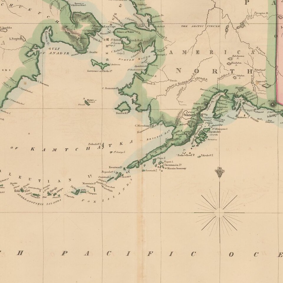
Rare map showing the Northwest Passage, via the Bering Straits, with a fantastic early depiction of Alaska (then Russian America) and contiguous parts of Canada.
Philip's map highlights the discoveries of Franklin and Richardson in the Arctic Sea (1825-26), one of the few maps to provide a detailed treatment of this part of the coastline of Alaska and Canada. A key at the bottom of the map shows the regions explored by various explorers, with the coastal details color coded to match the expedition.
The detail in the interior is also of interest, especially the identification of Canadian Indian Tribes on either side of the MacKenzie River. The course of the Youcon (Yukon) River and Colville River are shown in the interior of Alaska, although relatively little else was known at the time. While the coastline of Alaska is quite well depicted, there are still a fair number of areas marked with dotted lines or otherwise inaccurately mapped.
The present edition is apparently the first edition, including the tracks of Cook's Voyage in the region and referring to California as Upper or New California.
If you are a student, write to us in telegram: @antiquemaps and indicate what material you need and for what work you need a map in high detail. We are ready to provide material on special terms. For students only!
![[Eastern Hemisphere Globe Gores] (Nova et integra universi Orbis descriptio)](/map/small/54480.jpg)

