Map size in jpg-format: 28.6773MiB
Click to open in high resolution (open in new tab).
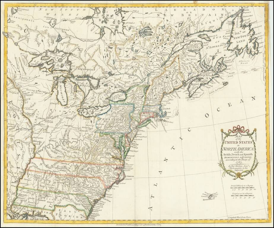
One of the earliest obtainable English Maps to name (and recognize) the newly independent United States of America.
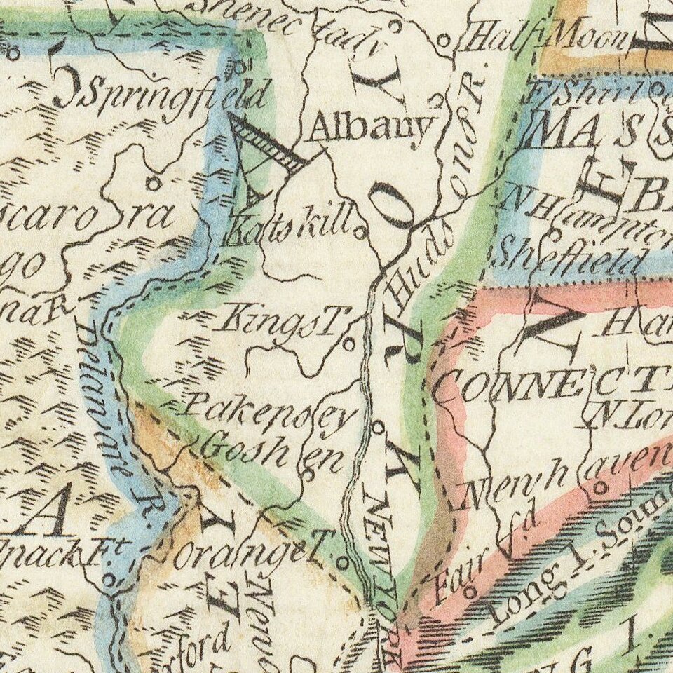
The map shows the United States extending to the Mississippi River, with the former colonial claims now Independent States. The states of Georgia, South Carolina, North Carolina, and Virginia stretch from the Atlantic to the Mississippi. The map is filled with information on early settlements, forts, Indian villages and fishing banks.
Thomas Kitchin, Hydrographer to the King, prepared the map for a special publication by Thomas Cadell. This is the first state of the map, identified by Ashley Baynton Williams in his Mapforum article on the earliest printed maps to name the United States. Later editions do not include the Cadell imprint and date below the neatline in the lower margin.
If you are a student, write to us in telegram: @antiquemaps and indicate what material you need and for what work you need a map in high detail. We are ready to provide material on special terms. For students only!

![[Signed Political Satire Artwork] Vietnam ... Vietnam ... Vietnam ...](/map/small/68726.jpg)
