Map size in jpg-format: 1.73898MiB
Click to open in high resolution (open in new tab).
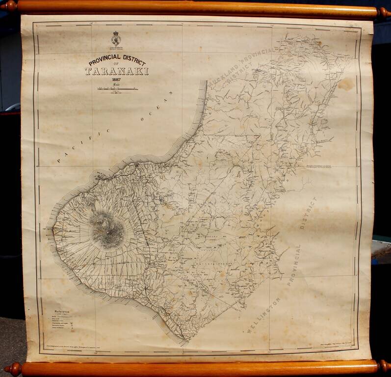
Rare Provincial Map of Taranaki District, New Zealand
Highly detailed map of Taranaki Province, by the New Zealand Survey, led locally by Thomas Humphries, Chief Surveyor in New Plymouth.
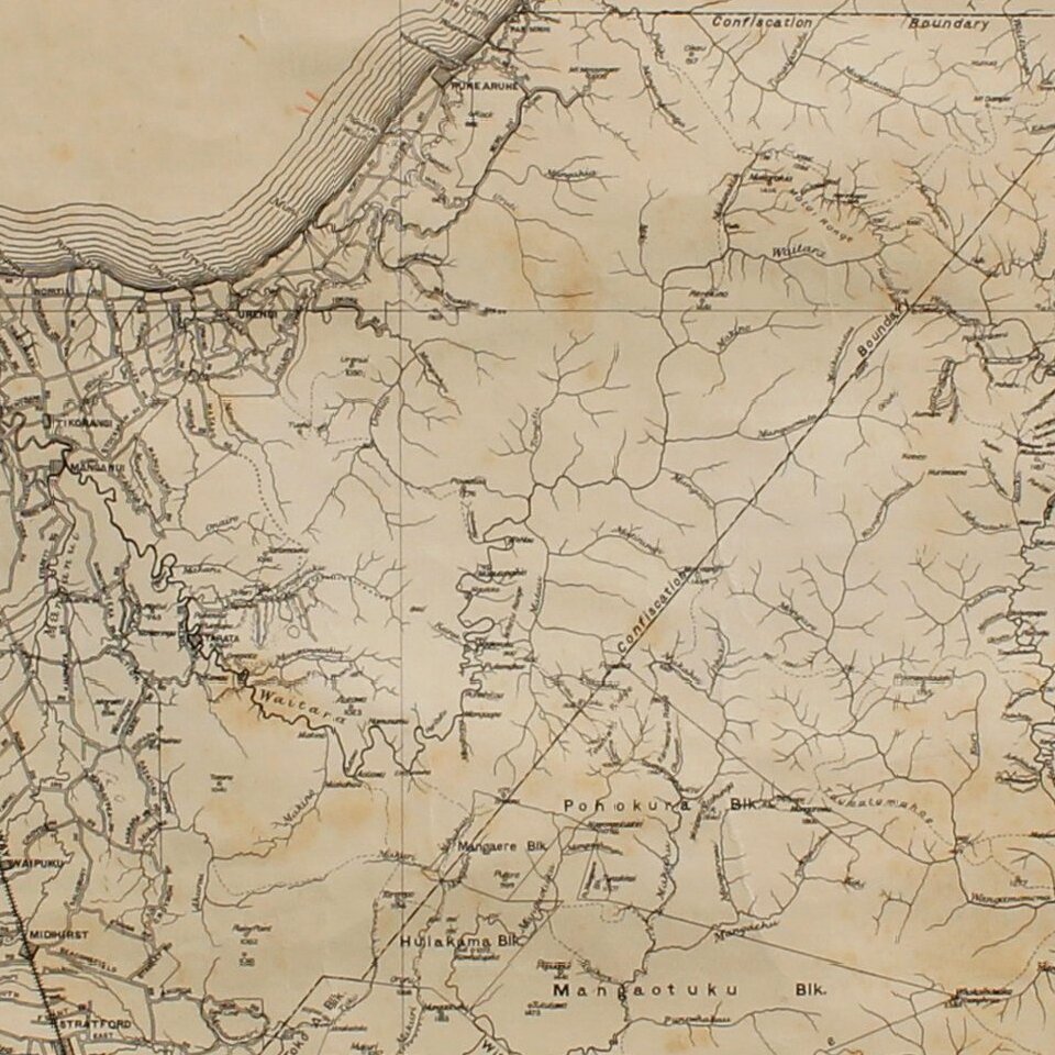
The most prominent feature on the map is Mount Taranaki, with many rivers, roads and small settlements noted.
The Confiscation Boundary is also noted, as is the Railroad extending from New Plymouth and Waitara.
The Confiscation Boundary refers to the lands confiscated from the Maori under the New Zealand Settlements Act 1863. In December 1863 the Parliament passed the New Zealand Settlements Act 1863, punitive legislation allowing unlimited confiscation of Māori land by the government, ostensibly as a means of suppressing "rebellion". Under the Act, Māori who had been "in rebellion" could be stripped of their land, which would be surveyed, divided and either given as 20 hectare farms to military settlers as a means of establishing and maintaining peace, or sold to recover the costs of fighting Māori. Volunteers were enlisted from among gold miners in Otago and Melbourne for military service and a total of 479,848 hectares were confiscated in Taranaki by means of proclamations in January and September 1865. Little distinction was made between the land of "rebels" and Māori loyal to the government.
According to the Waitangi Tribunal, Māori recognized that the British intention was to seize the greater part of their land for European settlement through a policy of confiscation and saw that their best hope of keeping their homes, lands and status lay in taking up arms. The 1927 Royal Commission on Confiscated Land, chaired by senior Supreme Court judge Sir William Sim, concluded: "The Natives were treated as rebels and war declared against them before they had engaged in rebellion of any kind ... In their eyes the fight was not against the Queen's sovereignty, but a struggle for house and home."
Rarity
The map is very rare. We note only the copy in the National Library of New Zealand.
If you are a student, write to us in telegram: @antiquemaps and indicate what material you need and for what work you need a map in high detail. We are ready to provide material on special terms. For students only!

![Pascaart vertoonende de zeecusten van Chili, Peru, Hispania Nova, Nova Granada, en California…. [Early New Zealand Inset]](/map/small/65168.jpg)