logo

1889. Railway Postal and Telegraph Map of the North Island New Zealand. 1889.

  • Railway Postal and Telegraph Map of the North Island New Zealand.  1889.

Railway Postal and Telegraph Map of the North Island New Zealand. 1889. information:

Year of creation: 
Resolution size (pixels): 
 4822x6393 px
Disk Size: 
 6.13905MiB
Number of pages: 
 1
Place: 
 Sydney & Melbourne
Author: 

Print information. Print size (Width x height in inches):
Printing at 72 dpi 
  66.97 х 88.79
Printing at 150 dpi 
 32.15 х 42.62
Printing at 300 dpi 
 16.07 х 21.31

An example of detailing the file of this map of in a printable high-resolution:

Click to open in high resolution (open in new tab).
Attention! this is just the central piece (central area 960x960 px) of the map file!
This is an example, so that you can see and study the level of detail of a given map. The entire Map will be fully available after payment!

Railway Postal and Telegraph Map of the North Island New Zealand.  1889.

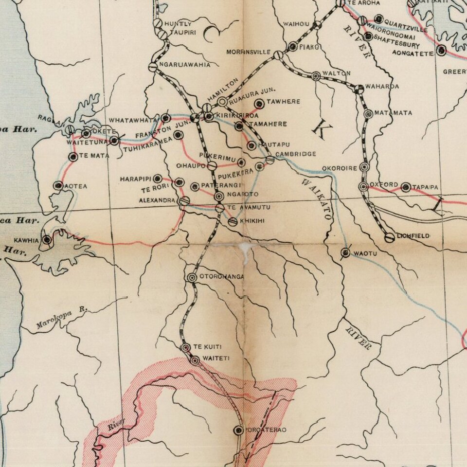
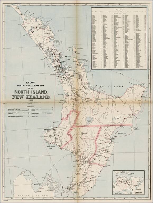
Map of the North Island of New Zealand showing railways, railway stations, post and telegraph offices and postal routes. Relief shown by hachures.

Index locates places within the island. One of the largest maps of North Island to appear in a commercial atlas.


Special conditions for students!

If you are a student, write to us in telegram: @antiquemaps and indicate what material you need and for what work you need a map in high detail. We are ready to provide material on special terms. For students only!

Item information:

Year of creation:
Size:
4822x6393 px
Disk:
6.13905MiB
Number of pages:
1
Place:
Sydney & Melbourne
Author:
Andrew Garran.
$14.99

Related item