Map size in jpg-format: 11.6226MiB
Click to open in high resolution (open in new tab).
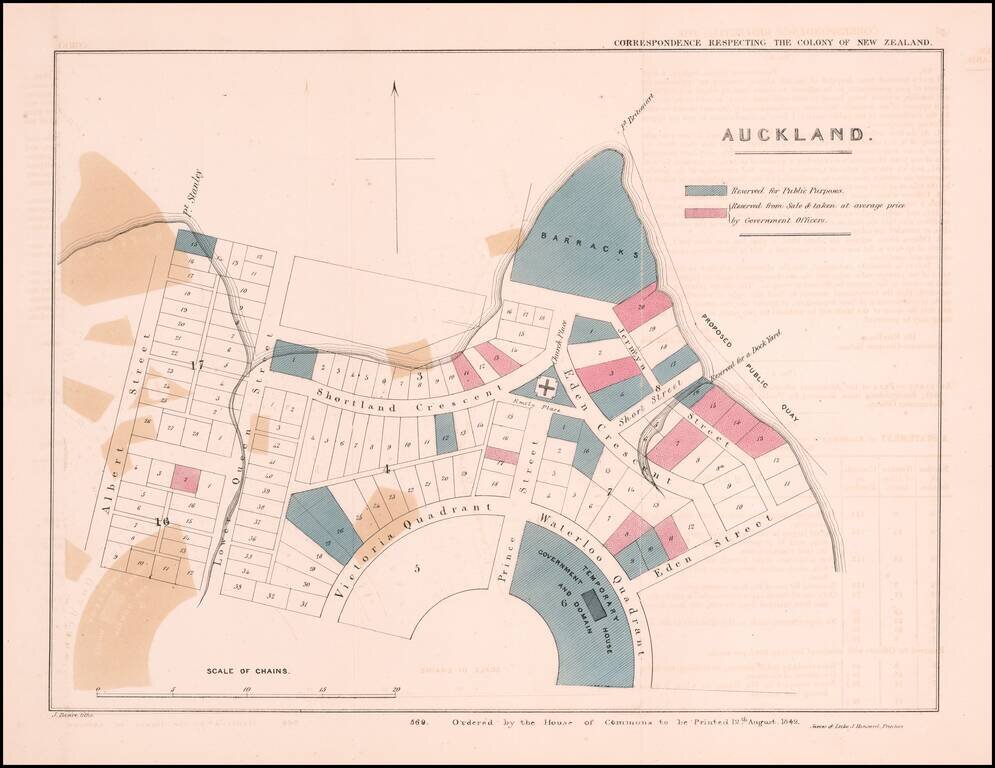
The Earliest Obtainable Map of Auckland, New Zealand
Early plan of Auckland, New Zealand, from the Correspondence respecting the Colony of New Zealand, published by the House of Commons in London.
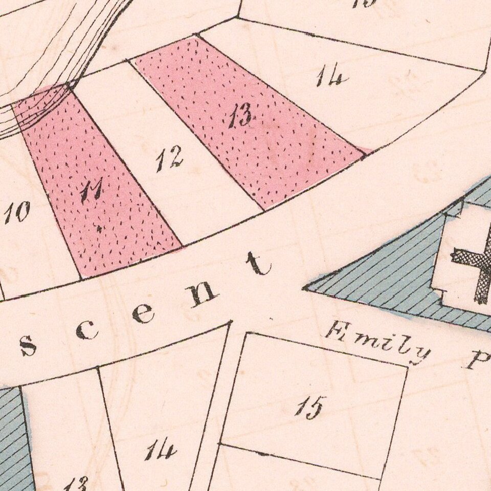
The map shows allotments in the area between Albert and Eden Streets, differentiated into those reserved for public purposes (blue), for Government officers (red), and available for public purchase (uncolored), government house and domain, barracks, and a dockyard.
In 1840 the Treaty of Waitangi was signed and Auckland was named the capital city of New Zealand. By 1865 the capital was moved to Wellington and by 1900 Auckland was New Zealand's largest city.
Rarity
The map appeared in British Parliamentary Papers, 1842, no. 569. Correspondence respecting the colony of New Zealand.
OCLC locates only the examples of the map (National Library of Australia and the British Library) and a photocopy in the Auckland Museum.
If you are a student, write to us in telegram: @antiquemaps and indicate what material you need and for what work you need a map in high detail. We are ready to provide material on special terms. For students only!

![Pascaart vertoonende de zeecusten van Chili, Peru, Hispania Nova, Nova Granada, en California…. [Early New Zealand Inset]](/map/small/65168.jpg)