Map size in jpg-format: 45.5989MiB
Click to open in high resolution (open in new tab).
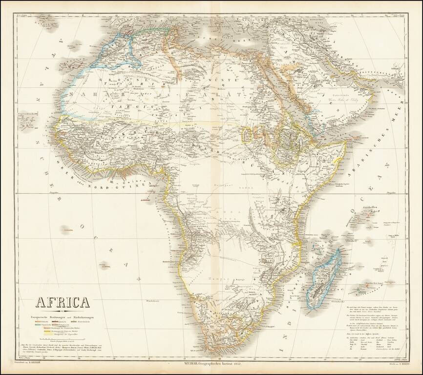
Fine large map of Africa, published by German mapmaker Heinrich Kiepert in Weimar.
The map is colored to illustrate the various local and colonial powers (Britain, Spain, Netherlands, France and Portugal).
The color coding also locate the possessions of the Ottoman Empire, possessions of the Imam of Muscat and the "northern border of the negro people."
Many early trade routes are located, with a massive void in Central Africa.
If you are a student, write to us in telegram: @antiquemaps and indicate what material you need and for what work you need a map in high detail. We are ready to provide material on special terms. For students only!
![[Eastern Hemisphere Globe Gores] (Nova et integra universi Orbis descriptio)](/map/small/54480.jpg)