Map size in jpg-format: 3.48626MiB
Click to open in high resolution (open in new tab).
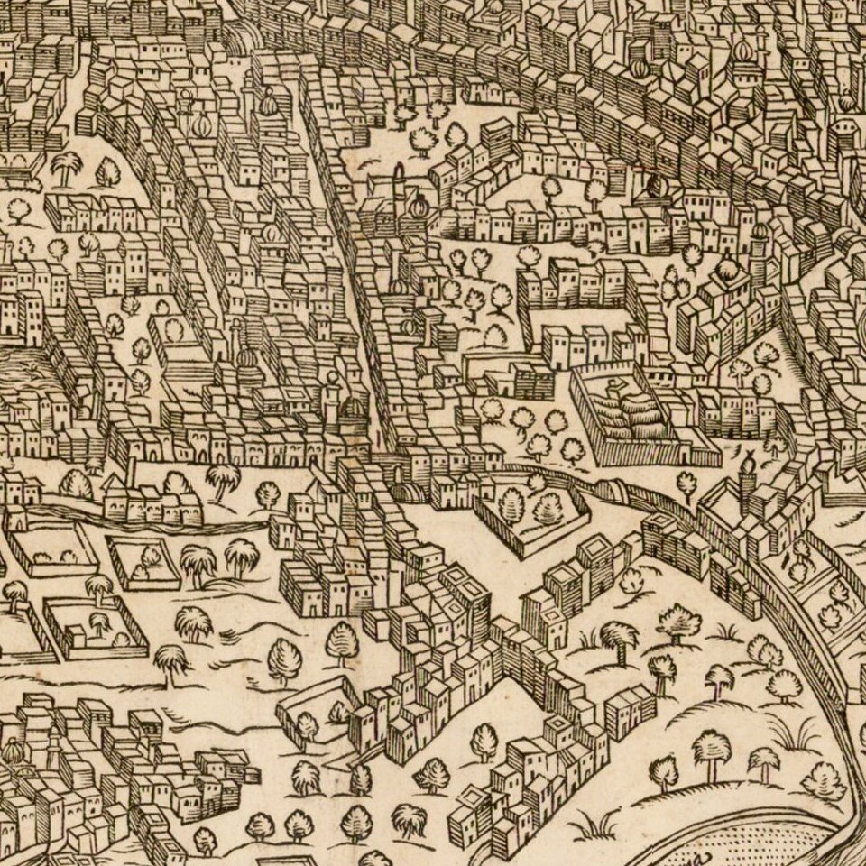
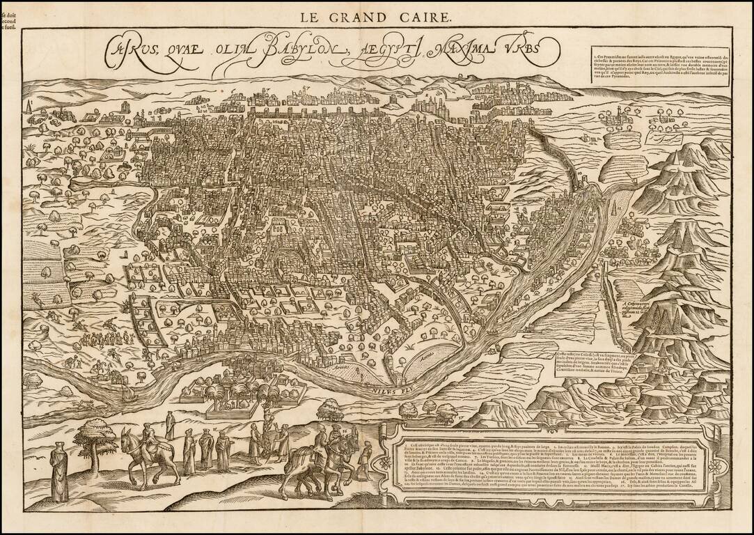
Rare 16th Century view of Cairo from a hillside opposite the Nile, published in Paris in 1575.
De Belleforest's view is drawn from Braun & Hogenberg's Civitatus Orbis Terrarum, the most important town book of the 16th Century.
Elaborate detail, including fortified walls, buildings, publish places, etc. A number of horsemen and other costumed figures in the foreground.
If you are a student, write to us in telegram: @antiquemaps and indicate what material you need and for what work you need a map in high detail. We are ready to provide material on special terms. For students only!
![[Arabian Peninsula, Red Sea, Nile River and Gulf of Aden] L'Afrique . . . 1740](/map/small/59382.jpg)
![Turcici Imperii Imago [shows Cyprus]](/map/small/68676.jpg)