![Карта Восточной Части Африки [Map of the Eastern Part of Africa]](/map/small/66634.jpg)
Detailed and very rare Russian-language map of Egypt and Sudan, published in Saint Petersburg in 1836. The map differentiates between "Egypt", "Lybian Steppe", "Nubia", "Darfur", "Kordofan", and "Abyssinia". Rarity The map is very scarce. We have...
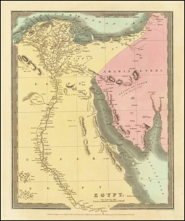
Striking full hand-color example of David Burr's map of Egypt which appeared in his Universal Atlas, in 1836. Burr's Atlas was perhaps the most elegant American commercially published atlas of its time, utilizing wonderful wash colors and elegant...
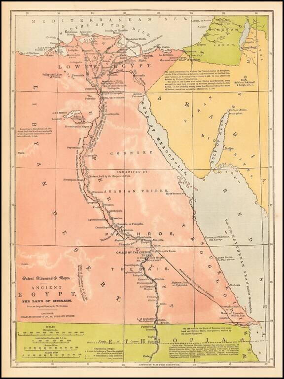
Fine example of Charles Knight's rare "Patent Illuminated Map" of Egypt. As noted by Jerem Norman, "In 1838, English printer and publisher Charles Knight received British patent No. 7673 for "Improvements in the Process and in the Apparatus used in...
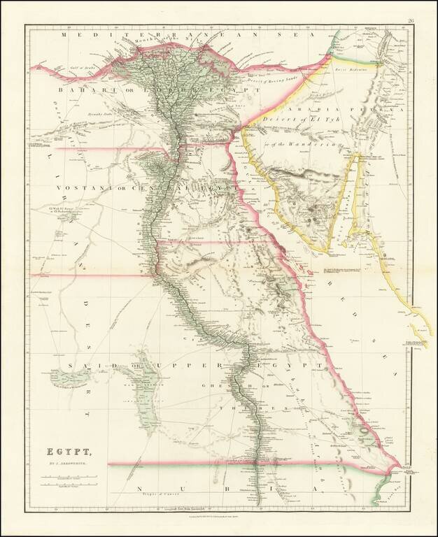
Fine example of John Arrowsmith's map of Egypt, from his London Atlas. Includes significant details along the Nile, caravan and trade routes, etc. Interesting notes include "Desert of Moving Sands," "Djewaby Arabs" and "Camel Breeders for the Esneh...
![[Manuscript Map of Nile River Expedition in 1855]](/map/small/61011.jpg)
Hand Drawn Antique Map of the Nile from the Cataracts to Alexandria Detailed map of the Nile River from Alexandria to the Cataracts and the Nubia-Egypt border, illustrating the travels of an English expedition up and down the Nile and from January 12,...
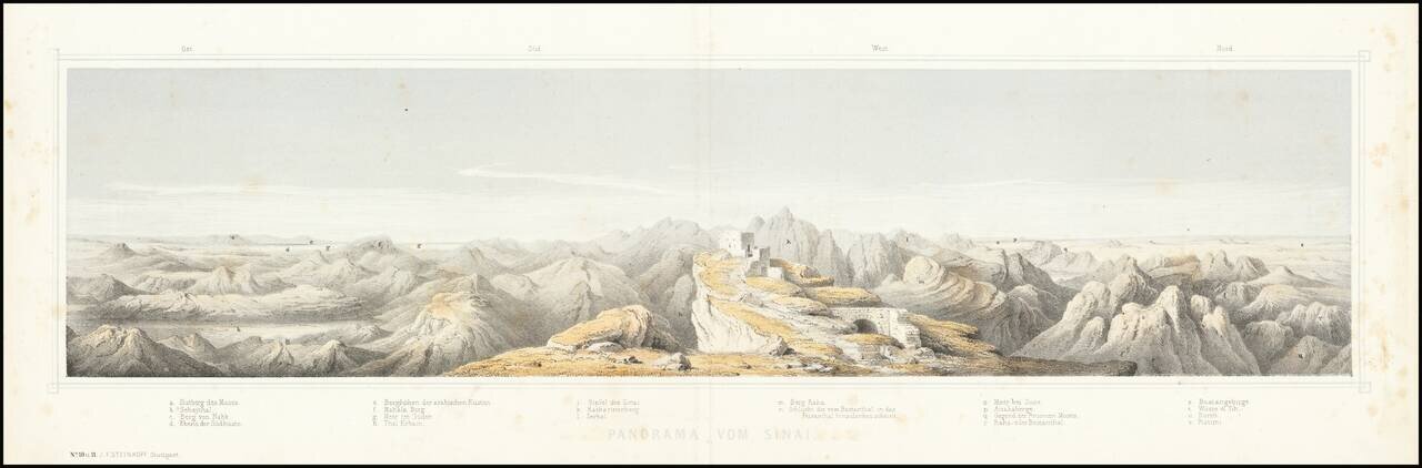
This is a nice panorama of Mt. Sinai, created by the German publisher J. F. Steinkopf. The view shows Mt. Sinai, one of the highest points in Egypt and an important religious site. Located in the southern Sinai peninsula, the mountain range is a...
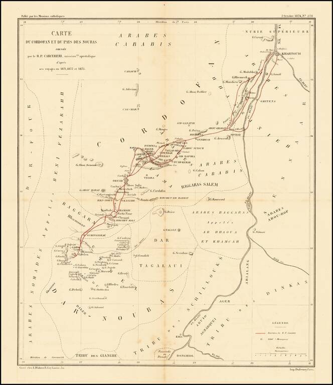
Scarce map of the Upper Nile and White Region, illustrating the travels of Stanislaus Carcereri in 1871-1873. Father Stanislaus Carcereri (1840-1899), along with six members of his order, played a vital role in the beginnings of missionary work...
Egypt During the Anglo-Egyptian War Detailed military reconnaissance map of the Lower Nile Delta, published by the British War Department. The map extends from Cairo in the South, to Alexandria and Port Said in the north, and includes significant...
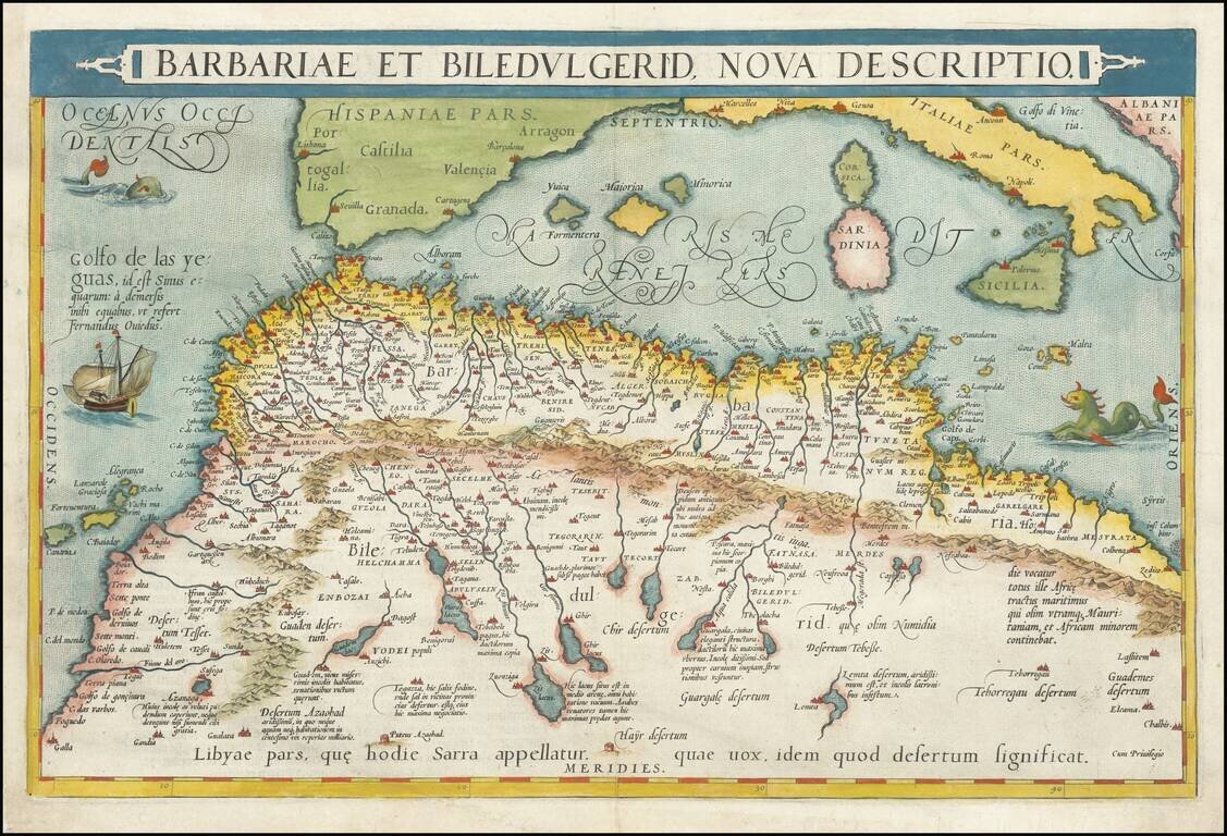
Nice full color example of Ortelius' map of coastal North Africa and the Mediterranean, from Ortelius' Theatrum Orbis Terrarum, the first modern atlas of the world. The map extends from Morocco and the Sahara to Libya and shows most of the...
Rare 1525 Edition. One of the earliest obtainable regional maps of Africa, focusing on Morocco and Algeria. First published in Strasbourg by Johannes Gruninger in 1522, Fries map is based upon Waldseemuller's map of 1513.
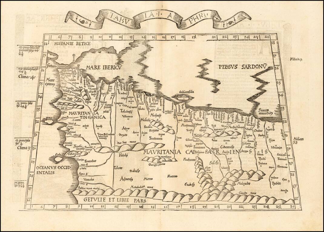
![[North Africa] Tabula Moderna Aphrice](/map/small/50930.jpg)
Rare 1525 edition of Lorenz Fries's woodcut map of the central part of the North African coastline, with islands in the Mediterranean, based upon the work of Waldseemuller.
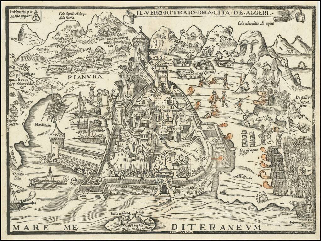
Rare Early Map of the Holy Roman Empire's Siege of Algiers in 1541 The only known example of Matteo Pagano's Map of the 1541 Conquest of Tunis, engraved in Venice by the master engraver Matteo Pagano. This rare and until recently unknown woodcut map...
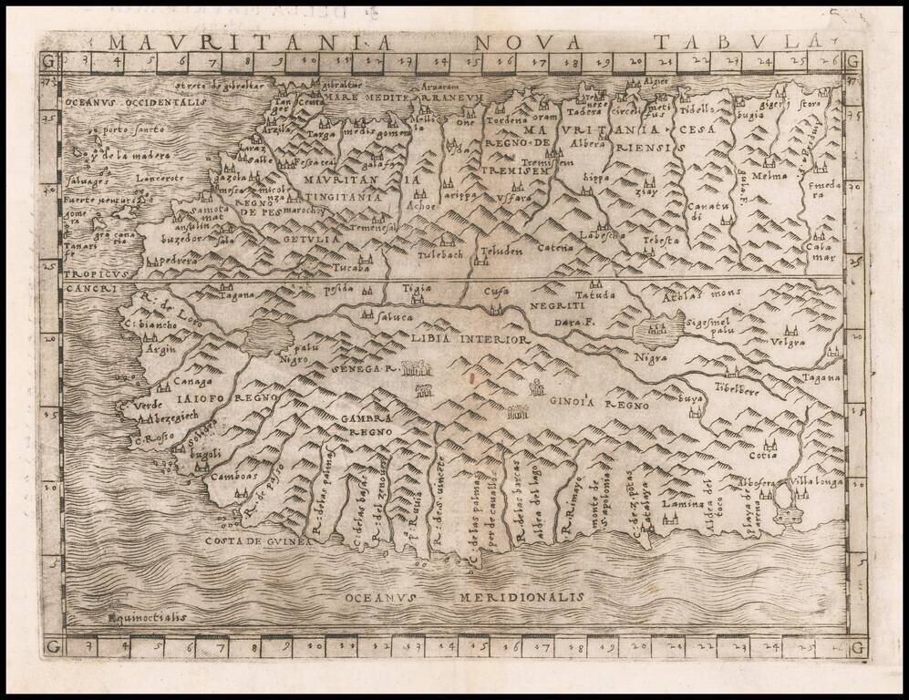
Fine example of Gastaldi's regional map of Northwest Africa, from Tangiers and Cueta to Villa Longa, the Atlas Mountains and Algeria. Giacomo Gastaldi is considered as the foremost Italian cartographer of the 16th century along with Paolo Forlani....
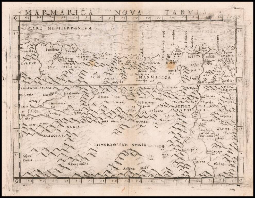
Nice example of Gastaldi's map of a portion of North Africa, centered on the Nubia Desert and showing Egypt, the Nile, etc. Giacomo Gastaldi is considered as the foremost Italian cartographer of the 16th century along with Paolo Forlani. From...
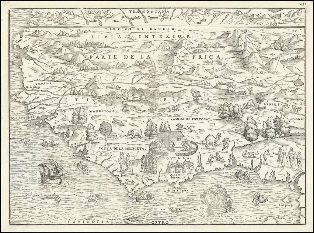
Striking Gastaldi Map of West Africa, Included in a Significant Travel Collection Finely-wrought early map of West Africa, compiled by Giacomo Gastaldi for Giovanni Battista Ramusio's Navigationi et Viaggi. This is an example of the first state,...
![[Christian Conquest and Fortification of Djerba in 1560] Aviso Del Successo Del Arm'ata De Christiani che si truova in Barberia, & della presa del Gerbi diretta al. S. Comendator Cambiano dal S. Paulo de la gesia Comedator; et secretario del R.S. gran Ma](/map/small/61878.jpg)
Rare Broadside Showing the Fortifications of Djerba After the Christian Victory in 1560 Rare broadside plan of walled fortifications on Djerba, published shortly after the successful taking of the island by a multi-national Christian force in early...