Map size in jpg-format: 68.019MiB
Click to open in high resolution (open in new tab).

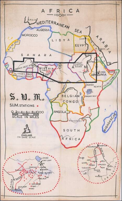
Manuscript Missionary Map of Africa.
Interesting map of Africa, prepared by the Christian missionaries "Sudan United Mission" or S.U.M.
The map highlights the group's area of focus - immediate Subsaharan Africa - and includes insets of their missions in southern Sudan (Anglo-Egyptian Sudan) and Nigeria.
An outline of England is positioned off the southwest coast of Africa for a comparison of sizes.
The map was made after the establishment of the Belgian Congo (1906) but before World War II.
Sudan United Mission was founded in 1904 and in 1989 changed its name to Action Partners.
If you are a student, write to us in telegram: @antiquemaps and indicate what material you need and for what work you need a map in high detail. We are ready to provide material on special terms. For students only!
![[Eastern Hemisphere Globe Gores] (Nova et integra universi Orbis descriptio)](/map/small/54480.jpg)