Map size in jpg-format: 691771B
Click to open in high resolution (open in new tab).
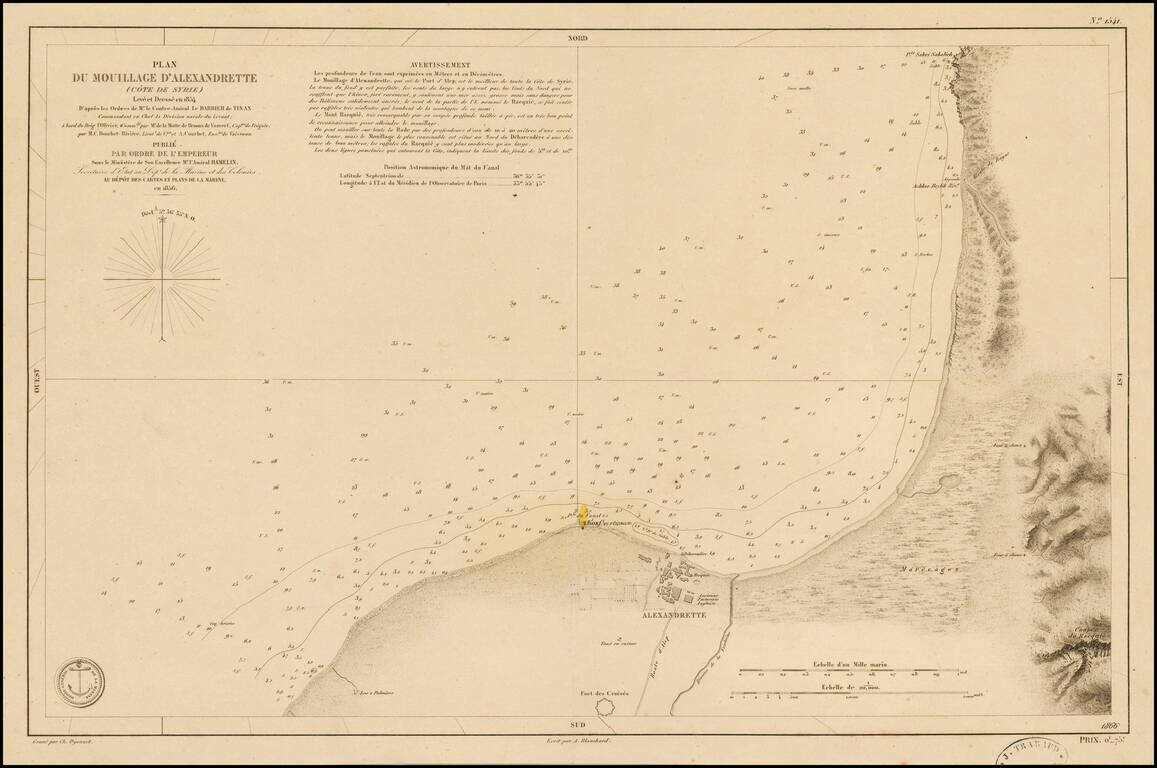
Fine chart of the coastal region of Syria, centered on Alexandrette (now called İskenderun or Scanderoon), published by the French Hydrographical Department in 1856.
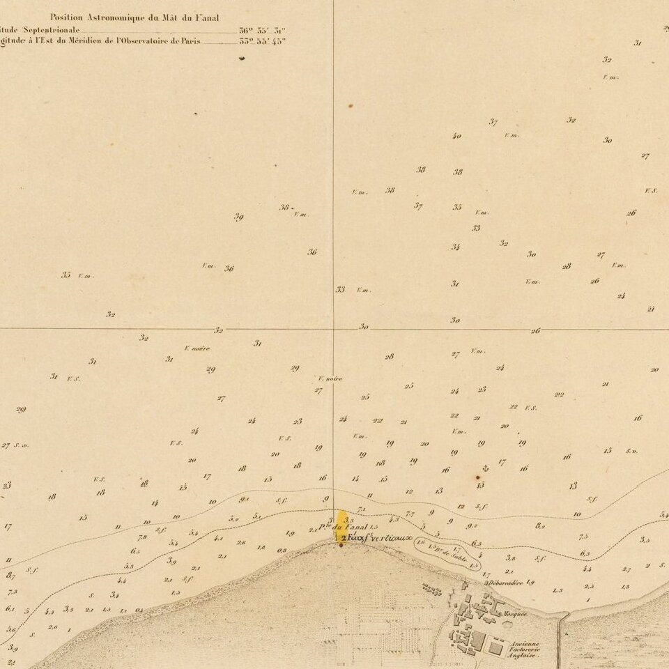
The chart shows soundings, the Iskendrun lighthouse, and topographical features, including the Road to Aleppo and "Fort des Croises".
In the later Ottoman period the city of Iskenderun grew as the main outlet for the overland trade from Baghdad and India, which had great importance until the establishment of the Egyptian overland route. Iskenderun served as a base, first for Genoese and Venetian merchants, then West and North European merchants. The British Levant Company maintained an agency and factory here for 200 years, until 1825, in spite of appalling mortality among its employees. During the 19th century the port grew, the railway was built in 1912, and the road to Aleppo was improved.
The Dépôt de la Marine, known more formally as the Dépôt des cartes et plans de la Marine, was the central charting institution of France. The centralization of hydrography in France began in earnest when Jean-Baptiste Colbert became First Minister of France in 1661. Under his watch, the first Royal School of Hydrography began operating, as did the first survey of France’s coasts (1670-1689). In 1680, Colbert consolidated various collections of charts and memoirs into a single assemblage, forming the core of sources for what would become the Dépôt.
The Dépôt itself began as the central deposit of charts for the French Navy. In 1720, the Navy consolidated its collection with those government materials covering the colonies, creating a single large repository of navigation. By 1737, the Dépôt was creating its own original charts and, from 1750, they participated in scientific expeditions to determine the accurate calculation of longitude.
In 1773, the Dépôt received a monopoly over the composition, production, and distribution of navigational materials, solidifying their place as the main producer of geographic knowledge in France. Dépôt-approved charts were distributed to official warehouses in port cities and sold by authorized merchants. The charts were of the highest quality, as many of France’s premier mapmakers worked at the Dépôt in the eighteenth century, including Philippe Bauche, Jacques-Nicolas Bellin, Rigobert Bonne, Jean Nicolas Buache, and Charles-François Beautemps-Beaupré.
The Dépôt continued to operate until 1886, when it became the Naval Hydrographic Service. In 1971, it changed names again, this time to the Naval and Oceanographic Service (SHOM). Although its name has changed, its purpose is largely the same, to provide high quality cartographic and scientific information to the France’s Navy and merchant marine.
If you are a student, write to us in telegram: @antiquemaps and indicate what material you need and for what work you need a map in high detail. We are ready to provide material on special terms. For students only!


![[Early Montanus World Map in Volume Eight of the Plantin Polyglot Bible]](/map/small/53766.jpg)