
Map size in jpg-format: 121.254MiB
Click to open in high resolution (open in new tab).

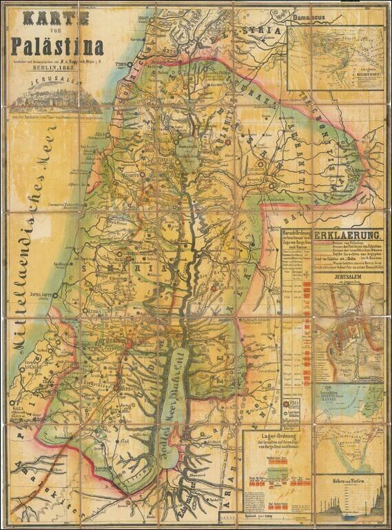
Scarce separately issued map of the Holy Land, published by F. von Rappard in Berlin.
The map shows both Biblical, Historical and modern place names and boundaries. The routes of the the Israelites exodus from Egypt is shown, as are the wanderings of the disciples of Christ and the the route taken by Alexander the Great.
The map includes a very unique topographical style and shows regions, towns, lakes, rivers, etc.
A key at the left identifies various ancient and modern details. The tables, insets and diagrams provide interesting historical information.
Rarity
This is the second time we have ever seen this map. We previously offered an 1870 edition of the map in 2013.
If you are a student, write to us in telegram: @antiquemaps and indicate what material you need and for what work you need a map in high detail. We are ready to provide material on special terms. For students only!


![[Early Montanus World Map in Volume Eight of the Plantin Polyglot Bible]](/map/small/53766.jpg)