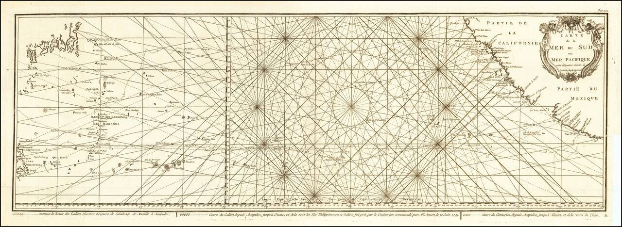
Impressive Chart of the Pacific Ocean Depicting a Thrilling Circumnavigation Dynamic chart of the mid-Pacific Ocean from the French-edition of Anson’s bestselling voyage account. It includes voyage tracks of Anson’s Centurion and the ship he...
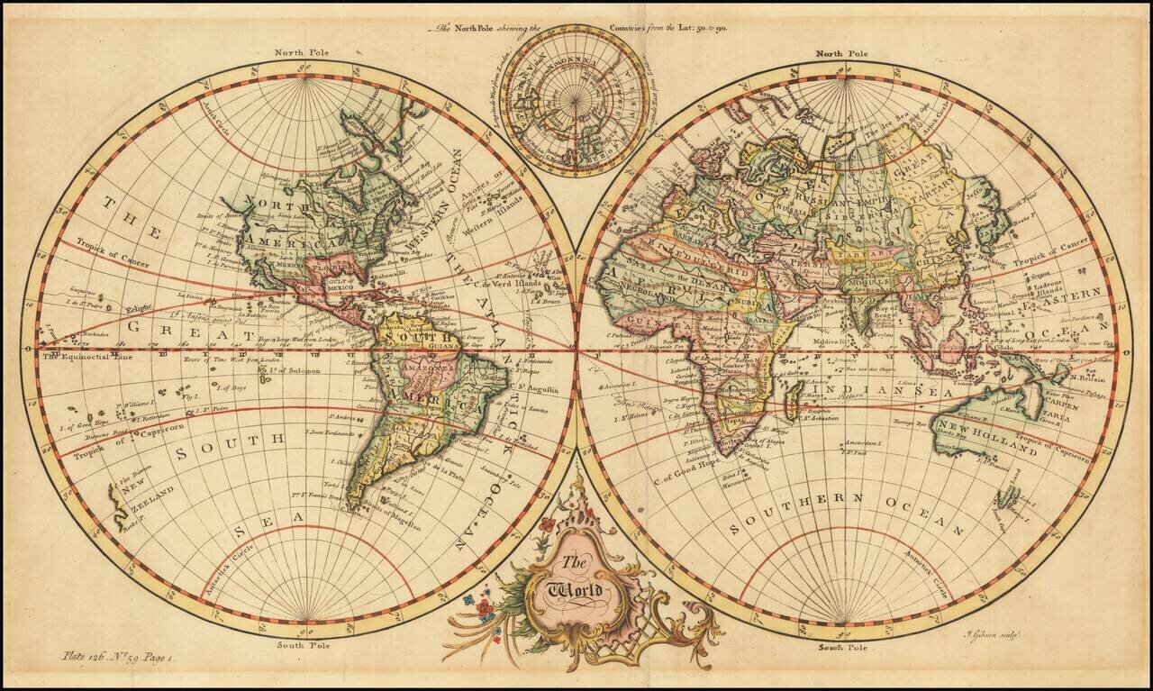
Fine Double-Hemisphere World Map Elegant world map, from Thomas Salmon’s Universall Traveller, and showing Anson’s circumnavigation track. The two hemispheres are set in a plain background. At bottom is a Baroque title cartouche. At top, nestled...

Nice example of Cellarius's chart illustrating the path of the sun's annual rotation around the earth, from the northern tropic to the southern. The band of the zodiac is included, with names and symbols of the various signs of the zodiac, surrounded...

Fine example of Cellarius's chart illustrating Claudius Ptolemy's earth-centered model of the universe. In the second century, Claudius Ptolemy, an important Egyptian Astronomer and Geographer, postulated that the Sun and Planets revolved around the...

Nice example of this finely executed map of the Northern Sky, illustrating the constellations of the Northern Hemisphere superimposed over the Pacific Ocean, first published by Andreas Cellarius in 1660. The map provides a fantastic image of the...

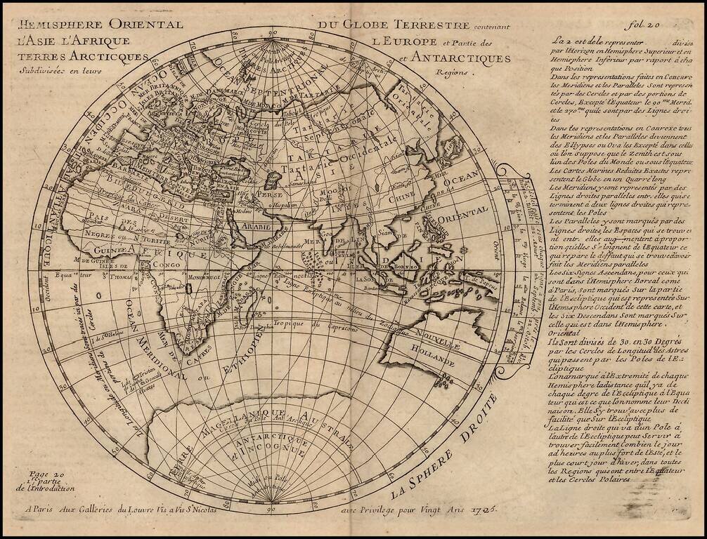
Detailed map of the Eastern Hemisphere, published in 1714 by De L'Isle. The map shows an incomplete Australian Coastline and early cartographic details in the Southern part of the hemisphere.
A detailed map of the Eastern Hemisphere, including a detailed depiction of the known coastlines of Australia. Four continents are shown in elegant color. Regions, cities, rivers, and more are all named and many more mountain ranges and features are...
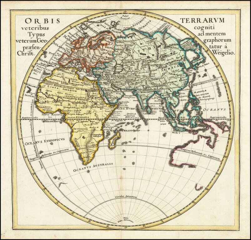
Rare map of the Eastern Hemisphere, from Pierre Moullart Sanson's rare Introduction a la Geographie. The map provides an interesting apocryphal treatment of the South Polar region and an incomplete Australia. The map is part of a series of maps...
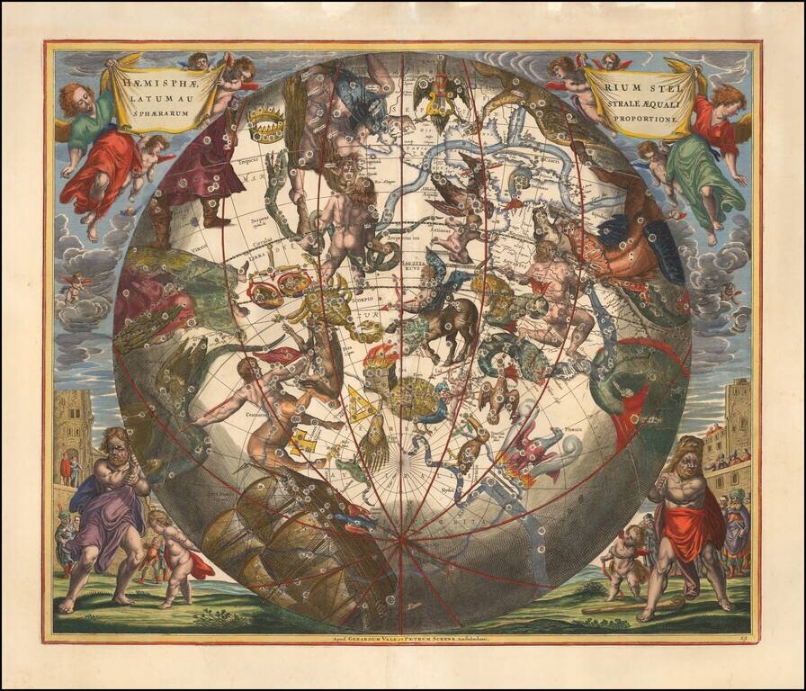
Decorative example of this finely executed map of the southwestern sky, illustrating the constellations of the Southwestern Hemisphere superimposed over a southwestern orientation of the Earth, first published by Andreas Cellarius in 1660. The chart...
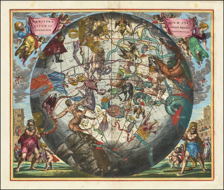
Decorative example of this finely executed map of the Southwestern Sky, illustrating the constellations of the Southwestern Hemisphere superimposed over a southwestern orientation of the Earth Hemisphere, first published by Andreas Cellarius in 1660....

Scarce late state of Guillaume De L'Isle's map of the Western Hemisphere, updated to include the 3 voyages of Captain James Cook. Dezauche also shows the route of the voyages of Abel Tasman (1642), Quiros, Magellan (1520), Le Maire (1616), Mendana...
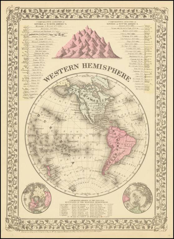
Detailed map of the Western Hemisphere with comparative lengths of river charts for North and South America. The map also shows mountain heights. Small tear in bottom margin to neat line. Beautiful decorative borders. SA Mitchell Jr. acquired his...

Willem Barentsz's Map of the Polar Regions, drawn from his observations during his third voyage of 1596-97 and engraved by Baptiste Van Deutecum. The Barentsz map of the polar regions is a major landmark in Arctic cartography, depicting the details...

Willem Barentsz's Map of the Polar Regions, drawn from his observations during his third voyage of 1596-97 and engraved by Baptiste Van Deutecum. The Barentsz map of the polar regions is a major landmark in Arctic cartography, depicting the details...

Extremely rare miniature map of the North Pole, from Seller's Atlas Maritimus. Both the cartographic detail and embellishments are based upon the Hondius/Jansson map of the North Polar Regions. Includes a coat of arms.
![[Spitzbergen & Wiches Lande]](/map/small/61990.jpg)
Mapping the early whaling voyages of the Muscovy Company Scarce early map of Spitzbergen, flanked by nine scenes of whaling, fishing, processing & bear hunting, and walruses (here called Seamorces), which first appeared in Purchas His Pilgrims...