Map size in jpg-format: 49.9792MiB
Click to open in high resolution (open in new tab).
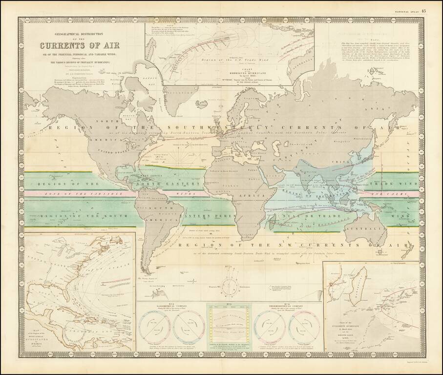
Fascinating map of the world, focused on hurricanes, air currents and other details.
At the lower left is a model illustrating Hurricanes in the West Indian regions. At the top center is a model of the Rodriguez Hurricane of April 1843, the lower right is a model of Culloden's Hurricane in March 1809 and Boyne's Gale in 1835.
If you are a student, write to us in telegram: @antiquemaps and indicate what material you need and for what work you need a map in high detail. We are ready to provide material on special terms. For students only!


