logo

1849. Planisphere

  • Planisphere

Map size in jpg-format: 6.13014MiB

Download "Planisphere", in high resolution.

Planisphere information:

Year of creation: 
Resolution size (pixels): 
 6279x4630 px
Disk Size: 
 6.13014MiB
Number of pages: 
 1
Place: 
 Paris
Author: 

Print information. Print size (Width x height in inches):
Printing at 72 dpi 
  87.21 х 64.31
Printing at 150 dpi 
 41.86 х 30.87
Printing at 300 dpi 
 20.93 х 15.43

An example of detailing the file of this map of in a printable high-resolution:

Click to open in high resolution (open in new tab).
Attention! this is just the central piece (central area 960x960 px) of the map file!
This is an example, so that you can see and study the level of detail of a given map. The entire Map will be fully available after payment!

Planisphere

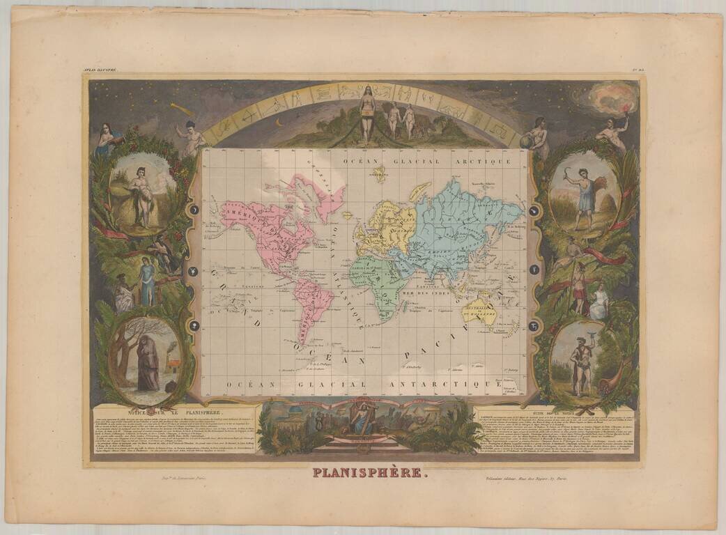
Decorative map of the world on Mercator's Projection, surrounded on all sides by decorative vignettes.

This decorative map was engraved by Raimond Bonheur, father of the famous French artist Rosa Bonheur. Shows the World on Mercator's projection with allegorical symbols and a symbolic chart of the zodiac.


Special conditions for students!

If you are a student, write to us in telegram: @antiquemaps and indicate what material you need and for what work you need a map in high detail. We are ready to provide material on special terms. For students only!

Item information:

Year of creation:
Size:
6279x4630 px
Disk:
6.13014MiB
Number of pages:
1
Place:
Paris
Author:
Victor Levasseur.
$14.99

Related item