Map size in jpg-format: 190.35MiB
Click to open in high resolution (open in new tab).

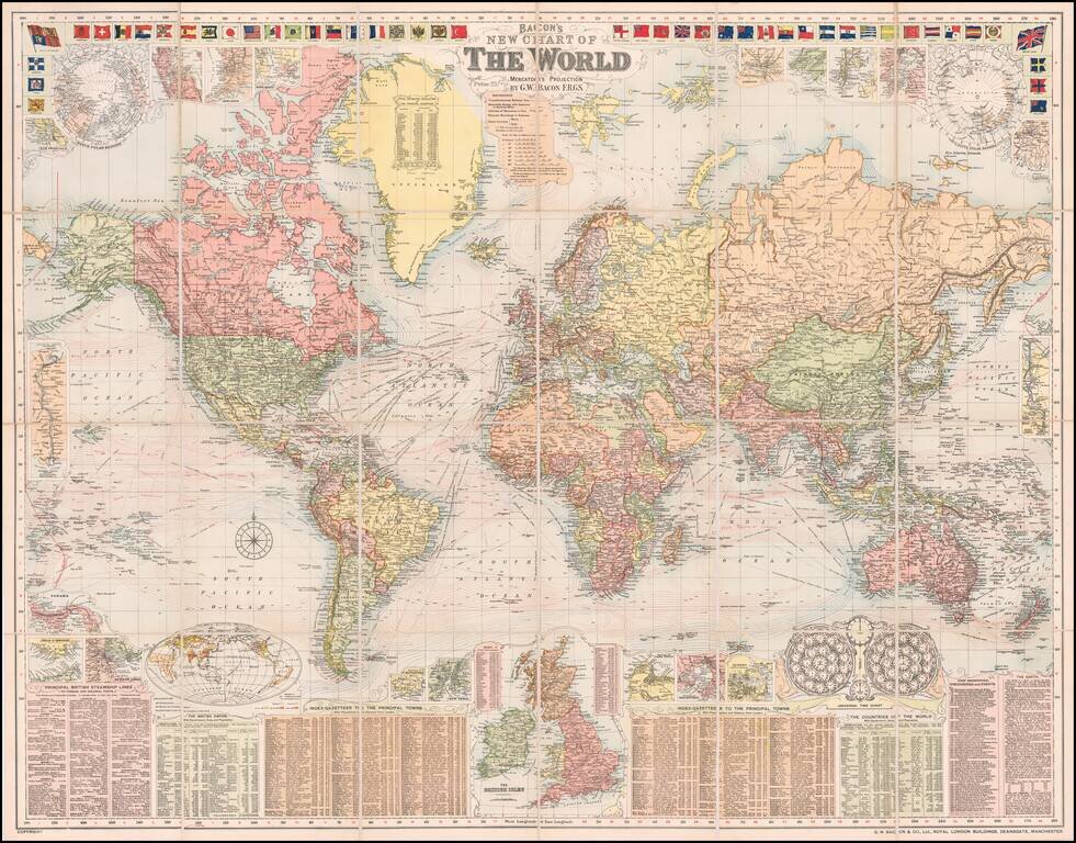
A Grand Map of the World At The Height of the British Empire
Decorative large format map of the world, showing the British Empire, at its height.
Around the map are inset details: with plans of towns including Hong Kong, Singapore, Sydney and New York; the Panama and Suez Canals; the British Isles; the two Poles; and a Universal Time Chart.
Along the top are a selection of national flags and ensigns; along the bottom are Gazetteers and a list of Principal British Steamship lines.
We date the map based upon the table of discoveries at the bottom right, which shows discoveries up to 1907 (Mikkelson Explores Beaufort Sea).
If you are a student, write to us in telegram: @antiquemaps and indicate what material you need and for what work you need a map in high detail. We are ready to provide material on special terms. For students only!


