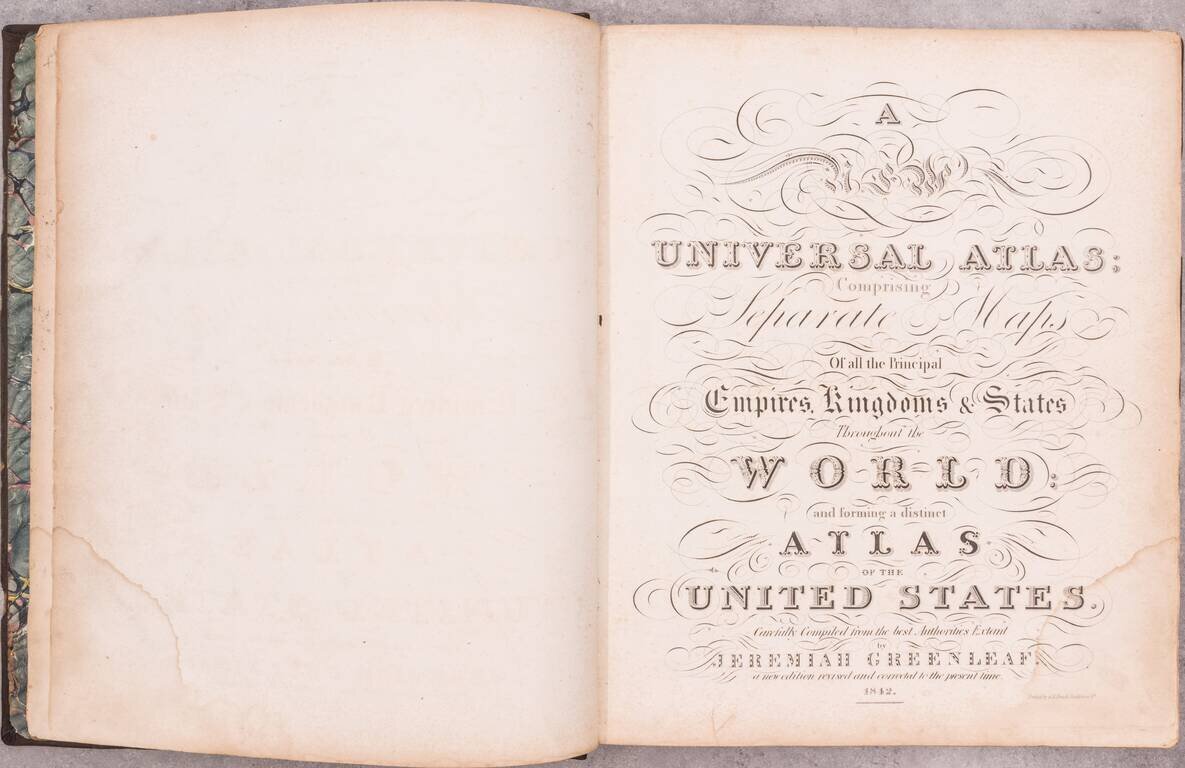
Including Maps of the Republic of Texas and Oregon Territory An important and elegantly colored American Atlas, published by Jeremiah Greenleaf in Brattleboro, Vermont. Jeremiah Greenleaf's Universal Atlas is the continuation of the work of David...

"Republic of Texas" Edition. A nice example of the 1842 edition of Lizars's Edinburgh Geographical General Atlas, with two maps labeling the "Republic of Texas" within the map image. Almost all maps from the Republic of Texas period simply label the...

Unique Stencil Color Example of Morse & Breese's Cerographic Atlas of the United States, bound with Morse's Cerographic Bible Atlas. The Cerographic Atlas of the United States was the first printed atlas to employ the use of cerography, a printing...
![[French Composite Sea Atlas Focusing on Colonization in Southeast Asia]](/map/small/68228.jpg)
Composite Atlas of French Sea Charts Chronicling Jean-Baptiste Cecille’s Attempts to Extend the French Empire in Asia. 35 engraved or lithographed charts mounted on tabs, all but one double-page. Large folio (26x20 inches). Contemporary...
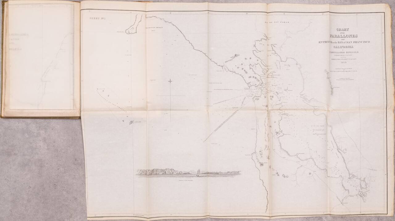
The First Set of Published Charts Focusing on California This is the fourth edition of Cadwalader Ringgold's A Series of charts, and the second to include Ringgold's San Francisco Bay surveys. The work has the distinction of being the first set of...
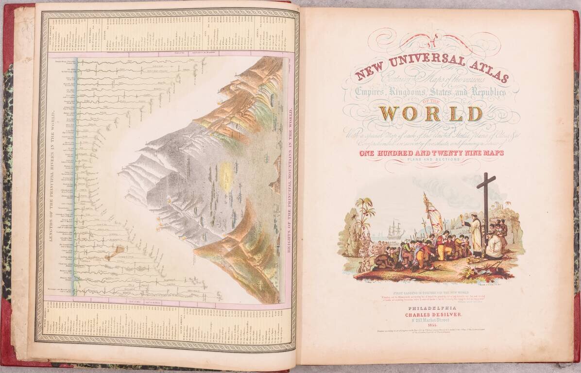
A handsome example of the 1855 Samuel August Mitchell New Universal Atlas, an important edition from one of the quintessential American atlas series of the 19th century. Despite being an atlas of the world, most of the atlas is concerned with the...

The Rare and Classic Rogers & Johnston Atlas. With its Famous Maps of Utah and Nebraska Territories, Among Many Other Good American Maps. This is an example of one of the most important atlases of North America published just before the start of...

The First Edition of the First Great Scientific Atlas of All of Mexico. Antonio Garcia Cubas is regarded as "el fundador de nuestra geografia como ciencia" (Diec. Porrua). Glass, page 680 (citing the plates and commentary for Mapa Siguenza and Codice...

First Edition. One of the more attractive and differentiated American atlases of the 1860s. Schonberg favored heavy coloring, and in some cases loose cartography. The map of the West is interesting for its very large Idaho Territory, which at the...
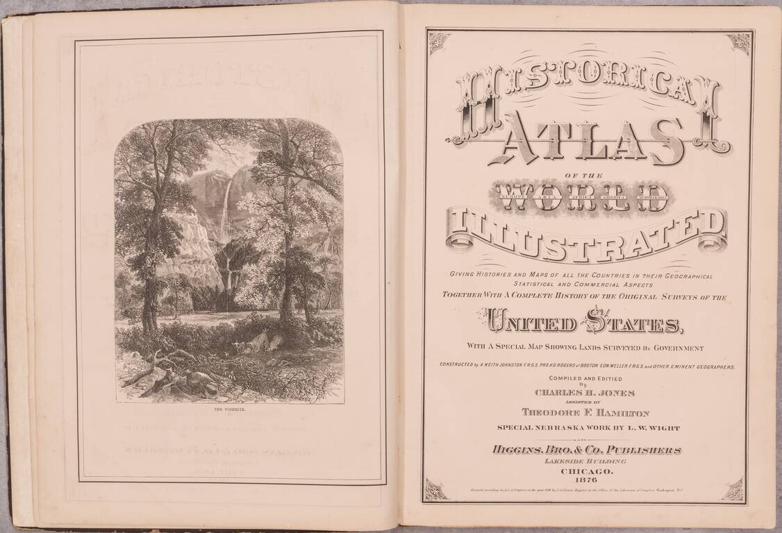
An interesting post-Civil War American atlas of the world, published by Higgins, Bros. & Co. in Chicago and authored by Charles H. Jones with the assistance Theodore F. Hamilton. This edition includes the rare L.W. Wight "New Section and Township...
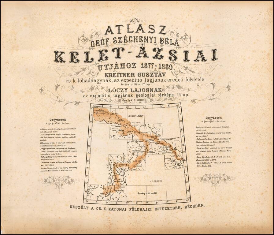
The First Geological Atlas of Tibet Rare geographical atlas of the northern Tibetan Mountains, published in Vienna by the Military Geographical Institute, published to accompany Széchenyi's three-volume account of his travels. From 1877 to 1880...
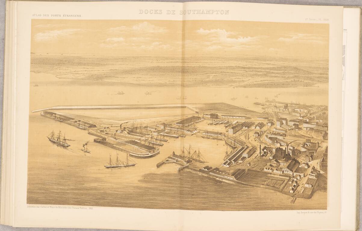
Scarce French Atlas of "foreign" ports, published by the French Ministry of Public Works. The atlas consists of 20 mostly double page and folding maps, including: Hamburg Hamburg (piers and wharfs) Boston Charleston Rio de Janeiro Cardiff and...
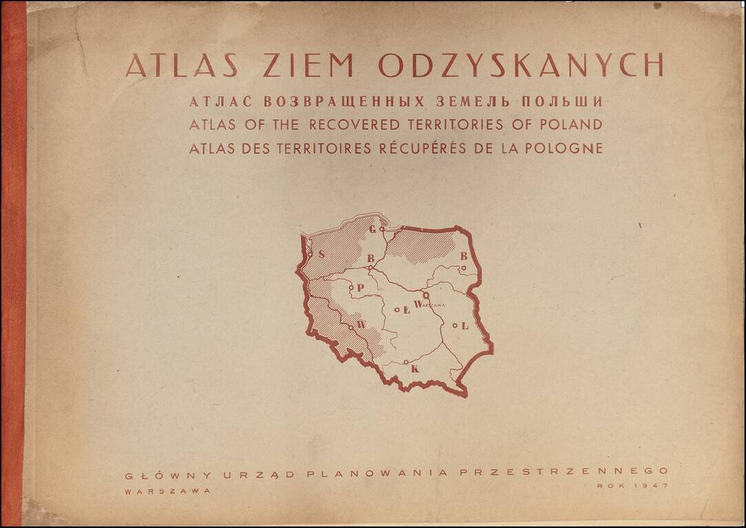
Rare Atlas of the Regions Recovered by Poland After World War II A rare and graphically sophisticated atlas that provides a multi-dimensional picture of the regions of Poland--then called the Recovered Territories--which were ceded back to Poland at...

Wonderful 12-sheet Vietnamese-language color-lithographed map of the region around Hanoi in northern Vietnam. Bound as separate sheets in the original publisher's portfolio, along with a general map showing how the sheets combine. The twelve sheets...

A Manual for Recording Scientific Observations while in Lunar Orbit An extremely rare Apollo 13 visualization guide for astronauts while they were in lunar orbit, detailing the lunar features they would see, and the scientific observations they should...
![[Apollo 14 Atlas, Images of the Fra Mauro Region and Geologic Explanation]](/map/small/68101.jpg)
A Geological Field Guide for a Walk on the Moon An extremely rare Apollo 14 extravehicular activity [EVA] guide made for astronauts, detailing two EVAs for each of the three possible landing sites (one targeted, two contingency) in the Fra Mauro...