Map size in jpg-format: 16.4206MiB
Click to open in high resolution (open in new tab).

"Republic of Texas" Edition.
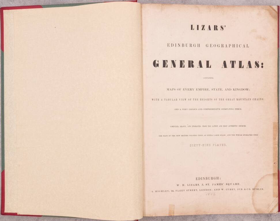
A nice example of the 1842 edition of Lizars's Edinburgh Geographical General Atlas, with two maps labeling the "Republic of Texas" within the map image.
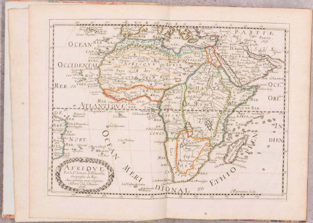
Almost all maps from the Republic of Texas period simply label the Republic "Texas" however, Lizars goes one step further in this atlas, choosing instead the full name of the polity. The maps showing the Republic of Texas are 63 ("United States & Texas. With all the Railways & Canals.") and 66 ("Mexico & Guatimala, with the Republic of Texas.")
The atlas is characteristic of Lizars' clean, considered engraving and coloring - qualities which had initially one him the business of producing John James Audubon's Birds of America (before he lost out to Havell's aquatinting capabilities.)
The atlas also includes wall maps of the continents in four sheets.
Lizars first started publishing the atlas in 1826 and continued to do so, with slightly varying titles, through 1842.
Maps
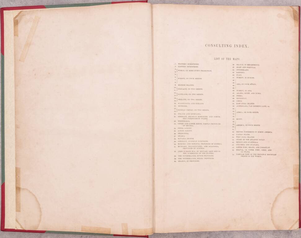
1. Western Hemisphere 2. Eastern Hemisphere 3, 4. World, on Mercator's Projection 5, 6, 7, 8. Europe, on Four Sheets 9. British Islands 10, 11. England, on Two Sheets 12, 13. Scotland, on Two Sheets 14, 15. Ireland, on Two Sheets 16. Scandinavia and Iceland 17. Denmark 18, 19. Russian Empire, on Two Sheets 20. Poland and Lithuania 21. Germany, Prussian Dominions, and Northern Independent States 22. Westphalia 23. Upper and Lower Rhine, partly Provinces of Prussia 24. Upper Saxony 25. Lower Saxony 26. Franconia 27. Swabia 28. Bavaria Proper 29. Germany, Austrian Dominions 30. Bohemia and Moravia, Provinces of Austria 31. Hungary, Transylvania, and Sclavonia, Provinces of Austria 32. (This number was, by mistake, left out in the numbering of the plates) *as indicated on the Consulting Index 33. The Netherlands, Dutch Provinces 34. The Netherlands, Belgic Provinces 35. France, in Provinces 36. France, in Departments 37. Spain and Portugal 38. Switzerland 39. Sardinia 40. Italy 41. Turkey, in Europe 42, 43, 44, 45. Asia, on Four Sheets 46. Turkey, in Asia 47. Arabia, Egypt, and Nubia 48. Persia 49. Hindostan 50. China 51. East India Islands 52. Australasia, Van Diemen's Land, &c. 53, 54, 55, 56. Africa, on Four Sheets 57. Egypt 58, 59, 60, 61. America, on Four Sheets 62. British Possessions in North America 63. United States 64. West India Islands 65. Chart of the Atlantic Ocean 66. Mexico and Guatemala 67. Columbia and Guyana 68. Lower Peru, Brazil, and Paraguay 69. Bolivia, or Upper Peru, Chili, and La Plata
If you are a student, write to us in telegram: @antiquemaps and indicate what material you need and for what work you need a map in high detail. We are ready to provide material on special terms. For students only!
![[Blaeu Atlas of America] America, Quae Est Geographiae Blavianae Pars Quinta Liber Unus Volumen Undecimum](/map/small/66852.jpg)