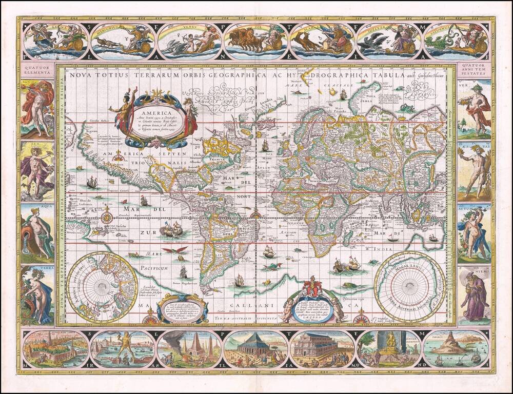
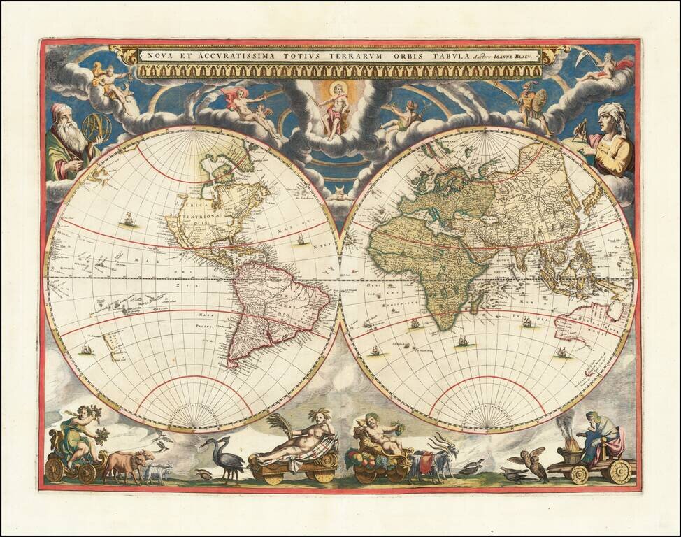
A Supreme Example of the Mapmaker's Art. Fine example of Guillaume Blaeu's classic world map on Mercator's projection, one of the most iconic maps of the Golden Age of Dutch Cartography. One of the finest and most famous world maps to appear in an...
![[World Map on Spanish Coat of Arms] Conclusiones Philosophicae, Medicae, et Metaphysicae](/map/small/62462.jpg)
Unrecorded document, surmounted by a coat of arms including a double hemisphere map of the World, engraved by Jean de Courbes. De Courbes was a French engraver, who is known to have been active in Madrid from 1621 to 1639. The document would seem to...
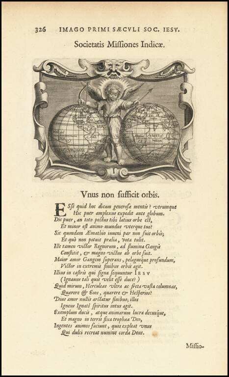
Rare map of the world, showing California as an island from a rare Jesuit emblem book, entitled Imago Prrimi Aaeculi Soc. Iesu a Provincia Flandro-Belgica Ejusdejm . . . representation of the baby Jesus is shown between the two hemisphere Within...
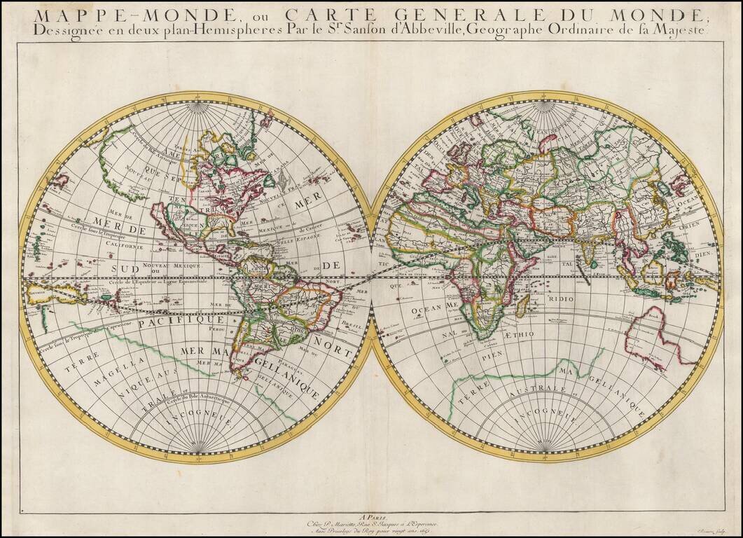
First State of Nicolas Sanson's First Map of the World First state of Sanson's first map of the World, published by the single most important French mapmaker of the 17th Century, whose modernistic approach to cartography would redefine commercial...
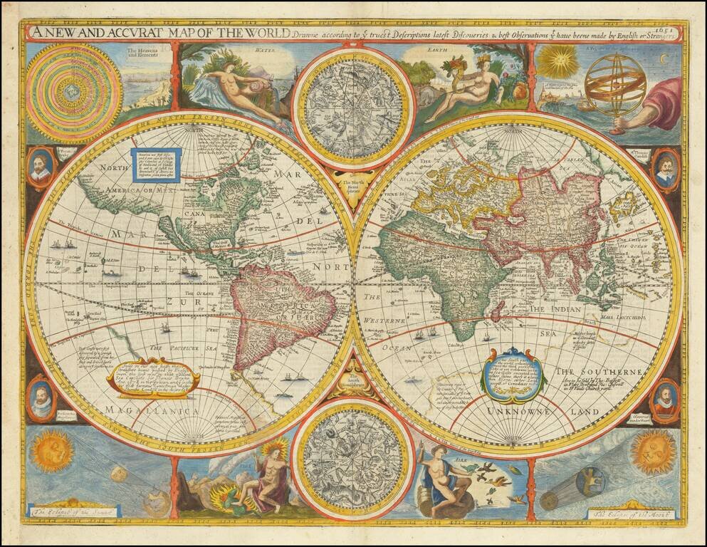
John Speed’s Acclaimed World Map Excellent example of Speed’s celebrated double hemisphere world map, highly sought after for its rarity, extraordinary early geographic detail, and striking illustrative ornamentation. It is one of the earliest...
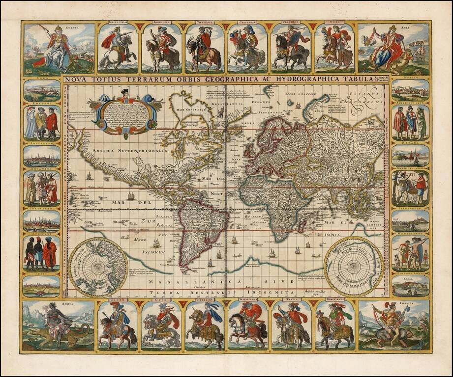
Nice example of Claes Janszoon Visscher's rare Twelve Caesars world map. CJ Visscher's world maps are among the most spectacular world maps published in the 17th Century. The present map is one of four world maps with decorative panels issued by...
One of the earliest of Sanson's world maps and one of the earliest obtainable maps to show the five Great Lakes. The map is based upon Sanson's 1651 map of the world (Shirley 390), but with more prominence given to marine and river features. California...
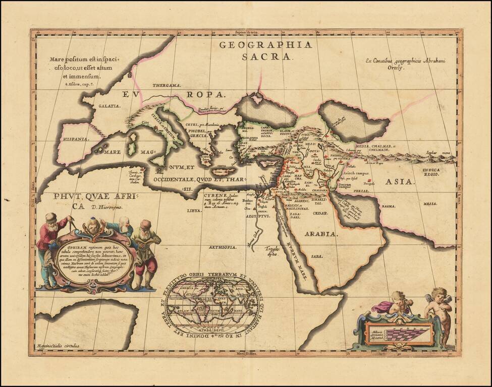
This is a decorative example of Jansson's map of the Ancient world, including an inset of his modern map of the world. The map is based on Ortelius's 1601 map of the same title, which originally appeared in the latter's Parergon, while this present...
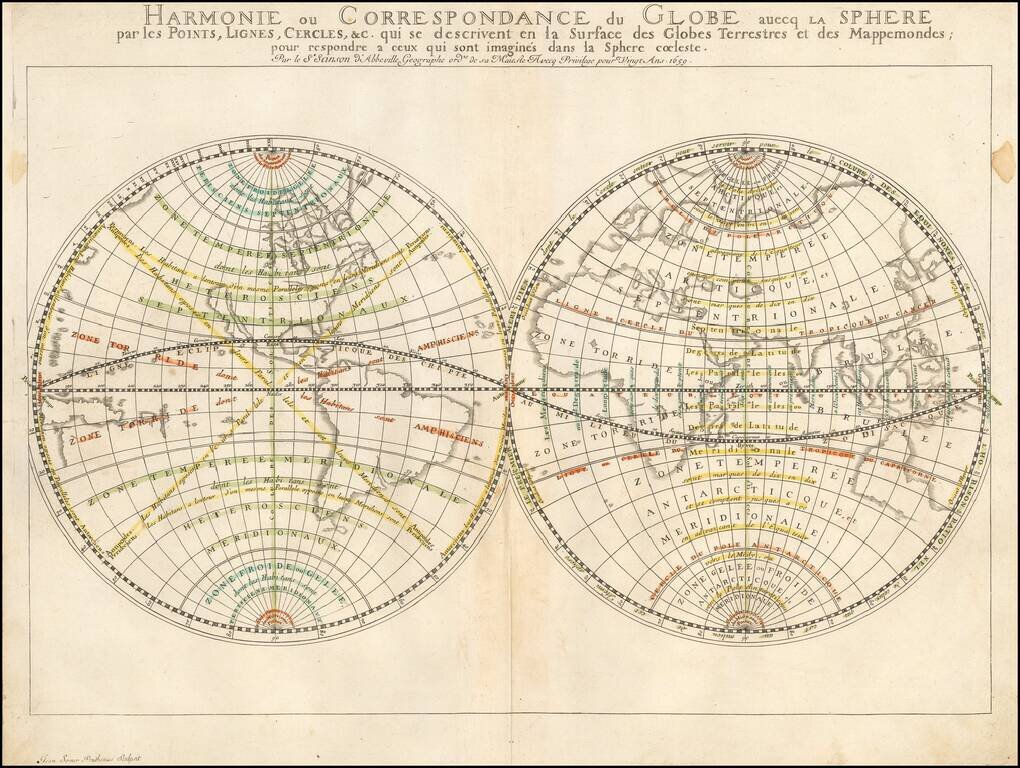
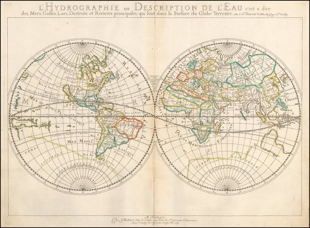
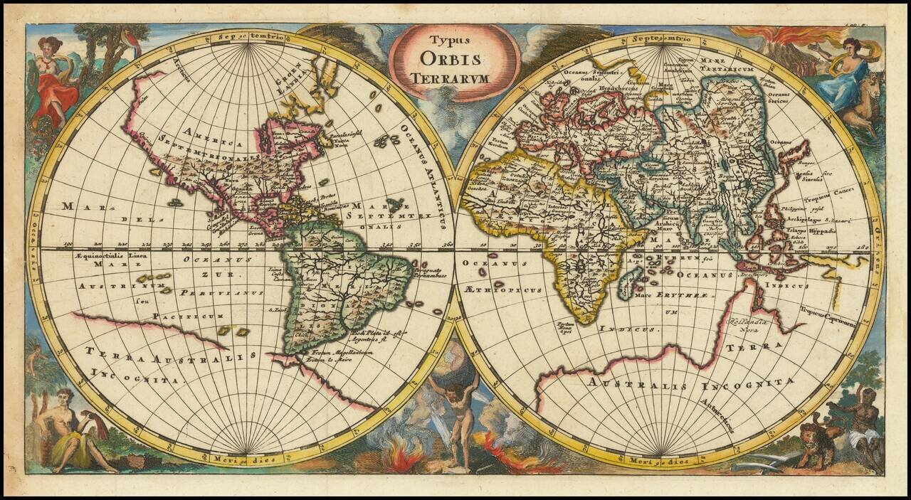
Nicolas Sanson's 1659 double-page engraved map of the world, featuring particular emphasis on latitudes, zones (e.g., "Zone Toride"), and meridians. While the main focus of the map is not detailed topography or toponyms, it includes some noteworthy...
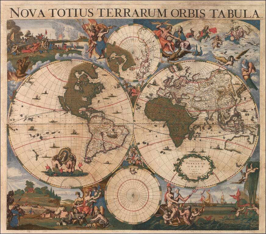
Blaeu's Important and Decorative Double-Hemisphere World Map. Finely colored example of Johannes Blaeu's scarce double hemisphere map of the World, originally prepared by Joan Blaeu for his Atlas Maior in 1662. The map was also included in...
A World Map Unknown To Rodney Shirley This rare double hemisphere map of the world is among the earliest maps to depict both of Abel Tasman's Voyages to Australia and New Zealand and among the earliest to depict the New Zealand and Australian...
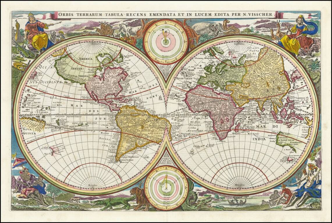
Scarce first state of Visscher's double hemisphere map of the world, which includes many of the great 17th Century cartographic myths and errors. A massive land extension north of California reaches nearly to Asia and shows the Straits of Anian and NW...
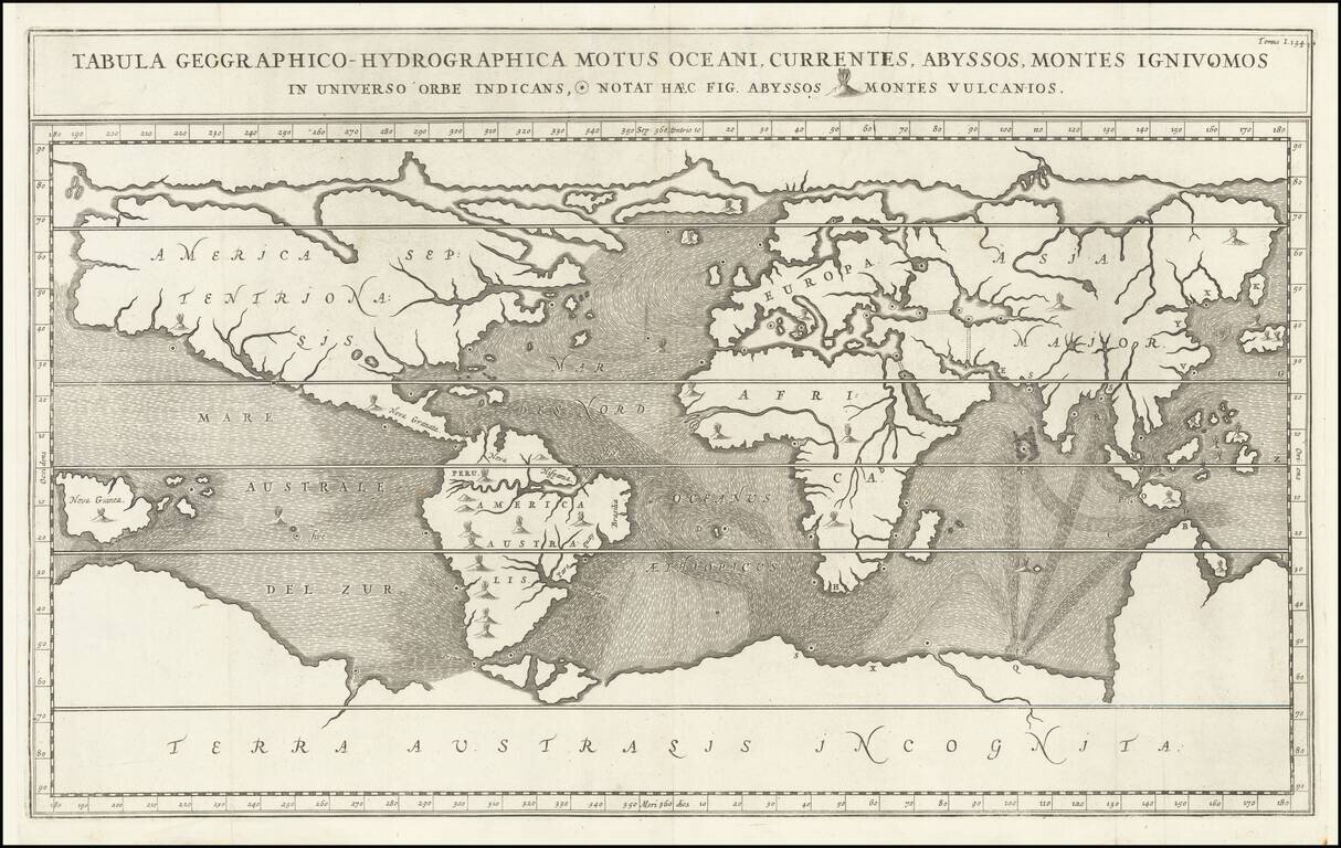
Fascinating World Map Showing Entrances to a Subterranean Realm Striking seventeenth-century map of the world, prepared to illustrate Athanasius Kircher's fascinating work on the underground passages and subterranean networks of the globe....
Interesting double hemisphere map of the world, from Cluver's Introductionis en Universum Geographicus…., one of the most prolific 17th and 18th Century Geography books. The map presents a classic depiction of the world as known in the mid-17th...
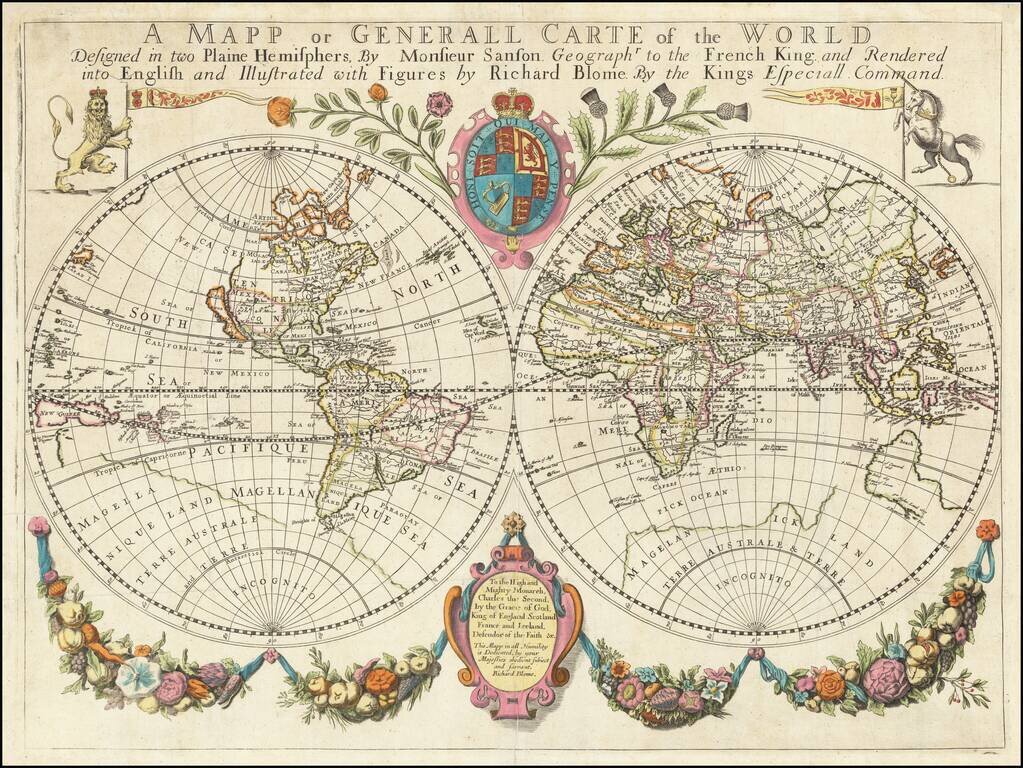
One of the Earliest Obtainable Large Format English World Maps. Old color example of Richard Blome's world map, embellished with decorative features and a dedication to Charles II. Beach is prominently mentioned in Australia, a marvelous reference...
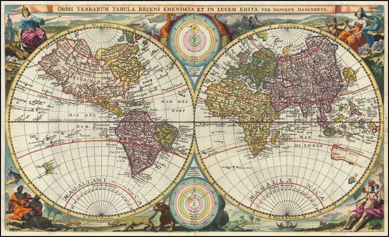
Unrecorded 17th Century Wall Map of the World By Cornelis Danckerts Old color example of this unrecorded 4-sheet wall map of the World, published in Amsterdam by Cornelis Danckets. The present example is an extraordinary survival, being the earliest...