![Uranometria, omnium asterismorum continens schemata, nova methodo delineata, aeris laminis expressa. [bound with:] Explicatio characterum aeneis uranometrias imaginum, tabulis, insculptorum, addita, & commodiore hac forma tertium redintegrata.](/map/small/70736.jpg)
Second Edition in Early Vellum, Bound With the Extremely Rare Text. First published in Augsburg in 1609, Bayer's Uranometria was one of the great celestial atlases of the 17th century, a veritable golden age for start chart production. This is the...
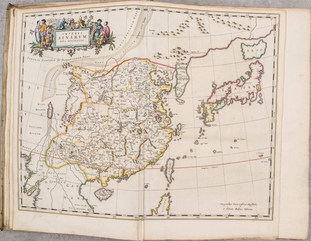
First Dutch Edition of the First European Atlas of China. 17 engraved maps in original hand-color, and engraved title pages in original hand-color, heightened in gold. [6], 213, [19], xviii, 40 pages of text in Dutch. A Handsome Example of the First...
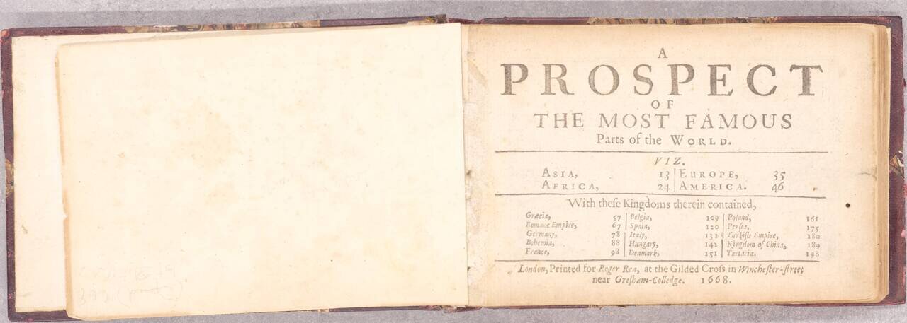
Rare Miniature Speed Atlas of the World. A wonderful miniature John Speed atlas of the world, first issued by William Humble, son of George Humble, in 1646. This edition published by Roger Rea in 1668. The elder Humble was the original publisher of...
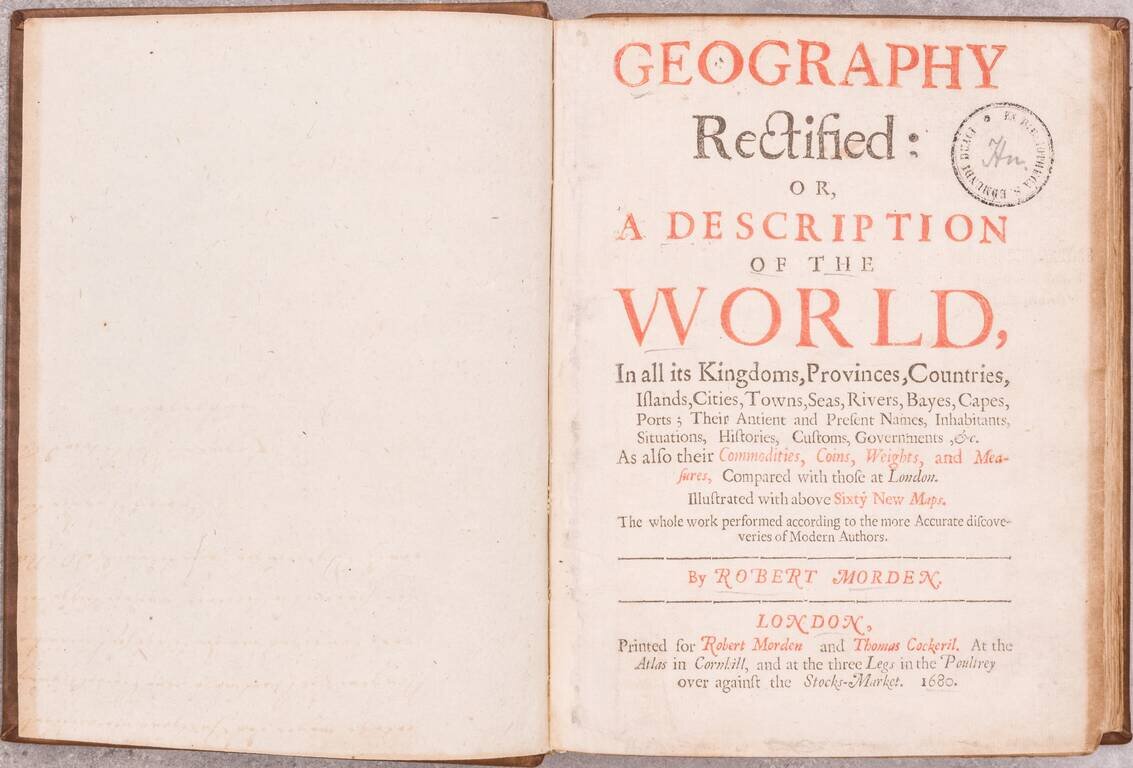
Rare First Edition of Morden's Geography Rectified This is an example of the rare first edition of Morden's important pocket world atlas, containing an extensive selection of Morden's maps of the world and its regions. The information Morden provides...
![L'Europe en Plusierus Cartes Nouvelles et Exactes [bound with] L'Asie en Plusieurs Cartes Nouvelles et Exactes [and] L'Afrique en Plusieurs Cartes Nouvelles et Exactses [and] L'Amerique en Plusieurs Nouvelles et Exactes](/map/small/69477.jpg)
All Maps in Original Outline Hand-Color. A handsome example of the 1683 Dutch pirated edition of Nicholas Sanson's four continental atlases, of Europe, Asia, Africa, and the Americas. These are the books with which Nicholas Sanson started his career...
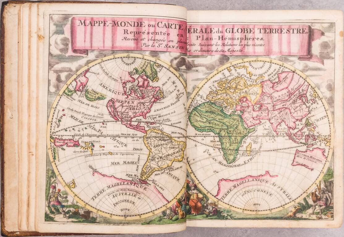
A beautiful miniature Halma edition of a Sanson gentleman's pocket atlas in exquisite full contemporary Dutch color. The volume includes Sanson's pocket atlas, with Bion's useful work on globes. Although this atlas is always listed under Nicolas...
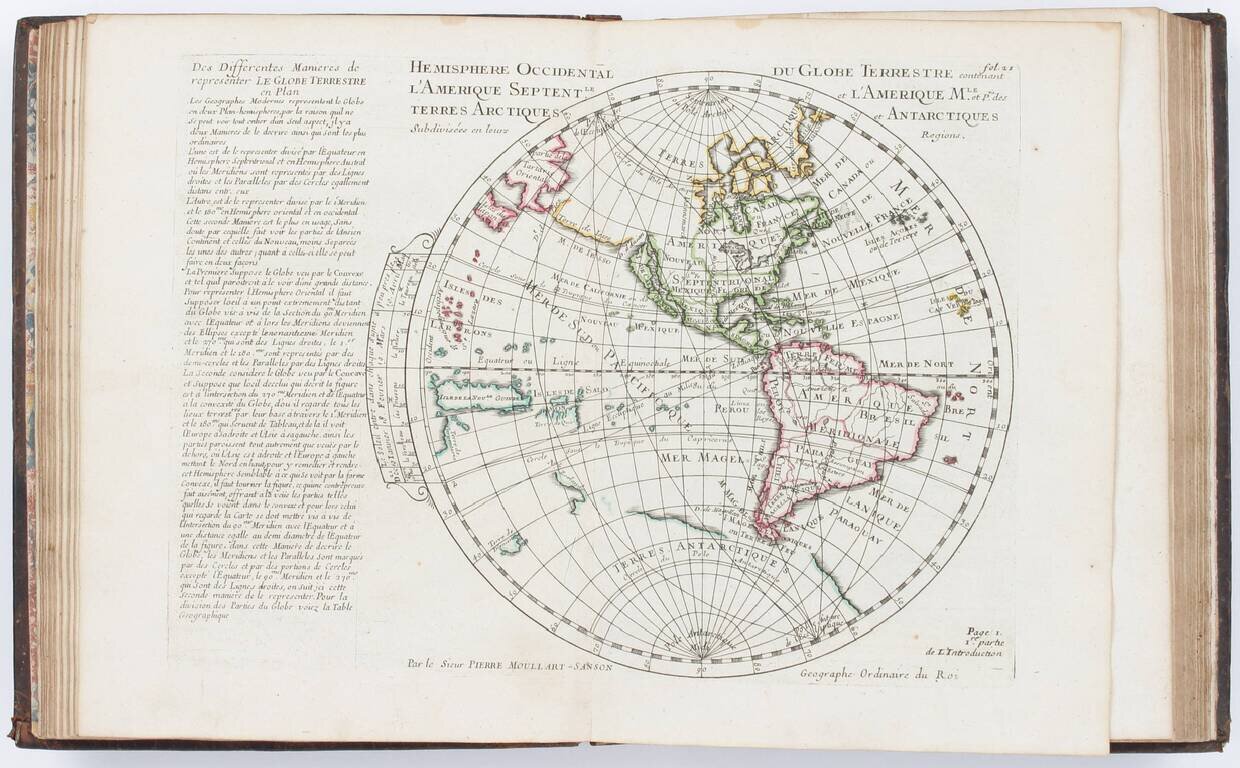
Moullart-Sanson's Very Rare Elementary Atlas with Many Maps of the World, Its Hemispheres, Poles, Etc. in Different Projections. Quarto (10 x 7.75 inches). Contemporary calf, spine richly gilt (somewhat rubbed and worn, head of spine chipped, rear...
A good example of German historian David Koehler's popular early 18th-century atlas by Nuremberg mapmaker Christopher Weigel, with maps based on models by Homann, Moll, and Goos. Includes a map of the world and continents and 25 regional maps,...

First Edition of the Most Important Celestial Atlas of the 18th Century, with the Engraved Portrait of Flamsteed. Engraved portrait of Flamsteed, title, dedication to George II, 9 pages of text, 1 page "A LIST of the SUBRIBERS." [sic], and 27 engraved...
Nice example of the last edition of the Mercator/Ptolemy atlas, with engraved frontispiece, and 28 double-page engraved maps. "All maps, except the world map, have a graticule and the matching letters in the border added. For one map (Europe 7)...
![[Celestial Atlas] Atlas Coelestis | Atlas Novus Coelestis in Quo Mundus Spectabilis, et in Eodem tam Errantium Quam Inerrantium Stellarum Phoenomena Notabilia, Crica Ipsarum Lumen...](/map/small/66645.jpg)
A Superb Example with Rich Original Hand-Coloring. Engraved allegorical additional title by J.C. Reinsperger after J.J. Preisler, title printed in red and black with engraved vignette, letterpress index, 30 double-page engraved plates all of which in...
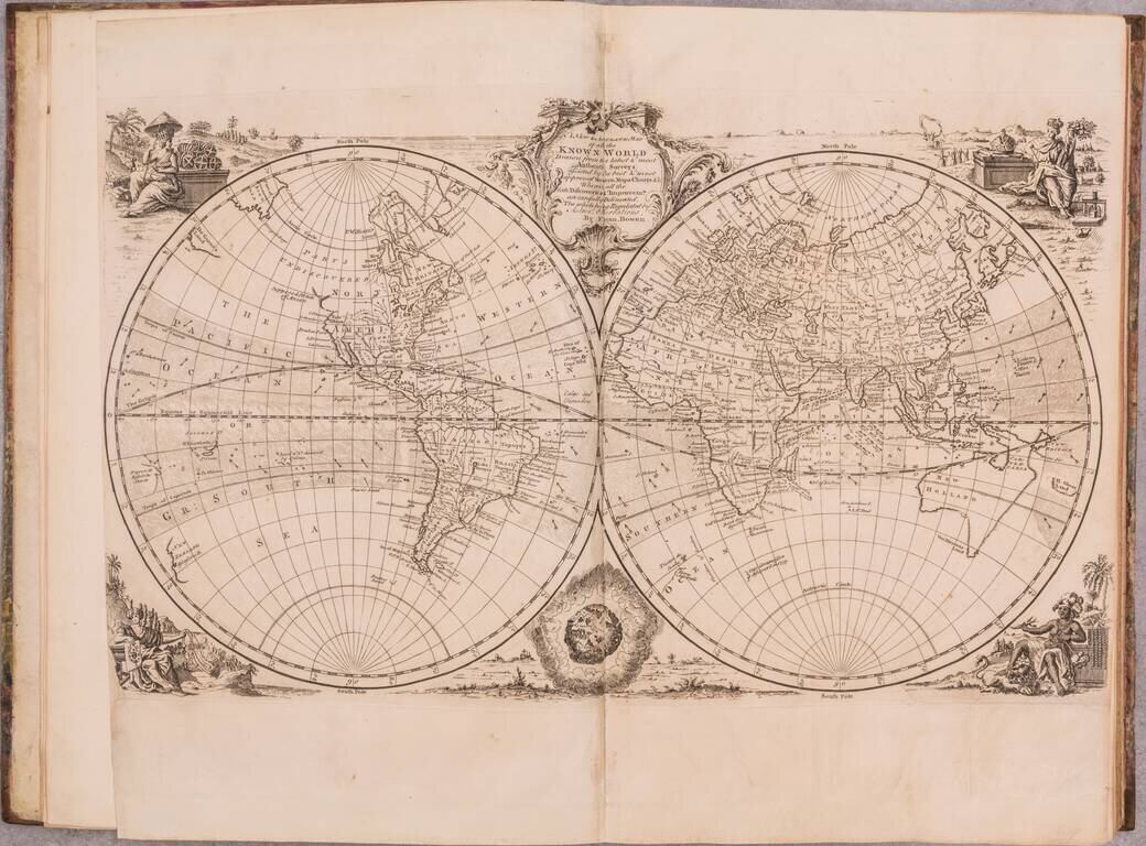
A wonderful example of this mid-18th century English atlas featuring a wide range of maps by Emanuel Bowen, published by him in London in 1752. Most of the maps feature Bowen's characteristic English Rococo cartouches and careful engraving. Perhaps...
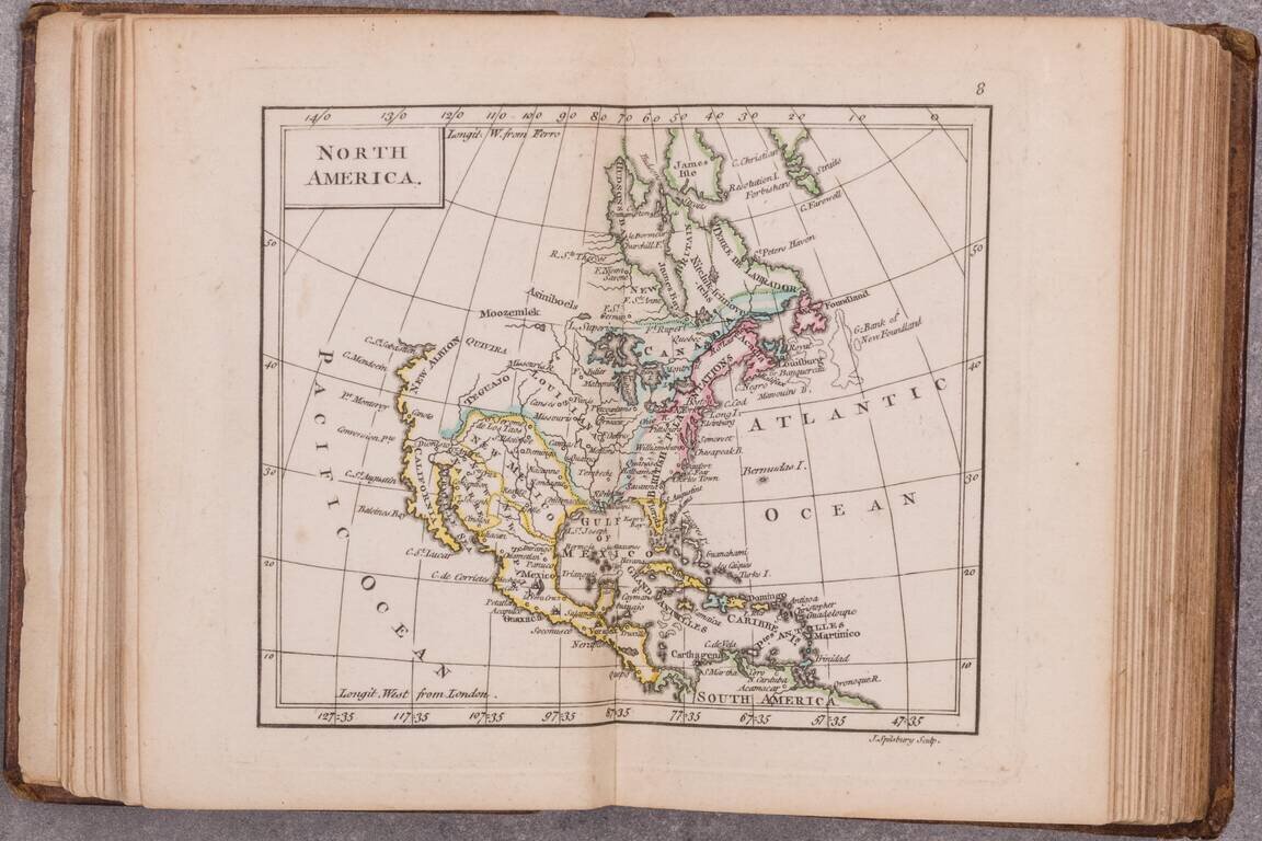
A little gem of an 18th-century English atlas, being the 1761 edition of Dury's New General and Universal Atlas. Rumsey (3004) says that the map of Canada is double-page in the 1763 edition but not in the 1761. The 1763 having been changed to reflect...
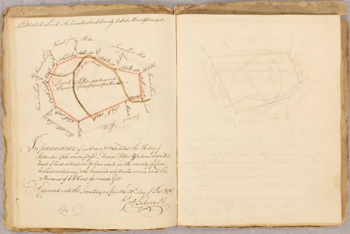
The Real Estate Journal of An Important Philadelphia Colonial Merchant Fascinating small archive, consisting of: James Hunter's Book of Land Draughts (1767 to 1789), consisting of approximately 60 written entries, most of which are finely executed...
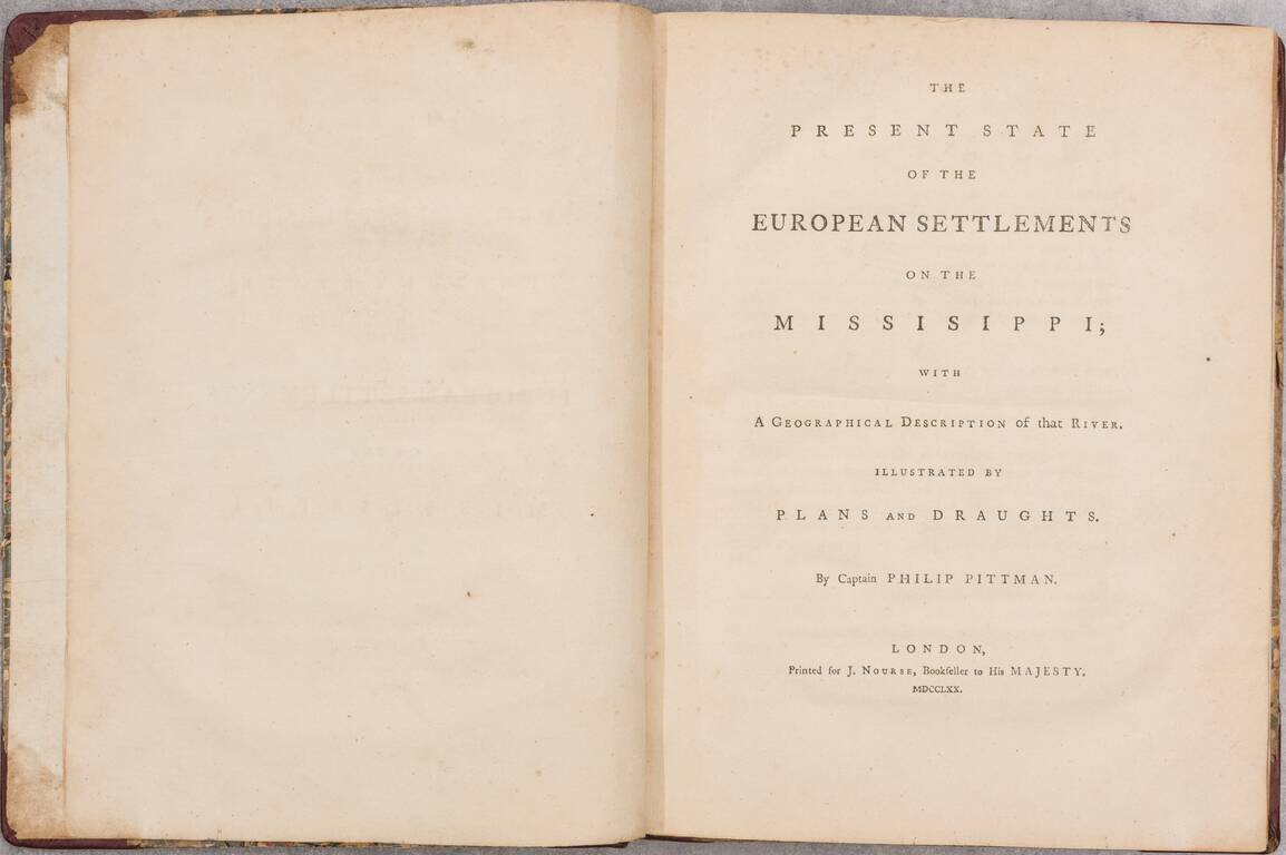
8 engraved maps (including the three sheets of the "Draught of the River Missisippi"). viii (including title and half-title), 99 pages. (Complete.) Quarto. Half red leather over contemporary boards, rebacked and recornered. An Exceptional Example of...
![[World Atlas]](/map/small/66935.jpg)
A Fine Example of D'Anville's General Atlas A complete set of D'Anville's maps as catalogued in his Cartes Geographique de M. D'Anville, in an original green binding. The atlas consists of 30 maps on 36 folding sheets, bound in a tall original binding...