
Flying visit of Truth to Berlin Rare satirical cartoon map of illustrating the British Royal Air Force propaganda raid on Berlin in September 1939, published by Rex Whistler. The image shows a winged goddess Britannia, with a trident and shield,...
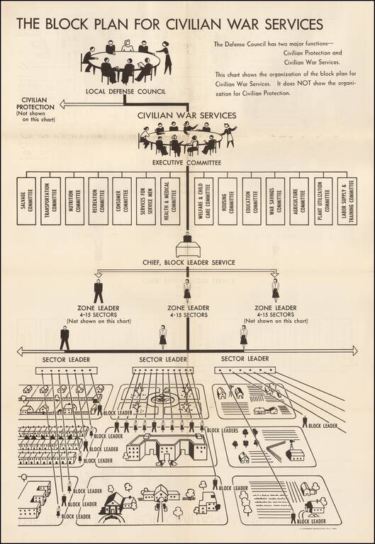
World War II Civilian War Services Organizational Chart Unusual organizational chart showing the means for organizing civilians during World War II. As the chart notes, this is the Civilian War Services chart, NOT the chart for Civilian Protection....
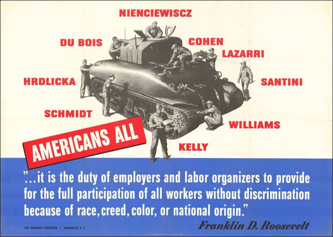
Fighting Labor Discrimination During World War II Large World War II broadside published by the American Government, stressing the importance of utilizing "All Americans" in the workplace and its importance in aiding the war effort. As noted by...
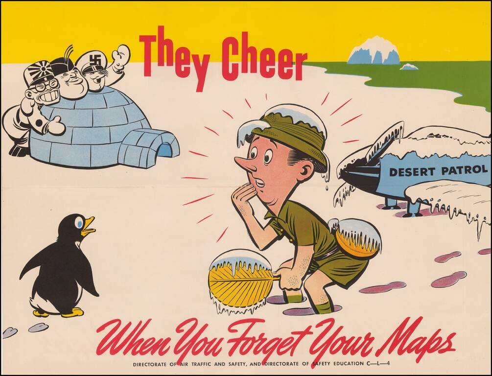
Whimsical World War II propaganda tool, published by the British Military services. The image is from the "They Cheer" series published by the "Directorate of Air Traffic and Safety" during the War. Tojo, Mussolini and Hitler are shown behind the...
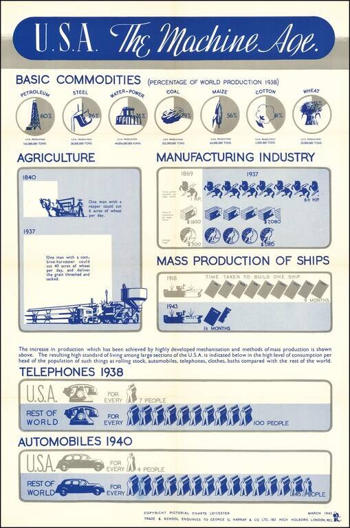
An interesting info-graphic, illustrating America's move toward industrialization in the 20th Century. The top line focuses in on the United States's increasing share of the productoin of Petroleum, Steel and Agricultural products. The next graphic...
![[Northwest Airlines -- Original Advertising Artwork] Transportation Down The Years Northwest Airlines](/map/small/70081.jpg)
Original Northwest Airlines advertising artwork, featuring a Boeing 377 Stratocruiser, which launched service in 1949. Striking image of a Boeing 377 Stratocruiser, introduced by Northwest Airlines on June 22, 1949. Beginning in the 1950s, the...
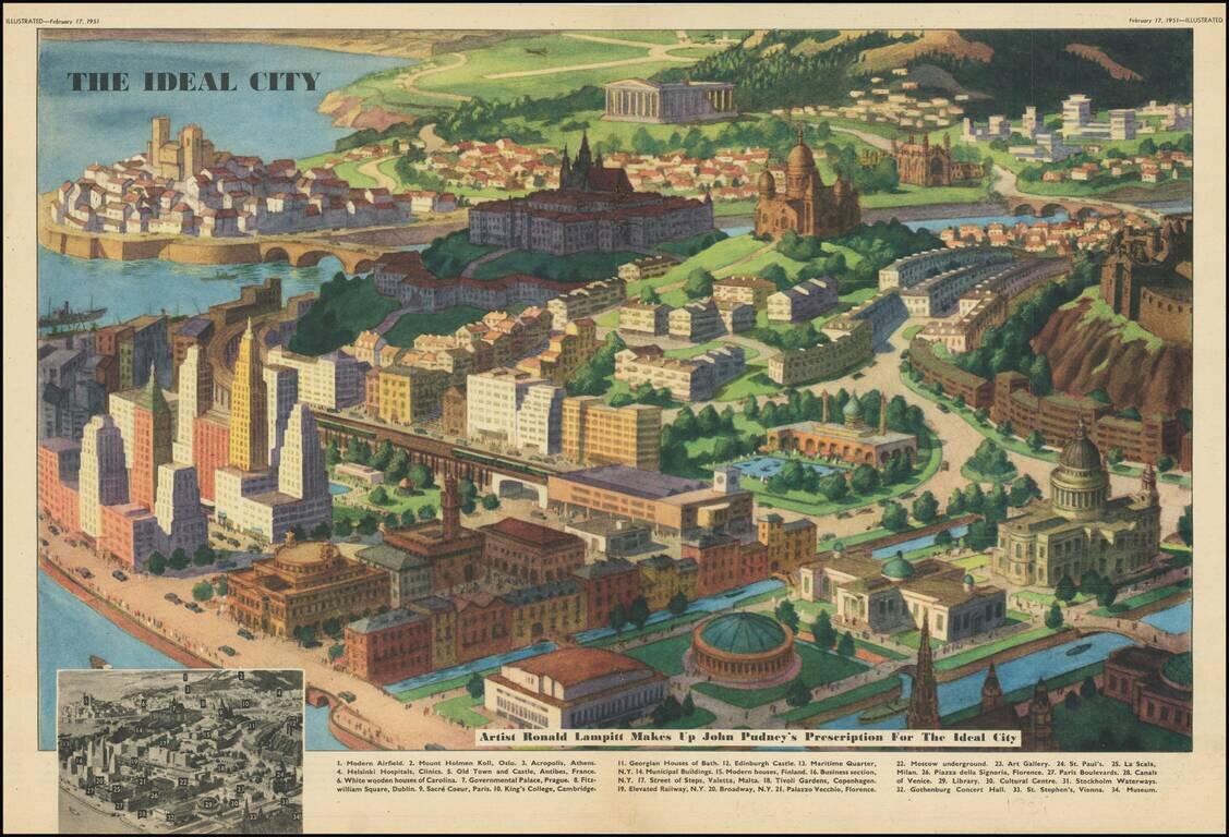
An interesting and humorous depiction of an "Ideal City," designed by the British illustrator Ronald Lampitt to accompany a piece by John Pudney which appeared in the 17 February 1951 issue of Illustrated Magazine. This imagined city borrows features...

Attractive promotional travel poster, promoting air travel to Guatemala. The map promotes travel via Pan Am's Clipper Service to Central America.
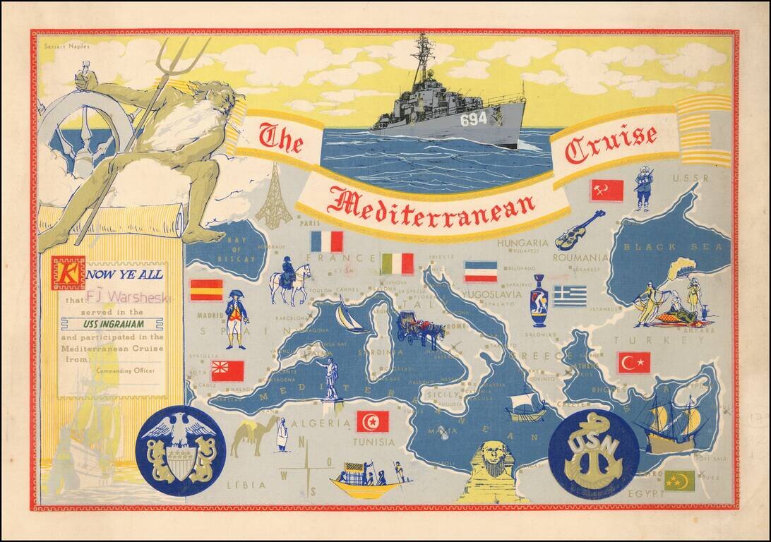
Decorative placemat map, given away aboard the USS Ingraham.
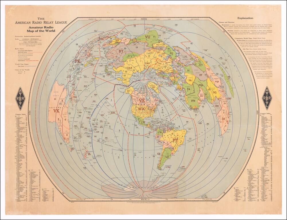
Finely executed map of the world, centered on the polar areas on a modified equidistant Azimuthal projection. Shows capital cities and major cities of the world, government radio districts and prefix areas, I.A.R.U. continental sub-divisions, I.T.U....
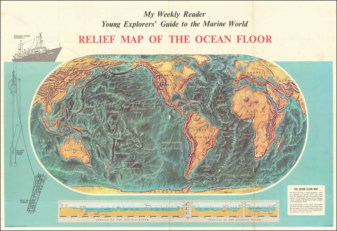
Fascinating map of the ocean floor, illustrating the topography of the seabeds for "Young Explorers". The map was issued as a supplement to My Weekly Reader, issued shortly after the expedition of the Bathyscaph Trieste to survey to survey the ocean...
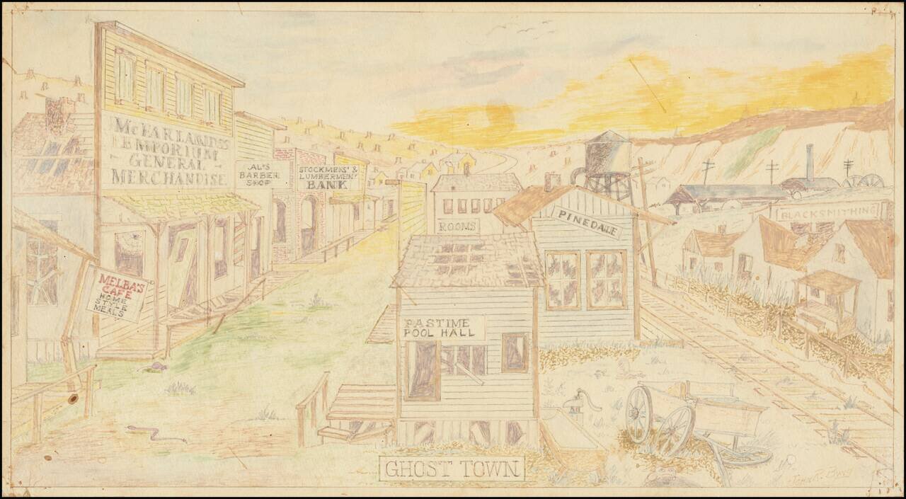
Quaint mid-century drawing of a fantasy Western Ghost Town by John R. Byng. Byng apparently made a number of these kinds of drawings of imagined urban scenes.
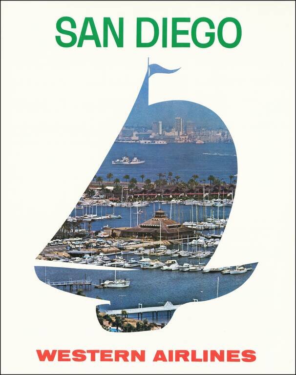
Scarce Western Airlines travel poster for San Diego. We estimated the date based upon the San Diego skyline and the cars in the parking lot of the marina.

Charles Eames Graphic Time Line on the History of Mathematicians -- Prepared For IBM A remarkable mathematical time line, designed for IBM by the Office of Charles Eames. As noted in the introduction: This is a chronological view of mathematics as...
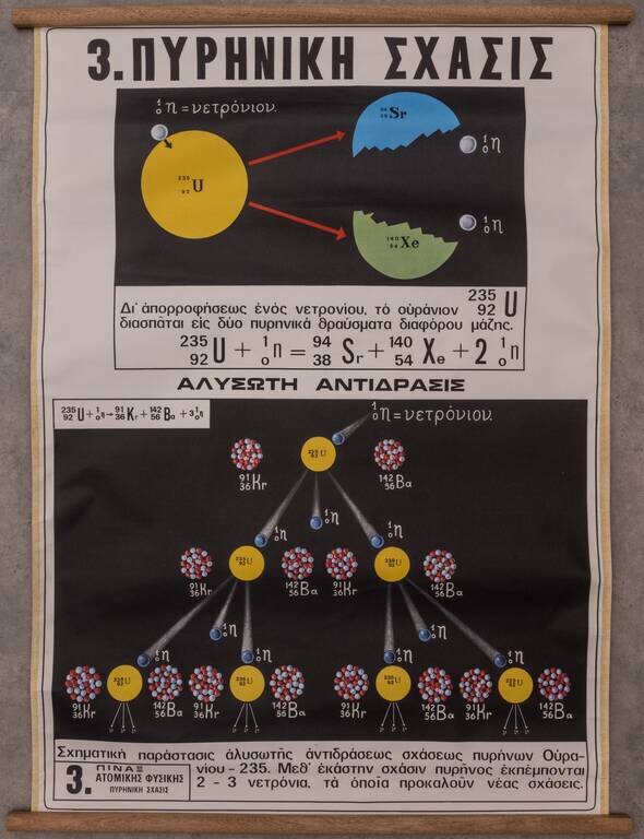
Interesting Greek-language didactic chart showing the process of nuclear fission for Uranium 235. The image above shows Uranium 235 splitting into Xenon and Strontium. The diagram at the bottom ("ΑΛΥΣΩΤΗ ΑΝΤΙΔΡΑΣΙΣ", i.e., "Chain...
![[Soviet Russian Ecology Propaganda Poster] Основы Водного Законодательства Союза ССР](/map/small/68343.jpg)
Original vintage Soviet Russian propaganda poster. The title translates as follows: The blue expanse is dear to us everywhere and it is not without reason that we are talking about it. - It's time to protect the wealth of our rivers and lakes in...