
Map size in jpg-format: 1.57534MiB
Click to open in high resolution (open in new tab).

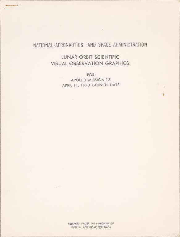
A Manual for Recording Scientific Observations while in Lunar Orbit
An extremely rare Apollo 13 visualization guide for astronauts while they were in lunar orbit, detailing the lunar features they would see, and the scientific observations they should record.
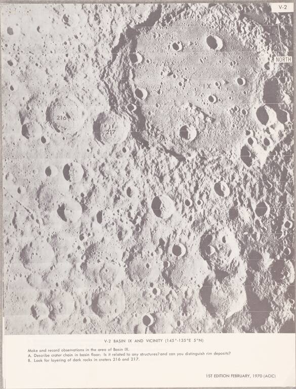
The atlas consists of a title page and 21 photographs of the moon [one sheet has two photos, another has none]. The ephemeral nature of the atlas (loose sheets secured with a single staple) probably contributes to the atlas's extreme rarity; we find no copies listed in OCLC nor of any other copies ever having been offered for sale.
The atlas reads like an undergraduate geological field guide. In it, photographs are shown and the astronauts are asked to make specific observations. These observations include: the color of the moon's surface at a different area, the size of blocks ejected from craters, and signs of volcanic activity. On the last sheet, they are even asked to use a sextant to measure the altitude of the Command and Service Module (CSM) over a mare. These observations would all have been of great use to scientists, but they would have been made by scientifically inexperienced astronauts. As such, this atlas was produced to help guide the observations that the astronauts would make while in orbit. One sheet has a different purpose: it is to be used to aid the astronauts while making a TV broadcast during trans-Earth injection so that they do not misidentify any features. It is almost certain that a copy of this atlas would have flown with the Apollo 13 crew.
The atlas was prepared for NASA by the Aeronautical Chart and Information Center of the U.S. Air Force.
Collation
The following is an enumeration of the contents of the atlas:
The Apollo 13 Mission
The Apollo 13 Mission was the most infamous of the Apollo missions, remembered for the epic effort undertaken to save the lives of the three astronauts after a spacecraft malfunction. The mission was led by Jim Lovell, with Jack Swigert and Fred Haise as command and lunar module pilots. This was supposed to be the first lunar mission to focus on scientific achievements, with the astronauts having been given a brief introduction to geology by Caltech scientist Lee Silver and NASA scientist Farouk El-Baz, and extensive instructions as to what they should record once in space.
The mission would go awry on the third day. The astronauts had just done a televised tour of the lunar module before checking their air tanks due to a suspicious pressure reading. One of the oxygen tanks subsequently exploded. This damaged parts of the module and left the astronauts dangerously low on oxygen and battery power, so the astronauts were forced to abandon the moon landing. The subsequent hours were spent trying to figure out what the quickest and safest route home would be, with extensive and difficult calculations needed to solve the issue. The crew moved to the lunar module, which they used as a lifeboat despite the increasing dampness and cold. They would survive there for the next few days, navigating using the stars and landmarks on earth, before landing in the Pacific Ocean. On earth, the crew members and mission control staff became popular heroes, and Apollo 13 still occupies a special place in the global imagination.
If you are a student, write to us in telegram: @antiquemaps and indicate what material you need and for what work you need a map in high detail. We are ready to provide material on special terms. For students only!
![[Blaeu Atlas of America] America, Quae Est Geographiae Blavianae Pars Quinta Liber Unus Volumen Undecimum](/map/small/66852.jpg)