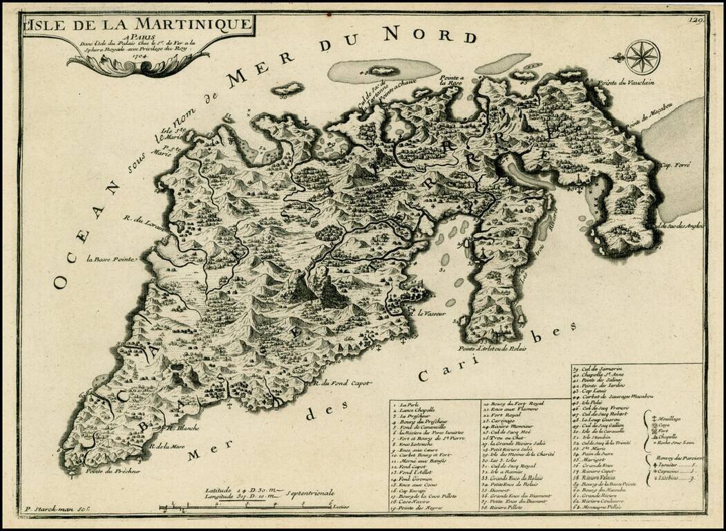
Detailed map of Martinique, oriented with east at the top. From De Fer's Atlas Curieux. The map provides a remarkable topographical and geographical look at Martinique, including forts, churches, anchorages, towns, rivers, mountains, bays, harbors,...
![[Heightened in Gold] Tabula Novissima atque Accuratissima Caraibicarum Insularum sive Cannibalum quae etiam Antille Gallicae Dicuntur Item Insulae Supraventum, et in Archipelago Mexicano](/map/small/60450op.jpg)
Fine contemporary color example of Ottens map of the Windward Islands, with a large inset map of Martinique. The map is heightened in gold and colored in the most deluxe fashion -- the best example we have ever seen. The map bears the imprint of the...
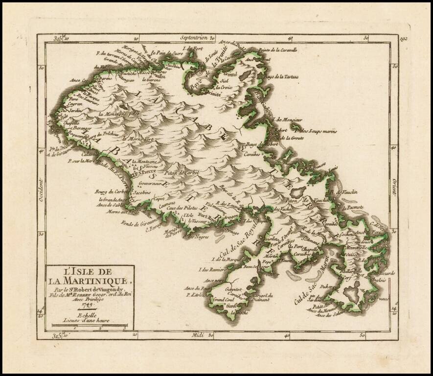
Striking example of De Vaugondy's map of Martinique, from his Atlas Portatif, Universel et Militaire. . . , first published in Paris, in 1748. The map provides a marvelous look at the topography of the island.
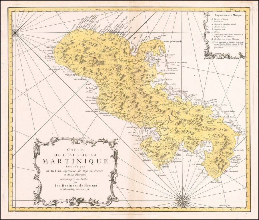
Decorative map of Martinique, published by the Homan Heirs in Paris. A highly detailed map of Martinique, based upon an earlier chart published by Nicholas Bellin in Paris. Depicted in the form of a sea chart with rhumb lines, the chart shows...
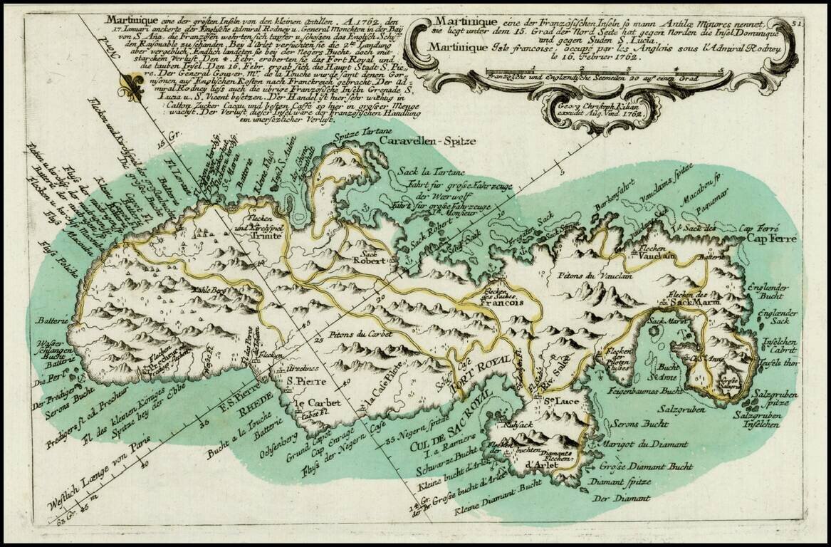
Scarce map of Martinique, showing both coastal and topographical details, from Heiden's Americanische urquelle derer innerlichen kriege des bedrängten Teutschlands. . . The map includes a number of place names and some topographical details. The...
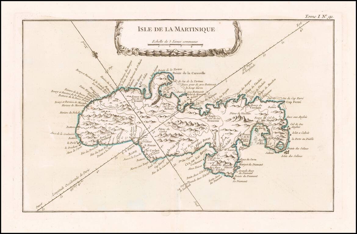
Detailed map of Martinique. Includes a decorative title cartouche. Highly detailed. One of the maps produced by Nichlas Bellin for his Petit Atlas Maritime.
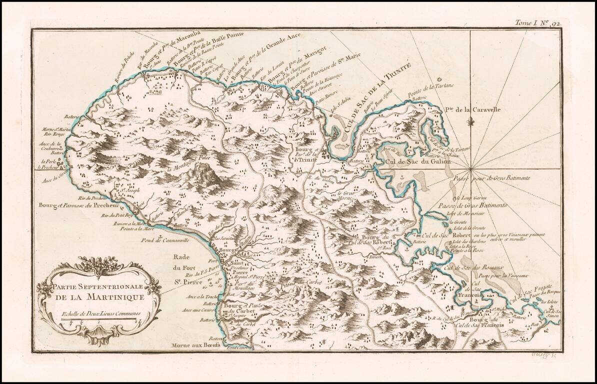
Detailed map of the northern part of the Island of Martinique. Includes a decorative title cartouche. One of the maps produced by Nichlas Bellin for his Petit Atlas Maritime.
Detailed map of the northern part of the Island of Martinique. Includes a decorative title cartouche. One of the maps produced by Nichlas Bellin for his Petit Atlas Maritime.
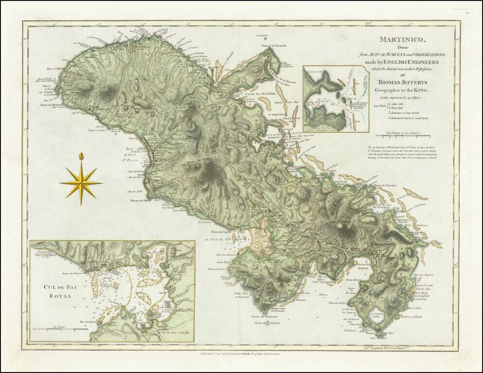
Detailed map of the lsland of Martinique, with inset maps of Port Royal Harbor and Gallion Harbor, which was first published by Thomas Jefferys in 1775. In 1720, a French naval officer, Gabriel de Clieu, procured a coffee plant seedling from the Royal...
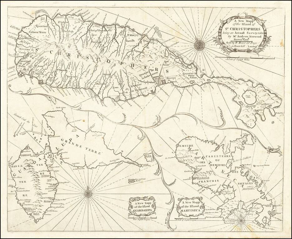
Nice example of John Thornton's sea chart of St. Kitts, Guadalupe and Martinique, which first appeared in the English Pilot, Fourth Book, in about 1706. Includes a fine map of St. Christophers, now known as St. Kitts, showing the parishes, forts,...
![[Barbados] Nieuwe Land en Zeekaart van het Eyland Barbados Geleegen in West Inida onder de Caribesse Eylanden. Afgeteekent na de Nieuste Opservatien . . .](/map/small/60428op.jpg)
Early Chart of Barbados in Fine Contemporary Color Fine contemporary colored example of Gerard Van Keulen's rare sea chart of Barbados. The chart is oriented with west at the top, illustrating Barbados in exceptional details. Within the interior...
![[Antigua] A New and Accurate Map of the Island of Antigua or Antego taken from Surveys, and adjusted by Astronl. Observations. Containing all the Towns, Parish Churches, Forts . . .](/map/small/68333.jpg)
Decorative and highly detailed map of Antigua. Shows towns, parishes, roads, mountains, islands, forts, plantations, sugar works, castles, etc. Decorative cartouche, compass rose and annotations.
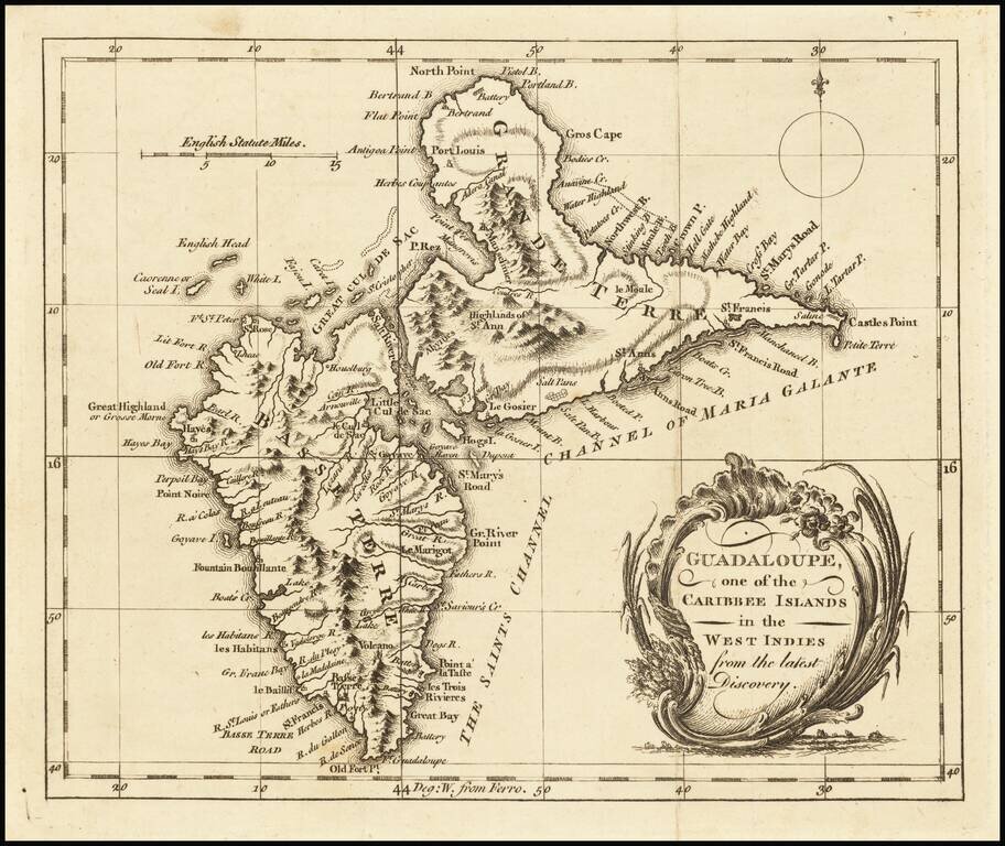
Detailed map of Guadalupe, showing towns, harbors, bays, rivers, lakes, and a host of other details. Decorative cartouche and compass rose.
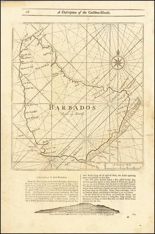
Detailed coastal map of the Island of Barbados, from Mount & Page's English Pilot, Fourth Book. The map includes a number of bays, harbors and other coastal feature, with sailing directions and a profile view below and on the verso.
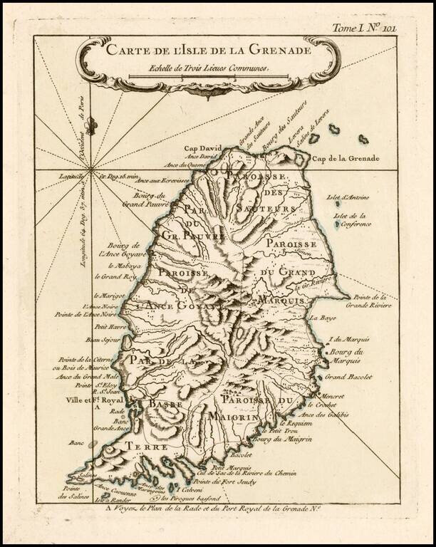
Antique Map of Grenada Detailed map of the Island of Grenada, showing remarkable detail for the period. Includes a large decorative title cartouche. From Bellin's Petit Atlas Maritime.
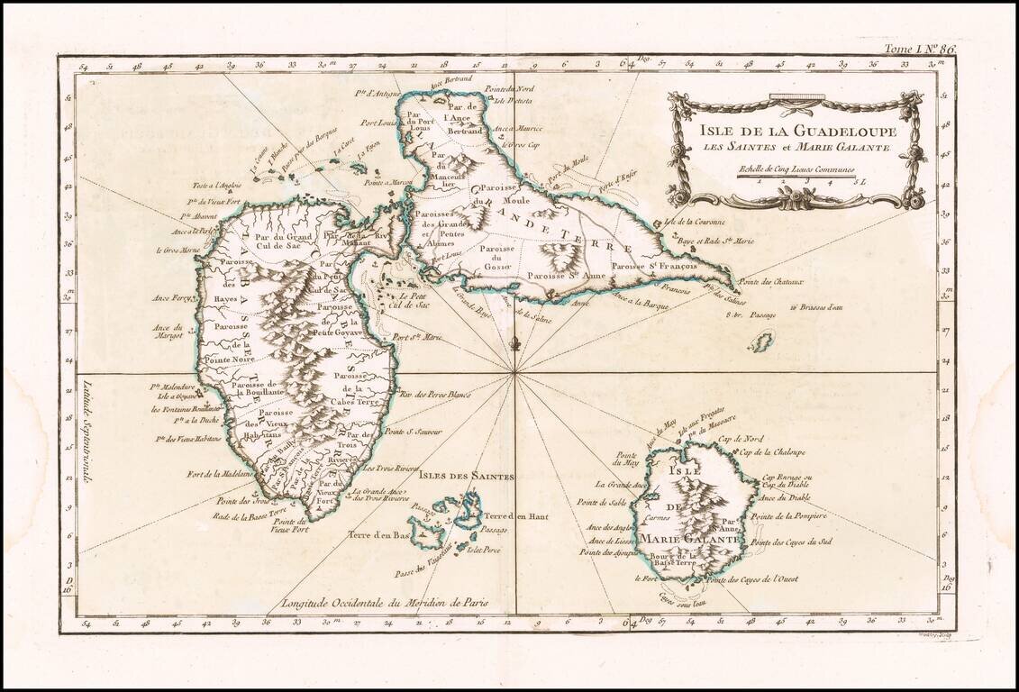
Detailed map of Guadalupe, Mari-Galante and the Isles de Saintes. Includes a decorative title cartouche, smaller cartouche and Rhumb lines. One of the maps produced by Nichlas Bellin for the Petit Atlas Maritime.