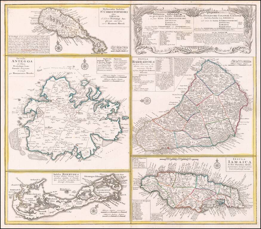
Interesting set of 5 maps on a single sheet, showing St. Kitts, Antigua, Bermuda, Barbados, and Jamaica, each in excellent detail. The maps area drawn from separate maps made by Herman Moll in 1729. Each is finely engraved and meticulously detailed...
![La Jamaique… [with] La Bermude…](/map/small/53986.jpg)
Delightful map of Bermuda and Jamaica in outline color, showing parishes, cities, forts, and the various types of plantations on Jamaica.
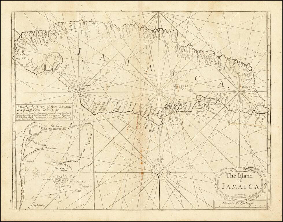
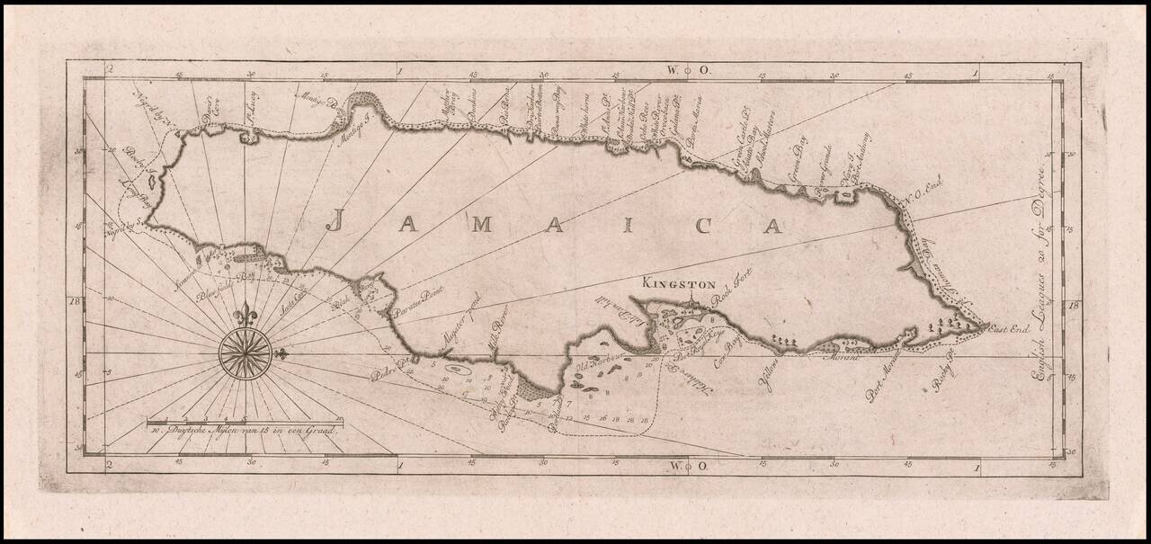
Late state of Mount & Page's sea chart of Jamaica, from the Fourth Book of the English Pilot. The chart was perhaps the single most widely utilized English sea chart of Jamaica during the first half of the 18th Century, as the success of the...
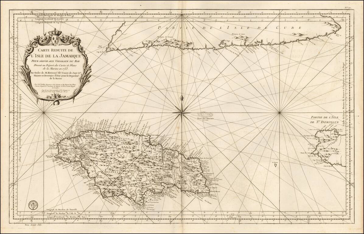
Detailed Depot De La Marine's sea chart of the region centered on Jamaica, with the southern part of Cuba and western end of Hispaniola. This detailed map of Jamaica, shown divided into parishes, includes strong topographical details with many...
Locates Caberets and Taverns! Detailed Depot De La Marine's sea chart of Jamaica, first published in 1758. This detailed sea chart of Jamaica, shown divided into parishes, includes strong topographical details with many coastal toponyms. Sugar...
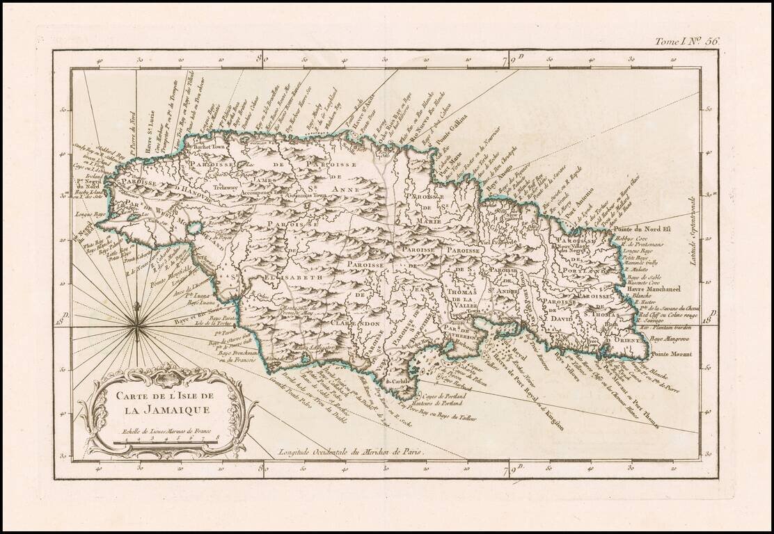
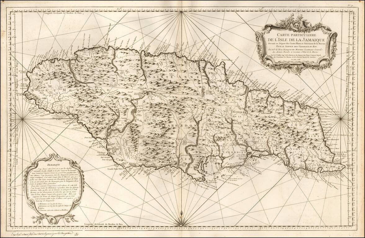
Detailed map of the Island of Jamaica, at the conclusion of the Seven Years War. Includes a large decorative title cartouche, compass rose and rhumb lines. One of the maps produced by Nicholas Bellin for his monumental Petit Atlas Maritime.
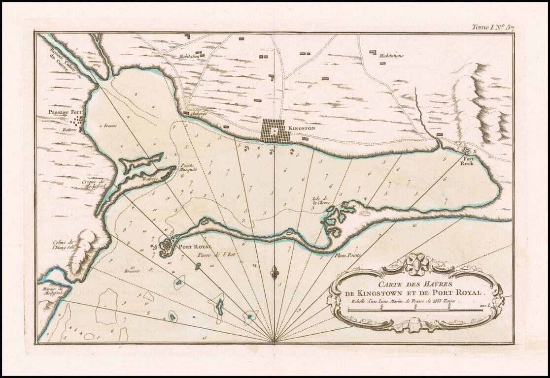
Kingston and Port Royal Harbor Fine original color example of this early chart of Kingston and Port Royal Harbor, which appeared in Jacques Nicolas Bellin's Petit Atlas Maritime. The map provides a fine early look at the region at the conclusion of...
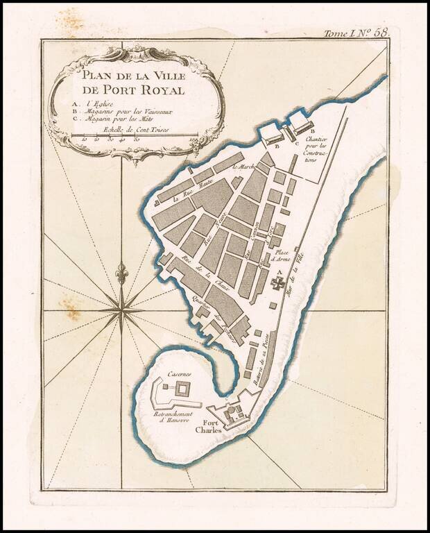
Port Royal Original color example of this early plan of Port Royal Harbor, which appeared in Jacques Nicolas Bellin's Petit Atlas Maritime. The map provides a fine early look at the region at the conclusion of the French & Indian War, a time...
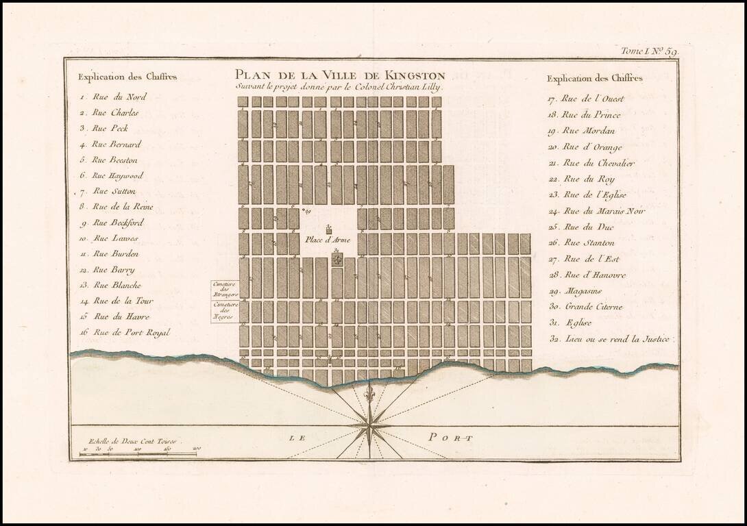
Early Plan of Kingston, Jamaica. Fine original color example of this early plan of Kingston, which appeared in Jacques Nicolas Bellin's Petit Atlas Maritime. The map provides a fine early look at the region at the conclusion of the French &...
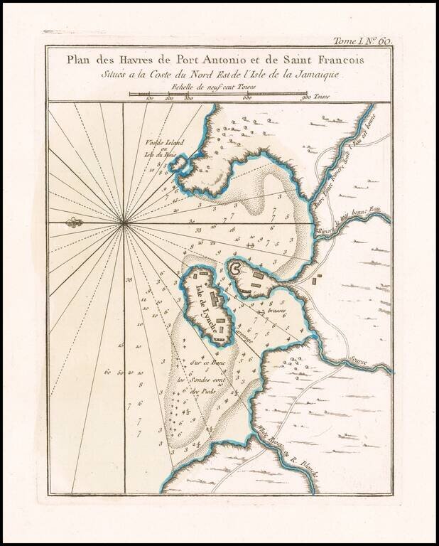
Port Antonio, Jamaica. Original color example of this early plan of Port Antonio and Navy Island, which appeared in Jacques Nicolas Bellin's Petit Atlas Maritime. The map provides a fine early look at the region at the conclusion of the French &...
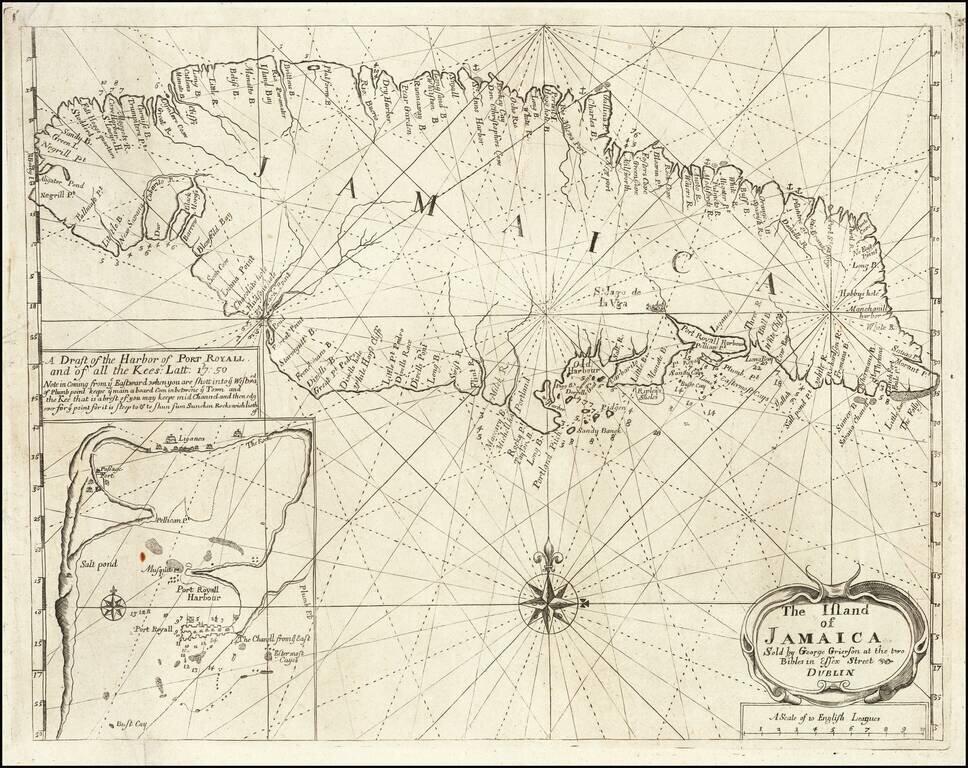
Rare Sea Chart of Jamaica, Published In Dublin! Rare Grierson sea chart of Jamaica, pubished in Dublin. Includes a large inset map of Port Royal. George Grierson (c.1678 - 1753) Scotish born George Grierson was one of the most important...
Separately Published Sea Chart of Jamaica By Gerard Hulst Van Keulen A rare separately published sea chart of Jamaica issued by Gerard Hulst Van Keulen. As noted in Appendix 5 of The Van Keulen Cartography (entry 188), the chart was separately...
![[Jamaica, Grenada, Dominica and St. Vincent) Carte de L'Isle de la Dominique . . . [and] Carte de L'Isle de la Grenade . . . [and] Carte de L'Isle St. Vincent . . . [ and] Carte De L'Ise de la Jamaique . . .](/map/small/66139.jpg)
Caribbean Theater During the Anglo-French War Rare separately published broadside set of 4 maps of British Colonial islands in the Caribbean, published during Anglo-French Wars in the Carbbean. Invasion of Dominica The Invasion of Dominica on...
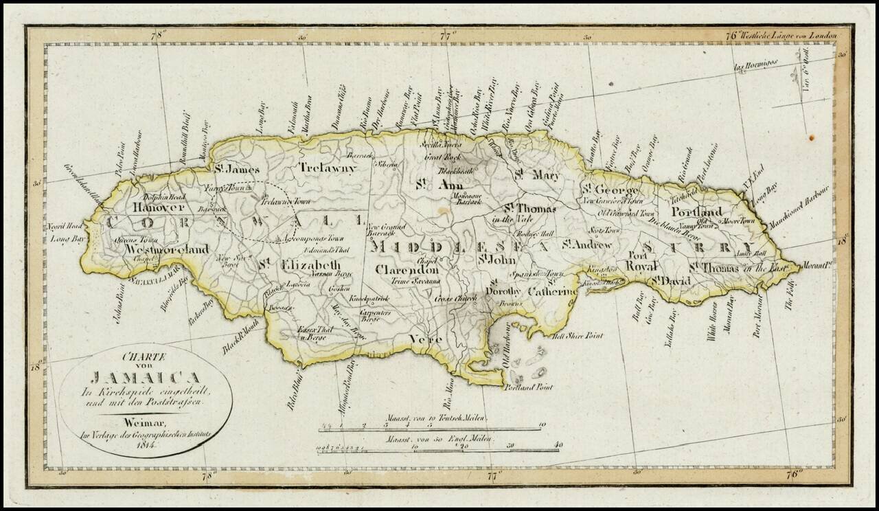
Detailed map of Jamaica, colored by Parishes. Shows Postal Roads, churches, towns, harbors, rivers, mountains and many other details. One of the earliest obtainable maps of Jamaica to locate postal roads.
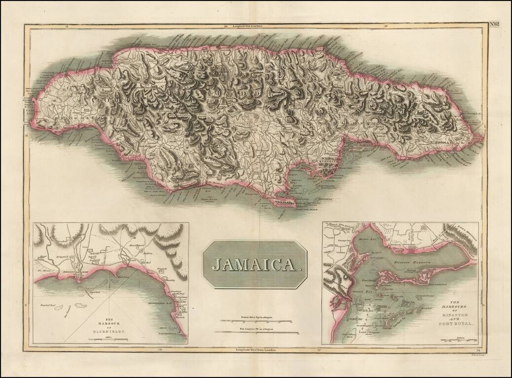
Detailed map of Jamaica, based upon Jefferys map of 1775. Includes large insets of the Harbors of Kingston and Port Royal and of Bluefields. Gorgeous topographical details. One of the best large format English maps of the period.
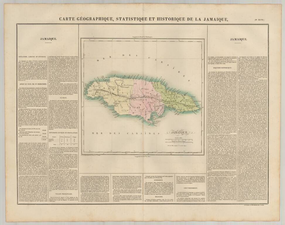
Detailed map of Jamaica, published in Paris. The map is colored by parishes, and locates roads, towns, rivers and topographical features. The map appeared in the French edition of Carey & Lea's Atlas is highly prized not only for its cartographic...