Map size in jpg-format: 580601B
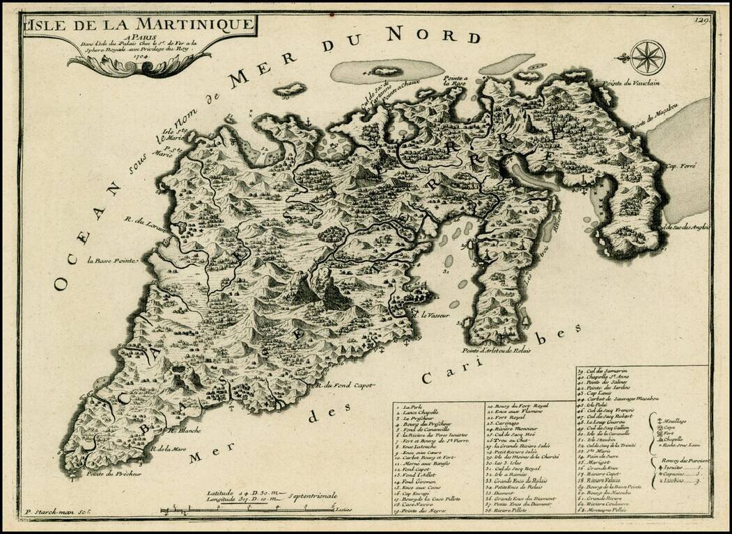
Detailed map of Martinique, oriented with east at the top. From De Fer's Atlas Curieux.
The map provides a remarkable topographical and geographical look at Martinique, including forts, churches, anchorages, towns, rivers, mountains, bays, harbors, smaller islands, etc. Key lists over 60 points of interest.
Nicholas de Fer (1646-1720) was the son of a map seller, Antoine de Fer, and grew to be one of the most well-known mapmakers in France in the seventeenth century. He was apprenticed at twelve years old to Louis Spirinx, an engraver. When his father died in 1673, Nicholas helped his mother run the business until 1687, when he became the sole proprietor.
His earliest known work is a map of the Canal of Languedoc in 1669, while some of his earliest engravings are in the revised edition of Methode pour Apprendre Facilement la Geographie (1685). In 1697, he published his first world atlas. Perhaps his most famous map is his wall map of America, published in 1698, with its celebrated beaver scene (engraved by Hendrick van Loon, designed by Nicolas Guerard). After his death in 1720, the business passed to his sons-in-law, Guillaume Danet and Jacques-Francois Benard.
If you are a student, write to us in telegram: @antiquemaps and indicate what material you need and for what work you need a map in high detail. We are ready to provide material on special terms. For students only!
![[Heightened in Gold] Tabula Novissima atque Accuratissima Caraibicarum Insularum sive Cannibalum quae etiam Antille Gallicae Dicuntur Item Insulae Supraventum, et in Archipelago Mexicano](/map/small/60450op.jpg)