

Decorative map of the Black Sea Region, with a large decorative cartouche surmounted by the Russian Imperial Coat of Arms. The map extends north to Moscow and Smolensk from Constantinople in the south.

Decorative regional map of eastern Germany. Major cities include Leipzig and Halle.
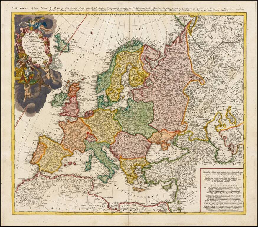
Decorative map of Europe, based upon Haase's stereographic horizontal projection, which was featured in his book on cartographic methodology. The map is hand colored by country, showing cities, towns, rivers, mtns, lakes, etc. Large decorative...

This is a scarce map encompassing Poland and parts of the grater Baltic Region, Russian, and Ukraine. The map extends from the Gulf of Riga to the Black Sea at the mouth of the Dniepr. The map includes an attractive cartouche. This is only the second...
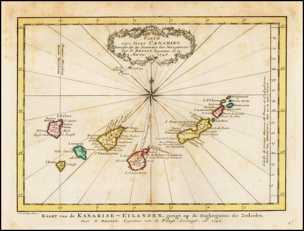
Detailed map of the Canary Islands, originally issued by Bellin and reissued in Dutch in 1770. Nice Cartouche and Compass Rose.
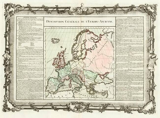
Decorative map of the continent. Includes remarkable decorative borders found only in the deluxe edition of Buy De Mornas' Atlas Methodique et Elementaire de Goegraphie et l'Histoire.
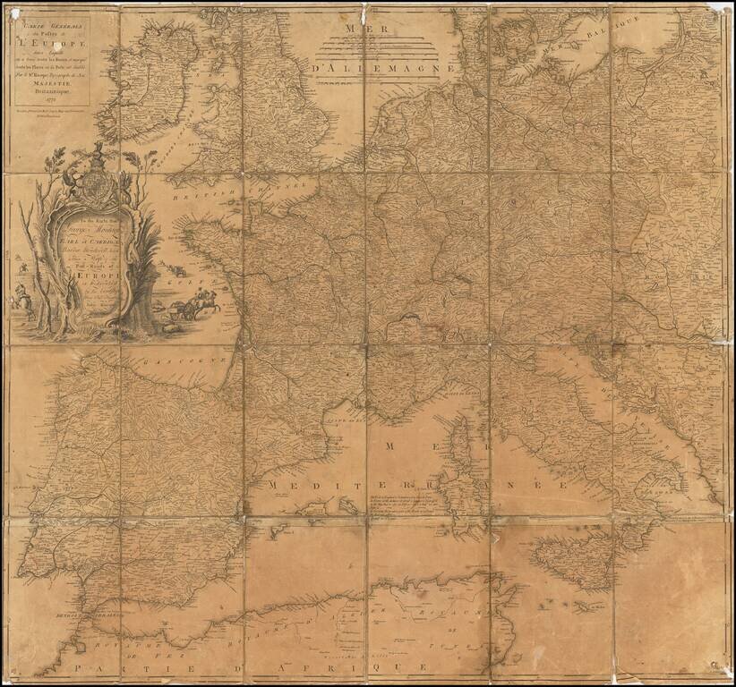
Somewhat warn example of John Rocque's map of the Post Roads of Europe, published by Robert Sayer in London, in 1773. The first state of the map appeared in 1758. The present map is the second printing in 1771, with the Sayer imprint, replacing the...
![[Martin Behaim Globe / Book] Pars Globi terrestris Ao. 1492 a Martino Behaim Equite Lusitano Norimbergae confecti Delineavit Christoph. Theoph de Murr 1778 (bound with:) Diplomatische Geschichte des Portugesischen berühmten Ritters Martin Behaims](/map/small/68828.jpg)
Behaim's Discovery of America -- Engraved Map Depicting a Section of Martin Behaim's Globe of 1492, Oldest Globe in the World -- Bound With Book on Martin Behaim Extremely rare map illustrating the "western" section of Martin Behaim's globe of 1492,...

Scarce 18th-century American map of Scandinavia, from Mathew Carey's General Atlas. Engraved by Samuel Hill in Boston.

Rare 2 sheet broadside showing the political history of Europe between 1783 and 1818. G. Wilkins, later G. Wilkins & Son, operated as a bookseller in Derby in the early part of the 19th Century. We note imprints for G. Wilkins (Queen Street)...
![Europe No. 16. Partie De La Russie D'Europe [Tambow, Woroniege, Saratow and Territoire De La Milice De Don, etc.]](/map/small/19823.jpg)
Regional map of part of Russia and the Ukraine. Shows towns, roads, rivers, mountains, and a host of other details. From Vandermaelen's remarkable 6 volume atlas, which if combined as globe gores forms an immense globe.
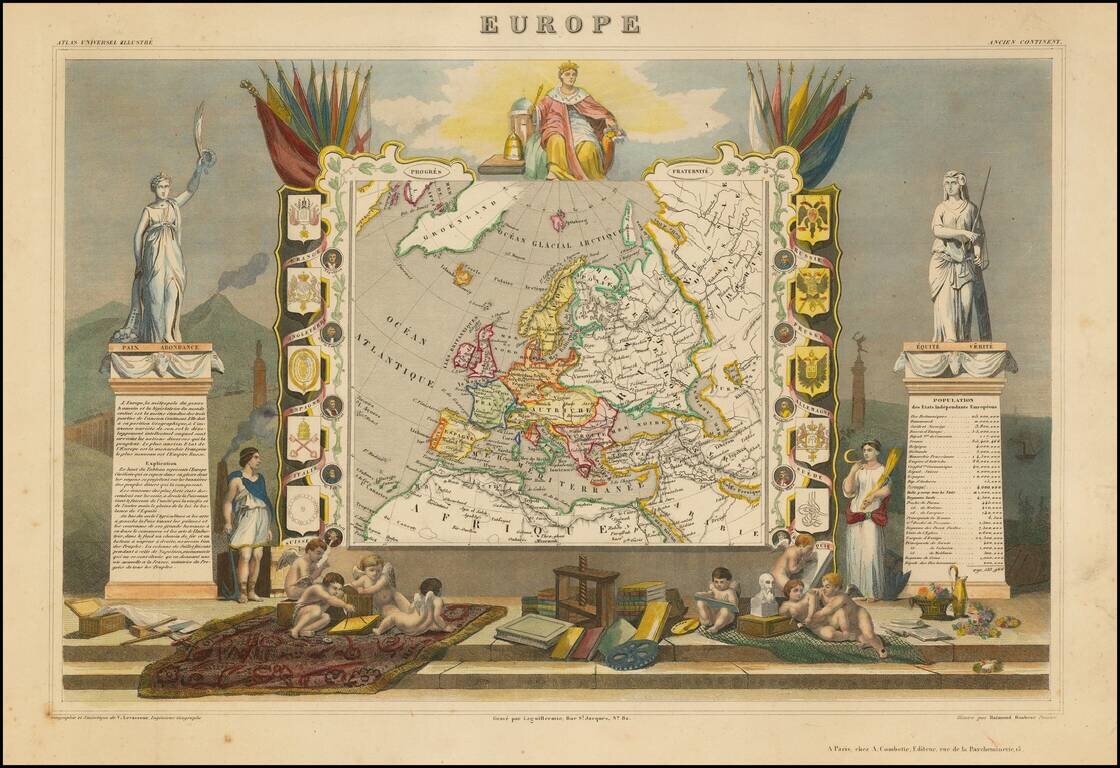
Decorative map of Europe surrounded by allegorical vignettes. Engraved by Raimond Bonheur, father of the famous French artist Rosa Bonheur.
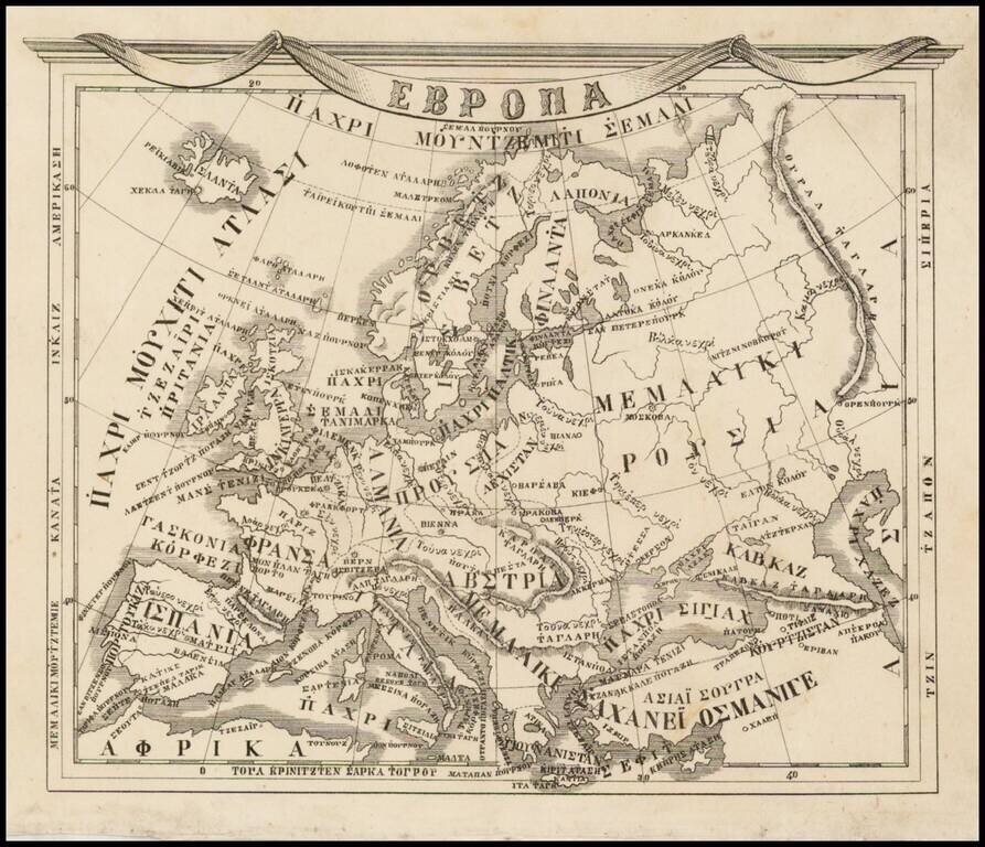
Rare 19th Century map of Europe printed in Athens with Greek text. This attractive map embraces all of Europe Dionysios Pyrros's Atlas neoteros (1845) and Athanasios A. Sakellarios's A tlas geographikos (1870).

This is a fabulous town plan of Rome, including a description and location of many of the important features of the city. This map was accompanied by a Plan of Ancient Rome, which showed the city stripped of much of the development seen here. The map...

Detailed map of the Greek Islands, showing towns, mountains, rivers, roads, lakes, gulfs, bays, etc. Decorative border. A terrific regional map, from JH Colton, one of the most prolific American mapmakers of the mid-19th Century.
