

Fine birds-eye view of the island of Terceira and the town of Angra, based upon Baptista van Deutecum's view of the Island, which appeared in LInschoten's Itinerario. Linschoten's view of Terceira in the Azores is one of the most decorative and...
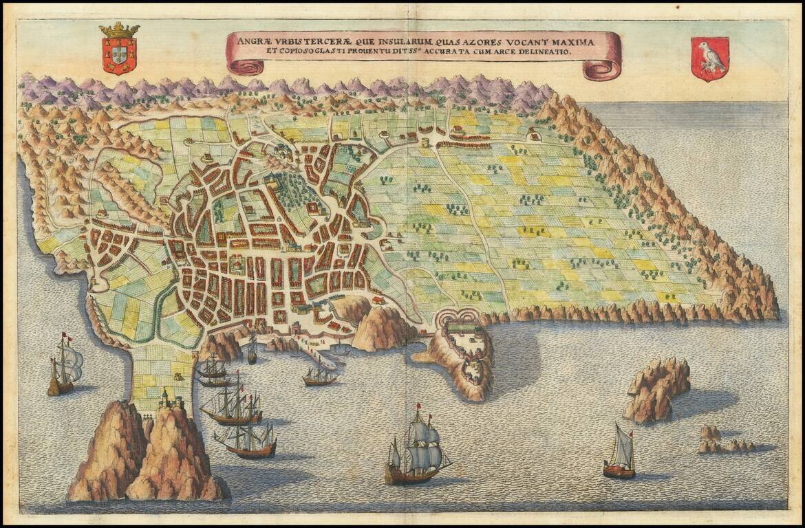
Fine birds-eye view of the island of Terceira and the town of Angra, based upon Baptista van Deutecum's view of the Island, which appeared in Linschoten's Itinerario. Linschoten's view of Terceira in the Azores is one of the most decorative and...
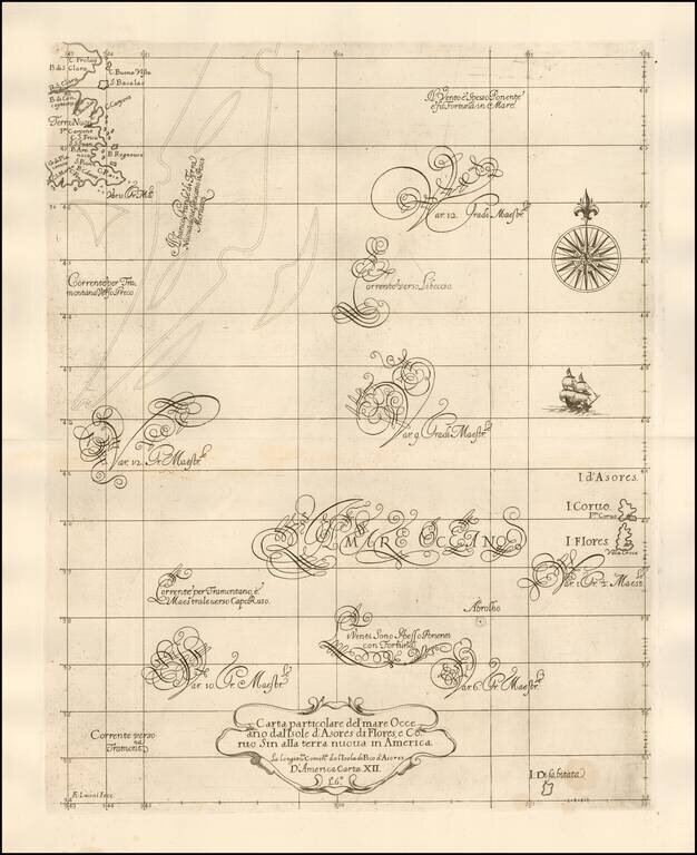
Robert Dudley's Rare Sea Chart of The North Atlantic -- Newfoundland to the Azores Second state of Robert Dudley's fine early sea chart of the North Atlantic, extending from the Grand Banks and Newfoundland to the western Azores, first published in...
![[Azores & Madera] Carta particolare dell' Isole d'Asores con l'Isola di Madera . . .](/map/small/58784.jpg)
Robert Dudley's Rare Sea Chart of the Azores and Madera and "a Doubtful" Island Important early sea chart of a portion of the Atlantic, centered on the Azore Islands and extending east to Madera, first published in his Arcano del Mare in 1646-47. The...
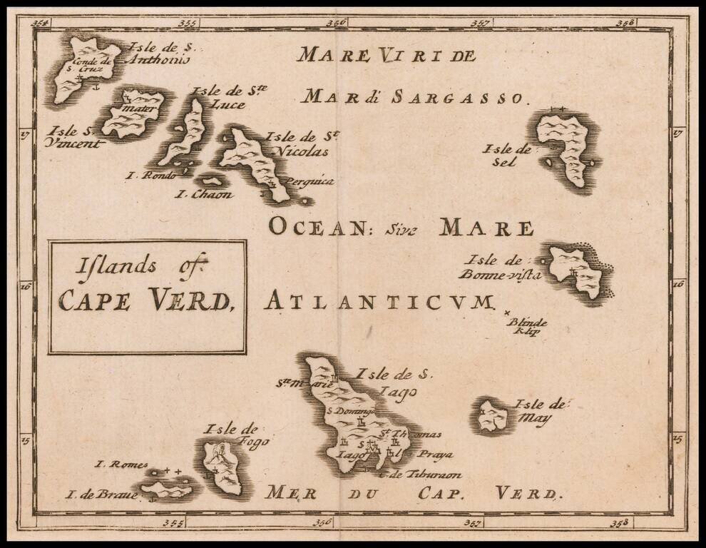
Rare Miniature English Map of the Cape Verd Islands Rare map of the Cape Verd Islands, published by Sir Jonas Moore in London. The map appeared in Moore's A New Geography. Many of the plates in the work were engraved by Herman Moll, who had moved to...
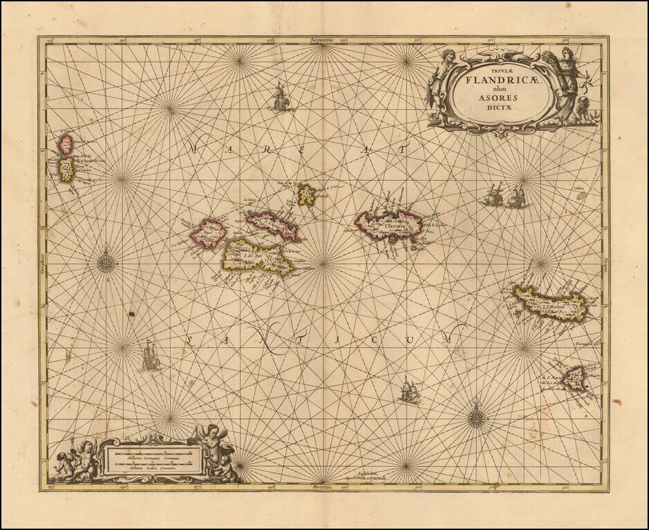
Nice example of Valk & Schenk's scarce sea chart of the Azores, published in Amsterdam in 1690. The map is oriented with north at the top and includes compass roses, sailing ships and 2 decorative cartouches. Each of the islands includes...
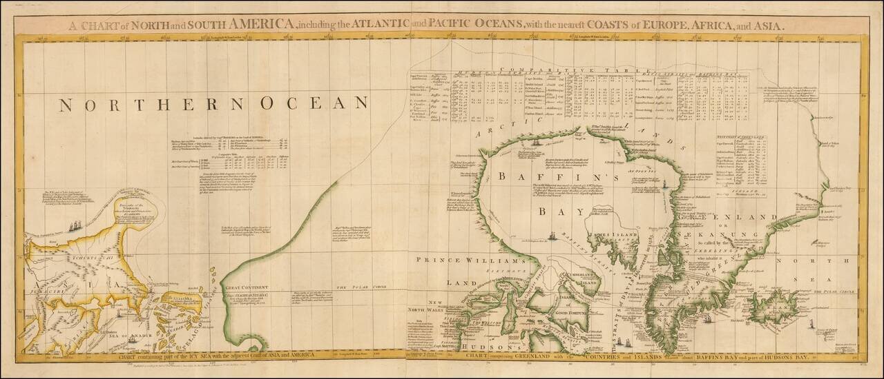
One of the Most Detailed and Important Map of the Americas made by a Scandalous Geographer This is a nice example of the northernmost sheets of 1775 edition of this important six sheet chart of North and South America, originally compiled by John...
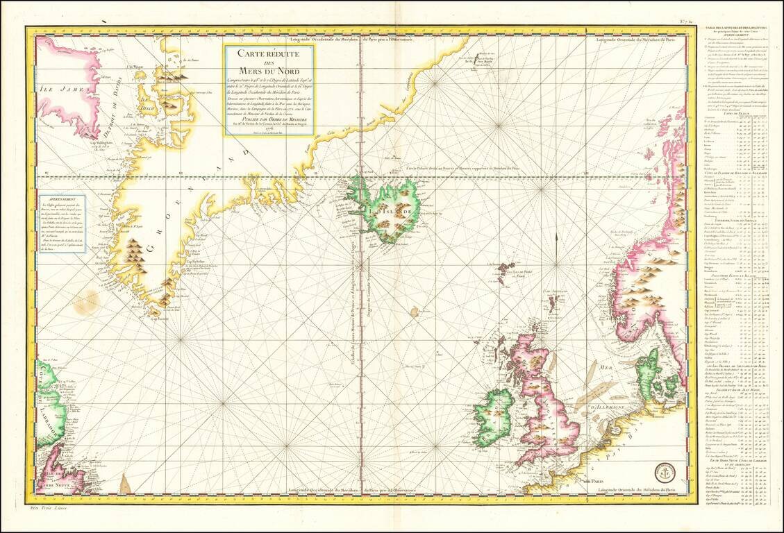
Late 18th Century Scientific Expedition In the North Atlantic Important mid-18th Century sea chart of the North Atlantic, published by the French Depot de la Marine. Centered on Iceland, the map extends from Labrador, Newfoundland, and Baffin Island...
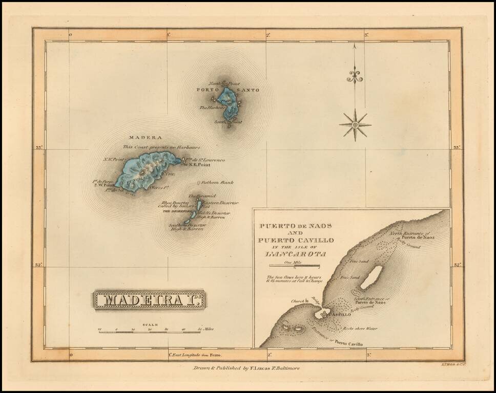
Scarce map of the Madeira Islands (with large inset map of Naos and Cavillo on Lanzarote Island) by Fielding Lucas Jr., which appeared in his General Atlas, as well as his A New General Atlas of the West India Islands. Lucas's map is one of the first...
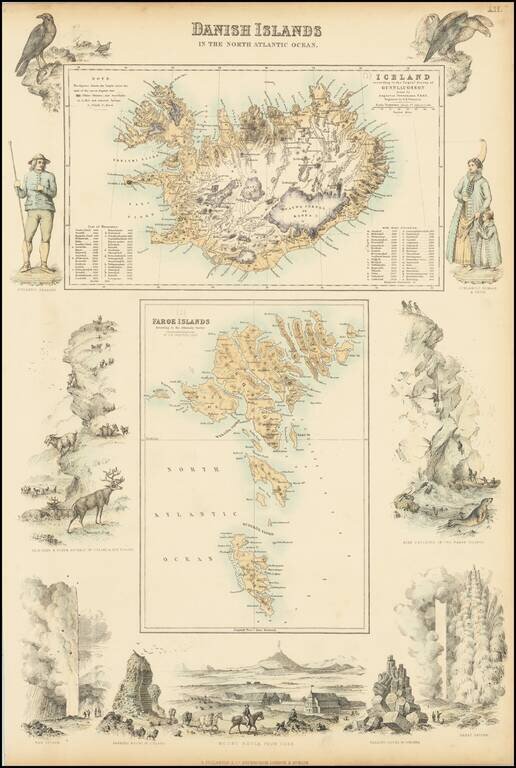
Two detailed maps (Iceland and the Faroe Islands) surrounded by decorative vignettes

Excellent "NavWar" pictorial map of the North Atlantic and Western European Theaters during World War II. The map is a very effective persuasive piece, which sweeping arcs depicting Allied naval power in the Atlantic combined with its air power over...
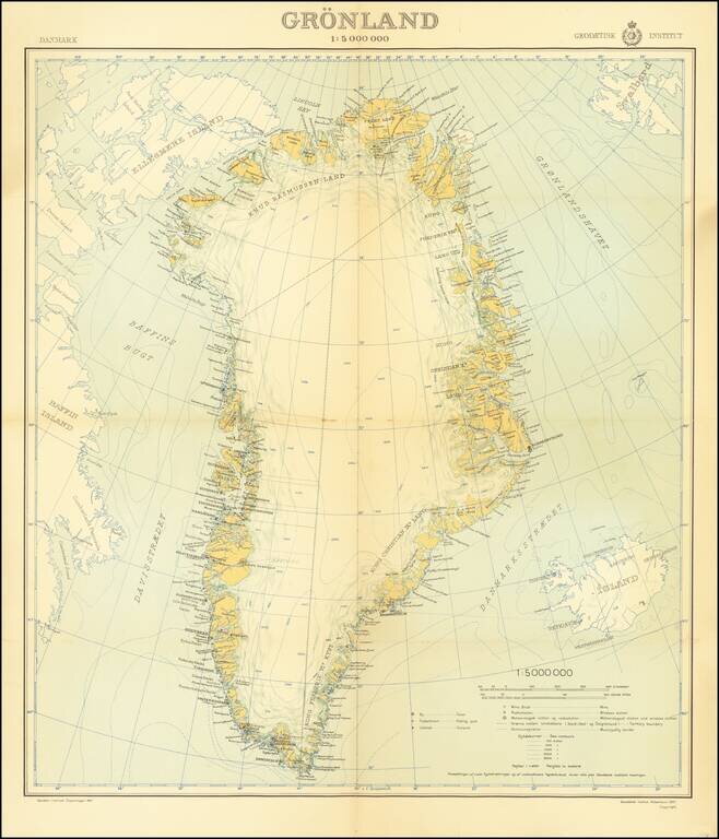
An attractive mid-century map of Greenland published by the Danish state-run cartographic institute. Greenland is shown in detail, and parts of Iceland, Baffin Island, and Svalbard are also shown. A legend is included, and the insignia of the...
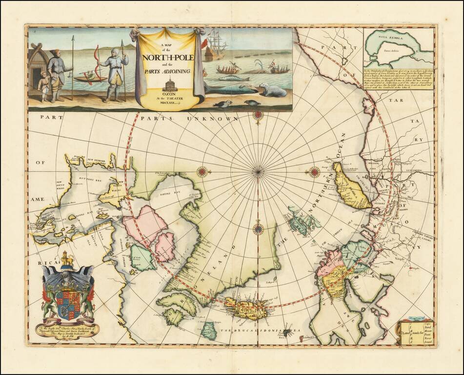
Remarkable Early English Map of the North Polar Regions Fine example of Moses Pitt's original map of the North Pole and surrounding lands. Moses Pitt initially set out to produce an expanded edition of Jansson's Atlas Maior with his partner Jacob Van...
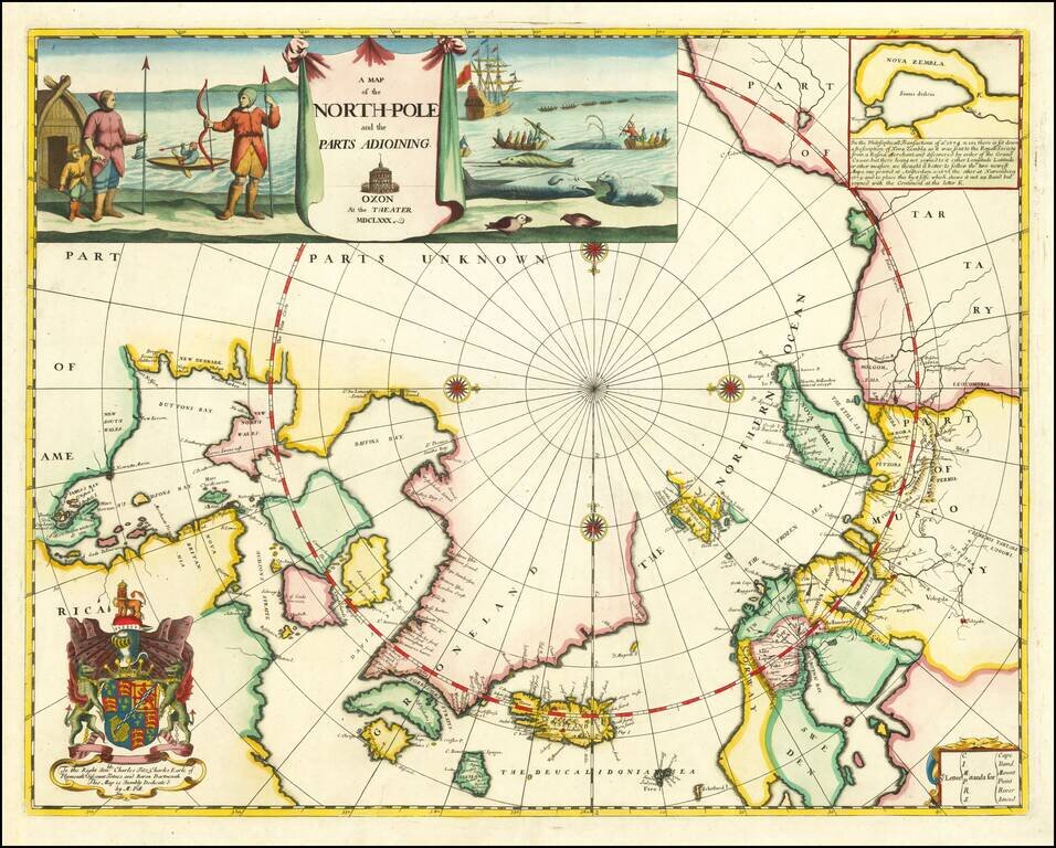
Remarkable Early English Map of the North Polar Regions Fine example of Moses Pitt's original map of the North Pole and surrounding lands. Moses Pitt initially set out to produce an expanded edition of Jansson's Atlas Maior with his partner Jacob Van...
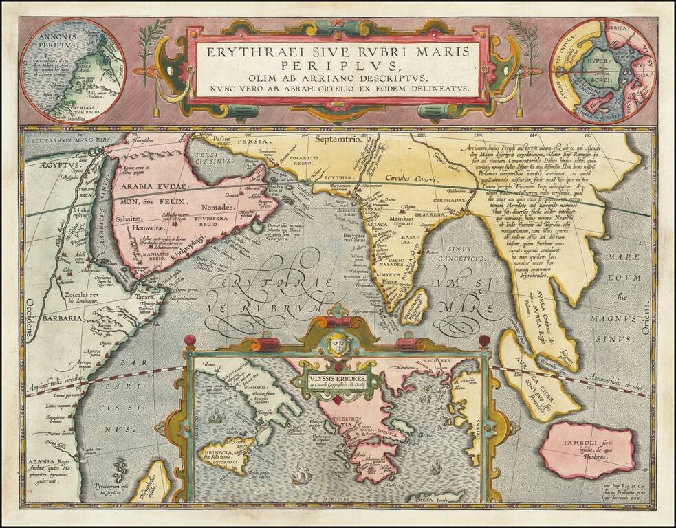
Fine Ortelius Map of the Indian Ocean Linking Mythical, Ancient, and Contemporary Exploration Striking historical map of the Indian Ocean and contiguous regions of the Middle East, India and Southeast Asia, published by Ortelius in his Parergon. This...
![[Polish Towns in the United States] Ks. Fr. Bolek Osiedla Zalozone Przez Polakow W. Stanach Zjednoczonych / The Towns and Villages Settled By Poles in the United States](/map/small/63071.jpg)
Interesting map of the United States, drawn by Polish historian Franciszek Bolek and published by the Polski Prezglad Kartograficzny (Polish Cartographic Review) in 1930. Franciszek Bolek (also known as Francis Bolek ) was a Polish historian,...