

Large manuscript game board, executed in ink and watercolor on paper, mounted on original linen. The game board is a curious historical montage, inspired by the French Opera, La belle Hélène, by Jacques Offenbach and the traditional Game of the...

Satirical cartoon map, drawn by Tom Merry (William Mecham). The cartoon satirizes Liberal MP William Ewart Gladstone. Gladstone (1809-1898), served as Liberal Prime Minister four times and as Chancellor of the Exchequer. Gladstone opposed the High...
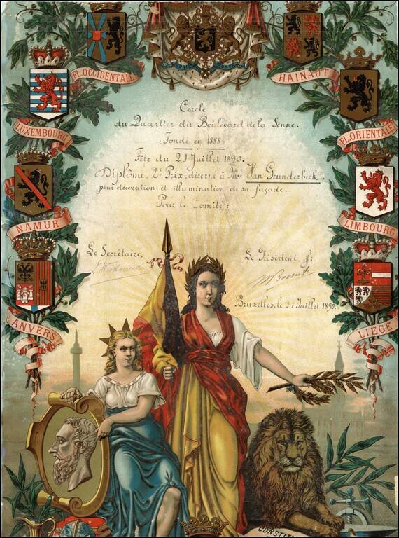
Decorative certificate, apparently an award to Mr. Van Grunderbeck, for his work in decorating and illuminating a facade for the celebration in July 1890. Based upon my limited research, there was apparently an organized effort to revive this quarter...
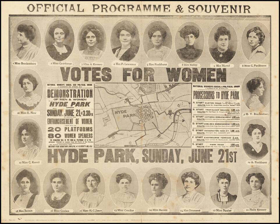
Separately Published Map of the Largest Suffragette March in the United Kingdom up to That Point. Rare separately-issued map of the Women's Sunday March of June 21, 1908, in Hyde Park, featuring the portraits of the 20 platform chairs. The map...
![[Charles Lindbergh] Spirit of St. Louis](/map/small/69234.jpg)
Spirit of St. Louis is the name of this printed cotton textile depicting the solo flight of Charles Lindbergh from New York to Paris.
![[Charles Lindbergh / New York to Paris View] Spirit of St. Louis](/map/small/69235.jpg)
Spirit of St. Louis is the name of this printed cotton textile depicting the solo flight of Charles Lindbergh from New York to Paris. At the left, the Lindbergh's plane flies over New York and past the Statue of Liberty. At the right, a view of...
![(Pro-Spanish Republic Political Broadside) [Lift The Embargo Against The Spanish Republic] President Roosevelt says . . .](/map/small/50218.jpg)
Anti-Neutrality / Arms Embargo Spanish Civil War Broadside Rare large political broadside, almost certainly printed in connection with the so-called National Conference to Lift the Embargo Against the Spanish Republic in late January 1939. The...

Flying visit of Truth to Berlin Rare satirical cartoon map of illustrating the British Royal Air Force propaganda raid on Berlin in September 1939, published by Rex Whistler. The image shows a winged goddess Britannia, with a trident and shield,...
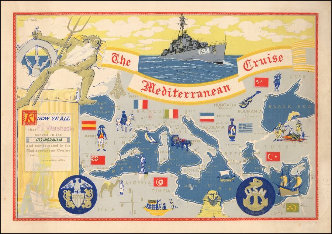
Decorative placemat map, given away aboard the USS Ingraham.
![[Soviet Russian Ecology Propaganda Poster] Основы Водного Законодательства Союза ССР](/map/small/68343.jpg)
Original vintage Soviet Russian propaganda poster. The title translates as follows: The blue expanse is dear to us everywhere and it is not without reason that we are talking about it. - It's time to protect the wealth of our rivers and lakes in...
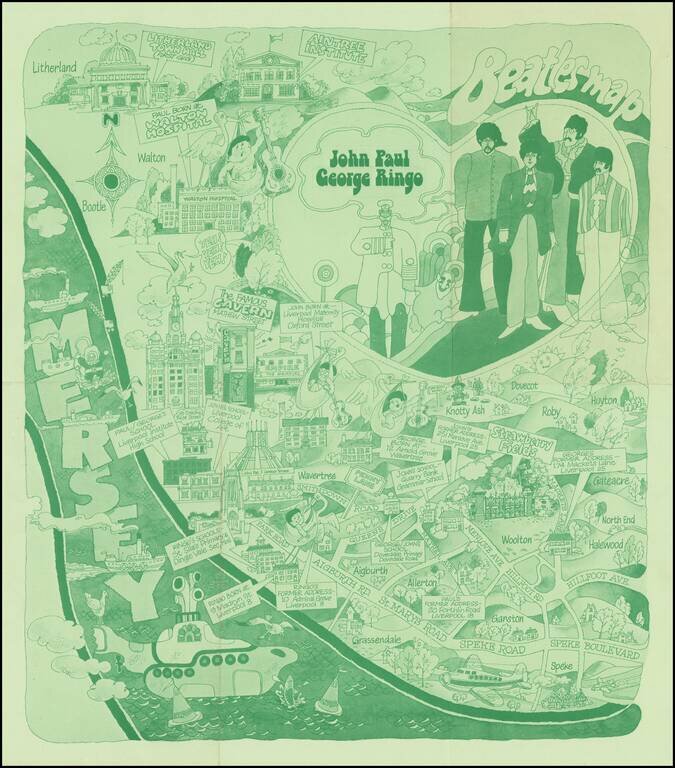
The Beatles Map of Liverpool was published in 1974 to commemorate the buildings and places where the Beatles started their career. As noted on the Liverpool Museums website: Featured here is one of the first Beatles maps of Liverpool that was ever...
![[Sea Atlas] Great-Britain's Coasting Pilot: Being a New Exact Survey of the Sea-Coast of England and Scotland From the River of Thames to the Westward and Northward; with the Islands of Scilly, And from Thence to Carlisle; Likewise The Islands of Orkney](/map/small/70378.jpg)
A nice example of probably the most famous chartbook for the British Isles, by Greenville Collins, who was a Royal Navy officer and prominent hydrographer during the 17th century. Collins's Coasting Pilot was the first comprehensive survey of the...

A Dane Eyes the East Coast of Britain. First edition of this very rare Danish atlas of the North Sea. Paul de Löwenörn (1751-1826) was a Danish mariner, later Adjutant-General, Captain-Lieutenant, and Director of the Royal Danish Marine Archives,...
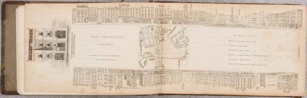
A Nice Set of Tallis's London Views That We Can Find Having Come to the Market. An impressive run of 47 parts (of 88) of John Tallis's fantastic project to provide a view of every major street in London during the late 1830s. This set includes views...
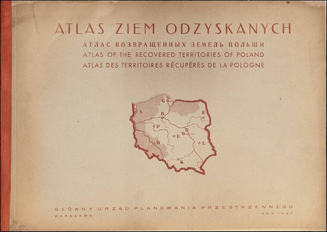
Rare Atlas of the Regions Recovered by Poland After World War II A rare and graphically sophisticated atlas that provides a multi-dimensional picture of the regions of Poland--then called the Recovered Territories--which were ceded back to Poland at...
![[Early Fascimile of the Disputed Christopher Columbus Portolan Chart]](/map/small/66588.jpg)
Early Photographic Facsimile of a 15th Century Portolan Chart Attributed By One Scholar To Christopher Columbus. From the Collection of Famous Map Scholar Edward Luther Stevenson. An impressive early facsimile of the "Columbus Mappa Mundi", which...