
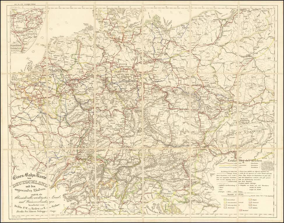
Rare railroad map of Western Europe, centered on Germany, noting the major railroads, roads and other means of commercial transit radiating out from Germany at the center of the map. The map illustrates railroad lines completed (red), under...
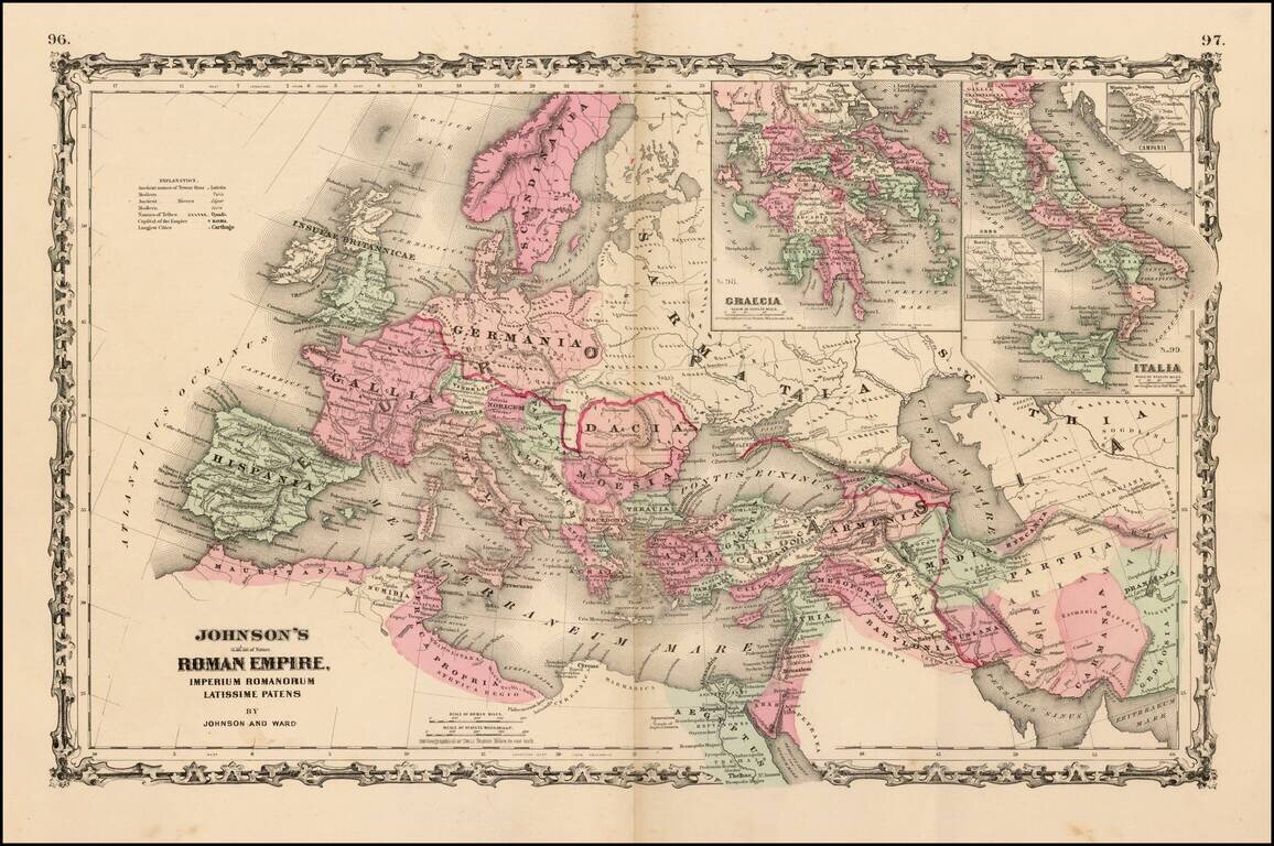
Large format map of the Roman Empire with insets of Roman Greece and Roman Italy. Includes ancient place names, rivers, mountains, etc. Decorative borders. A marvelous historian's map.
![[Ten Kingdoms of the Roman Empire]](/map/small/69498.jpg)
Interesting map of ten regions controlled by the Roman Empire, published for Benjamin Wills Newton. The caption on the map notes: The coloured part of this Map is intended to suggest the probable Territorial Arrangements That Will Be Found in the...
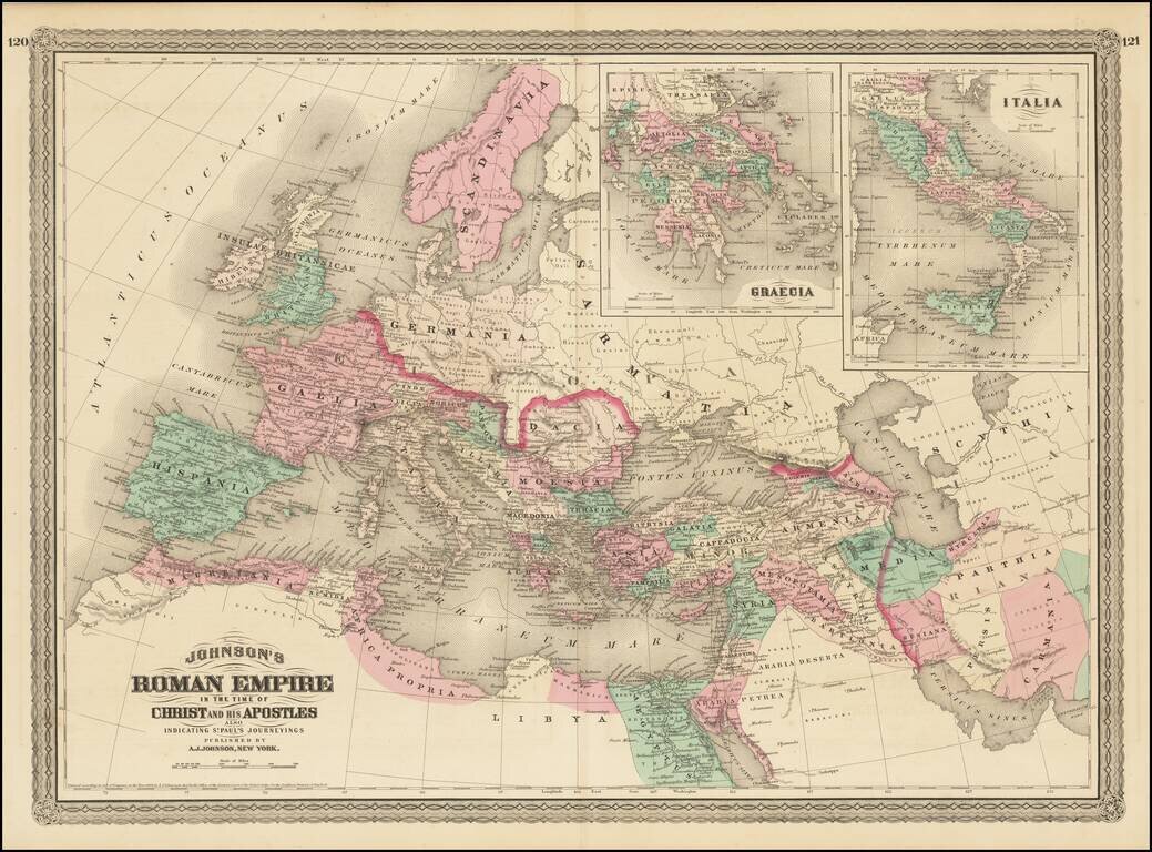
Large format map of the Roman Empire with insets of Roman Greece and Roman Italy. Includes ancient place names, rivers, mountains, etc. Decorative borders. A marvelous historian's map.
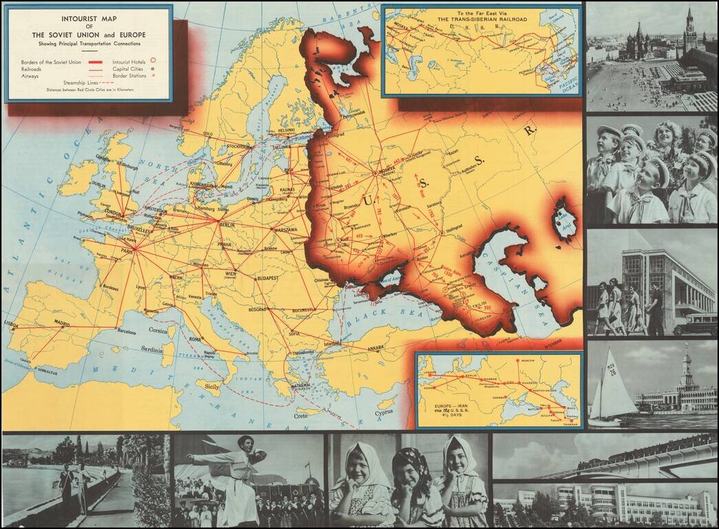
Interesting pictorial map of Europe an the Soviet Union, published by Intourist, promoting tourism in the Russia. The map shows major transit lines and charming monochromatic photos, with the verso giving different travel itineraries and general...
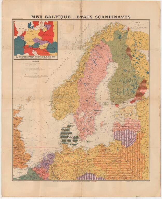
Large format map of the Theater of War in 1940, published in Paris. The inset map shows the German Confederation as it will appear in 1950, based upon a public German document from 1904. The areas identified in Striped regions have already been taken...
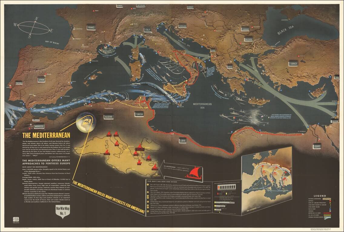
Excellent "NavWar" pictorial map of the Mediterranean Theater during the Second World War. The map highlights the progress of British and American forces in liberating North Africa and parts of southern Italy and the strategic advantages that these...
![(Second World War - Eastern Front) [Strikes by the Red Army on the Enemy in 1944] Удары Красной Армии По Противнику в 1944г.](/map/small/68414.jpg)
Extremely rare Red Army-published map of the progress of the Second World War on the Eastern Front during 1944. The map shows the extensive gains of the U.S.S.R. throughout late 1943 and 1944, from their nadir, with the Germans at the outskirts of...
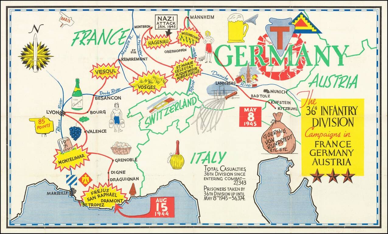
Triumphal Pictorial Map of the 36th Infantry Division's Campaign in Europe. The map shows the T-patchers landing in Saint-Raphaël-Fréjus in southern France on Aug. 15, 1944, during Operation Dragoon. The Division proceeds to Montelimar where it...
![[Stop The Fake News!] Halte au Menteurs! Les Colo Bacilles Sement La Haine!](/map/small/59951.jpg)
Halt The Liars! Stop The Fake News! Rare separately published political broadside, decrying the channeling of Stalinist Russia's lies, fake news and disinformation campaigns via the French Communist Party, after World War II. As described in greater...
![[August 1961: The Berlin Crisis and Foreshadowing Construction of the Berlin Wall]](/map/small/59512.jpg)
The Berlin Wall in Popular Media Fine large format news map issued in August 1961 by Newsweek, illustrating the Berlin Crisis and foreshadowing the construction of the Berlin Wall. The larger map illustrates the division between the Russian and...

Rare Early Map of Northern Europe Important early map of Northern Europe, Scandinavia and the British Isles, which first appeared in the 1507-1508 Rome edition of Ptolemy's Geography, Claudii Ptholomei Alexandrini. Cosmographia..., created under the...
![Tabula Europae I [British Isles]](/map/small/62810.jpg)
First edition, second state of Munster's map of the British Isles. Includes a large ship in the Northern Sea and an interesting projection of the Albion and Hibernia. The map is unchanged from the 1540 edition. Munster's Geographia was a cartographic...

One of the earliest obtainable modern maps of the British Isles. Fine example of Gastaldi's important early map of British Isles. Giacomo Gastaldi was one of the most important Italian mapmakers of the early 16th Century. His set of maps for the...

Finely engraved view of the City of Chester in England, from Braun & Hogenberg's Civitatus Orbis Terrarum. Based on the survey of William Smith, the bird's-eye plan shows the town's prominent Norman castle, walled defenses and central cathedral.

The First Map of London Fine example of this important early bird's-eye view of London, which appeared in Volume 1 of Braun & Hogenberg's Civitates Orbis Terrarum. The view was based on a now-lost twenty-sheet plan of London believed to have...