Map size in jpg-format: 4.9229MiB
Click to open in high resolution (open in new tab).
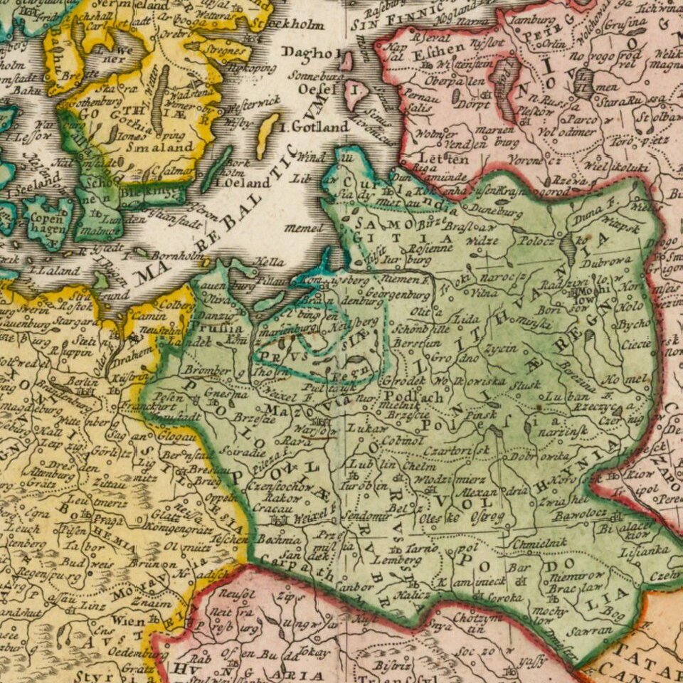
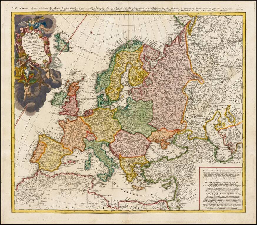
Decorative map of Europe, based upon Haase's stereographic horizontal projection, which was featured in his book on cartographic methodology.
The map is hand colored by country, showing cities, towns, rivers, mtns, lakes, etc.
Large decorative cartouche in full color.
If you are a student, write to us in telegram: @antiquemaps and indicate what material you need and for what work you need a map in high detail. We are ready to provide material on special terms. For students only!

![[Eastern Hemisphere Globe Gores] (Nova et integra universi Orbis descriptio)](/map/small/54480.jpg)
![[The First Maps in a la poupée Printed Color] Cartes en Couleur des Lieux Sujets aux tremblements de Terre Dans toutes les parties du Monde Selon le Sisteme de l’impulsion Solaire](/map/small/52293op.jpg)