logo

1740. Magni Turcarum Dominatoris Imperium per Europam, Asiam, et Africam . . .

  • Magni Turcarum Dominatoris Imperium per Europam, Asiam, et Africam . . .

Magni Turcarum Dominatoris Imperium per Europam, Asiam, et Africam . . . information:

Year of creation: 
Resolution size (pixels): 
 14371x12503 px
Disk Size: 
 60.1174MiB
Number of pages: 
 1
Place: 
 Augsburg
Author: 

Print information. Print size (Width x height in inches):
Printing at 72 dpi 
  199.6 х 173.65
Printing at 150 dpi 
 95.81 х 83.35
Printing at 300 dpi 
 47.9 х 41.68

An example of detailing the file of this map of in a printable high-resolution:

Click to open in high resolution (open in new tab).
Attention! this is just the central piece (central area 960x960 px) of the map file!
This is an example, so that you can see and study the level of detail of a given map. The entire Map will be fully available after payment!

Magni Turcarum Dominatoris Imperium per Europam, Asiam, et Africam . . .

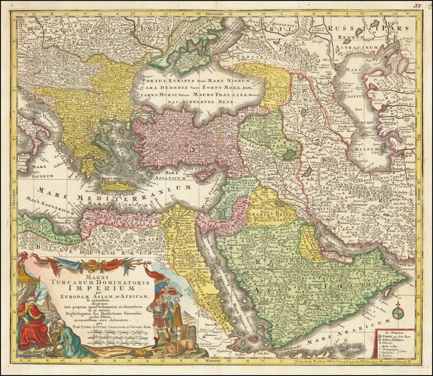
Striking regional map of the Turkish / Ottoman Empire, centered on Turkey and Asia Minor, and showing the Eastern Mediterranean, Balkans, Greece, Persia, Saudi Arabia, the Black Sea and the Caspian Sea.

Includes a decorative cartouche in the lower left corner.

Tobias Conrad Lotter (1717-1777) is one of the best-known German mapmakers of the eighteenth century. He engraved many of the maps published by Matthaus Seutter, to whose daughter Lotter was married. He took over Seutter’s business in 1756. Lotter’s son, M. A. Lotter, succeeded his father in the business.


Special conditions for students!

If you are a student, write to us in telegram: @antiquemaps and indicate what material you need and for what work you need a map in high detail. We are ready to provide material on special terms. For students only!

Item information:

Year of creation:
Size:
14371x12503 px
Disk:
60.1174MiB
Number of pages:
1
Place:
Augsburg
Author:
Tobias Conrad Lotter.
$14.99

Related item