logo

1770. A Correct Plan of Constantinople with the Adjacent Country, from An Actual Survey

  • A Correct Plan of Constantinople with the Adjacent Country, from An Actual Survey

A Correct Plan of Constantinople with the Adjacent Country, from An Actual Survey information:

Year of creation: 
Resolution size (pixels): 
 1501x1108 px
Disk Size: 
 547749B
Number of pages: 
 1
Place: 
 London
Author: 

Print information. Print size (Width x height in inches):
Printing at 72 dpi 
  20.85 х 15.39
Printing at 150 dpi 
 10.01 х 7.39
Printing at 300 dpi 
 5 х 3.69

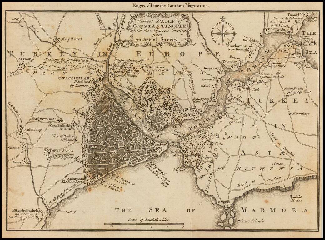
Detailed map of the area around Istanbul, published in the London Magazine.

The map shows the area of Istanbul, and the Bosphorus Straits, with a number of roads and smaller towns, much of which is now a part of the sprawling Istanbul Metropolis.


Special conditions for students!

If you are a student, write to us in telegram: @antiquemaps and indicate what material you need and for what work you need a map in high detail. We are ready to provide material on special terms. For students only!

Item information:

Year of creation:
Size:
1501x1108 px
Disk:
547749B
Number of pages:
1
Place:
London
Author:
London Magazine.
$9.99

Related item