
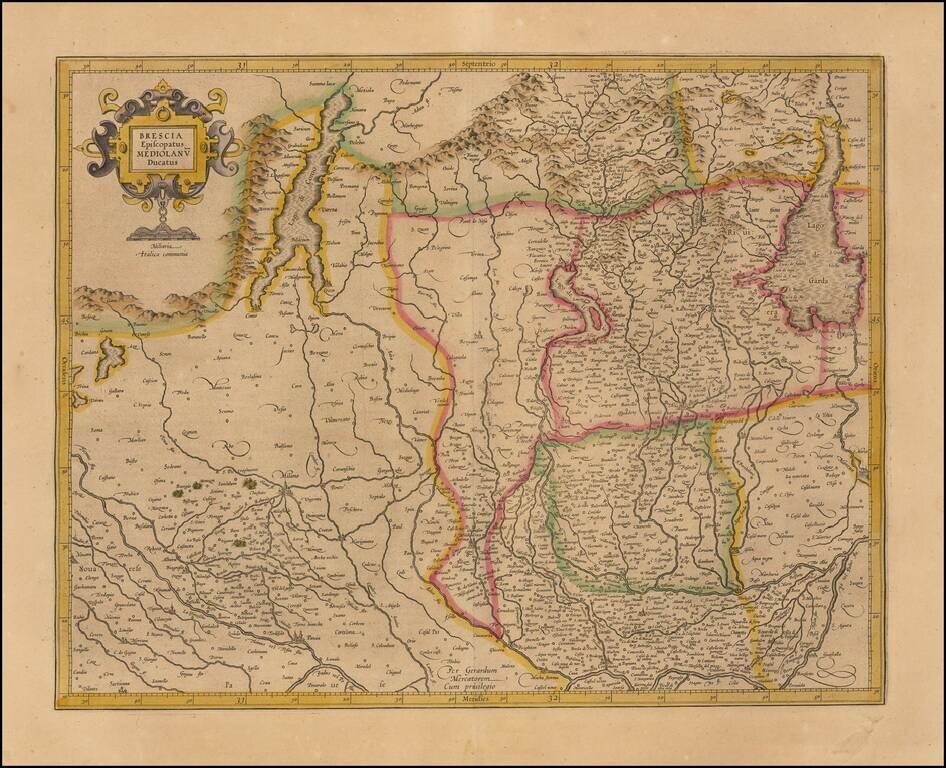
Striking map of Brescia, centered on Bergamo and including Milan, Cremona, Brescia, Lago De Garda, Lago Di Como, etc. Covers the region between Lago di Como and Lago Di Garda and extending south to the Po River region. Includes decorative title...
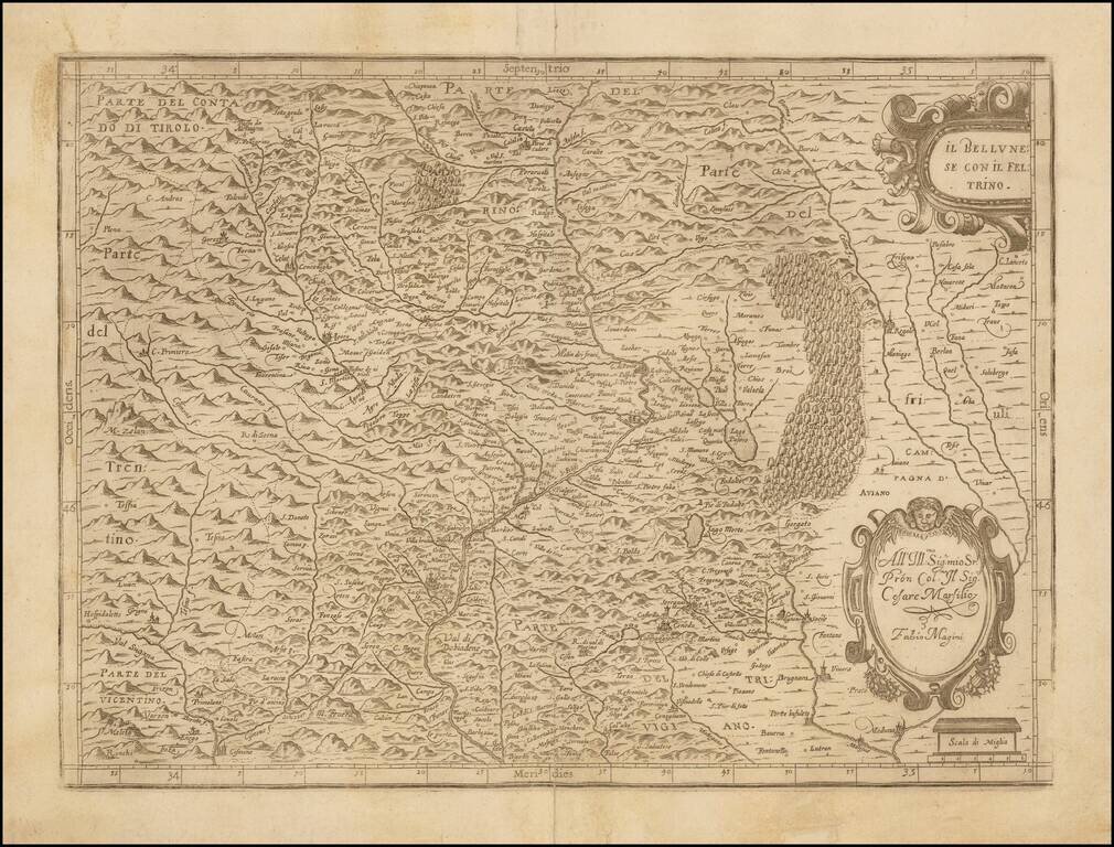
Detailed engraved regional map of Feltrino, the territory around Feltre, published in Bologna. The view was published in the collection of views under the title Italia di Gio. Ant. Magini. Giovanni Antonio Magini was a prolific 16th century Italian...
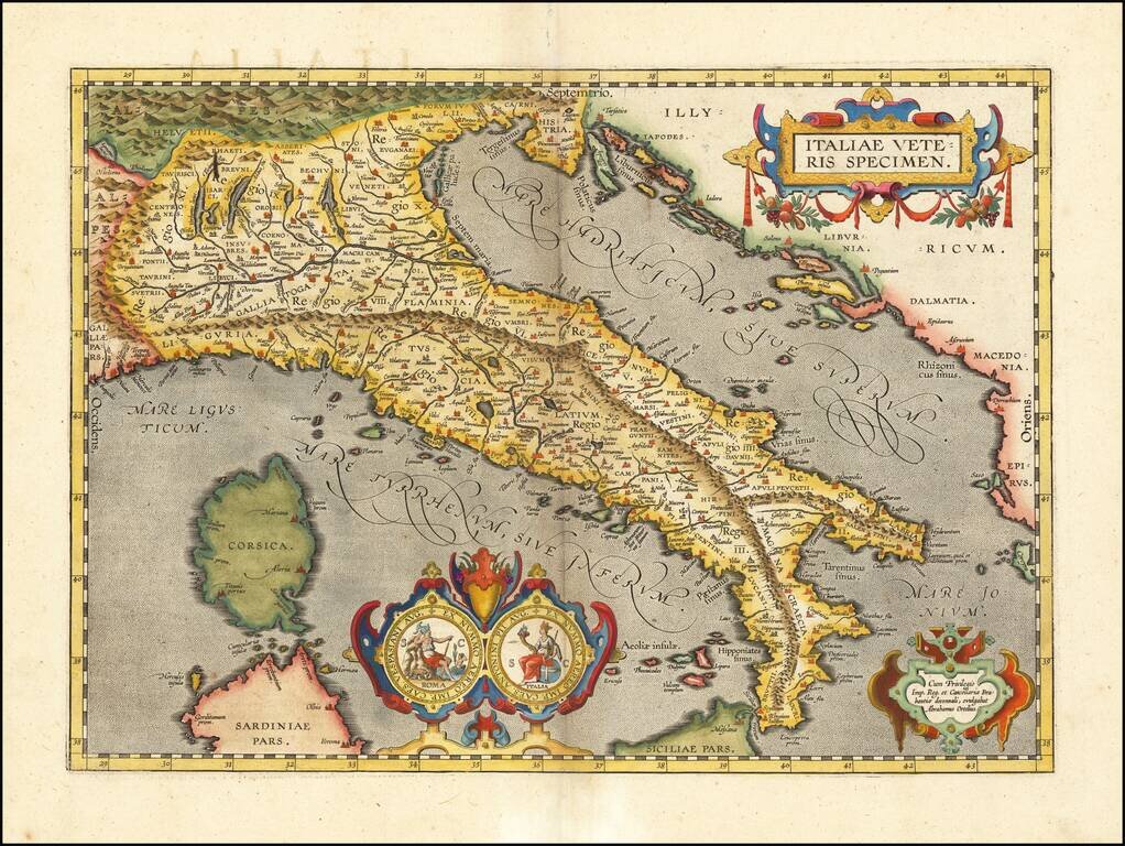
Nice example of Ortelius' map of ancient Italy, from Ortelius' Theatrum Orbis Terrarum, the first modern world atlas. The map is based upon Gastaldi's map of Italy, supplemented with classical sources. Beginning in 1601, a second state of the map was...
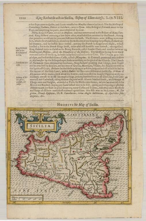
Detailed and attractive map of Sicily with a large cartouche. From the 1625-26 edition of Purchas His Pilgrims, one of the seminal early 17th Century English Language travel works. On a 13 x 9 inch sheet with English text, front and back.
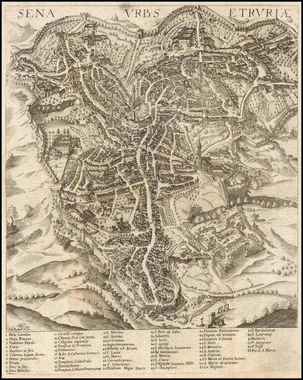
Rare early birdseye view of Siena, published in Augsburg. Original copperplate by Wolfgang Kilian, from the first edition of 'Mercurius Italicus'. The map is based on a wall map of Siena by Vanni, published by De Jode.
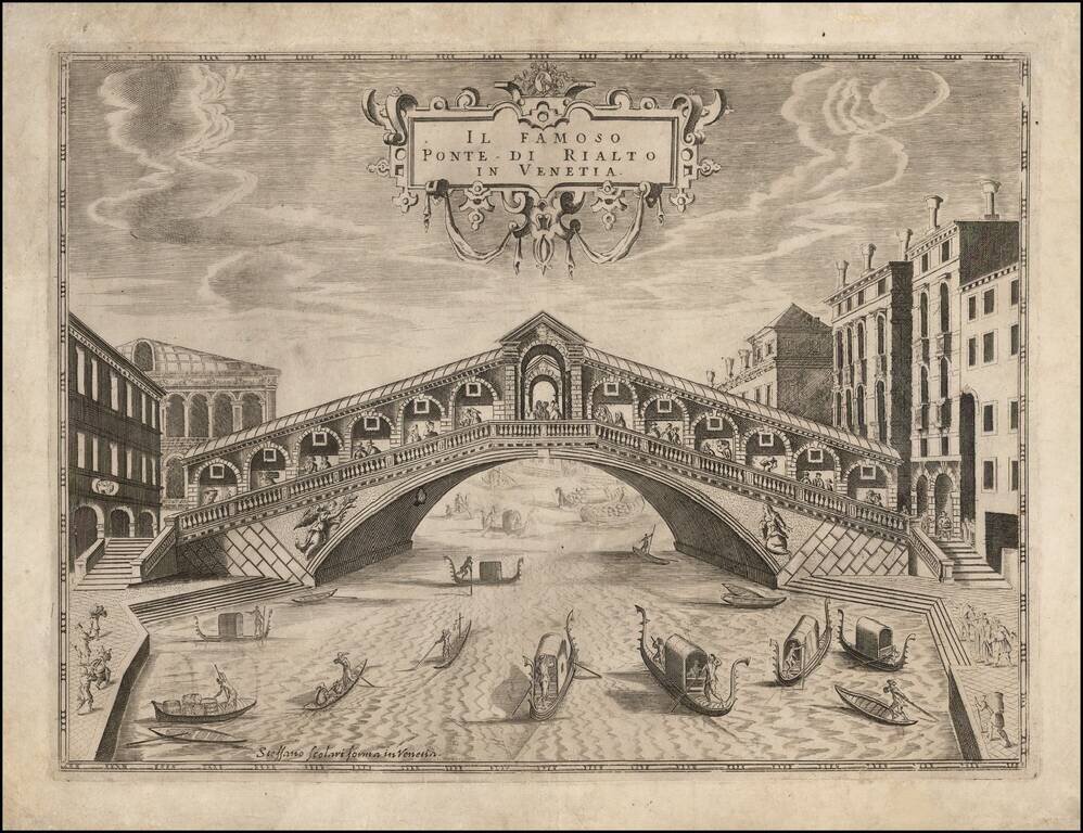
Rare view of the Rialto Bridge, one of the most famous bridges in Venice. The Rialto Bridge is one of the earliest bridges in Venice. The first dry crossing of the Grand Canal was a pontoon bridge built in 1181 by Nicolò Barattieri. It was called the...
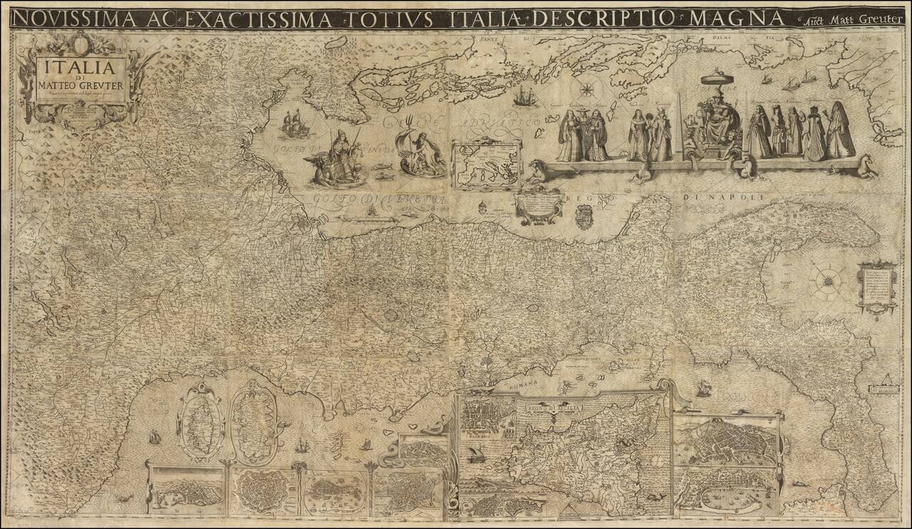
A Landmark Seventeenth-Century Wall Map of Italy Spectacular 12-sheet map of Italy, first published by Matteo Greuter in Rome in 1630 and offered here in its second publication, by Stefano Scolari in Venice in 1657. At the time of its publication,...
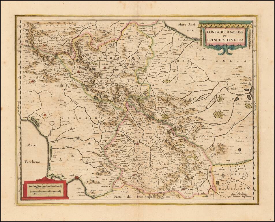
Decorative regional map of Southern Italy, engraved by Jansson. Larger cities include Benevento, Ariano, Avellino, Conza, Troia and Lucera. Napoli appears at the far southwest corner of the map.
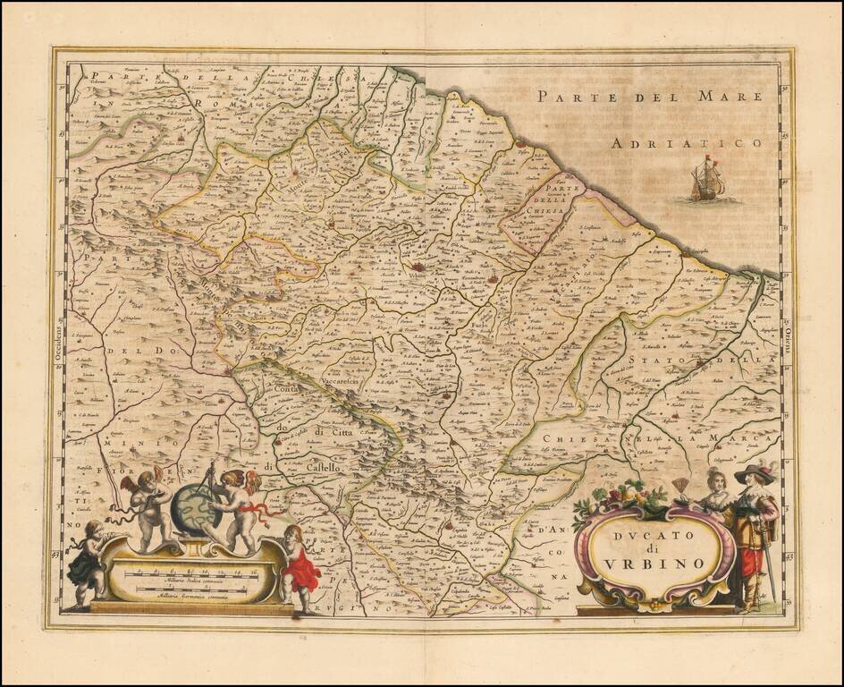
Nice example of Blaeu's double-page engraved map of the Duchy of Urbino in the Marche region of central Italy.
![Stato Della Chiesa Con La Toscana [Tuscany, Rome, Florence, Siena, Pisa, etc.]](/map/small/64065op.jpg)
Nice example of Blaeu's map of the central portion of Italy, from Blaeu's Atlas Novus. Includes sailing ships, sea monster, and other decorative embellishments.
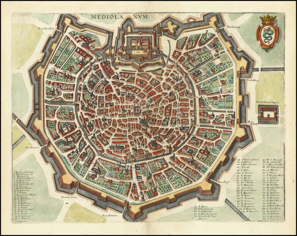
A detailed town plan of Milan, showing the fortified walls, city gates, inner ring and important public buildings, squares, and much more. A key names seventy three places of interest. The coat of arms of the Visconti, once rulers of the city, is shown...
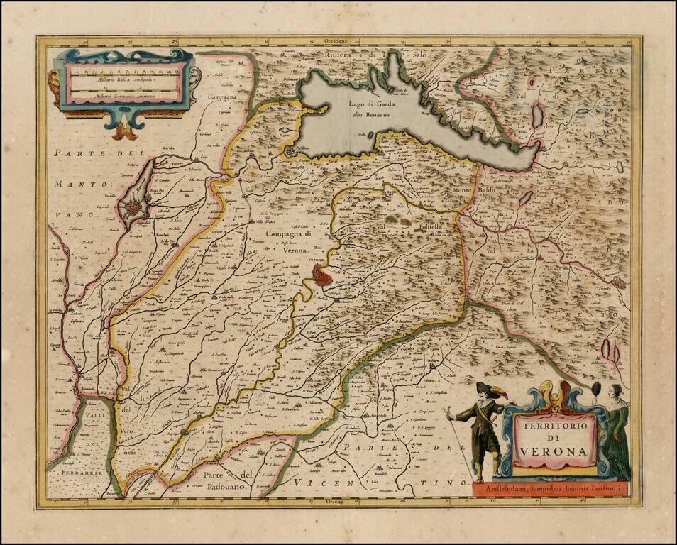
Nice old color example of Jansson''s map of the Territory of Verona, centered on Verona and Lago di Garda. Decorative title cartouche and scale of miles.
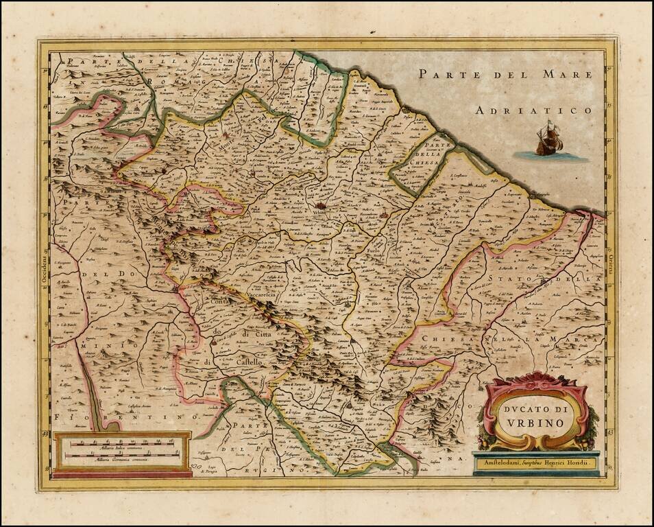
Nice old color example of Hondius' map of the Urbino region. Includes a decorative cartouche.
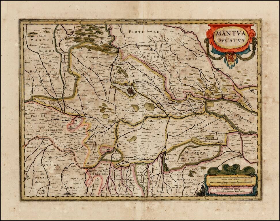
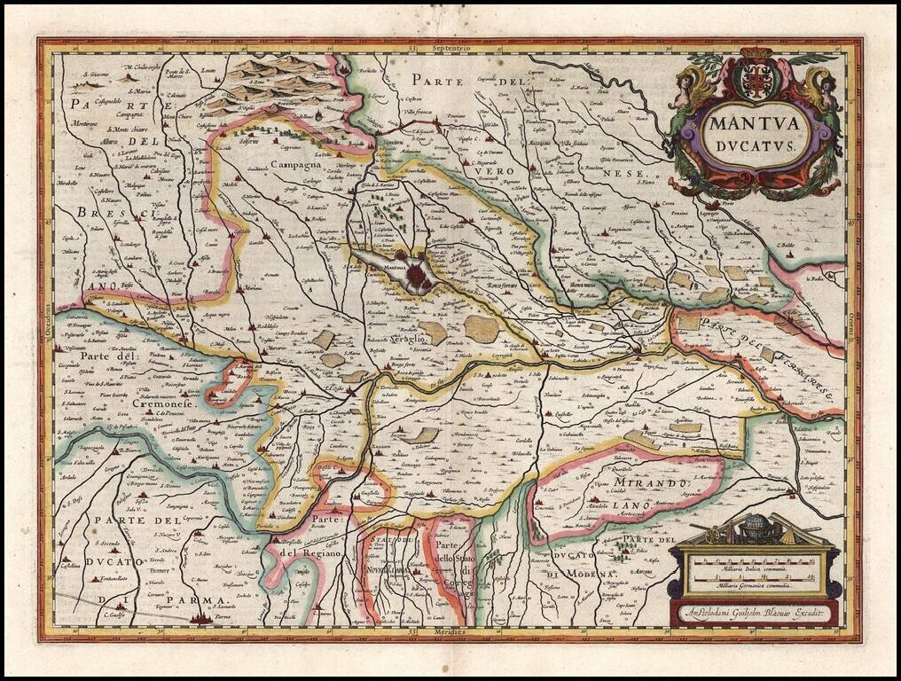
Nice old color example of Jansson's map of the Duchy of Mantua. Includes a decorative cartouche.
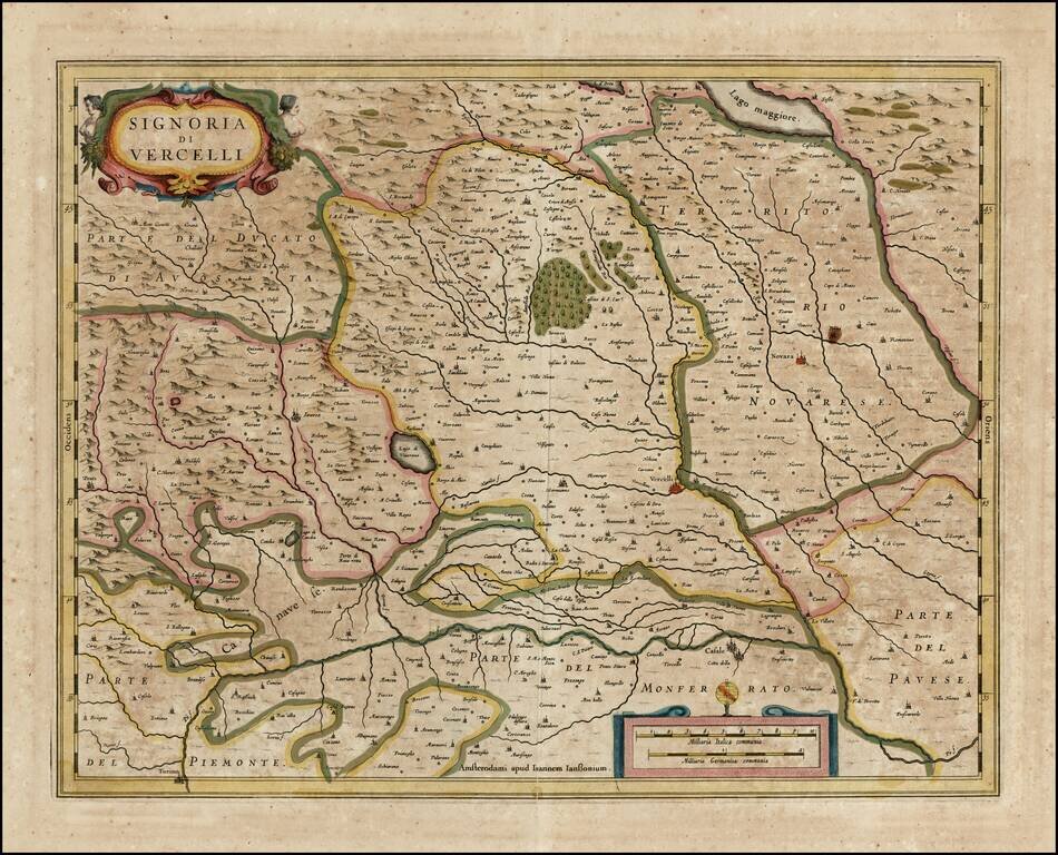
Nice old color example of Jansson's map of the Signory of Vercelli. Includes a decorative cartouche.