
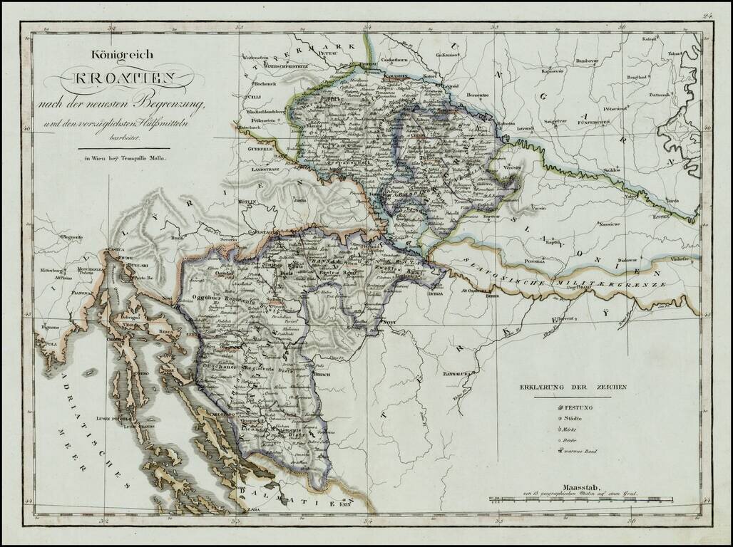
Rare regional map of the Kingdom of Croatia and neighboring regions, published in Vienna at the begnning of the 19th Century. One of the few regional maps of the period to focus on this region.
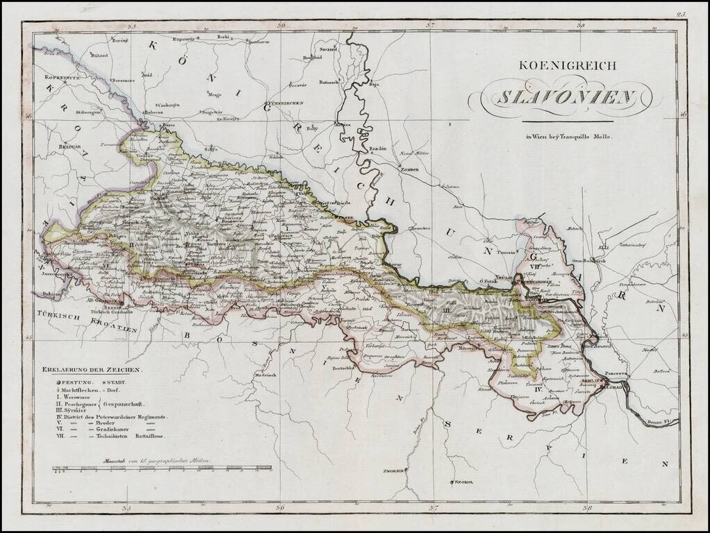
Rare regional map of the Kingdom of Slovenia and neighboring regions, published in Vienna at the begnning of the 19th Century. One of the few regional maps of the period to focus on this region.
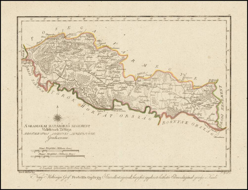
Finely engraved hand colored in outline map of the Gradisca region. Showing administrative boundaries, cities, towns, rivers, forests and mountains. Includes compass rose. Relief shown by hachures. The map is from Gorog's Magyar Atlas, the first...
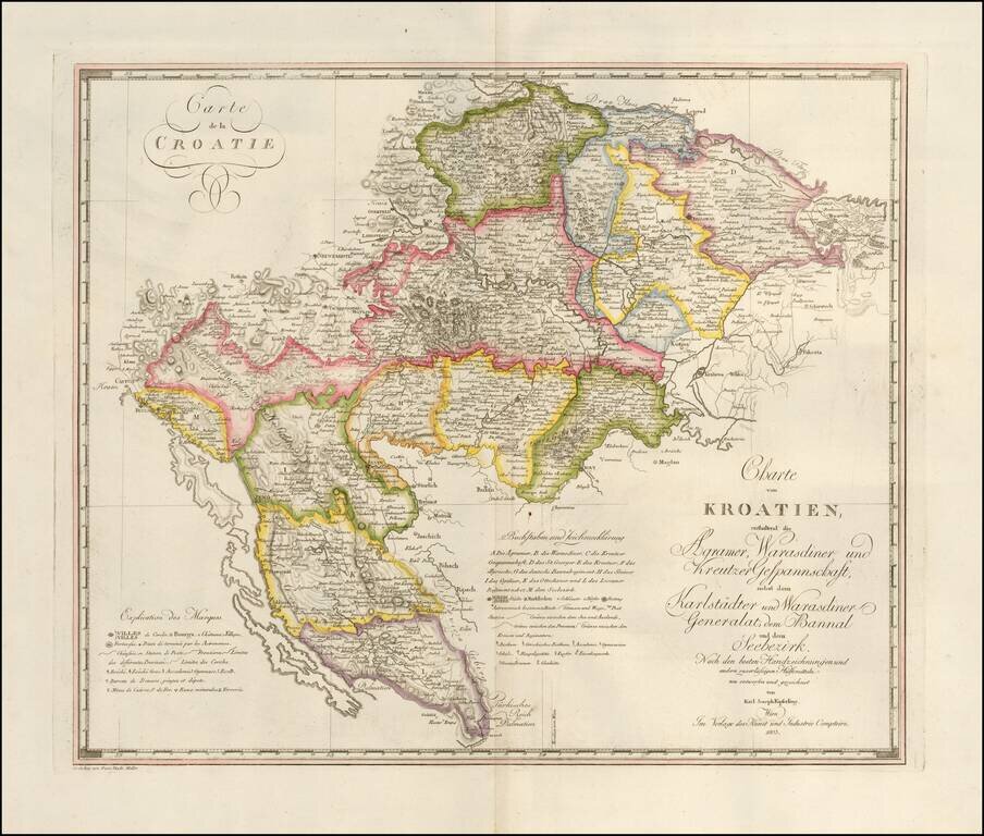
Fine large format map of Croatia and Krajina, which appeared in Kipferling's rare Atlas des Österreichischen Kaiserthums, published in by the Kunst und Industrie Comptoirs in Vienna in 1805. The map was issued shortly after the Venetian Republic in...
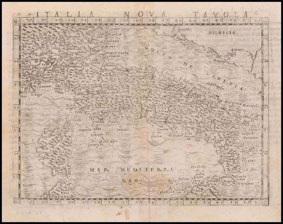
Nice example of Gastaldi's modern map of Italy, one of the earliest obtainable modern maps of Italy. Giacomo Gastaldi is considered as the foremost Italian cartographer of the 16th century along with Paolo Forlani. From Piedmont, Gastaldi established...
![[Italy]](/map/small/54236.jpg)
Finely engraved image of Northern and Central Italy, with south at top. The Apennine Mountains can be seen running down the center of the map. The image appeared in the 1568 Venice edition of Ludovico Ariosto's Orlandi Furioso, which first published...
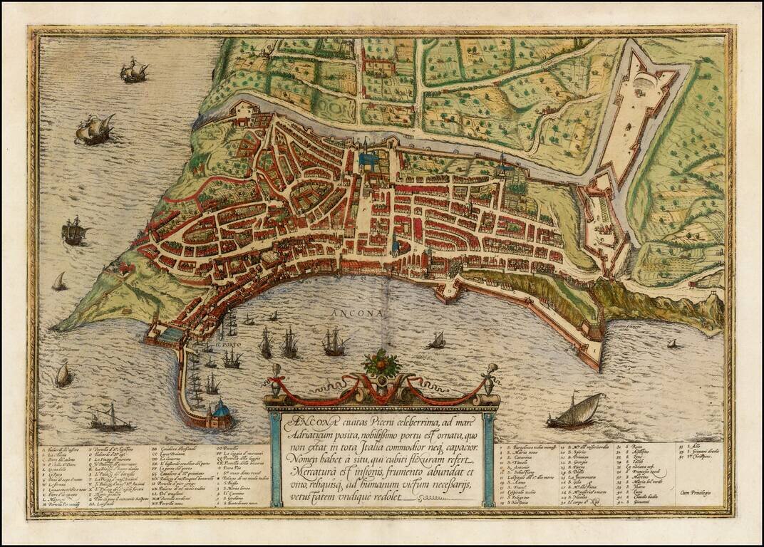
A fine early view of Ancona in the Marche region of Italy, published by Braun & Hogenberg in their monumental 6 volume Civitatus Orbis Terrarum.
![Genua Ligurum domina . . . [and] Florentia urbs est Insignis Hetruariae, olim Fluentia dicta . . . (Genoa & Florence)](/map/small/67437.jpg)
Beautiful Original Hand-Color view of Florence and Genoa A fine example of this pair of birdseye views of "Genua" and "Firenze." The details on these views is extensive, and the work is attractively produced. Additional text describes both cities and...
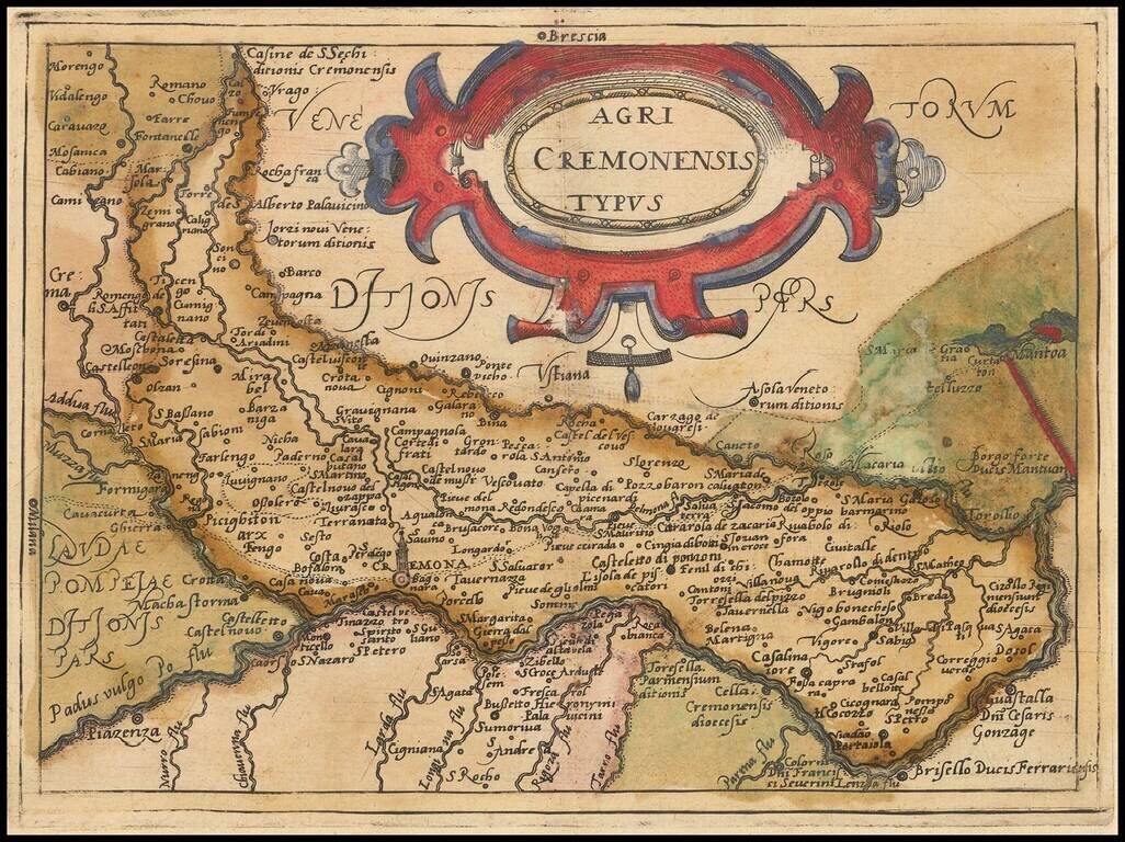
Rare modern map of the Cremona region, published in Cologne by Johannes Metellus in 1579 in fine original color. The map is one of the earliest obtainable modern maps published by the so-called Cologne School of mapmakers, which consisted primarily of...
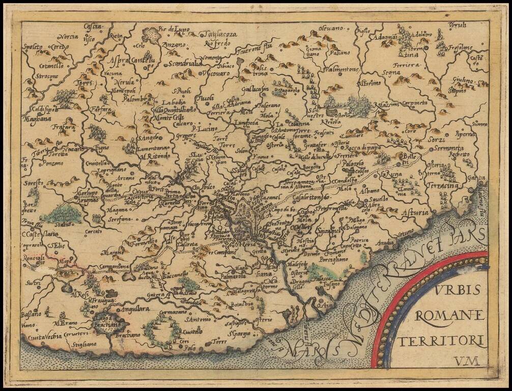
Rare modern map of the Territory of Rome, published in Cologne by Johannes Metellus in 1579 in fine original color. The map is one of the earliest obtainable modern maps published by the so-called Cologne School of mapmakers, which consisted primarily...
![Insularum Aliquot Maris Mediterranei Descriptio [Sicily, Malta, Sardinia, Corfu, Elba and Zerbia]](/map/small/45115.jpg)
Fine example of Ortelius' maps of the islands of Sicily, Malta, Sardinia, Corfu, Elba and Zerbia, from the Ortelius' Theatrum Orbis Terrarum, the first modern Atlas of the World. Includes a number of sailing ships, including a sinking vessel off...
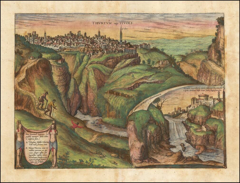
The city of Tivoli, shown from Mount Tiburtini, with an inset of the famous cascading waterfalls. In the foreground, illustrations of 3 climbers include Hoefnagel and Abraham Ortelius, who visited the town and studied it in 1578, as noted in the...
![[Venice]](/map/small/30280.jpg)
Rare 16th Century map of Venice, published in Venice by Leandro Alberti of Bologna, in his Isolario appartenenti alla Italia, published in 1588. A very scarce early map, with a very unique printing style.
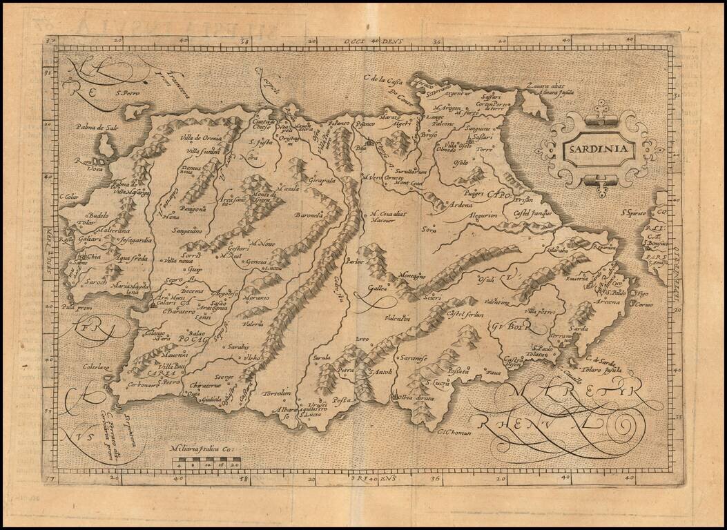
Scarce early map of Sardinia. Matthaus Quad was a German cartographer based in Cologne. The map was engraved by Johannes Bussemacher and appeared in several geographical works published by Quad and Bussemacher at the end of the 16th and beginning of...
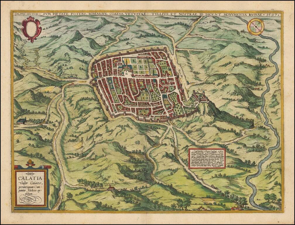
Striking town plan of Caiazzo from Braun & Hogenberg's Civitas Orbis Terrarum, first issued in 1597. Caiazzo is a city in the province of Caserta (Campania) in Italy. It is located on the right bank of the Volturnus, northeast of Capua. The...
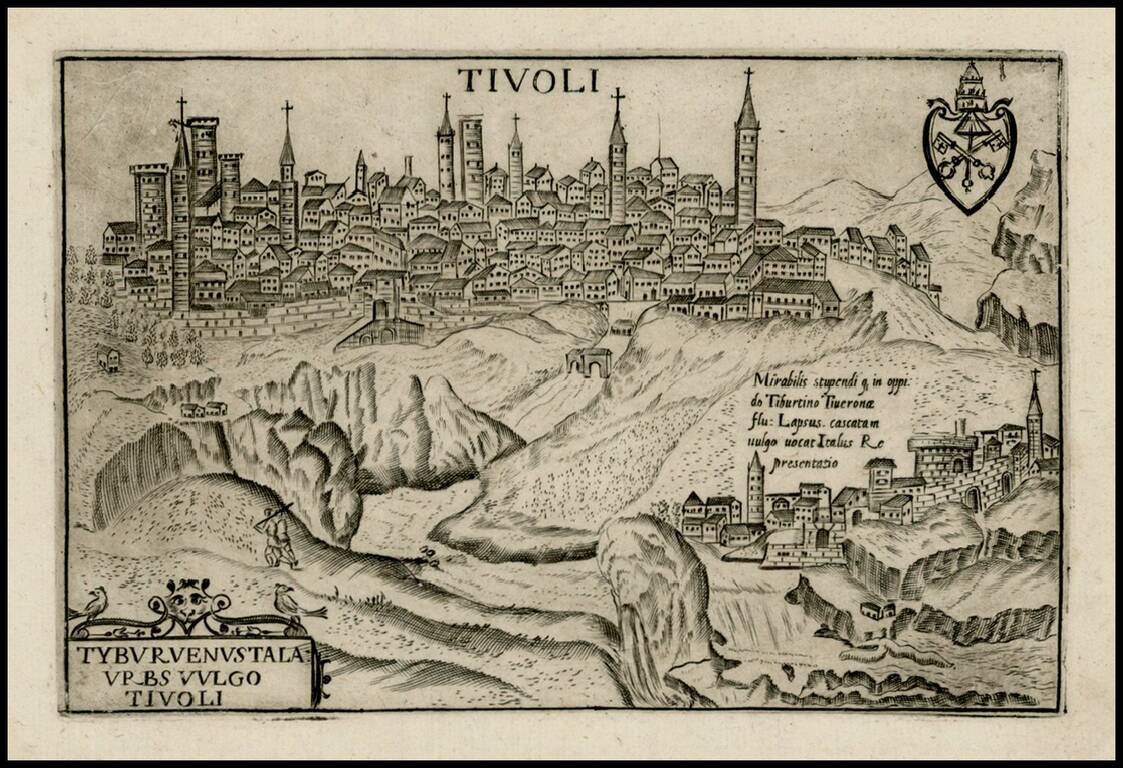
Detailed view of Tivoli, which appeared in Bertelli's Theatrum Urbium Italicarum, first published in Venice in 1599. Includes a detailed view of the interior of this walled hill city, river, bridge and Mirabilis in the foreground, with a decorative...