logo

1624. Italiae Veteris Specimen

  • Italiae Veteris Specimen

Italiae Veteris Specimen information:

Year of creation: 
Resolution size (pixels): 
 13050x9808 px
Disk Size: 
 41.6063MiB
Number of pages: 
 1
Place: 
 Antwerp
Author: 

Print information. Print size (Width x height in inches):
Printing at 72 dpi 
  181.25 х 136.22
Printing at 150 dpi 
 87 х 65.39
Printing at 300 dpi 
 43.5 х 32.69

An example of detailing the file of this map of in a printable high-resolution:

Click to open in high resolution (open in new tab).
Attention! this is just the central piece (central area 960x960 px) of the map file!
This is an example, so that you can see and study the level of detail of a given map. The entire Map will be fully available after payment!

Italiae Veteris Specimen

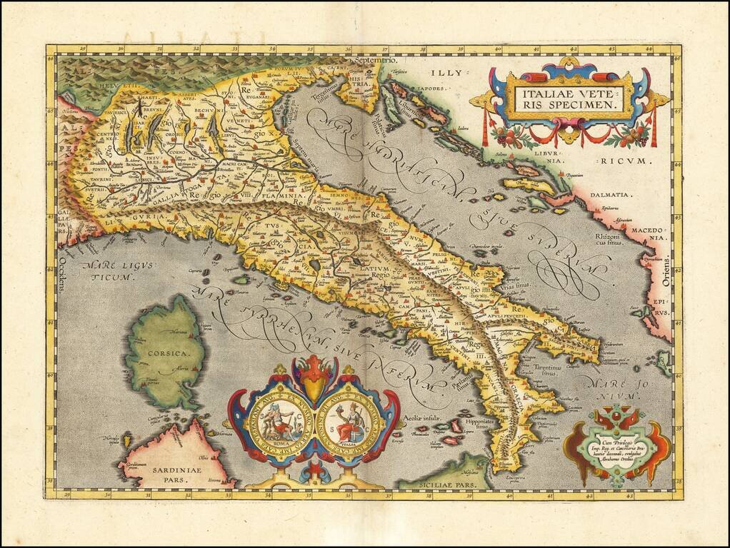
Nice example of Ortelius' map of ancient Italy, from Ortelius' Theatrum Orbis Terrarum, the first modern world atlas.

The map is based upon Gastaldi's map of Italy, supplemented with classical sources.

Beginning in 1601, a second state of the map was issued, with a revised cartouche (2 medallions) and a different scale of miles (lacking the date).

Van Den Broecke 204.

Special conditions for students!

If you are a student, write to us in telegram: @antiquemaps and indicate what material you need and for what work you need a map in high detail. We are ready to provide material on special terms. For students only!

Item information:

Year of creation:
Size:
13050x9808 px
Disk:
41.6063MiB
Number of pages:
1
Place:
Antwerp
Author:
Abraham Ortelius.
$14.99

Related item