
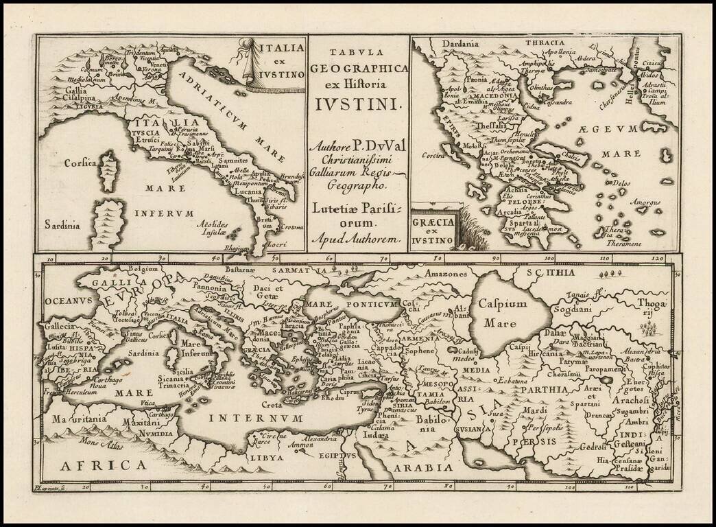
Antique engraved map of ancient Italy, Greece, Europe and the Middle East, after the writings of the Roman historian Justin.
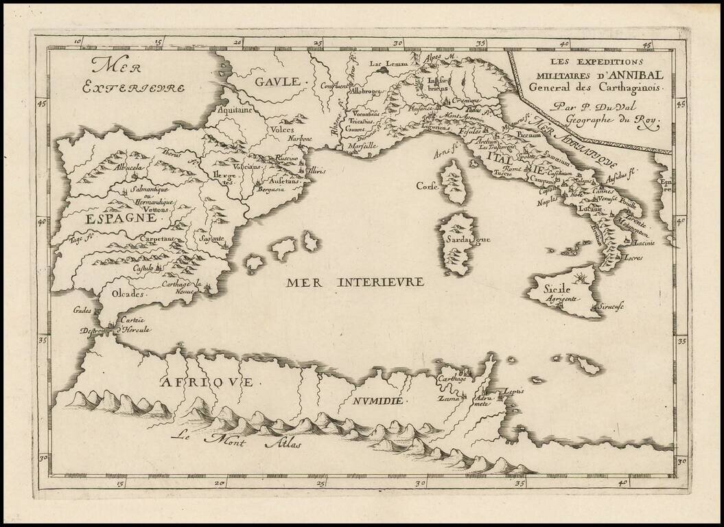
Antique engraved map of the military expedition of Hannibal, the Carthaginian general, published in Paris circa 1660 by Pierre Du Val. The map covers all of the western Mediterranean, with the most detail in Italy and Spain and a few locations in...
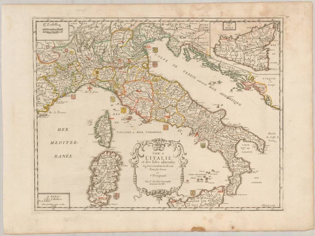
Scarce map of Italy, published in Paris by Pierre Du Val in 1663. The map is embellished by approximately 20 coats of arms of the various regions of Italy. Highly detailed, including towns, roads, rivers, castles, harbors, bays and a host of other...
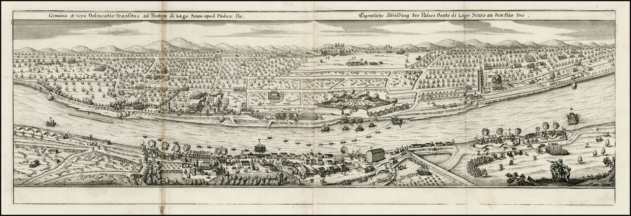
Decorative view of the Po River, near the Lake Scuro, from Merian's Theatrum Euopaeum.
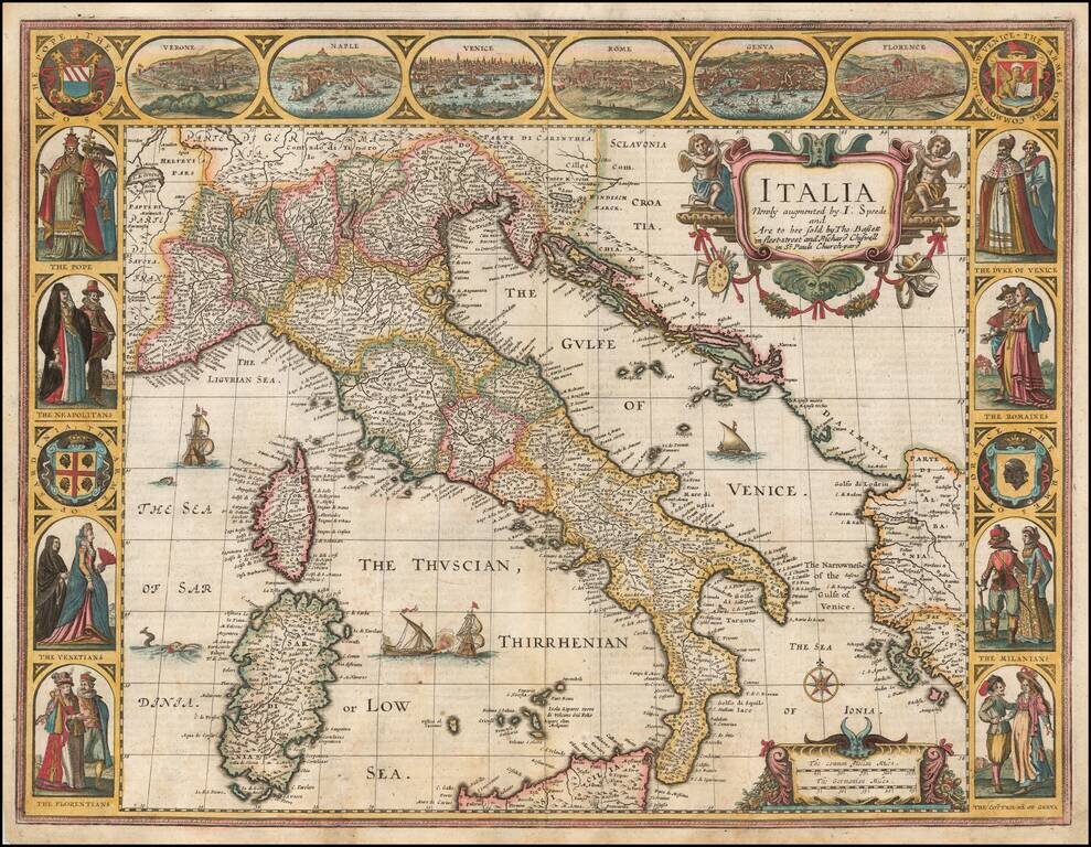
Nice example of John Speed's map of Italy, from the 1676 edition of his Prospect of the Most Famous Parts of the World. Widely regarded as the most beautiful and decorative map of Italy to appear in an English language atlas in the 17th century....
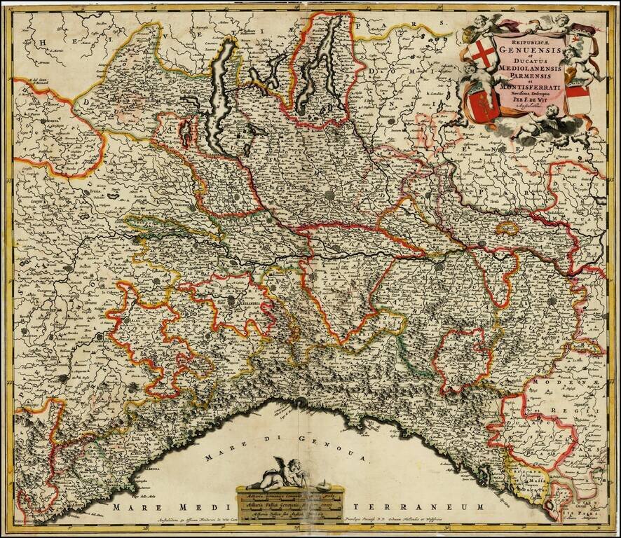
Decorative map of the Republic of Genoa, and Dutchies of Milan, Parma and Montisferrati and contiguous regions. Includes an elaborate cartouche, incliuding 4 coat of arms.
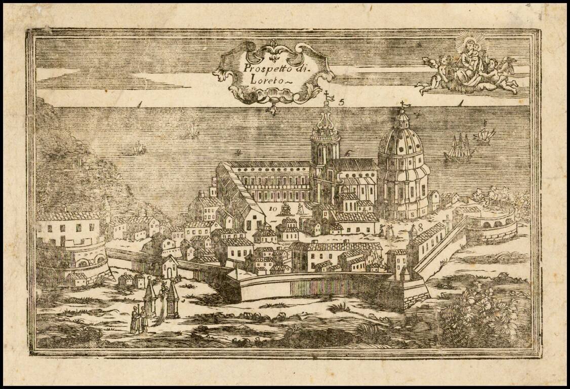
Very rare view of Loreto (Ancona) and the Basilica della Santa Casa, apparently a wood cut, prepared to illustrate a pilgrimage between Nazareth, Tersatto (Trast, Croatia) and the Basilica della Santa Casa, in Loreto (Ancona) on the Adriatic...
![Status Ecclesiasticus Magnus Ducatus Thoscanae [Tuscany, Rome, Siena, Pisa, Florence, etc] (Heightened with Gold Leaf!)](/map/small/50344.jpg)
With Gold Leaf added to the Cartouche and Coat of Arms Old Color, gold heighted example of De Wit's detailed map of the State of the Church and Tuscany, with a portion of Corsica to the west. Cartouche depicts cherubs, a merman and coat of arms.
![Regnum Siciliae Cum circumjacentibus Regnis et Insulis… [shows Malta] (Heighten with Gold Leaf)](/map/small/50376.jpg)
Fine old color, gold leaf example of Visscher's map of Sicily, Malta and a bit of Naples and Sardinia. Large decorative cartouche with 2 coats of arms and a large decorative military scale.
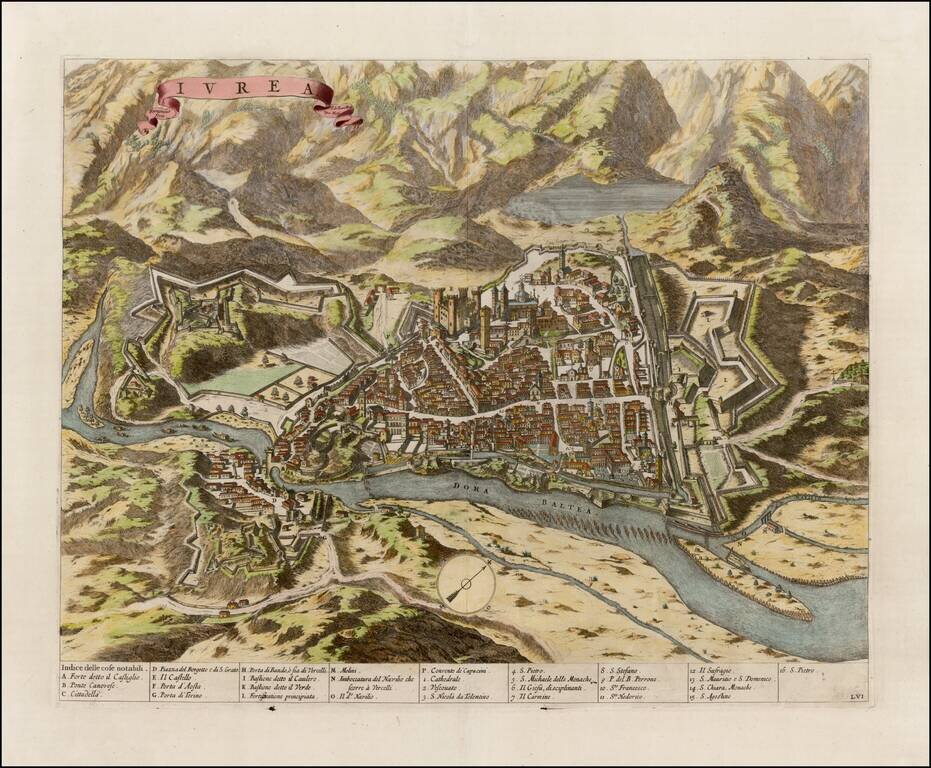
Fine example of Blaeu's view of Ivrea, from the Theatrum Statuum Regiae Celsitudinis Sabaudiae Ducis, Pedemontii Principis, published in 1682. The view was engraved by Johannes de Ram. Ivrea is a town in the modern Turin Province, in northwest Italy.
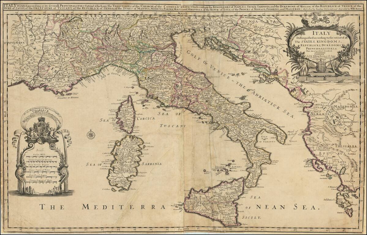
Rare example of William Berry's 2 sheet map of Italy, Corsica, Sardinia, Sicily, and adjoining regions. The map includes a large dedication cartouche to Charles II, King of England. Dated 1682, the map was issued shortly after Charles dissolved the...
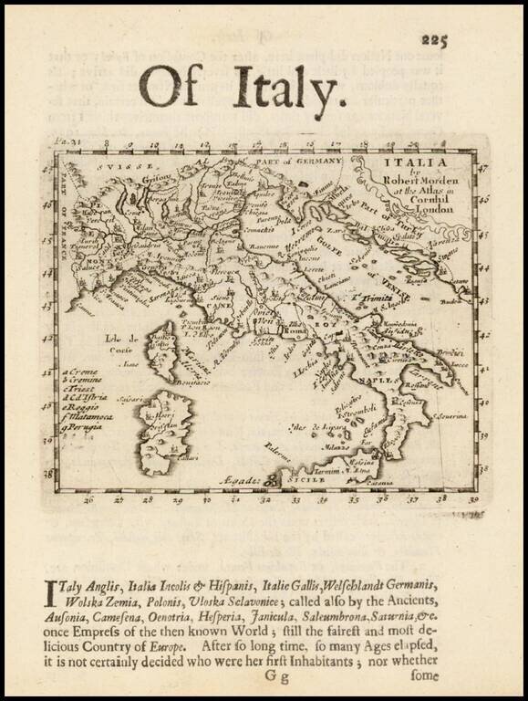
Rare early English map of Italy, in excellent detail, published by Robert Morden. This map first appeared in Modern's rare Atlas Terestris, first published in 1687.
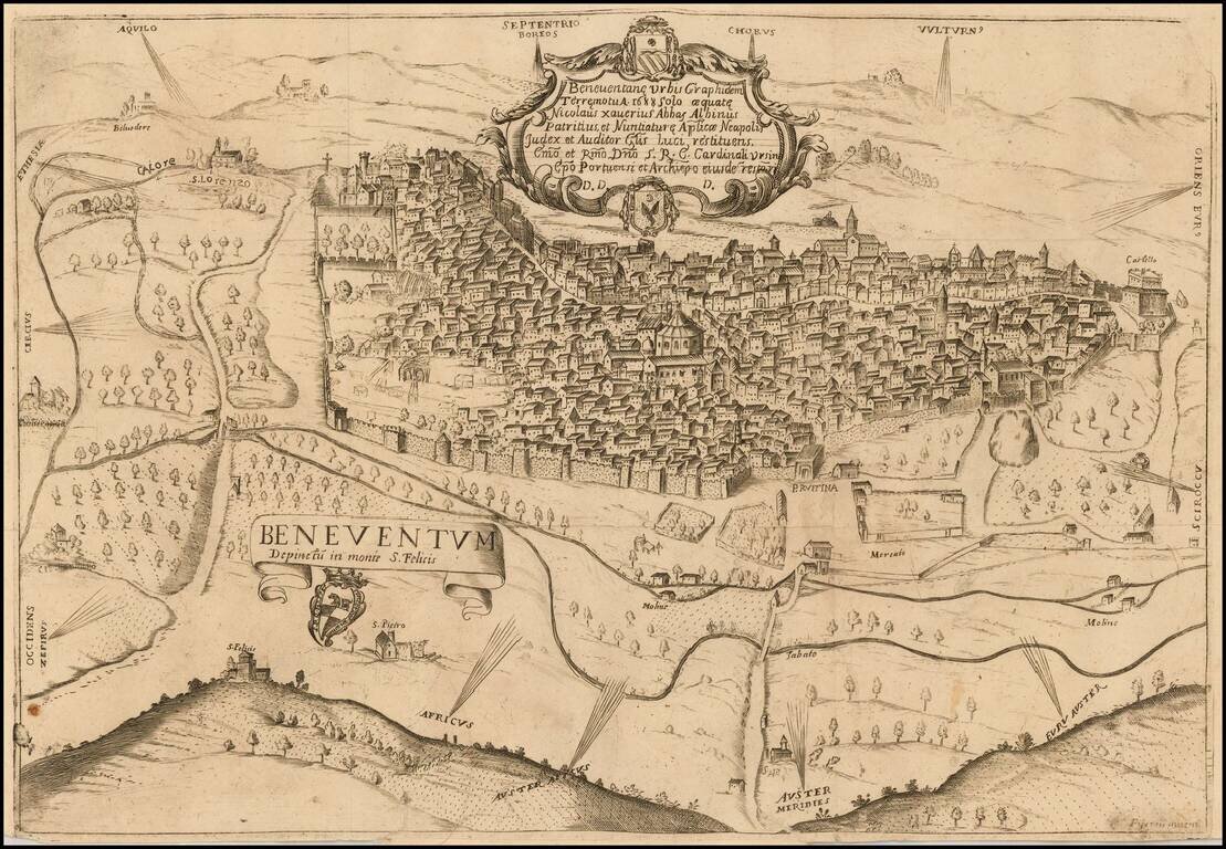
The First Printed Map of Benevento Rare view of Benevento, Italy, published in Benevento and engraved by XXXX.
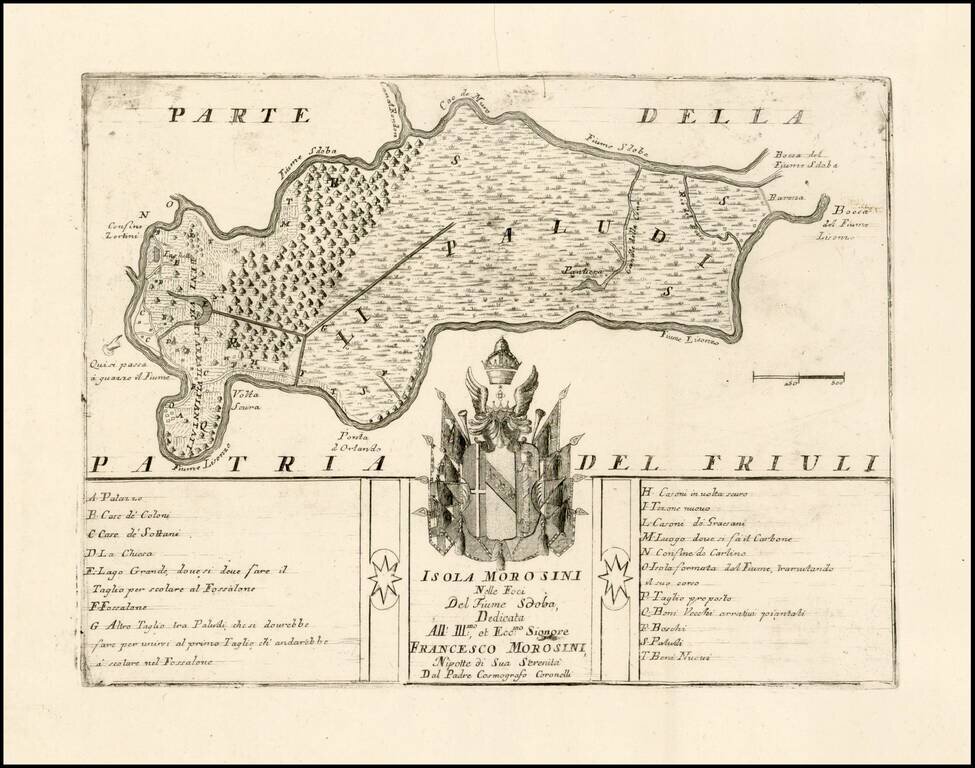
Fine example of this very rare map of the Isola Morosini, formed by the area between the Lisonzo River and Sdoba River. The map is dedicated to Francesco Morosini and includes the family coat of arms and a key locating approximately 20 places on the...
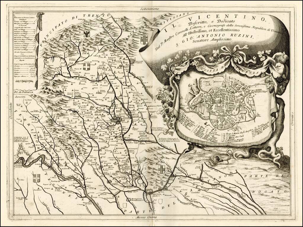
Fine depiction of part of The territory of Vicenza, published in Venice by Coronelli. The map provides a remarkable depiction of the rivers, mountains and valleys, in the region, extending from the Alpine regions to the rivers draining toward the Gulf...
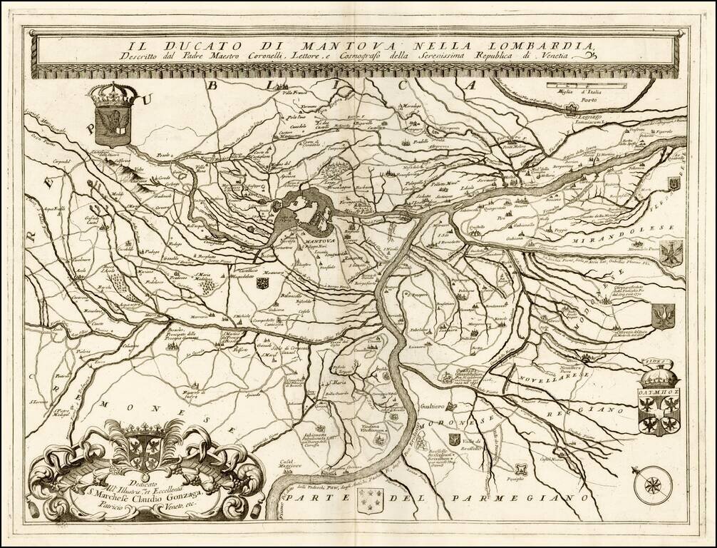
Fine example of this scarce map of the Duchy of Mantova and environs, published by Coronelli in his C orso Geogrpaphico. The map shows the section of the Po River and Tributaries in the Duchy of Mantova, including 8 coats of arms. Vincenzo Coronelli...