
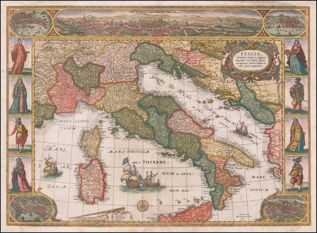
Rare decorative map of Italy, published in Amsterdam by Cornelis Danckerts. Striking example of State 3 of Willem Blaeu's rare carte-a-figures map of Italy, first published in 1606. The map is based on the Mercator map of 1589. The map is embellished...
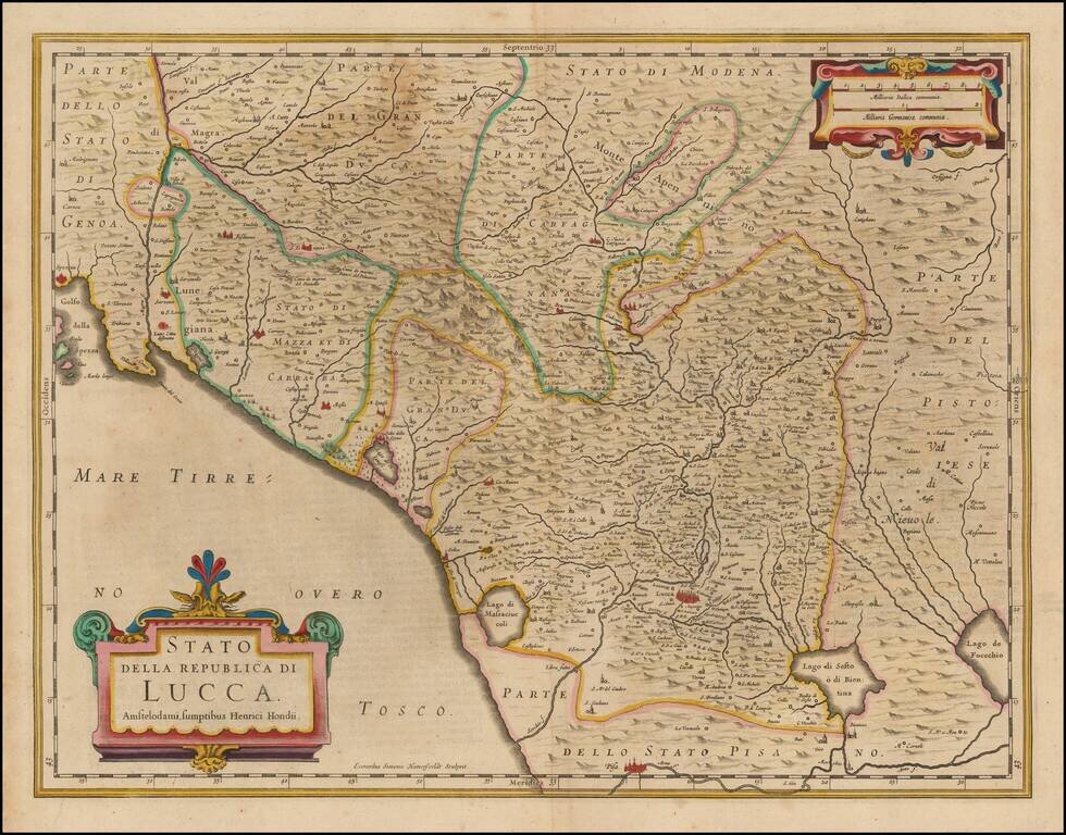
Nice old color example of Hondius' map of the Republic of Lucca. The map covers part of Tuscany and the Italian Coast from Spezia to the Pisa area. Includes a decorative cartouche.
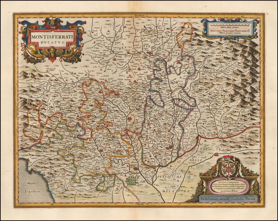
Decorative wide margined example of Blaeu's detailed regional map of Northern Italy. Larger cities on the map include Turin, Alba, Aste, Casale Monferrato, Allesandria della Paglia, Acqui Terme, Novara, etc. Includes three cartouches and coat of arms.
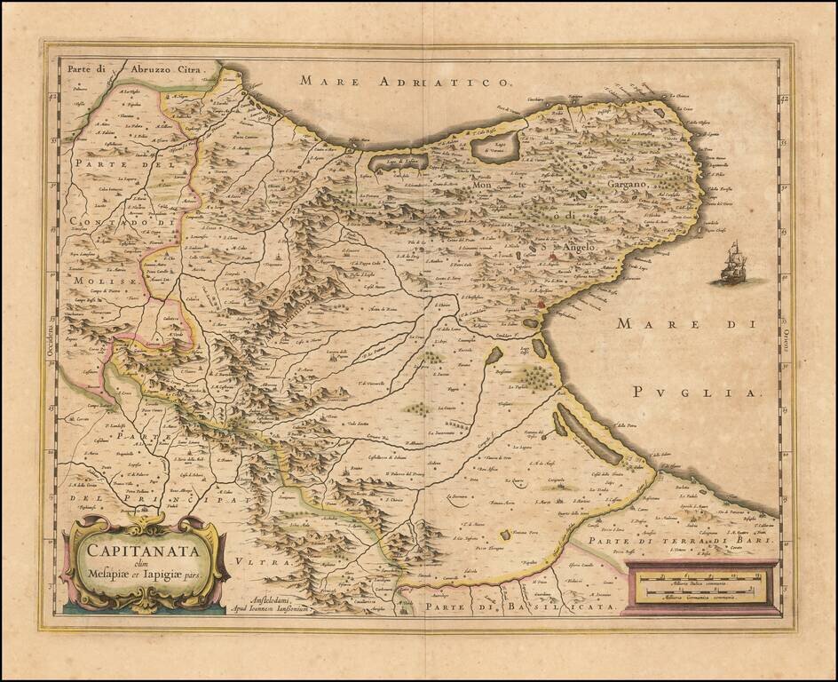
A nice example of Jan Janssonius's circa 1640 double-page engraved map of Foggia, Italy. Johannes Janssonius Johannes Janssonius (1588, Arnhem - buried July 11, 1664, Amsterdam) (born Jan Janszoon, often called Jan Jansson) was a Dutch cartographer...
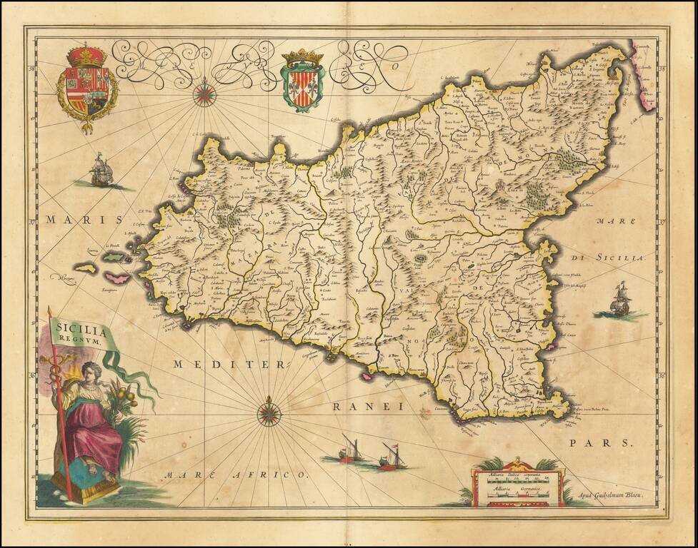
A gorgeous example of Blaeu's fine decorative map of Sicily, from his Atlas Novus. Blaeu's map is without doubt one of the most attractive of all 17th Century atlas maps of Sicily, with 2 ornate cartouches, large coat of arms, 4 sailing ships, sea...
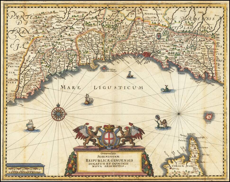
Fine example of Merian's map of the Republic of Genoa. Includes a decorative cartouche, compass rose, sailing ships and sea monsters.
Rare map of Italy, first published by Melchior Tavernier and later re-issued with the new title pasted over the old title by a Nicolas Sanson. The original title of the map was Italia Antiqua Cum Insulis Sicilia, Sardinia & Corsica . . . This...
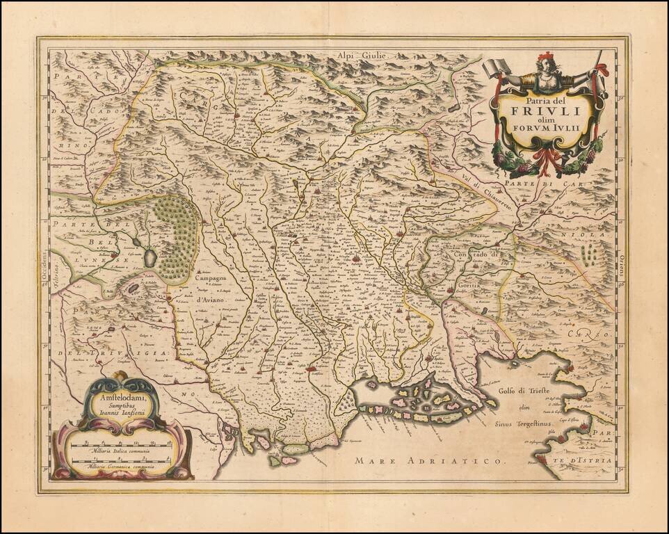
Nice old color example of Jansson's maps of Friuli and the Gulf of Trieste. Includes a decorative cartouche and sailing ships.
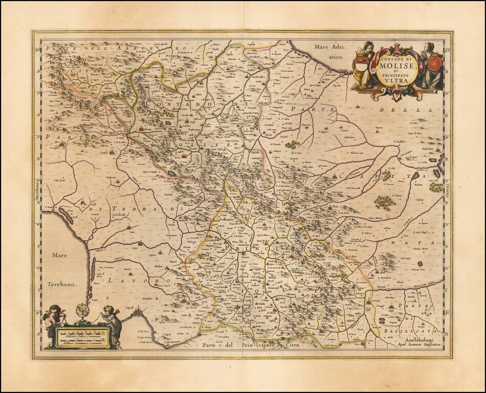
Decorative regional map of Italy, engraved by Jan Jansson. Larger cities include Benevento, Ariano, Avellino, Conza, Troia and Lucera. Napoli appears at the far southwest corner of the map.
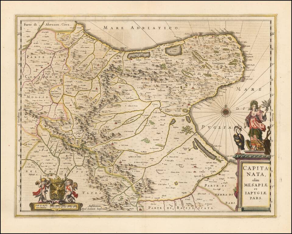
A nice example of Jan Janssonius's circa 1650 double-page engraved map of the Province of Foggia, Italy. Johannes Janssonius Johannes Janssonius (1588, Arnhem - buried July 11, 1664, Amsterdam) (born Jan Janszoon, often called Jan Jansson) was a...
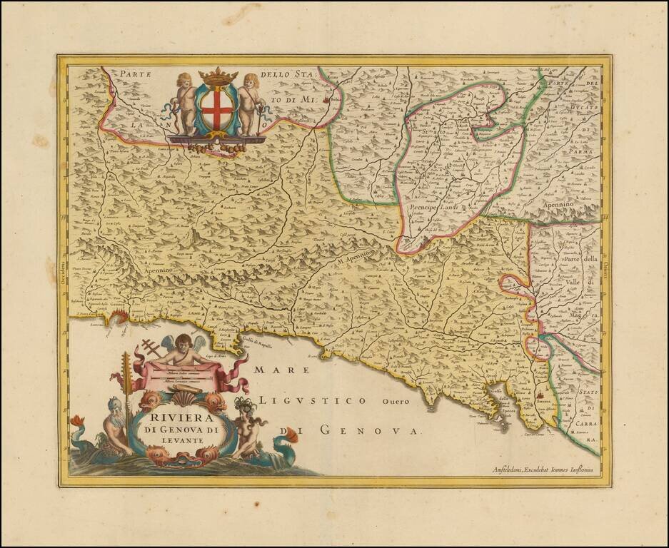
Decorative map of the Italian Riviera, including the Cinque Terre. Scarce Jan Jansson of the Italian Riviera, from Genoa to the Gulf of Spezia. Includes a decorative cartouche and coat of armes supported by Cherubs.
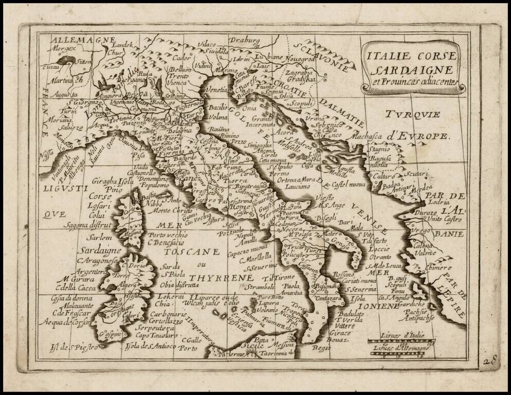
Rare map of Italy, Corsica and Sardinia, which appeared in Picart's Tresor des carte Geographiques, published in Paris. Picart's map is based upon Jansson's map of the same region, published in his Atlas Minor in 1628. The first French version of the...
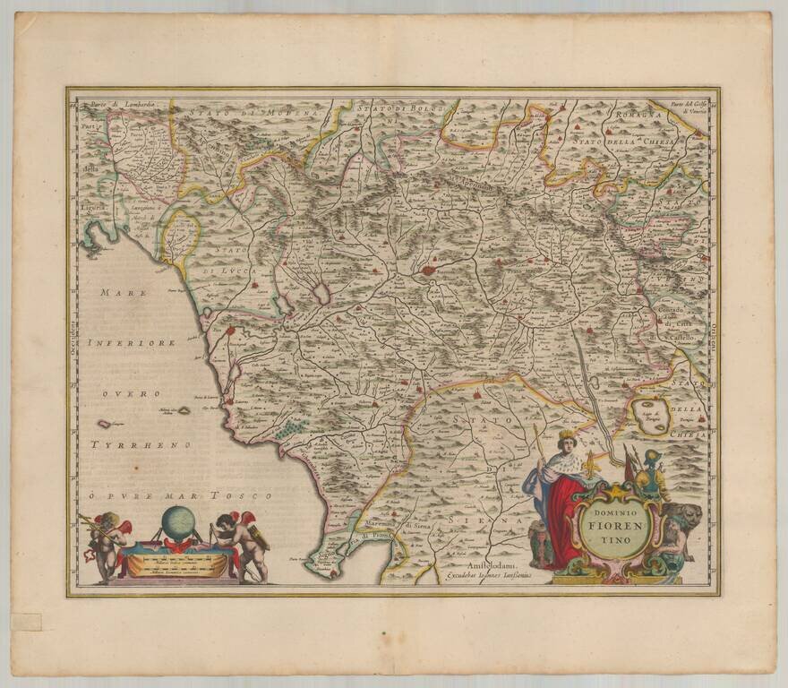
Gorgeous old color example of Jansson's map of Fiorentino, centered on Florence. Includes Siena, Perugia, Luca, and Pisa. Two large decorative cartouches. This example includes rich full hand coloring and was likely bound into a deluxe edition of...
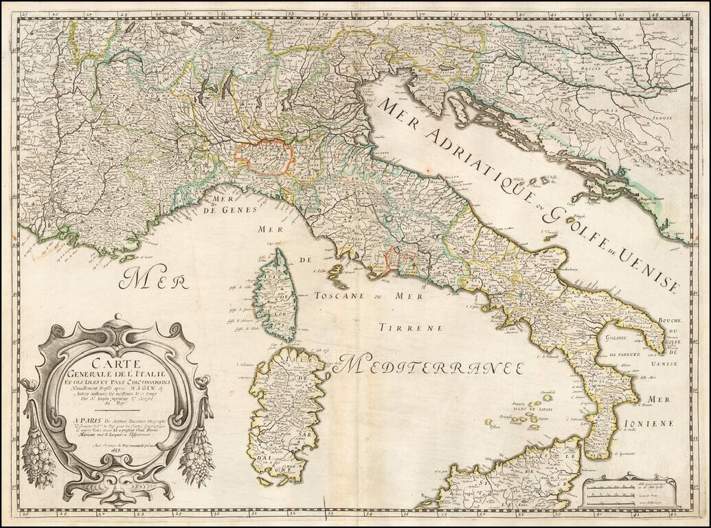
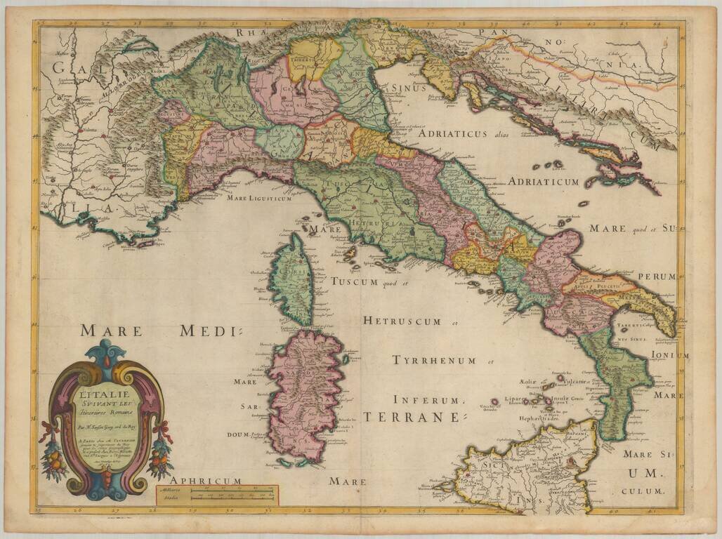
Nicolas Sanson's double-page engraved map of Italy, with a large, attractive cartouche in the lower left. Published in Paris in 1658. The map was first issued by Tavernier in the 1640s.
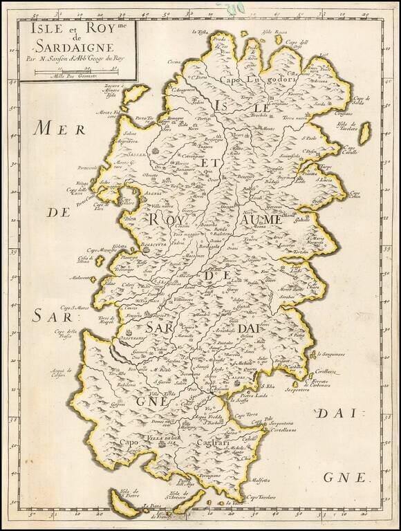
Nicolas Sanson's engraved map of Sardinia, published in Paris in 1658.
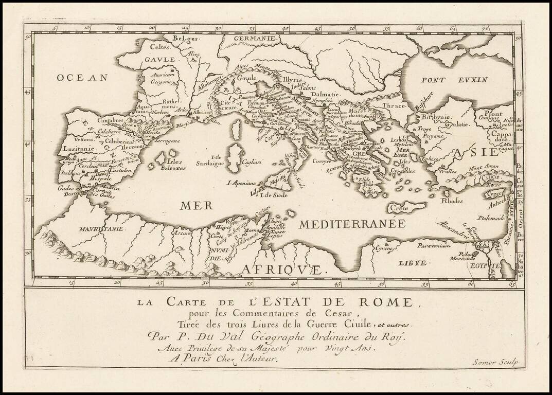
Antique engraved map of the Roman Empire, published by Pierre Duval in Paris in the 1660s. The map shows the important early Roman cities around the Mediterranean. According to the title, the map shows the State of Rome, from the Commentaries of...