Map size in jpg-format: 31.0606MiB
Click to open in high resolution (open in new tab).
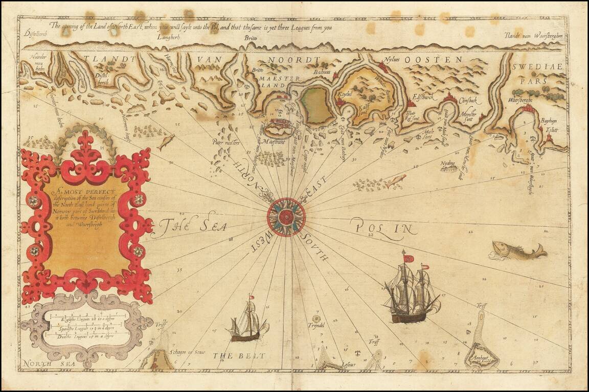
Rare English Waghenaer Map of Southwestern Swedish Coastline
Old color example of this scarce English edition of Waghenaer's sea chart showing the coastlines of Sweden, centered on Marstrand and the coastline west of Gothenberg.
The chart is oriented with northeast at the top and extends from
The chart is richly embellished with compass roses, sea monsters, sailing ships, and rhumb lines.
Shirley says of the English Waghenaer:
In 1588 Anthony Ashley, clerk to the Privy Council, was commissioned by Sir Christopher Hatton to prepare and English language version of... Waghenaer's... Spieghel der Zeevaerdt... For the English version new plates were engraved in England by Theodore de Bry, Jodocus Hondius, Augustine Ryther and Johannes Rutlinger .The last copy of the English Waghenaer to be publicly sold was Lord Wardington's, which made 90,000 GBP plus premium at Sotheby's in 2006.
If you are a student, write to us in telegram: @antiquemaps and indicate what material you need and for what work you need a map in high detail. We are ready to provide material on special terms. For students only!


